 Block
Aledo, Illinois
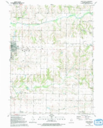
12 topographic sheets cover this place, the earliest surveyed in 1923 and the latest in 1992. It stands in Mercer Township. It lies in ZIP code area 61231. The Survey maps it on the Aledo East quadrangle. 3,633 people lived here at the 2020 count. It stands 653 feet above sea level.
On record in Aledo
Buildings and businesses the archive holds for this place. Each opens its own page, with the source record it came from.
On the National Register 4 records
 Downtown Aledo Historic Districtlisted 2016
 Mercer County Courthouselisted 1982
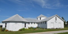 Mercer County Fairgroundslisted 1997
 Mercer County Jaillisted 1997
Topographic sheets covering this place
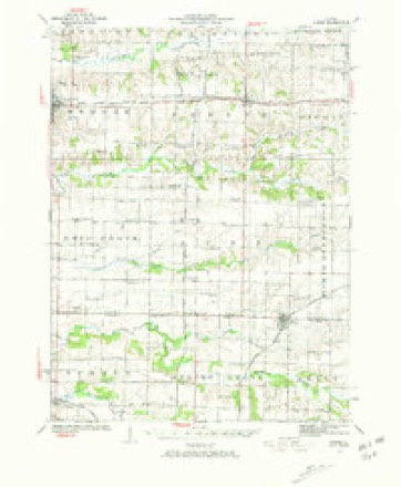
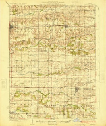
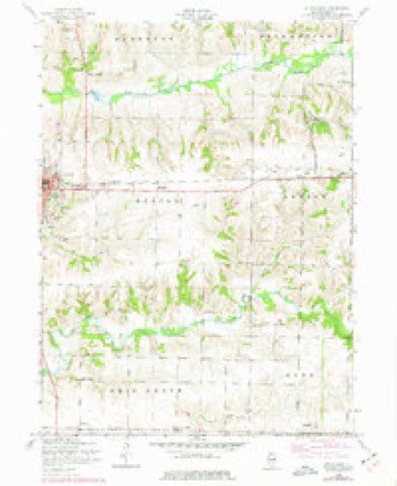
9 surveys from 12 printed sheetsMatched by testing this settlement's coordinate against the published boundary of every sheet in the United States Geological Survey's historical collection. Each opens the scanned sheet at the Survey.
- 1923 USGS Alexis quadrangle1:62500, 2 printings
- 1925 USGS Alexis quadrangle1:62500
- 1953 USGS Aledo East quadrangle1:24000, 2 printings
- 1958 USGS Davenport quadrangle1:250000, 2 printings
- 1961 USGS Davenport quadrangle1:250000
- 1962 USGS Davenport quadrangle1:250000
- 1984 USGS Aledo quadrangle1:100000
- 1989 USGS Aledo quadrangle1:100000
- 1992 USGS Aledo East quadrangle1:24000





In the county-history sources
53,031 words on this townshipHistory of Mercer County : Together with Biographical Matter, Statistics, Etc., Gathered from Mattter Furnished by the Mercer County Historical Society, Interviews with Old Settlers, County, Township and Other Records, and Extracts from Files of Papers, Pamphlets, and Such Other Sources As Have Been Available : Containing Also a Short History of Henderson County, published 1882 names this settlement in its chapter on Mercer Township. These are the passages that mention it, exactly as the scans read.
Mercer township includes all the congressional township known as 14 N., R. 3 west of the 4th P. M. The soil is generally black and rich, with some clay along the brakes and water courses. It is well watered, Edwards river traversing the north tier of sections, from east to west, and Pope creek crossing the southeast corner and following west near the south line, in Ohio Grove township. These, with their numerous runs, as feeders, furnish an ample supply of water for stock and irrigation. Along the creeks the land is broken, but there is very little so steep that it cannot be cultivated. On the "divide," as it is called, between Pope and Edwards, the land is level, and until brought under cultivation, much of it was of a swamp}- nature. Over this prairie in early times there was scarcely a track that rose to the dignity of a road, as travel was not frequent enough to keep down the luxui-iant growth of grass, which often grew so high that a man on horseback could see but a short distance. Woe then to the luckless traveler who undertook to cross the prairie in a wet time with wagon and team. Suddenly his oxen would sink in the mud, knee deep, the wagon go down to the hub, and there was nothing to do but to unload, and then perhaps "-double teams," if perchance tliei-e was some one to double with, or if not, go two or three miles to secure assistance. But cultivation and judicious draining have so changed the nature of the soil in this respect that it is difficult to convince our farmer boys of to-day that the most productive parts of their farms were at one time little better than impassable swampr-i.
Much of the township is underlaid with coal of a good quality, but there have, as yet, been but few banks opened, as it generally lies too deep to work with profit. Banks in the northeast part of the township have been run for many years, but seldom at a great profit. Within a few years mines have been opened near Aledo and are still run on a small scale.
Prairie fires were of yearly occurrence. The luxuriant growth of grass, scorched by the summer's heat, by early fall was as dry as tinder, and a spark from a careless hunter's pipe, or sometimes the wad from his gun would start a conflagration which soon became at once grand and terrible. IS^one who have once seen it can ever forget the majestic sweep of the wall of fire as it sped before the ever increasing wind, stretching out its arms farthei" and farther on either side, rivaling in speed the horse or deer, and gathering up and devouring all within its reach. Such was the prairie fire of early days, and fortunate was it for him who, caught in the track of the fast-coming Hames, understood the pioneer's way of fighting fire with fire. Without this knowledge a severe scorching, if nothing worse, most surely awaited him.
Machine-read from a century-old scan, so expect the errors a machine makes: misspelled names, dropped words, stray characters.
Read the whole chapter on Mercer Township - it names this place 166 more 166 times.
Mines and quarries near this place
1 within 5 milesRegional context, not property-specific evidence. The federal mineral resources record lists 1 working within 5 miles of Aledo: 1 past producer. None of them still produces. What was taken out: Stone. Distance is straight-line from the map coordinates, so a quarry counted here may appear on a neighbouring settlement's page as well.
| Where | Site | Commodity | Status | Recorded |
|---|---|---|---|---|
| Mercer County Pit | Stone | Past Producer |
Storms near this place
40 since 1993Regional context, not property-specific evidence. The National Weather Service names Aledo in 40 storm reports between 1993 and 2025: 24 thunderstorm wind, 8 hail, 4 tornado, 1 lightning. The reports record 1 death. Each account below is quoted exactly as the forecast office filed it, from the NOAA Storm Events Database, and each date opens the federal record of that event.
| When | Event | Place named | Harm | What the report says |
|---|---|---|---|---|
| June 1997 | Lightning | Aledo | 1 killed | no account filed |
| April 2003 | Tornado (F1) | Aledo | $500,000 | Damaged farm buildings |
| June 2010 | Flash Flood | Aledo | $50,000 | Heavy rains resulted in flash flooding in Aledo, IL during the evening of June 18. Several streets were flooded and Highway 17 had water covering it. |
| April 2003 | Tornado (F0) | Aledo | $50,000 | traveled through open country |
| May 2003 | Tornado (F0) | Aledo | $50,000 | no account filed |
| April 2006 | Hail | Aledo | $20,000 | Window cracked with hole the size of a half dollar; pea to half dollar size hail during the storm. |
| April 2006 | Thunderstorm Wind | Aledo | $10,000 | Trees/limbs and power lines down across the city. |
| March 2006 | Thunderstorm Wind | Aledo | $5,000 | Trees and power lines down |
| June 2000 | Thunderstorm Wind | Aledo | $1,000 | no account filed |
| August 2025 | Thunderstorm Wind | Aledo | - | Trees and power lines were blown down in town. |
| February 2024 | Hail | Aledo | - | The hail was half dollar to silver dollar size. |
| February 2024 | Hail | Aledo | - | Photo received through social media. |
| April 2024 | Thunderstorm Wind | Aledo | - | A public report of power poles down near Highway 17and 200th Street. The time of the event was estimated using radar. |
| April 2024 | Thunderstorm Wind | Aledo | - | An NWS Storm Survey found that a portion of the roof was torn off the Community Bible Fellowship Church. |
| August 2023 | Hail | Aledo | - | Broadcast media relayed a report of a mix of quarter to half dollar size hail. |
| March 2022 | Thunderstorm Wind | Aledo | - | A trained spotter reported a thunderstorm wind gust of 60 MPH. |
| August 2022 | Tornado (EFU) | Aledo | - | Eyewitness reports along with video and photographic evidence from storm chasers support an intermittent tornado path of nearly 3 miles. There are also reports of minor crop damage associated with tornado. Times were based on detailed information from chasers. With no observable damage to assess, this tornado is rated an EF-U. |
| April 2021 | Thunderstorm Wind | Aledo | - | A trained spotter reported thunderstorm wind damage to a farm outbuilding south of Aledo. Pictures via social media show part of a wall blown out, but the barn was open to one side and the other wall is partially covered. Time of the event was estimated using radar. |
| July 2020 | Thunderstorm Wind | Aledo | - | Downed power pole reported. |
| July 2020 | Thunderstorm Wind | Aledo | - | A large pine tree was uprooted along Highway 94 south of Aledo. |
| August 2018 | Thunderstorm Wind | Aledo | - | Law enforcement relayed a report of trees down in Aledo. |
| September 2018 | Thunderstorm Wind | Aledo | - | Local law enforcement reported a few trees and power lines down. |
| July 2017 | Thunderstorm Wind | Aledo | - | The county emergency manager reported a couple of trees were down. |
| July 2017 | Thunderstorm Wind | Aledo | - | Local law enforcement reported a tree was down. |
| July 2016 | Thunderstorm Wind | Aledo | - | The emergency manager reported furniture blown around and a semi trailer was blown over at the Mercer County Fair in Aledo. Some trees were also blown down in town. Winds were estimated around 60 MPH. |
| June 2008 | Hail | Aledo | - | Penny to nickel-sized hail fell just northeast of Aledo, IL around 6:45 pm June 14. |
| March 2007 | Thunderstorm Wind | Aledo | - | Sheriffs department reported at least one power pole blown down just north of Aledo, and numerous small branches down around the Aledo area. |
| March 2002 | Thunderstorm Wind | Aledo | - | A homestead in rural Aledo suffered heavy damage. High winds shattered windows and destroyed a barn, three empty grain storage bins, a fence, several dog houses and a children's swing set. |
| June 2002 | Thunderstorm Wind | Aledo | - | A wooden swingset was blown over, and a trampoline was picked up and blown into a field. |
| May 2002 | Flood | Aledo | - | Minor flooding reported on some secondary roads. |
| June 1999 | Thunderstorm Wind | Aledo | - | Several tree limbs downed. A large tree was blown down onto a baseball field. |
| March 1998 | Thunderstorm Wind | Aledo | - | Numerous trees and power lines were downed. |
| July 1997 | Thunderstorm Wind | Aledo | - | Trees and power lines down. |
| June 1997 | Thunderstorm Wind | Aledo | - | Trees down across route 94. |
| August 1993 | Thunderstorm Wind | Aledo | - | Winds knocked out windows and damaged a gutter at a house. Eight trees were uprooted, farm buildings were damaged. |
| April 2024 | Hail | Aledo | - | no account filed |
| August 2023 | Hail | Aledo | - | no account filed |
| April 2003 | Funnel Cloud | Aledo | - | no account filed |
| June 2002 | Hail | Aledo | - | no account filed |
| April 1997 | Thunderstorm Wind | Aledo | - | no account filed |
Nearest settlements
The eight closest, with where each one stands in the county. Distances are straight-line, computed from the Geographic Names Information System coordinates.
| Map | Place | Distance | Sheets |
|---|---|---|---|
| Sugar Grove | 2.6 miles | 12 | |
| Gingle Corners | 4.4 miles | 18 | |
| Millersburg | 4.7 miles | 15 | |
| Sunbeam | 5.1 miles | 12 | |
| Shale City | 5.9 miles | 12 | |
| Gilchrist | 6.6 miles | 12 | |
| Wanlock | 6.7 miles | 12 | |
| Old Gilchrist | 6.9 miles | 12 |
Elsewhere
Matched on this settlement's Geographic Names Information System number rather than its name, so it cannot be a different place of the same name in another state.
| Wikipedia article on Aledo | An encyclopaedic summary. Its text is share-alike, so it is linked here rather than copied. |
| Wikidata item Q576814 | The structured record the population and elevation above come from. Public domain (CC0). |
Provenance
This settlement is recorded in the Geographic Names Information System as feature 403393. The sheet list is computed by point-in-boundary test against the United States Geological Survey's historical topographic inventory. Both are works of the United States government and carry no copyright under 17 U.S.C. 105.
Mines and quarries. USGS Mineral Resources Data System (MRDS) https://mrdata.usgs.gov/mrds/ A work of the United States government, no copyright under 17 U.S.C. 105.
Storms. NOAA National Centers for Environmental Information, Storm Events Database https://www.ncei.noaa.gov/stormevents/ A work of the United States government, no copyright under 17 U.S.C. 105. Narratives are quoted verbatim from the National Weather Service report and are not edited or summarised.