 Block
Osco, Illinois
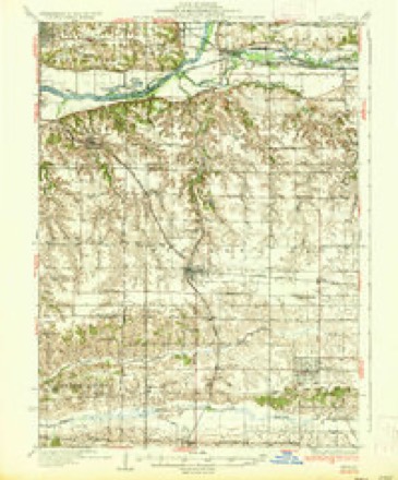
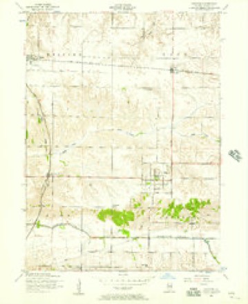
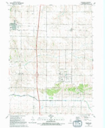
11 topographic sheets cover this place, the earliest surveyed in 1937 and the latest in 1991. It stands in Osco Township. It lies in ZIP code area 61274. The Survey maps it on the Andover quadrangle. 108 people lived here at the 2020 count. It stands 771 feet above sea level.
Topographic sheets covering this place
8 surveys from 11 printed sheetsMatched by testing this settlement's coordinate against the published boundary of every sheet in the United States Geological Survey's historical collection. Each opens the scanned sheet at the Survey.
- 1937 USGS Orion quadrangle1:62500, 2 printings
- 1953 USGS Andover quadrangle1:24000, 2 printings
- 1958 USGS Davenport quadrangle1:250000, 2 printings
- 1961 USGS Davenport quadrangle1:250000
- 1962 USGS Davenport quadrangle1:250000
- 1984 USGS Aledo quadrangle1:100000
- 1989 USGS Aledo quadrangle1:100000
- 1991 USGS Andover quadrangle1:24000





In the county-history sources
8,305 words on this townshipHistory of Henry County, Illinois : It's Taxpayers and Voters; Containing Also, a Biographical Directory, a Condensed History of the State; Map of the County; a Business Directory...etc, published 1877 names this settlement in its chapter on Osco Township. These are the passages that mention it, exactly as the scans read.
The town of Osco was originally known by the governmental description of Town 16, North Range 26 East of the 4th P. M., and is situated west of the center of the county. It is almost exclusively prairie land, less than one per cent, of its surface being originally covered with timber. Its surface is beautifully undulating with just sufficient declination to make perfect drainage, and with no level, wet or marshy areas to mar its beauty or excellence. The soil is a rich, black alluvium of marvelous fertility, and varying from eighteen inches to two feet in depth. In the early days of its settlement it was noted for the luxuriance of the grass and other vegetation which grew upon its broad prairies.
Passage source: History of Henry County, Illinois : It's Taxpayers and Voters; Containing Also, a Biographical Directory, a Condensed History of the State; Map of the County; a Business Directory...etc, published 1877.
Owing to the prevailing opinion among the early settlers that the open prairies were uninhabitable on account of the severe winds which then prevailed, the excessive cold of the winters, and the distance from timber (whicJi was then the only fuel), the area which now comprises the town received but little attention. Thriving settlements had sprung-up in various parts of the county, in the vicinity of streams and timber, but Osco remained unsettled, an uninviting, treeless plain. The first settlement within the limits of the town was made by Israel Crocker, on the north half of Section 3, at a place which was known in those days as Crocker's Grove. Here, according to the traditions of the early settlers, the elder Crocker located in the year 1838, and built a house of considerable size (which is. now standing), and inclosed with a sod fence about 160 acres of land, and imported and placed on his farm a large flock of sheep, out of which he intended to amass a fortune. Ill success attended the venture, and after eight or ten years struggling with bad luck with his sheep, and poor health in his family, he finally succumbed to adverse circumstances and sold out to Ben Graham, who continued the business so inauspicously begun by Mr. Crocker, with about the same results. After the settlement of Mr. Crocker in 1838, no further attempt was made until the year 1851, a lapse of thirteen years. In May of that year, Albert Melton moved upon the Crocker Grove farm, which had been purchased by F. P. Brown ; in June, Willis Hinman settled in the south part of the township, and was soon followed by S. C. Welton and Benjamin Manning, Philip Emmert and John Weedlem. The next year came Francis Gerard and Hiram Woodward, followed soon after by A. A. and E. M. Crane, Jared H. Smith, Lester C. Welton, and others, who have, in the short space of twenty-five years, transformed the wild and uninhabitable prairie into a rich agricultural settlement, with not one acre of uninclosed land within its limits.
Passage source: History of Henry County, Illinois : It's Taxpayers and Voters; Containing Also, a Biographical Directory, a Condensed History of the State; Map of the County; a Business Directory...etc, published 1877.
This village was laid out on Nov. 30, and Dec. 1, 2, 3, 1870, by Patterson, Holmes County Surveyor, on the S. E. N. E. Sec. 29 - 40 acres, then owned by Orion E. Page, who caused the same to be done. It originally contained 11 blocks laid off into 183 lots. The streets leading east and west as named from north to south, are North Street, North R. R. Street, Market Street and South R. R. Street, and two avenues, leading north and south ; the west one is called Lincoln Avenue, and the other in the eastern part Washington Avenue. The first house was built in July, 1871, by G. P. Woodworth and Samuel Smith, the next by D. L. Purviance the same year. It now contains twelve dwellings, eight business houses and a blacksmith shop. There are about 80,000 bushels of corn and 90 to 100 cars of stock shipped annually from this place.
Passage source: History of Henry County, Illinois : It's Taxpayers and Voters; Containing Also, a Biographical Directory, a Condensed History of the State; Map of the County; a Business Directory...etc, published 1877.
Machine-read from a century-old scan, so expect the errors a machine makes: misspelled names, dropped words, stray characters.
Read the whole chapter on Osco Township - it names this place 8 more 8 times.
Mines and quarries near this place
1 within 5 milesRegional context, not property-specific evidence. The federal mineral resources record lists 1 working within 5 miles of Osco: 1 producer. All of them still produce. What was taken out: Sand and Gravel, Construction. Distance is straight-line from the map coordinates, so a quarry counted here may appear on a neighbouring settlement's page as well.
| Where | Site | Commodity | Status | Recorded |
|---|---|---|---|---|
| Orlo Woodcock Pit | Sand and Gravel, Construction | Producer |
Storms near this place
13 since 1996Regional context, not property-specific evidence. The National Weather Service names Osco in 13 storm reports between 1996 and 2024: 6 hail, 5 thunderstorm wind, 1 heavy rain, 1 flash flood. No death or injury is recorded in these reports. Each account below is quoted exactly as the forecast office filed it, from the NOAA Storm Events Database, and each date opens the federal record of that event.
| When | Event | Place named | Harm | What the report says |
|---|---|---|---|---|
| June 1999 | Thunderstorm Wind | Osco | $2,500 | Several pieces of equipment were blown over or damaged at J&L Feed Service. |
| July 2003 | Heavy Rain | Osco | $2,000 | in 30 minutes |
| February 2017 | Hail | Osco | - | A spotter reported dime size hail. |
| February 2017 | Hail | Osco | - | A spotter reported dime size hail. |
| August 2016 | Flash Flood | Osco | - | Law Enforcement reported that a vehicle was off the road on its side due to water over the highway. |
| April 2008 | Hail | Osco | - | A trained spotter estimated hail the size of pennies in Osco. |
| July 2008 | Hail | Osco | - | Nickel-sized hail fell 6 miles northwest of Cambridge, IL at 440 pm July 10. |
| August 2007 | Thunderstorm Wind | Osco | - | Winds estimated to be 70 mph blew down a large tree across a road on the north side of Osco, IL. Time estimated. |
| August 2007 | Thunderstorm Wind | Osco | - | Winds were estimated to be gusting between 65 and 70 mph in Osco, IL.| |
| June 1999 | Thunderstorm Wind | Osco | - | A few large trees downed. |
| April 2024 | Hail | Osco | - | no account filed |
| April 2023 | Hail | Osco | - | no account filed |
| October 1996 | Thunderstorm Wind | Osco | - | no account filed |
Nearest settlements
The eight closest, with where each one stands in the county. Distances are straight-line, computed from the Geographic Names Information System coordinates.
| Map | Place | Distance | Sheets |
|---|---|---|---|
| Morristown | 3.5 miles | 12 | |
| Andover | 3.8 miles | 11 | |
| Orion | 5.4 miles | 12 | |
| Lynn Center | 5.5 miles | 11 | |
| Cambridge | 5.5 miles | 11 | |
| Warner | 6.7 miles | 14 | |
| Sunny Hill | 8.0 miles | 14 | |
| Sunny Hill Estates | 8.6 miles | 14 |
Elsewhere
Matched on this settlement's Geographic Names Information System number rather than its name, so it cannot be a different place of the same name in another state.
| Wikipedia article on Osco | An encyclopaedic summary. Its text is share-alike, so it is linked here rather than copied. |
| Wikidata item Q7106426 | The structured record the population and elevation above come from. Public domain (CC0). |
Provenance
This settlement is recorded in the Geographic Names Information System as feature 415194. The sheet list is computed by point-in-boundary test against the United States Geological Survey's historical topographic inventory. Both are works of the United States government and carry no copyright under 17 U.S.C. 105.
Mines and quarries. USGS Mineral Resources Data System (MRDS) https://mrdata.usgs.gov/mrds/ A work of the United States government, no copyright under 17 U.S.C. 105.
Storms. NOAA National Centers for Environmental Information, Storm Events Database https://www.ncei.noaa.gov/stormevents/ A work of the United States government, no copyright under 17 U.S.C. 105. Narratives are quoted verbatim from the National Weather Service report and are not edited or summarised.