 Block
Salem Center, Indiana
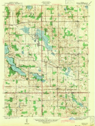
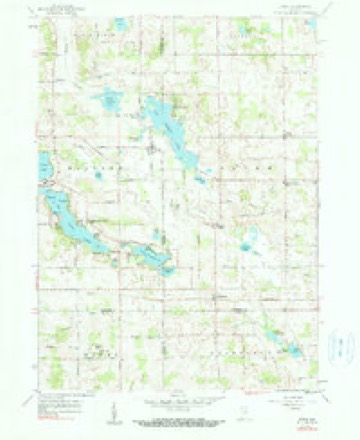
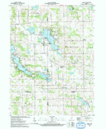
13 topographic sheets cover this place, the earliest surveyed in 1942 and the latest in 1993. It stands in Salem Township. It lies in ZIP code area 46747. The Survey maps it on the Stroh quadrangle. It stands 1,050 feet above sea level.
Topographic sheets covering this place
6 surveys from 13 printed sheetsMatched by testing this settlement's coordinate against the published boundary of every sheet in the United States Geological Survey's historical collection. Each opens the scanned sheet at the Survey.
- 1942 USGS Stroh quadrangle1:24000, 2 printings
- 1953 USGS Fort Wayne quadrangle1:250000, 4 printings
- 1956 USGS Fort Wayne quadrangle1:250000, 2 printings
- 1959 USGS Stroh quadrangle1:24000, 2 printings
- 1985 USGS Elkhart quadrangle1:100000, 2 printings
- 1993 USGS Stroh quadrangle1:24000


In the county-history sources
18,467 words on this townshipHistory of Steuben County, Indiana, Together with... Biographies of Representative Citizens, published 1885 names this settlement in its chapter on Salem Township. These are the passages that mention it, exactly as the scans read.
John Slick (deceased), long known as the oldest inhabitant of Salem Township, was born in Prussia, Dec. 18, 1785, and lived in that country with his parents until he arrived at his twentieth year. He was then pressed into the military service of Napoleon Bonaparte, in which he remained under the immediate command of Marshal Ney about four years, during Napoleon's war with Spain. He finally deserted and went to Lisbon, where, finding an English ship bound tor Liverpool, he took passage for England . Soon after arriving in the British realm, he was again pressed into the naval service, at the beginning of the war of 1812. He remained with the British army three and a half years, during vvhicli time he was in the principal engagements between the British and the United States. But English service suited him no better than French, and being one night placed on picket near the American forces, he quietly left his post and crossed the river; finding our sentinel asleep on his post he waked him and expressed a desire to go into camp. This ended his service as a soldier. He soon after settled in the village of Rush, near Rochester, N. Y., where, in the year 1815 he married Mary Hempstead, who remained a faithful companion to him during the remainder of his long life. Early in the history of Steuben County he left Cattaraugus County, N. Y., and settled in Salem Township, this county, where he resided for forty years, half a mile south of Salem Center. During his latter years Mr. Slick's advanced age and eventful life made him an interesting conversationalist. It was really entertaininoto hear him narrate his narrow escapes from prison and death, and he took great delight in relating them and exhibiting his scars to verify the truth of his statements. He died at his home in Salem Township, Thursday, July 31, 1879, aged ninety-three years and seven months. He left a wife, aged seventy-eight, two sons, three daughters, thirty -six grandchildren and twenty-three great-grandchildren. The wife has since died, at the age of eighty-five years.
Passage source: History of Steuben County, Indiana, Together with... Biographies of Representative Citizens, published 1885.
Salem Township now contains many highly cultivated farms, which indicate the tirelpss energy of the early settlers, who cleared away the mighty forests, and they and their descendants have made the waste places "bud and blossom as the rose." There are three postoffices in the township - Hudson, Salem Center and Turkey Creek. The first named is in the southeast corner, on the line between Salem and Steuben townships. Salem Center is a mile north of the center of the township, while Turkey Creek is situated on the creek of the same name in the southwestern part of the township.
Passage source: History of Steuben County, Indiana, Together with... Biographies of Representative Citizens, published 1885.
Salem Center was never platted as a village, but has for many years supported two mercantile establishments doing a very respectable business, beside considerable other trade. The history of the village began in 1843, when W. H. Austin and Edward Wright opened the first store, a block structure erected by Mr. Austin on the present site of Hammond, Dole & Co.'s store. Two years later Wright bought the interest of his partner, and after a time was succeeded by Adolphus Gale, who, in turn, sold to W. W. Braden. Dr. Joseph C. Kimsey bought this building and converted the timbers into fuel, the lot having been purchased by James Richards, who erected thereon a frame building, the first story of which he used for a time as a work shop, and the upper story was used as a lodge-room by the Masonic fraternity. About 1862 E. T, Hammond and Casper Conger bought this building a- d fitted it up for a store, into which they put a stock of goods in 1864. The following year Mr. Hammond became sole proprietor, and after a time he sold to John Carey, who carried on the business for several years, and was burned out in the autumn of 1871. He soon after rebuilt on the same lot, and sold to T. J. Warner.
Passage source: History of Steuben County, Indiana, Together with... Biographies of Representative Citizens, published 1885.
Machine-read from a century-old scan, so expect the errors a machine makes: misspelled names, dropped words, stray characters.
Read the whole chapter on Salem Township - it names this place 7 more 7 times.
Fires near this place
2 since 2003Regional context, not property-specific evidence. The federal wildfire occurrence database lists 2 fires within 5 miles of Salem Center between 2003 and 2005, burning about 5 acres in total. None started naturally. None was recorded as arson. Distance is straight-line from the map coordinates, so a fire counted here may appear on a neighbouring settlement's page as well.
| Reported cause | Fires |
|---|---|
| Recreation and ceremony | 2 |
The most recent of them, most recent first, with the day each was reported and the service that recorded it.
| Date | Cause | Size | Reported by | Name on the report |
|---|---|---|---|---|
| 4 April 2005 | Recreation and ceremony | 3.0 acres | Indiana State Fire Marshal's Office | not named |
| 13 April 2003 | Recreation and ceremony | 2.0 acres | Indiana State Fire Marshal's Office | not named |
Settlements close enough to share some of these fires:
Mines and quarries near this place
1 within 5 milesRegional context, not property-specific evidence. The federal mineral resources record lists 1 working within 5 miles of Salem Center: 1 producer. All of them still produce. What was taken out: Sand and Gravel, Construction. Distance is straight-line from the map coordinates, so a quarry counted here may appear on a neighbouring settlement's page as well.
| Where | Site | Commodity | Status | Recorded |
|---|---|---|---|---|
| Viking Gravel Pit | Sand and Gravel, Construction | Producer |
Storms near this place
8 since 2001Regional context, not property-specific evidence. The National Weather Service names Salem Center in 8 storm reports between 2001 and 2023: 4 hail, 4 thunderstorm wind. No death or injury is recorded in these reports. Each account below is quoted exactly as the forecast office filed it, from the NOAA Storm Events Database, and each date opens the federal record of that event.
| When | Event | Place named | Harm | What the report says |
|---|---|---|---|---|
| June 2023 | Thunderstorm Wind | Salem Center | $30,000 | A large barn sustained structural damage and a small outbuilding was destroyed. |
| June 2023 | Thunderstorm Wind | Salem Center | $7,500 | Piece of roof covering lost and damage to a wall reported at the Salem Township Fire Department. |
| June 2008 | Thunderstorm Wind | Salem Center | $5,000 | Amateur radio operators reported a tree falling onto a house trailer. Damage is estimated at $5,000. |
| May 2014 | Hail | Salem Center | - | The public reported hail was covering the ground with sizes ranging from pea to half dollar. |
| June 2008 | Thunderstorm Wind | Salem Center | - | Trained spotters reported a 22-inch diameter maple tree snapped off and other large limbs down west of Salem Center. |
| March 2019 | Hail | Salem Center | - | no account filed |
| May 2014 | Hail | Salem Center | - | no account filed |
| April 2001 | Hail | Salem Center | - | no account filed |
Nearest settlements
The eight closest, with where each one stands in the county. Distances are straight-line, computed from the Geographic Names Information System coordinates.
| Map | Place | Distance | Sheets |
|---|---|---|---|
| Westview | 2.3 miles | 13 | |
| Turkey Creek | 2.6 miles | 13 | |
| Meadow Shores Park | 2.7 miles | 13 | |
| Indian Hills | 2.7 miles | 13 | |
| Wildwood | 2.7 miles | 13 | |
| Otter Lake | 4.0 miles | 15 | |
| Helmer | 4.1 miles | 13 | |
| Holiday Woods | 4.5 miles | 14 |
Elsewhere
Matched on this settlement's Geographic Names Information System number rather than its name, so it cannot be a different place of the same name in another state.
| Wikipedia article on Salem Center | An encyclopaedic summary. Its text is share-alike, so it is linked here rather than copied. |
| Wikidata item Q27988936 | The structured record the population and elevation above come from. Public domain (CC0). |
Provenance
This settlement is recorded in the Geographic Names Information System as feature 449727. The sheet list is computed by point-in-boundary test against the United States Geological Survey's historical topographic inventory. Both are works of the United States government and carry no copyright under 17 U.S.C. 105.
Wildfire. Short, Karen C. 2022. Spatial wildfire occurrence data for the United States, 1992-2020 [FPA_FOD_20221014]. 6th Edition. Fort Collins, CO: Forest Service Research Data Archive. https://doi.org/10.2737/RDS-2013-0009.6 Collected with United States Government funding and usable without additional permissions or fees.
Mines and quarries. USGS Mineral Resources Data System (MRDS) https://mrdata.usgs.gov/mrds/ A work of the United States government, no copyright under 17 U.S.C. 105.
Storms. NOAA National Centers for Environmental Information, Storm Events Database https://www.ncei.noaa.gov/stormevents/ A work of the United States government, no copyright under 17 U.S.C. 105. Narratives are quoted verbatim from the National Weather Service report and are not edited or summarised.