 Block
Whitewater, Indiana
11 topographic sheets cover this place, the earliest surveyed in 1915 and the latest in 1986. It stands in Franklin Township. It lies in ZIP code area 47374. It stands on White Creek. The Survey maps it on the Whitewater quadrangle. 71 people lived here at the 2020 count. It stands 1,129 feet above sea level.
Population over time
2 figuresWhitewater fell from 83 to 71 between 2010 and 2020. These are the recorded population figures Wikidata holds for this place, reached through the Geographic Names Information System number this page is keyed on rather than by name, so they belong to this place and not to another of the same name. Most are census counts, but not all are: an early figure may be a founding or settlement estimate, and an estimate published within five years of a census is left out. The change column is computed, and is left blank where more than 20 years separate a figure from the one before it, because a gap that long is not a change between two counts.
| Year | People | Change |
|---|---|---|
| 2010 | 83 | |
| 2020 | 71 | -12 (-14%) |
Topographic sheets covering this place
6 surveys from 11 printed sheetsMatched by testing this settlement's coordinate against the published boundary of every sheet in the United States Geological Survey's historical collection. Each opens the scanned sheet at the Survey.
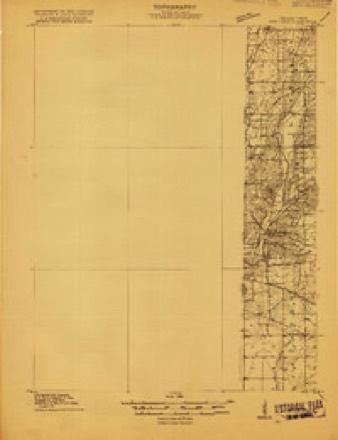
- 1915 USGS New Paris quadrangle1:48000
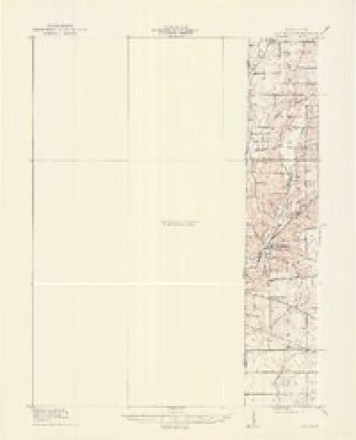
- 1918 USGS New Paris quadrangle1:62500
- 1953 USGS Cincinnati quadrangle1:250000, 3 printings
- 1957 USGS Cincinnati quadrangle1:250000
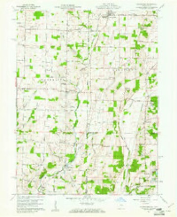
- 1960 USGS Whitewater quadrangle1:24000, 3 printings
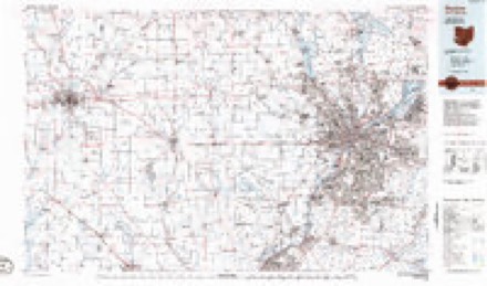
- 1986 USGS Dayton quadrangle1:100000, 2 printings


In the county-history sources
3,760 words on this townshipHistory of Wayne County, Indiana, from Its First Settlement to the Present Time : with Numerous Biographical and Family Sketches, published 1872 names this settlement in its chapter on Franklin Township. These are the passages that mention it, exactly as the scans read.
Franklin township was formed from New Garden, ]May, 1834. Its shape is oldong, being 7 miles in length, north and south, and 4 miles in breadth, east and Avest, containing 28 square miles of territory. The Richmond and Hillsboro' turnpike enters the toAvnship one mile west of the Ohio line ; and the road runs along the lines of lots straight through the township to its north line. Its principal stream is the Middle Fork of Whitewater, which enters the township from Ohio, about 2J miles south of the north-east corner, and runs almost directly south, about half a mile from the Ohio line, to the south line of the township.
Passage source: History of Wayne County, Indiana, from Its First Settlement to the Present Time : with Numerous Biographical and Family Sketches, published 1872.
The progress of settlement northward was materially retarded by apprehensions of danger from the Indians, until after the close of the war of 1812^ Job Elliott, K C, in 1815 settled half a mile south of the present town of Whitewater, where F. Fonts lately lived, now Josiah White. Stephen Elliott on quarter adjoining town. Wm. Hunt, N. C, on the east side of town ; land afterward sold to John Uiitliank, and next to Jolin White; now owned principally hy Handy D. Bowen. Henry ISTewton, from England, where John Pyle lives on state line. Jonathan Commons on state line, where David Stidham lives. Thomas Mason, from N. C, in 1816, near town, on the qnarter now owned by AYm. Addleman and Joseph S. Wood. In 1818 Samuel AVilliams, from IST. C, near town, on land no^v owned by James K. Dugdale and Peter T. Parris. Henry Garrett, N. C.,land now owned by James Garrett, Hiram Snpplee, and Barnabas Barton. Benj. Parker, from N". C, and Joseph Skinner, on the quarter now o"wned by John Powell and Joseph Draher. Elihu Hunt, !N". C, a mile north-east of town, where Jonathan Williams lives. Richard Bunch on land now owned by Stephen Bunnell. Thomas Mason, Jun., three-fourths of a mile north of town, on the quarter owned by Jesse Hunt, Wm. Worden, and Wm. D. Kemp. Nathan Jones, from IST. C., entered the land now owned by Calvin C. Hunt and Peter Blose. Gabriel Ilarrell, from N. C, half a mile south-west of town, on the quarter now owned by Henry Albright and others.
Passage source: History of Wayne County, Indiana, from Its First Settlement to the Present Time : with Numerous Biographical and Family Sketches, published 1872.
The first Merchant in Whitewater is said to have been John Price. After two or three years he sold the goods to Stephen Elliott, who was on the south-west corner, and by whom the house had been built. Thomas Morton, of Miami, Ohio, had a store in the north-east corner about two years, and built on the corner where Joseph A. Bowen now trades. Elliott sold his goods to John II. Bruce and Jonathan D. Gray. Wm. B. Schenck was here at least as early as 1839, and as late as 1844. T. J. Ferguson & Co., in, 1844. At Bethel, Wm. :\lcFarland appears to have been the first merchant in 1845, on the northeast corner, where are now a grocer}^ and a tavern, ke})t by jSTathan Harlan, and traded several years. Edward Osborn, of Newport, soon after established a store, kept by Joseph Unthank. There were afterward, at different times, John A. Unthank, Walker Yeatraan, Jesse Richards, Jacob & Howard Harlan, Morgan & Henderson. Present merchants - Martin Wiley, dry goods; Xathan Harlan, grocer. Present merchants at AVhitewater - Joseph A. Bowen, north-west corner;
Passage source: History of Wayne County, Indiana, from Its First Settlement to the Present Time : with Numerous Biographical and Family Sketches, published 1872.
Machine-read from a century-old scan, so expect the errors a machine makes: misspelled names, dropped words, stray characters.
Read the whole chapter on Franklin Township - it names this place 8 more 8 times.
Mines and quarries near this place
5 within 5 milesRegional context, not property-specific evidence. The federal mineral resources record lists 5 workings within 5 miles of Whitewater: 4 producers, 1 past producer. 4 still produce. What was taken out: Sand and Gravel, Construction, Stone, Crushed/Broken. Distance is straight-line from the map coordinates, so a quarry counted here may appear on a neighbouring settlement's page as well.
| Where | Site | Commodity | Status | Recorded |
|---|---|---|---|---|
| Middleboro Stone Quarry | Stone, Crushed/Broken | Producer | ||
| Springfield Limestone Quarry #223 | Stone, Crushed/Broken | Producer | ||
| Belleview Plant Pit | Sand and Gravel, Construction | Producer | ||
| Fountain City | Sand and Gravel, Construction | Producer | ||
| New Paris Pit | Sand and Gravel, Construction | Past Producer |
Storms near this place
3 since 2010Regional context, not property-specific evidence. The National Weather Service names Whitewater in 3 storm reports between 2010 and 2019: 2 thunderstorm wind, 1 flash flood. No death or injury is recorded in these reports. Each account below is quoted exactly as the forecast office filed it, from the NOAA Storm Events Database, and each date opens the federal record of that event.
| When | Event | Place named | Harm | What the report says |
|---|---|---|---|---|
| June 2014 | Flash Flood | Whitewater | $50,000 | State Route 227 was closed due to high rushing water caused by heavy rainfall between Whitewater Road and Wallace Road. A culvert was washed out along this segment of highway as a result of the flash flood. High water was also reported across much of the county with several additional road closures. |
| May 2019 | Thunderstorm Wind | Whitewater | $3,000 | Multiple trees were downed near the intersection of Whitewater Road and State Route 227. |
| May 2010 | Thunderstorm Wind | Whitewater | $2,000 | Trees were reported down due to damaging thunderstorm winds. |
Nearest settlements
The eight closest, with where each one stands in the county. Distances are straight-line, computed from the Geographic Names Information System coordinates.
| Map | Place | Distance | Sheets |
|---|---|---|---|
| Bethel | 2.9 miles | 11 | |
| Middleboro | 3.5 miles | 11 | |
| Fountain City | 4.6 miles | 9 | |
| Chester | 4.9 miles | 9 | |
| Wayne | 6.4 miles | 9 | |
| Webster | 6.7 miles | 9 | |
| Spring Grove | 7.4 miles | 10 | |
| Spring Grove Heights | 7.7 miles | 10 |
Elsewhere
Matched on this settlement's Geographic Names Information System number rather than its name, so it cannot be a different place of the same name in another state.
| Wikipedia article on Whitewater | An encyclopaedic summary. Its text is share-alike, so it is linked here rather than copied. |
| Wikidata item Q3299825 | The structured record the population and elevation above come from. Public domain (CC0). |
Provenance
This settlement is recorded in the Geographic Names Information System as feature 449747. The sheet list is computed by point-in-boundary test against the United States Geological Survey's historical topographic inventory. Both are works of the United States government and carry no copyright under 17 U.S.C. 105.
Mines and quarries. USGS Mineral Resources Data System (MRDS) https://mrdata.usgs.gov/mrds/ A work of the United States government, no copyright under 17 U.S.C. 105.
Storms. NOAA National Centers for Environmental Information, Storm Events Database https://www.ncei.noaa.gov/stormevents/ A work of the United States government, no copyright under 17 U.S.C. 105. Narratives are quoted verbatim from the National Weather Service report and are not edited or summarised.