 Block
Fountain City, Indiana
9 topographic sheets cover this place, the earliest surveyed in 1915 and the latest in 1986. It stands in New Garden Township. It lies in ZIP code area 47341. It stands on Fellow Brook. The Survey maps it on the Fountain City quadrangle. 714 people lived here at the 2020 count. It stands 1,102 feet above sea level.
On record in Fountain City
Buildings and businesses the archive holds for this place. Each opens its own page, with the source record it came from.
On the National Register 2 records
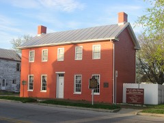 Levi Coffin HouseNational Historic Landmark · listed 1966
- Fountain City Historic Districtlisted 2018
Population over time
2 figuresFountain City fell from 796 to 714 between 2010 and 2020. These are the recorded population figures Wikidata holds for this place, reached through the Geographic Names Information System number this page is keyed on rather than by name, so they belong to this place and not to another of the same name. Most are census counts, but not all are: an early figure may be a founding or settlement estimate, and an estimate published within five years of a census is left out. The change column is computed, and is left blank where more than 20 years separate a figure from the one before it, because a gap that long is not a change between two counts.
| Year | People | Change |
|---|---|---|
| 2010 | 796 | |
| 2020 | 714 | -82 (-10%) |
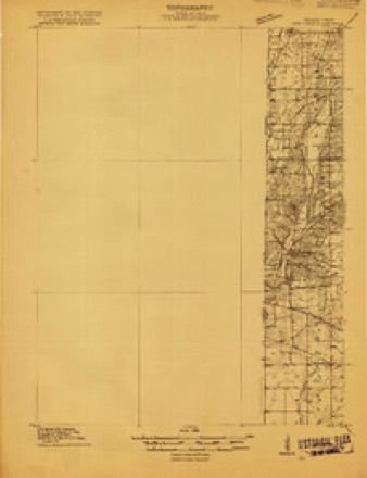
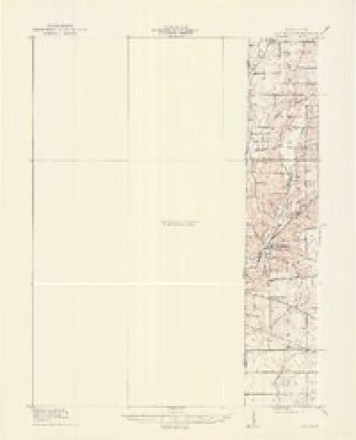
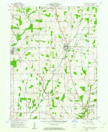
Topographic sheets covering this place
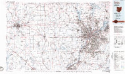
6 surveys from 9 printed sheetsMatched by testing this settlement's coordinate against the published boundary of every sheet in the United States Geological Survey's historical collection. Each opens the scanned sheet at the Survey.
- 1915 USGS New Paris quadrangle1:48000
- 1918 USGS New Paris quadrangle1:62500
- 1953 USGS Cincinnati quadrangle1:250000, 3 printings
- 1957 USGS Cincinnati quadrangle1:250000
- 1960 USGS Fountain City quadrangle1:24000
- 1986 USGS Dayton quadrangle1:100000, 2 printings


In the county-history sources
18,780 words on this townshipHistory of Wayne County, Indiana : Together with Sketches of Its Cities, Villages and Towns, published 1884 names this settlement in its chapter on New Garden Township. These are the passages that mention it, exactly as the scans read.
The early settlers of the township were mostly from North Carolina, and a large proportion of them were Friends, many of them from the neighborhood of a Friends' meetinghouse, named New Garden, in Guilford County, N. C, or attached to that Yearly Meeting. This township without doubt was named from that meeting-house.
Passage source: History of Wayne County, Indiana : Together with Sketches of Its Cities, Villages and Towns, published 1884.
There has been much speculation and there is yet quite a difference of opinion as to who were the first settlers. From the best and most reliable evidence John Turner and Jonathan Marine were among, if not the very first settlers of the township, both having settled there in 1809 or 1810.
Passage source: History of Wayne County, Indiana : Together with Sketches of Its Cities, Villages and Towns, published 1884.
About the same time, from 1811 to 1816, the southeast part of the township was settled by Abraham Hampton, Jacob Hampton, Frank Swin, Hampton Brown, James Massey, and others whose names we cannot give. South of Newport, now Fountain City, about the same time the following persons located : Obadiah Harris, Cader Woodard, Francis Tliomas, Benjamin Thomas, Sr., and Josiah Woodard.
Passage source: History of Wayne County, Indiana : Together with Sketches of Its Cities, Villages and Towns, published 1884.
Machine-read from a century-old scan, so expect the errors a machine makes: misspelled names, dropped words, stray characters.
Read the whole chapter on New Garden Township - it names this place 30 more 30 times.
Mines and quarries near this place
2 within 5 milesRegional context, not property-specific evidence. The federal mineral resources record lists 2 workings within 5 miles of Fountain City: 2 producers. All of them still produce. What was taken out: Sand and Gravel, Construction. Distance is straight-line from the map coordinates, so a quarry counted here may appear on a neighbouring settlement's page as well.
| Where | Site | Commodity | Status | Recorded |
|---|---|---|---|---|
| Fountain City | Sand and Gravel, Construction | Producer | ||
| Hutchens Gravel Company | Sand and Gravel, Construction | Producer |
Storms near this place
18 since 2000Regional context, not property-specific evidence. The National Weather Service names Fountain City in 18 storm reports between 2000 and 2026: 7 thunderstorm wind, 6 flood, 3 hail, 1 flash flood. No death or injury is recorded in these reports. Each account below is quoted exactly as the forecast office filed it, from the NOAA Storm Events Database, and each date opens the federal record of that event.
| When | Event | Place named | Harm | What the report says |
|---|---|---|---|---|
| December 2015 | Tornado (EF0) | Fountain City | $150,000 | A storm survey was conducted in northeast Wayne County Indiana, in coordination with the Wayne County Emergency Management Agency. Damage began near a property along East Fountain City Pike east of Fountain City, in which several outbuildings were destroyed. Some of the damage followed a southwest to northeast path, although there was evidence of rotation within the debris pattern, which would coincide with a weak tornado. The damage continued in a northeast path and crossed Elliott Road and continued northeast to Bethel. Additional outbuilding damage was surveyed at 2 properties along Elliott Road, in which small outbuildings were destroyed and there was additional damage to larger barns. The path continued northeast to Bethel, where a chimney collapse and roof damage occurred at a church in Bethel. |
| May 2011 | Thunderstorm Wind | Fountain City | $20,000 | Trees were reported down due to damaging thunderstorm winds. Siding, window, and garage damage occurred to a house as well due to the winds. |
| September 2024 | Thunderstorm Wind | Fountain City | $8,000 | A few trees and wires were downed. |
| July 2022 | Thunderstorm Wind | Fountain City | $5,000 | Several trees were downed across northern Wayne County. |
| August 2002 | Thunderstorm Wind | Fountain City | $3,000 | Trees were downed in and around the village. |
| April 2026 | Thunderstorm Wind | Fountain City | $1,000 | A tree was downed in Fountain City. |
| July 2015 | Thunderstorm Wind | Fountain City | $1,000 | A couple of trees were downed. |
| June 2000 | Thunderstorm Wind | Fountain City | $1,000 | Several trees were blown down. |
| March 2023 | Flood | Fountain City | - | High water was reported near Boundary Road between Hinshaw and Overman Roads. |
| March 2023 | Flood | Fountain City | - | High water was reported along Bockhofer Road between Boundary and Middle Roads. |
| February 2019 | Flood | Fountain City | - | Several roads were still closed due to high water. |
| September 2018 | Flood | Fountain City | - | High water was over roadways near the intersection of Wallace Road and Arba Pike. |
| June 2017 | Flood | Fountain City | - | Several roads in the northern part of the county remained closed due to high water. |
| April 2014 | Flood | Fountain City | - | Two roads were closed in the county due to high water caused by heavy rainfall. |
| May 2004 | Flash Flood | Fountain City | - | Boundry Road was flooded and closed. |
| May 2019 | Hail | Fountain City | - | no account filed |
| May 2004 | Hail | Fountain City | - | no account filed |
| May 2004 | Hail | Fountain City | - | no account filed |
Nearest settlements
The eight closest, with where each one stands in the county. Distances are straight-line, computed from the Geographic Names Information System coordinates.
| Map | Place | Distance | Sheets |
|---|---|---|---|
| Webster | 3.9 miles | 9 | |
| Williamsburg | 4.2 miles | 9 | |
| Whitewater | 4.6 miles | 11 | |
| Wayne | 4.7 miles | 9 | |
| Chester | 4.9 miles | 9 | |
| Bethel | 5.1 miles | 11 | |
| Middleboro | 6.2 miles | 11 | |
| Spring Grove | 7.5 miles | 10 |
Elsewhere
Matched on this settlement's Geographic Names Information System number rather than its name, so it cannot be a different place of the same name in another state.
| Wikipedia article on Fountain City | An encyclopaedic summary. Its text is share-alike, so it is linked here rather than copied. |
| Wikidata item Q1439902 | The structured record the population and elevation above come from. Public domain (CC0). |
Provenance
This settlement is recorded in the Geographic Names Information System as feature 434712. The sheet list is computed by point-in-boundary test against the United States Geological Survey's historical topographic inventory. Both are works of the United States government and carry no copyright under 17 U.S.C. 105.
Mines and quarries. USGS Mineral Resources Data System (MRDS) https://mrdata.usgs.gov/mrds/ A work of the United States government, no copyright under 17 U.S.C. 105.
Storms. NOAA National Centers for Environmental Information, Storm Events Database https://www.ncei.noaa.gov/stormevents/ A work of the United States government, no copyright under 17 U.S.C. 105. Narratives are quoted verbatim from the National Weather Service report and are not edited or summarised.