 Block
Alden, Minnesota
8 topographic sheets cover this place, the earliest surveyed in 1954 and the latest in 1985. It stands in Alden City. It lies in ZIP code area 56009. The Survey maps it on the Alden quadrangle. 583 people lived here at the 2020 count. It stands 1,270 feet above sea level.
Population over time
2 figuresAlden fell from 661 to 583 between 2010 and 2020. These are the recorded population figures Wikidata holds for this place, reached through the Geographic Names Information System number this page is keyed on rather than by name, so they belong to this place and not to another of the same name. Most are census counts, but not all are: an early figure may be a founding or settlement estimate, and an estimate published within five years of a census is left out. The change column is computed, and is left blank where more than 20 years separate a figure from the one before it, because a gap that long is not a change between two counts.
| Year | People | Change |
|---|---|---|
| 2010 | 661 | |
| 2020 | 583 | -78 (-12%) |
Topographic sheets covering this place
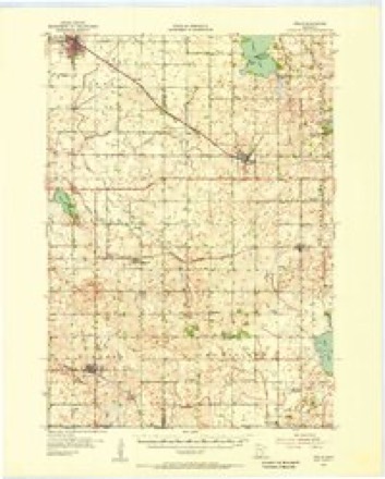
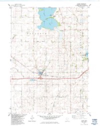
6 surveys from 8 printed sheetsMatched by testing this settlement's coordinate against the published boundary of every sheet in the United States Geological Survey's historical collection. Each opens the scanned sheet at the Survey.
- 1954 USGS Mason City quadrangle1:250000, 2 printings
- 1955 USGS Wells quadrangle1:62500
- 1957 USGS Mason City quadrangle1:250000
- 1958 USGS Mason City quadrangle1:250000
- 1982 USGS Alden quadrangle1:24000
- 1985 USGS Albert Lea quadrangle1:100000, 2 printings




In the county-history sources
5,685 words on this townshipHistory of Freeborn County, published 1882 names this settlement in its chapter on Alden City. These are the passages that mention it, exactly as the scans read.
This lies in the western tier ot Freeborn county's towns, and is separated from Iowa by one town. Its contiguous stirronndings are, Carlston on the north; Pickerel Lake on the east; Mansfield on the south, and Faribault county on the webt. It is constituted as originally surveyed by the United States officers, of thirty-six square miles, and contains 23,040 acres, of which the greater portion is under a high state of cultivation, being one of the richest farming towns in this part of the State, and containing as much real value.
Passage source: History of Freeborn County, published 1882.
The early development of this sub-division of Freeborn county commenced a little later than the average of towns in this part of Minnesota, but the changes wrought have been equal to any and surpassed by none; for, we find the township, by a glance at the statistical returns, as productive and rich, agriculturally, as the best.
Passage source: History of Freeborn County, published 1882.
Joseph W. Harrington, a native of lUinois, came to Alden in 186.3, and in the spring of that year took a homestead in section twelve, where he remained until 1873, when he removed to the village and remained there until the time of his death, which occurred in 1875. He was among the prominent men of this locality.
Passage source: History of Freeborn County, published 1882.
Machine-read from a century-old scan, so expect the errors a machine makes: misspelled names, dropped words, stray characters.
Read the whole chapter on Alden City - it names this place 22 more 22 times.
Fires near this place
3 since 1999Regional context, not property-specific evidence. The federal wildfire occurrence database lists 3 fires within 5 miles of Alden between 1999 and 2015, burning about 10 acres in total. None started naturally. None was recorded as arson. Distance is straight-line from the map coordinates, so a fire counted here may appear on a neighbouring settlement's page as well.
| Reported cause | Fires |
|---|---|
| Debris and open burning | 2 |
| Missing data/not specified/undetermined | 1 |
The most recent of them, most recent first, with the day each was reported and the service that recorded it.
| Date | Cause | Size | Reported by | Name on the report |
|---|---|---|---|---|
| 1 May 2015 | Missing data/not specified/undetermined | 1.2 acres | Windom Wetland Management District | IOWA CHICAGO & EASTERN |
| 16 April 2007 | Debris and open burning | 9.0 acres | Windom Wetland Management District | HALLS LAKE |
| 27 November 1999 | Debris and open burning | under an acre | Windom Wetland Management District | FOSTER CREEK |
Settlements close enough to share some of these fires:
Storms near this place
37 since 1994Regional context, not property-specific evidence. The National Weather Service names Alden in 37 storm reports between 1994 and 2025: 13 hail, 10 thunderstorm wind, 6 tornado, 3 flash flood. No death or injury is recorded in these reports. Each account below is quoted exactly as the forecast office filed it, from the NOAA Storm Events Database, and each date opens the federal record of that event.
| When | Event | Place named | Harm | What the report says |
|---|---|---|---|---|
| June 2014 | Thunderstorm Wind | Alden | $100,000 | Several roofs were blown off sheds, and multiple grain bins were blown down around the city of Alden. |
| June 2013 | Thunderstorm Wind | Alden | $10,000 | Several trees were blown down in North Park, plus a garage was blown down on County Road 51, east of Alden. |
| June 1994 | Hail | Alden | $5,000 | Dime-size hail and major tree damage was reported from the city of Alden. Along with downed trees, structural damage had occurred to some of the buildings in town. |
| June 1994 | Thunderstorm Wind | Alden | $5,000 | Dime-size hail and major tree damage was reported from the city of Alden. Along with downed trees, structural damage had occurred to some of the buildings in town. |
| July 2022 | Thunderstorm Wind | Alden | $500 | Several large tree branches were blown down in the city of Alden. |
| June 2025 | Flash Flood | Alden | - | Hwy 109 closed between Wells and Alden due to water over the roadway. Two county roads west of Alden were damaged due to flooding (CR 61 and CR 51). One Carlston Township road (630th Av north of Hwy 109) was also damaged due to flooding. |
| August 2025 | Thunderstorm Wind | Alden | - | Numerous trees and power lines were downed throughout the city of Alden. |
| August 2025 | Thunderstorm Wind | Alden | - | Power lines were downed across I90 eastbound near Alden, MN. |
| June 2025 | Flood | Alden | - | At least 12 residents in the city of Alden reported water in their basements. The City of Alden used pumps to bypass the sewer system to alleviate overload to the sewage ponds. This flooding was a result of heavy rain that occurred throughout the day on June 16th. |
| June 2025 | Tornado (EF0) | Alden | - | A tornado was caught on video in Faribault County, just north of Interstate 90. It moved across fields before moving into Freeborn County, where it hit some trees. Satellite imagery confirmed the tornado path. Based on the tree damage, the maximum wind speed was estimated at 80 mph. |
| June 2025 | Tornado (EF0) | Alden | - | Trained spotters and some members of the public took photos of a tornado that crossed the southern portion of Freeborn Lake. Before crossing the lake, it damaged trees at an abandoned farmstead. After crossing the lake, it damaged some corn on the eastern side of the lake before it dissipated. |
| June 2024 | Flash Flood | Alden | - | County Road 61 washed out near I-90 just west of Alden. At least six inches of water was flowing across 850th Avenue north of Maple Island. |
| July 2022 | Tornado (EF0) | Alden | - | A low topped mini supercell produced a brief tornado. It broke several large branches from a few trees and partially ripped off some soffits. A storm chaser caught video of the tornado breaking tree branches and dropping them to the ground. |
| December 2021 | Tornado (EF1) | Alden | - | The first damage observed was a bent road sign near the tornado origin point. A path of tree and utility pole damage continued to the northeast before ending just south of I-90. Several trees were uprooted. |
| December 2021 | Tornado (EF1) | Alden | - | This tornado developed to the east of Alden, damaging trees and a large building that housed farm equipment. It then continued to the northeast, damaging additional trees before dissipating in a field. |
| May 2020 | Funnel Cloud | Alden | - | A deputy and several others observed a funnel cloud for several minutes. The funnel was also photographed. |
| June 2013 | Heavy Rain | Alden | - | A rainfall amount of 2.25 inches fell near Alden in the past 4 hours. |
| June 2013 | Thunderstorm Wind | Alden | - | A semi-trailer was blown over on Interstate 90 near Alden. |
| June 2013 | Flash Flood | Alden | - | Several resources including trained spotters, emergency managers and the local media indicated that significant flooding occurred in western Freeborn County. County Road 109 between Alden (Freeborn County) and Wells (Faribault County) had several areas at which one lane was closed due to water over the roadway. In addition, several farms, fields and flood prone areas had standing water for several hours after 2 to 3 inches of rain fell in a short period of time. |
| September 2010 | Heavy Rain | Alden | - | The local media measured 7.0 inches of rainfall overnight. |
| June 2009 | Tornado (EF0) | Alden | - | Tornado touched down briefly at 1932 CST in an open field, then lifted up, and touched down again at 1935 CST. During the time that it was off the ground, video showed the same parent funnel overhead. When it touched back down again, it moved across a corn field and into a farmstead, knocking down several trees and blowing away a garden bench. The tornado continued moving north into another corn field, where it dissipated. The tornado was photographed and videotaped by numerous storm chasers. |
| June 2009 | Funnel Cloud | Alden | - | Funnel east of Alden was caught on video by a storm chaser and also witnessed by members of the Alden fire department. |
| July 2007 | Thunderstorm Wind | Alden | - | Six inch tree limb down near Interstate 90. |
| June 1999 | Thunderstorm Wind | Alden | - | Windows blown out of house. Estimated windspeed. |
| June 1998 | Thunderstorm Wind | Alden | - | Trees down. Damage to sheds and barns. |
| May 2018 | Hail | Alden | - | no account filed |
| May 2018 | Hail | Alden | - | no account filed |
| June 2013 | Hail | Alden | - | no account filed |
| June 2013 | Hail | Alden | - | no account filed |
| June 2013 | Hail | Alden | - | no account filed |
| June 2013 | Hail | Alden | - | no account filed |
| April 2008 | Hail | Alden | - | no account filed |
| June 2008 | Hail | Alden | - | no account filed |
| October 2005 | Hail | Alden | - | no account filed |
| May 2004 | Hail | Alden | - | no account filed |
| May 2000 | Hail | Alden | - | no account filed |
| May 2000 | Hail | Alden | - | no account filed |
Nearest settlements
The eight closest, with where each one stands in the county. Distances are straight-line, computed from the Geographic Names Information System coordinates.
| Map | Place | Distance | Sheets |
|---|---|---|---|
| Conger | 4.6 miles | 8 | |
| Armstrong | 5.7 miles | 10 | |
| Freeborn | 6.6 miles | 8 | |
| Mansfield | 7.0 miles | 8 | |
| Manchester | 7.6 miles | 10 | |
| Hartland | 10.4 miles | 7 | |
| Albert Lea | 11.1 miles | 10 | |
| Twin Lakes | 11.1 miles | 10 |
Elsewhere
Matched on this settlement's Geographic Names Information System number rather than its name, so it cannot be a different place of the same name in another state.
| Wikipedia article on Alden | An encyclopaedic summary. Its text is share-alike, so it is linked here rather than copied. |
| Wikidata item Q2170168 | The structured record the population and elevation above come from. Public domain (CC0). |
Provenance
This settlement is recorded in the Geographic Names Information System as feature 639262. The sheet list is computed by point-in-boundary test against the United States Geological Survey's historical topographic inventory. Both are works of the United States government and carry no copyright under 17 U.S.C. 105.
Wildfire. Short, Karen C. 2022. Spatial wildfire occurrence data for the United States, 1992-2020 [FPA_FOD_20221014]. 6th Edition. Fort Collins, CO: Forest Service Research Data Archive. https://doi.org/10.2737/RDS-2013-0009.6 Collected with United States Government funding and usable without additional permissions or fees.
Storms. NOAA National Centers for Environmental Information, Storm Events Database https://www.ncei.noaa.gov/stormevents/ A work of the United States government, no copyright under 17 U.S.C. 105. Narratives are quoted verbatim from the National Weather Service report and are not edited or summarised.