 Block
Freeborn, Minnesota
8 topographic sheets cover this place, the earliest surveyed in 1954 and the latest in 1985. It stands in Freeborn City. It lies in ZIP code area 56032. The Survey maps it on the Freeborn quadrangle. 264 people lived here at the 2020 count. It stands 1,234 feet above sea level.
Population over time
2 figuresFreeborn fell from 297 to 264 between 2010 and 2020. These are the recorded population figures Wikidata holds for this place, reached through the Geographic Names Information System number this page is keyed on rather than by name, so they belong to this place and not to another of the same name. Most are census counts, but not all are: an early figure may be a founding or settlement estimate, and an estimate published within five years of a census is left out. The change column is computed, and is left blank where more than 20 years separate a figure from the one before it, because a gap that long is not a change between two counts.
| Year | People | Change |
|---|---|---|
| 2010 | 297 | |
| 2020 | 264 | -33 (-11%) |
Topographic sheets covering this place
5 surveys from 8 printed sheetsMatched by testing this settlement's coordinate against the published boundary of every sheet in the United States Geological Survey's historical collection. Each opens the scanned sheet at the Survey.
- 1954 USGS Mason City quadrangle1:250000, 2 printings
- 1957 USGS Mason City quadrangle1:250000
- 1958 USGS Mason City quadrangle1:250000
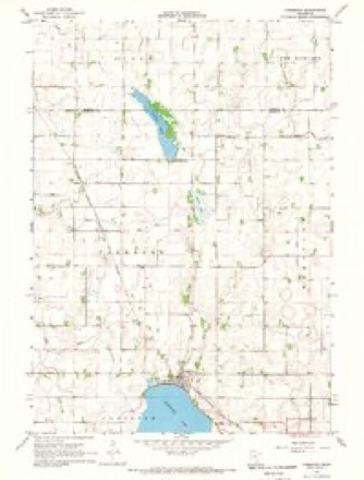
- 1967 USGS Freeborn quadrangle1:24000, 2 printings
- 1985 USGS Albert Lea quadrangle1:100000, 2 printings




In the county-history sources
2,397 words on this townshipHistory of Freeborn County, Minnesota, published 1911 names this settlement in its chapter on Freeborn City. These are the passages that mention it, exactly as the scans read.
This township has a name identical with that of the county. Its immediate surroundings are Waseca county on the north, Faribault county on the west, Carlston county on the south, and Hartland on the east. It is constituted, as are all the townships in this county, of a full congressional township, containing 23,040 acres, known in legal parlance as township 104, range 23. Free¬ born is principally a prairie town, not so much inclined to be rolling as most of the towns, but level and in places marshy. The lakes are surrounded by a small growth of the shrubby varieties of timber. The soil is a dark and sandy loam, with a sub-soil of clay and gravel, and almost the entire area is well adapted to agricultural purposes, and has a large cultivated acreage, yielding good crops of the cereals and other products of the latitude, and in the low lands hay is a most valuable crop. The township is well watered by numerous lakes and streams, which diversify the scenery and help make the land valuable for agricultural purposes. First in order should be mentioned the lake bearing the name of Freeborn, which extends from Carlston township, in which a greater part of the lake lies, northward, and covers a few acres of land in section 35, just south of the village of Freeborn. Lake George lies about one mile to the north, in sections 26 and 27. Still further north, in sections 11 and 14, is located another small body of water, known as Spicer lake. Trenton lake covers quite an area in sections 2 and 3, and extends northward into Waseca county. Another body of water, known as Prairie lake, is located in the extreme southwestern part of the town. Two rivers, known as the Big and Little Cobb rivers, traverse the town from the southeast to the northwest, almost parallel, within about two miles of each other, and enter Faribault county.
Passage source: History of Freeborn County, Minnesota, published 1911.
Early Settlement. In the early days it was generally agreed that the first settlers in this township were T. K. Page and William Montgomery, who came from Dodge county, Wisconsin, and in July, 1856, located in section 26 and commenced improvements, the former erecting the first house, of logs. They remained sev¬ eral years, when they returned to their former homes. The first permanent settlers came June 13, 1856, and were H. T. Simms, who located on a tract of land in section 10 ; Jeremiah Davis, and son, D. C., who located in section 2. and John W. Avars, who settled in the northern part of the township on sections 3 and 4. Another member of the party was a Mr. Heritage, who remained in the township but a short time and then returned to Wisconsin. This party of pioneers came from Wisconsin in covered wagons, drawn by ox teams, and for weeks after their arrival here they camped in their wagons while rude log houses were being erected. The locality in which these people located is still known as Seventh Day Adventists' Grove. About the same time came E. S. Dunn, long a justice of the peace, who settled in the northern part of the township. Mr. Dunn remained upon this farm until 1857, when he removed to the southern part of the town, and in June took 320 acres of land in sections 34 and 35, under the provisions of the law allowing it for townsite purposes. He lived here until 1881, when he removed to Missouri. September 10, in 1856, came Charles Giddings, Parker Page and L. T. Scott, from Dodge county, Wisconsin, who all settled upon sections 35 and 26. Mr. Giddings remained about six years, when he removed to Fari¬ bault, and from there to Blooming Prairie, Steele county. Mr. Page remained about eight years, when he went to Nebraska. Mr. Scott now lives in the village and is one of the most successful as well as most prominent men. This party came with ox teams, bringing also a few cows. Mr. Scott brought with him his wife, as did Parker Page. Theodore Page had a wife and boy with him, while Mr. Giddings also brought his wife and a small child. Among the pioneers of Freeborn township and vicinity may be mentioned: Stephen Fuller, Jason Goward, John G. Harrison, Henry Olin, Thomas, John B., Alexander and William Purdie, John A. Scroen, John Bostwick, Ezra Stearns, George Snyder, Nathan McQuinney, F. M. Snyder, Nathan McQuivey, W. H. Miller, D. A. Scoville, Charles Scoville, Levi W. Gilmore (in Carlston), Henry Simmons, Geo. M. Chase, E. D. Rodgers, Andrew Aughenbaugh, John Penny, Levi Stearns, C. H. Derby, Morris Stillman, John G. Harrison, George Seath, Alfred Crandall, Rus¬ sell D. Burdick, James Hanson, Francis Drake, Orville S. Gilmore, Ole Johnson, N. P. Stillman.
Passage source: History of Freeborn County, Minnesota, published 1911.
Historical Sketch. This sketch of the township, prepared by D. G. Parker, president of the Old Settlers' Association, was read by him at their annual reunion in the spring of 1877. Freeborn was settled by T. K. Page and William Montgomery in July, 1856. The former built a house of logs and opened a farm. The same season, being in advance of any other, Clark and West opened a small store in the winter of 1857-58 in the village, but left in the following spring. E. D. Rogers, a blacksmith, was the first me¬ chanic. J. R. Giddings was the first lawyer, and located in 1860. In 1861 J. K. Moore offered his services as the first doctor. The first school was taught at the village in E. S. Dunn's log house by Emeline Allen, in the summer of 1857. The first schoolhouse was built by district No. 13, in the fall of 1858. In 1857 L. T. Scott
Passage source: History of Freeborn County, Minnesota, published 1911.
Machine-read from a century-old scan, so expect the errors a machine makes: misspelled names, dropped words, stray characters.
Read the whole chapter on Freeborn City - it names this place 2 more 2 times.
Fires near this place
1 since 2007Regional context, not property-specific evidence. The federal wildfire occurrence database lists 1 fire within 5 miles of Freeborn in 2007, burning about 9 acres in total. None started naturally. None was recorded as arson. Distance is straight-line from the map coordinates, so a fire counted here may appear on a neighbouring settlement's page as well.
| Reported cause | Fires |
|---|---|
| Debris and open burning | 1 |
The most recent of them, most recent first, with the day each was reported and the service that recorded it.
| Date | Cause | Size | Reported by | Name on the report |
|---|---|---|---|---|
| 16 April 2007 | Debris and open burning | 9.0 acres | Windom Wetland Management District | HALLS LAKE |
Settlements close enough to share some of these fires:
Storms near this place
27 since 1996Regional context, not property-specific evidence. The National Weather Service names Freeborn in 27 storm reports between 1996 and 2026: 12 hail, 5 thunderstorm wind, 5 tornado, 2 flood. No death or injury is recorded in these reports. Each account below is quoted exactly as the forecast office filed it, from the NOAA Storm Events Database, and each date opens the federal record of that event.
| When | Event | Place named | Harm | What the report says |
|---|---|---|---|---|
| June 2014 | Flood | Freeborn | $625,000 | In Albert Lea, West Main Street between Garfield Avenue and Newton Avenue were|closed due to flooding. Of the local lakes; flood waters submerged several islands. Boat docks were submerged along Fountain Lake, and six holes at Oak Island Disc Golf Course were unplayable due to flood waters. |
| September 2016 | Flood | Freeborn | $280,000 | Runoff from torrential rainfall that occurred across most of northern Freeborn County Wednesday night, September 21st, caused numerous roads to remain impassable and closed. Local officials indicated that nearly 300 properties in Freeborn County had reported flood damage. Repair work for regrading and re-rocking gravel roads, replacing riprap and reimbursing cost were estimated at $280,000. |
| July 2016 | Lightning | Freeborn | $3,000 | An attic fire was reported about three quarters of a mile north of Freeborn. It was caused by a lightning strike at about 2:30 a.m. cst. A husband and wife were home at the time of the fire, but were able to leave the house safely. The damage was estimated to be close to $3,000. |
| April 2026 | Tornado (EF1) | Freeborn | - | This tornado track and timing are based on drone and ground survey from the Freeborn County Sheriff's Office as also videos from two different storm chasers. The tornado appears to have taken a semi-circular path, first moving east and then northeast. A farm was hit at 43.8283, -93.5877 where several outbuildings were destroyed and trees snapped. The maximum wind speed was estimated at 105 mph; this was based on drone video and ground-based photos provided by the Freeborn County Sheriff's Office. |
| June 2025 | Tornado (EF0) | Freeborn | - | A trained spotter took photos and video of a tornado that crossed the northern portion of Freeborn Lake. It damaged some corn on the western edge of the lake, then knocked down large branches on the east side of the lake. |
| June 2025 | Tornado (EF0) | Freeborn | - | A trained spotter took photos and video of a tornado northwest of the city of Freeborn. It hit a grove of trees at the outset, then crossed several fields before dissipating. |
| June 2025 | Tornado (EF1) | Freeborn | - | Storm chasers and trained spotters (including fire and law personnel) took photos and video of a tornado that began west-southwest of Hartland. It moved across one farm where large branches were knocked down, then moved just northwest of Hartland, barely missing the city and two more farms. It eventually hit one farm at 42.8204, -93.4657 before turning a little more northward and dissipating north of 325th St. At the farm, several outbuildings were destroyed. Just northeast of the farm, power poles were knocked over. The path was confirmed through drone video and satellite imagery. |
| May 2020 | Funnel Cloud | Freeborn | - | Two funnel clouds were observed and photographed. These funnel clouds were observed for approximately 10-15 minutes as the storm associated with the funnel clouds moved northward. |
| July 2015 | Heavy Rain | Freeborn | - | A private weather station rain gauge measured 3.95 inches of rainfall near Albert Lea. |
| June 2014 | Thunderstorm Wind | Freeborn | - | Several large trees were blown down, and a shed's roof was blown off. |
| June 2010 | Thunderstorm Wind | Freeborn | - | Several dozen large trees were toppled or uprooted. |
| July 2008 | Hail | Freeborn | - | Estimated winds of 55 mph also reported. |
| July 2008 | Hail | Freeborn | - | In addition, there was an estimated 50 mph wind gust reported. |
| June 2004 | Tornado (F1) | Freeborn | - | A tornado touched just southwest of the intersection of Highway 33 and Highway 6 about 3 miles northwest of Freeborn. It moved northeast on the ground for 4 miles before lifting just east of Highway 10 about 5 miles north northeast of Freeborn. The tornado caused damage to a number of farm buildings along its path. On 632nd and 640th avenues, trees were downed. On 655th Avenue, 3 foot diameter trees were downed and a house sustained minor damage. On 660th Avenue, large trees were downed, power poles were tilted, three grain bins were damaged, and minor damage was reported to buildings. |
| July 2003 | Thunderstorm Wind | Freeborn | - | Several trees blown down, including two on a house in Alden. |
| September 2014 | Hail | Freeborn | - | no account filed |
| June 2013 | Hail | Freeborn | - | no account filed |
| June 2013 | Hail | Freeborn | - | no account filed |
| April 2009 | Hail | Freeborn | - | no account filed |
| July 2008 | Hail | Freeborn | - | no account filed |
| July 2008 | Hail | Freeborn | - | no account filed |
| July 2008 | Thunderstorm Wind | Freeborn | - | no account filed |
| May 2004 | Hail | Freeborn | - | no account filed |
| May 2001 | Hail | Freeborn | - | no account filed |
| June 2001 | Hail | Freeborn | - | no account filed |
| May 2000 | Hail | Freeborn | - | no account filed |
| May 1996 | Thunderstorm Wind | Freeborn | - | no account filed |
Nearest settlements
The eight closest, with where each one stands in the county. Distances are straight-line, computed from the Geographic Names Information System coordinates.
| Map | Place | Distance | Sheets |
|---|---|---|---|
| Hartland | 4.9 miles | 7 | |
| Manchester | 6.6 miles | 10 | |
| Alden | 6.6 miles | 8 | |
| Armstrong | 8.6 miles | 10 | |
| Bath | 10.1 miles | 7 | |
| Conger | 10.6 miles | 8 | |
| Bancroft | 11.9 miles | 10 | |
| Clarks Grove | 12.5 miles | 7 |
Elsewhere
Matched on this settlement's Geographic Names Information System number rather than its name, so it cannot be a different place of the same name in another state.
| Wikipedia article on Freeborn | An encyclopaedic summary. Its text is share-alike, so it is linked here rather than copied. |
| Wikidata item Q2165506 | The structured record the population and elevation above come from. Public domain (CC0). |
Provenance
This settlement is recorded in the Geographic Names Information System as feature 643914. The sheet list is computed by point-in-boundary test against the United States Geological Survey's historical topographic inventory. Both are works of the United States government and carry no copyright under 17 U.S.C. 105.
Wildfire. Short, Karen C. 2022. Spatial wildfire occurrence data for the United States, 1992-2020 [FPA_FOD_20221014]. 6th Edition. Fort Collins, CO: Forest Service Research Data Archive. https://doi.org/10.2737/RDS-2013-0009.6 Collected with United States Government funding and usable without additional permissions or fees.
Storms. NOAA National Centers for Environmental Information, Storm Events Database https://www.ncei.noaa.gov/stormevents/ A work of the United States government, no copyright under 17 U.S.C. 105. Narratives are quoted verbatim from the National Weather Service report and are not edited or summarised.