 Block
Hartland, Minnesota
7 topographic sheets cover this place, the earliest surveyed in 1954 and the latest in 1985. It stands in Hartland Township. It lies in ZIP code area 56042. The Survey maps it on the Hartland quadrangle. 321 people lived here at the 2020 count. It stands 1,263 feet above sea level.
Population over time
2 figuresHartland grew from 315 to 321 between 2010 and 2020. These are the recorded population figures Wikidata holds for this place, reached through the Geographic Names Information System number this page is keyed on rather than by name, so they belong to this place and not to another of the same name. Most are census counts, but not all are: an early figure may be a founding or settlement estimate, and an estimate published within five years of a census is left out. The change column is computed, and is left blank where more than 20 years separate a figure from the one before it, because a gap that long is not a change between two counts.
| Year | People | Change |
|---|---|---|
| 2010 | 315 | |
| 2020 | 321 | +6 (+2%) |
Topographic sheets covering this place
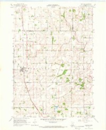
5 surveys from 7 printed sheetsMatched by testing this settlement's coordinate against the published boundary of every sheet in the United States Geological Survey's historical collection. Each opens the scanned sheet at the Survey.
- 1954 USGS Mason City quadrangle1:250000, 2 printings
- 1957 USGS Mason City quadrangle1:250000
- 1958 USGS Mason City quadrangle1:250000
- 1967 USGS Hartland quadrangle1:24000
- 1985 USGS Albert Lea quadrangle1:100000, 2 printings




In the county-history sources
1,272 words on this townshipHistory of Freeborn County, Minnesota, published 1911 names this settlement in its chapter on Hartland Township. These are the passages that mention it, exactly as the scans read.
Early Events. The first birth in Hartland township was that of Mary A. McColley, August 9, 1858. Freeman Beede was another early birth. The first marriage ceremony performed within the limits of the town took place in May, 1859, the con¬ tracting parties being J. Seely and Frances Farris. The first death was that of Martha, a daughter of William and Judith Wrangham, on June 18, 1859. The township was named Hartland by Mrs. 0. Sheldon in 1858, and she also bestowed the same name upon the postoffice, which was established at the same time, with O. Sheldon as postmaster. During the late war of the rebel¬ lion bonds were voted to the amount of $1,700 to secure volun¬ teers. John McCartney, John McClelland and Perry Haugen, of this township, never returned, the second named leaving a wife and child to mourn his loss. Bonds to the amount of $10,000 were voted to the Minneapolis & St. Louis Railroad as a bonus. Michael Sheehan relates some interesting incidents of the pioneer days, among which is the story of his employment as the first mail carrier in the township in 1858. He was employed by O. Sheldon, the first postmaster, to carry the mail from Geneva to Hartland postoffice. Judge E. C. Stacy was postmaster at Geneva at that time. Mike made the trip on foot every Monday, carry¬ ing the mail on his back, and received the handsome salary of a dollar a week. The first postoffice in the township is still stand- ing on the John Donahue farm. The first school taught in the township was by Mrs. Charles Morehouse at her home in 1858. She had six pupils. The next school was in the winter of 1858, taught by James Seeley at his home. Among his pupils were Michael Fitzgerald, three Wrangham children, Peter Peterson and August Peterson.
Passage source: History of Freeborn County, Minnesota, published 1911.
In 1858 Rev. Isaac McReynolds, of Albert Lea, organized a Methodist class at the home of B. J. Boardman and held regular services for over a year. A church was organized in 1859 at William Wrangham 's home, with six members. Rev. Corey was the pastor. A Congregational church was started in the schoolhouse in district No. 8 by Elder Cobb. There were twelve mem¬ bers, and later a store building was purchased in Hartland and used for a church. Rev. Wilbur Fisk, later of Freeborn, was pastor at one time. A Presbyterian organization was effected in 1869 by Rev. William Wrallson and meetings were held regu¬ larly every three weeks for several years. The history of the Lutheran denomination is given on another page.
Passage source: History of Freeborn County, Minnesota, published 1911.
west. It is bounded on the north by Waseca county, on the south by the township of Manchester, on the east by Bath, and on the west by Freeborn. It is constituted as originally surveyed, of thirty-six sections, but the survey correction line passing through it cuts off 278.85 acres, making it so much less than the usual congressional township, and leaving about 22,861.15 acres. It is almost entirely a prairie township. The entire area of the town is well adapted to the modes of agriculture and crops of the day, and the farmers are, as a rule, in moderate circum¬ stances, with good farm buildings and modern conveniences. The soil is a dark loam, from eighteen to twenty-four inches deep, underlaid with a sub-soil of clay. Rocks or stone of any kind are scarce, and there is no limestone whatever. The soil in the burr oak region of Mule lake is more of a sandy nature. Three are two water courses in the town and one lake. Mule lake is situated in the four corners of sections 13, 14, 23 and 24, and constitutes the headwaters of the LeSueur river, which takes a northward course, bearing a little to the east, until it leaves the township, when it bears westwardly. Boot creek rises in sec¬ tion 10 and flows northwesterly to enter Waseca county. A few words as to the lake will not be out of place. The Indians named it Le Sueur, and it went by this name through the early settle¬ ment ; but, in 1857, a fine span of mules belonging to B. J. Boardman were drowned in it and the settlers began designating it as Mule lake until it was as generally known under this caption as the other. The township has one village, known as Hartland.
Passage source: History of Freeborn County, Minnesota, published 1911.
Machine-read from a century-old scan, so expect the errors a machine makes: misspelled names, dropped words, stray characters.
Storms near this place
21 since 1994Regional context, not property-specific evidence. The National Weather Service names Hartland in 21 storm reports between 1994 and 2021: 8 hail, 7 thunderstorm wind, 3 funnel cloud, 3 tornado. No death or injury is recorded in these reports. Each account below is quoted exactly as the forecast office filed it, from the NOAA Storm Events Database, and each date opens the federal record of that event.
| When | Event | Place named | Harm | What the report says |
|---|---|---|---|---|
| June 1994 | Hail | Hartland | $500 | Dime-size hail and wind gusts to 60 miles an hour were reported in city of Hartland. |
| June 1994 | Thunderstorm Wind | Hartland | $500 | Dime-size hail and wind gusts to 60 miles an hour were reported in city of Hartland. |
| December 2021 | Tornado (EF2) | Hartland | - | A fast-moving tornado touched down to the southwest of Hartland and moved into town, damaging numerous buildings, trees, and utility poles. The damage in the southern residential part of town was mainly tree and roof damage. As the tornado tracked into the center of town, more significant damage was observed to buildings along Broadway Street. The most significant damage was to two buildings along Broadway and Johnson in the center of town with significant damage to the walls of low-rise commercial buildings. More tree and roof damage was observed to the northeast with some branches observed along State Highway 13. The tornado dissipated to the northeast in a field with no further damage observed. |
| May 2020 | Funnel Cloud | Hartland | - | A rope funnel was observed and photographed. |
| August 2018 | Hail | Hartland | - | A swath of large hail, up to half dollar size, fell across northern Freeborn county. |
| June 2014 | Thunderstorm Wind | Hartland | - | Large branches were downed, causing power outages around the town of Hartland. |
| June 2010 | Tornado (EF0) | Hartland | - | Several dozen trees were broken or snapped. The top of the elevator was sheared off. Several sheds were destroyed. This was the last tornado from a complex that moved southeast and which produced a series of tornadoes that began around Courtland of Nicollet County. |
| July 2008 | Hail | Hartland | - | Fifty mile per hour winds were also measured at this location. |
| June 2007 | Funnel Cloud | Hartland | - | Funnel reached halfway to the ground. |
| April 2004 | Thunderstorm Wind | Hartland | - | A 60 MPH wind gust was recorded by a spotter. |
| June 2004 | Funnel Cloud | Hartland | - | A sheriff's deputy spotted a funnel cloud at the intersection of Highway 31 and Highway 13. |
| June 2004 | Tornado (F0) | Hartland | - | A tornado briefly touched down at a farm where it was seen picking up debris. |
| June 1998 | Thunderstorm Wind | Hartland | - | Grain bins blown down. Estimated windspeed. |
| June 1995 | Thunderstorm Wind | Hartland | - | Numerous branches down. |
| April 2015 | Hail | Hartland | - | no account filed |
| July 2007 | Hail | Hartland | - | no account filed |
| July 2007 | Hail | Hartland | - | no account filed |
| June 2001 | Thunderstorm Wind | Hartland | - | no account filed |
| June 2001 | Hail | Hartland | - | no account filed |
| March 1998 | Hail | Hartland | - | no account filed |
| June 1996 | Thunderstorm Wind | Hartland | - | no account filed |
Nearest settlements
The eight closest, with where each one stands in the county. Distances are straight-line, computed from the Geographic Names Information System coordinates.
| Map | Place | Distance | Sheets |
|---|---|---|---|
| Freeborn | 4.9 miles | 8 | |
| Bath | 5.4 miles | 7 | |
| Manchester | 5.7 miles | 10 | |
| Clarks Grove | 8.8 miles | 7 | |
| Armstrong | 9.7 miles | 10 | |
| Bancroft | 9.9 miles | 10 | |
| Alden | 10.4 miles | 8 | |
| Geneva | 11.7 miles | 7 |
Elsewhere
Matched on this settlement's Geographic Names Information System number rather than its name, so it cannot be a different place of the same name in another state.
| Wikipedia article on Hartland | An encyclopaedic summary. Its text is share-alike, so it is linked here rather than copied. |
| Wikidata item Q2212395 | The structured record the population and elevation above come from. Public domain (CC0). |
Provenance
This settlement is recorded in the Geographic Names Information System as feature 644707. The sheet list is computed by point-in-boundary test against the United States Geological Survey's historical topographic inventory. Both are works of the United States government and carry no copyright under 17 U.S.C. 105.
Storms. NOAA National Centers for Environmental Information, Storm Events Database https://www.ncei.noaa.gov/stormevents/ A work of the United States government, no copyright under 17 U.S.C. 105. Narratives are quoted verbatim from the National Weather Service report and are not edited or summarised.