 Block
Mansfield, Minnesota
8 topographic sheets cover this place, the earliest surveyed in 1954 and the latest in 1985. It stands in Mansfield Township. It lies in ZIP code area 56009. The Survey maps it on the Conger quadrangle. It stands 1,247 feet above sea level.
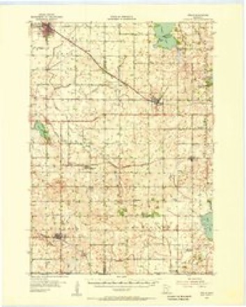
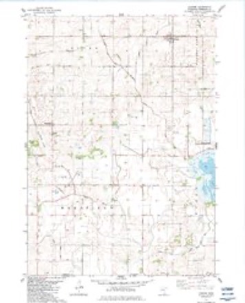
Topographic sheets covering this place
6 surveys from 8 printed sheetsMatched by testing this settlement's coordinate against the published boundary of every sheet in the United States Geological Survey's historical collection. Each opens the scanned sheet at the Survey.
- 1954 USGS Mason City quadrangle1:250000, 2 printings
- 1955 USGS Wells quadrangle1:62500
- 1957 USGS Mason City quadrangle1:250000
- 1958 USGS Mason City quadrangle1:250000
- 1982 USGS Conger quadrangle1:24000
- 1985 USGS Albert Lea quadrangle1:100000, 2 printings




In the county-history sources
4,663 words on this townshipHistory of Freeborn County, Minnesota, published 1911 names this settlement in its chapter on Mansfield Township. These are the passages that mention it, exactly as the scans read.
The township bearing this name is a full congressional town¬ ship, embracing the territory of town 101, range 23. It is the southwestern subdivision of Freeborn county, its contiguous sur- roundings being Alden on the north, Nunda on the east, Faribault county on the west and the state of Iowa on the south. As to the surface and physical features, not much can be said of this that would not readily apply to almost any other prairie town, and this is one in the full sense of the word. The northwestern part of the town is high and rolling, furnishing some of the finest farming land imaginable; but toward the south and east it be¬ comes more level and Ioav. In the extreme southeastern corner a ridge of high land abruptly pushes its way through the surface of the prairie, which inaugurates the area of the tableland, com¬ mencing here and extending eastward through Nunda and other towns. The soil is a dark loam, with a subsoil of sand and gravel, as a rule; but this is not invariable, for in places a marked tendency to a lighter nature is visible with a clay subsoil. Mans¬ field has no lakes within its borders, nor has it any streams of much importance. The largest in the township is Steward's creek, which rises in Alden and, crossing a corner of section 2, passes through the center of sections 1 and 12, forming a minia¬ ture lake in section 1, touches a corner of 13 and leaves the town on its way to Bear lake, in Nunda. Lime creek crosses the south¬ eastern corner of the township. Another small stream rises in sec¬ tion 8 and, flowing northward through section 5, leaves the town and enters Alden. The geological and natural history survey of the county of Freeborn, by N. H. Winchell, state geologist, pub¬ lished in 1875, says of Mansfield : "This town is nearly all prairie, a small patch of oak openings occurring in sections 3, 10 and 15. The northwestern part of the township is rolling, and the south¬ eastern is level and wet with marshes."
Passage source: History of Freeborn County, Minnesota, published 1911.
Mansfield township has one small hamlet, also known as Mans¬ field, situated in the northern part of section 9. There is a cemetery located in the northeastern part of section 16. The United Brethren church and cemetery are located in the southern part of section 7. The German Lutheran church and cemetery are in the northeastern part of section 8. The Swedish Lutheran church and cemetery are in the southern part of section 20. The Norwegian Lutheran church and cemetery are in the southeastern part of section 36.
Passage source: History of Freeborn County, Minnesota, published 1911.
Early Settlement. The earliest steps leading to the founding and subsequent development of this thriving township commenced early in 1856. The first settlers in Mansfield were the Tunell brothers, John and Henry, who came from Illinois by the way of Iowa with their families and with teams, arriving June 23, 1856. and locating on section 8. Here John remained until 1873, when he went to Oregon, while Henry remained on the farm which he originally secured in section 8. These brothers brought with them about one hundred head of cattle, and shortly after their arrival commenced putting up hay, securing enough to carry them safely through the winter ; but a prairie fire destroyed it. For a time the prospect looked dubious, but they finally managed to purchase enough hay from parties in Iowa to tide them over the winter, without a loss of more than half their stock. Shortly after these parties made their appearance Henry Schmidt and Henry Jahnke arrived and secured tracts of the government domain ; Henry Schmidt located on section 10 ; Mr. Jahnke located in section 10. After this there were no arrivals for some time, but gradually the attention of incomers was turned this way and. the government land began to disappear. Messrs. Stenaldson and Kittleson, natives of Norway, came in and located on valuable farms in section 15. Shortly after this H. Knutson, Nels Nelson, and John Kraus Haar arrived and located in the township.
Passage source: History of Freeborn County, Minnesota, published 1911.
Machine-read from a century-old scan, so expect the errors a machine makes: misspelled names, dropped words, stray characters.
Read the whole chapter on Mansfield Township - it names this place 4 more 4 times.
Mines and quarries near this place
7 within 5 milesRegional context, not property-specific evidence. The federal mineral resources record lists 7 workings within 5 miles of Mansfield: 7 producers. All of them still produce. What was taken out: Sand and Gravel, Construction. Distance is straight-line from the map coordinates, so a quarry counted here may appear on a neighbouring settlement's page as well.
| Where | Site | Commodity | Status | Recorded |
|---|---|---|---|---|
| Dunbar Pit and Mill | Sand and Gravel, Construction | Producer | ||
| Hans Hanson Pit | Sand and Gravel, Construction | Producer | ||
| Jande Pit | Sand and Gravel, Construction | Producer | ||
| Janke Mill | Sand and Gravel, Construction | Producer | ||
| Kluender Pit & Mill | Sand and Gravel, Construction | Producer | ||
| Nickerson Pit & Plant | Sand and Gravel, Construction | Producer | ||
| Ron Thompson Pit & Plant | Sand and Gravel, Construction | Producer |
Storms near this place
4 since 1997Regional context, not property-specific evidence. The National Weather Service names Mansfield in 4 storm reports between 1997 and 2010: 2 funnel cloud, 2 tornado. The reports record 1 death and 14 injuries. Each account below is quoted exactly as the forecast office filed it, from the NOAA Storm Events Database, and each date opens the federal record of that event.
| When | Event | Place named | Harm | What the report says |
|---|---|---|---|---|
| June 2010 | Tornado (EF4) | Mansfield | 1 killed, 14 hurt | The tornado initially moved northeast to approximately 3.5 miles west of Conger, where at about (43.6156, -93.6015), it began to move more to the east-northeast. West of Armstrong, at about (43.6597, -93.4938), it began tracking nearly due north to just west of Manchester, where at about (43.7357, -93.4801), it began to move to the north-northwest, before dissipating 1.5 miles west of Hartland. Accounting for the changes in direction of this track, the actual path length covered by the tornado was 19.95 miles.||Near 180th Street and County Road 2, a home was likely in the outer circulation of the tornado, as it sustained some roof and siding damage. A barn was also destroyed to its brick foundation and a car was also flipped over lengthwise. Some evidence of tree debarking was noted. The tornado continued to the northeast and caused extensive crop damage approximately 500 yards in width. Near County Roads 17 and 63, the tornado intensified to produce EF-3 damage, impacting a farmstead and causing the complete destruction of three swine barns and the loss of 12 head of swine. Two empty grain bins were completely blown away at this location. The house at this location had some roof damage but appeared to be northwest of the main tornado path. Approximately 100 feet northeast of the house, a 150 foot tripod style wind turbine tower was twisted and toppled. This location also marked the beginning of crops being completely raked, with only stalks of corn left, and soybean fields being almost unrecognizable.||After passing through this farmstead the tornado took a more easterly path across County Road 63, and maintained EF-3 strength. After passing County Road 63, another farmstead was hit, and two empty harvester silos were toppled. The tornado continued to the northeast across County Road 4, where continued raking of the fields was noted with significant deposition of debris along the tornado path. Numerous trees were toppled at County Road 89 where it turns to the north. The tornado continued to the north-northeast, grew to 1000 yards, and around 1750 LST impacted a farmstead along County Road 12 two miles north of Conger, where EF-4 damage was observed. The house at this location was completely destroyed, as was the barn and several other buildings. Extensive tree damage was noted with nearly all branches being removed from the trunks. Debarking of trees was widespread at this location. A car was also tumbled a distance of 3200 feet, coming to rest in a field east of County Road 12.||The tornado continued to the northeast across County Road 69 and County Road 46, where it weakened slightly to EF-3 intensity. As it crossed County Road 46, a house was rotated off the foundation. The tornado was approximately 700 yards wide at this point. To the north-northeast, a swine barn was destroyed with sheet metal being carried off to Interstate 90. At this same time, a satellite tornado developed and caused damage in the town of Armstrong (see separate entry).||The main tornado continued to the north-northeast and was 500 yards in width. The tornado crossed County Road 74 and caused EF-2 damage to three farmsteads. One farmstead with a manufactured home was hit, resulting in one fatality and one severe injury. The tornado crossed Interstate 90 just west of County Road 14 as it grew to one third of a mile in width and re-strengthened to EF-3 intensity. Several farmsteads saw significant damage between Sugar Lake and County Road 14, with a house and two barns completely destroyed. From this point the tornado continued to the north, growing to one mile in width. Around 1800 LST, a house and barn were destroyed approximately one mile west of Manchester on County Road 25, where extensive tree and structural damage was also noted at several properties in the area. Additionally, west of this tornadic damage, a separate area of tree and structural damage was caused by strong thunderstorm winds associated with a rear flank downdraft (see separate entry).||About one mile north, the tornado weakened slightly to EF-2 Intensity, where it damaged three full grain bins near County Road 29. The tornado was approximately 1300 yards at this point. Further north, at County Road 95, the tornado continued to weaken, although a farmstead still received EF-1 damage to trees and structures. Finally, the tornado continued north and began to narrow and weaken. It dissipated west of Hartland. One person was killed and 14 injured from this tornado. |
| June 2010 | Tornado (EF1) | Mansfield | - | A brief tornado moved across open fields and groves of trees after developing in Faribault County. It snapped numerous power poles approximately five feet off the ground along County Road 11. Several dozen trees also had large branches snapped off. Tornado was photographed and recorded on video by chasers. |
| June 2009 | Funnel Cloud | Mansfield | - | There were too many trees and hills in the way to determine whether it reached the ground. |
| July 1997 | Funnel Cloud | Mansfield | - | no account filed |
Nearest settlements
The eight closest, with where each one stands in the county. Distances are straight-line, computed from the Geographic Names Information System coordinates.
| Map | Place | Distance | Sheets |
|---|---|---|---|
| Conger | 5.2 miles | 8 | |
| Alden | 7.0 miles | 8 | |
| Emmons | 8.0 miles | 10 | |
| Armstrong | 9.8 miles | 10 | |
| Twin Lakes | 9.9 miles | 10 | |
| Manchester | 13.4 miles | 10 | |
| Freeborn | 13.5 miles | 8 | |
| Albert Lea | 13.8 miles | 10 |
Elsewhere
Matched on this settlement's Geographic Names Information System number rather than its name, so it cannot be a different place of the same name in another state.
| Wikipedia article on Mansfield | An encyclopaedic summary. Its text is share-alike, so it is linked here rather than copied. |
| Wikidata item Q48847378 | The structured record the population and elevation above come from. Public domain (CC0). |
Provenance
This settlement is recorded in the Geographic Names Information System as feature 647450. The sheet list is computed by point-in-boundary test against the United States Geological Survey's historical topographic inventory. Both are works of the United States government and carry no copyright under 17 U.S.C. 105.
Mines and quarries. USGS Mineral Resources Data System (MRDS) https://mrdata.usgs.gov/mrds/ A work of the United States government, no copyright under 17 U.S.C. 105.
Storms. NOAA National Centers for Environmental Information, Storm Events Database https://www.ncei.noaa.gov/stormevents/ A work of the United States government, no copyright under 17 U.S.C. 105. Narratives are quoted verbatim from the National Weather Service report and are not edited or summarised.