 Block
Block
Cuyahoga Falls, Ohio
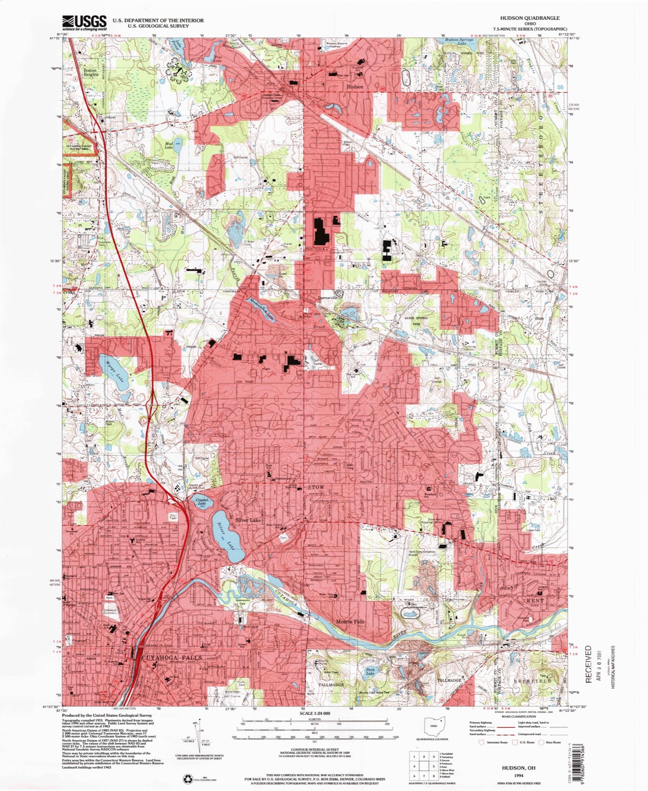
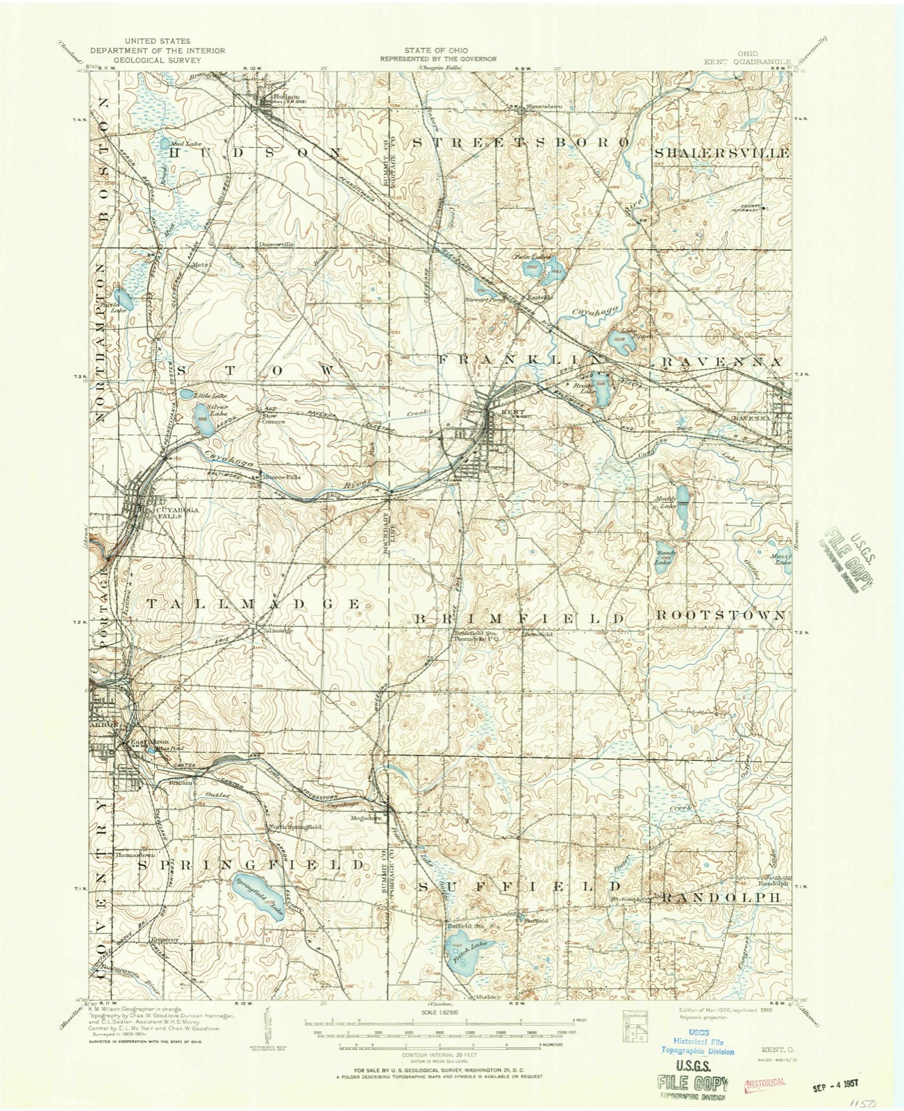
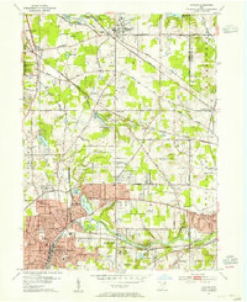
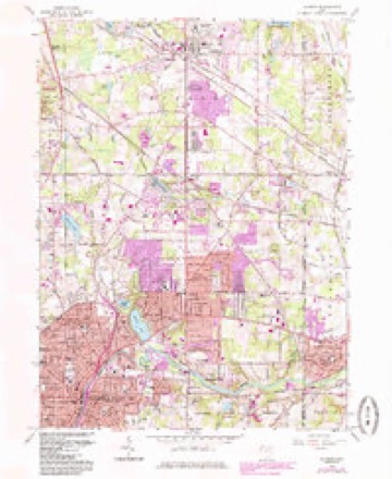
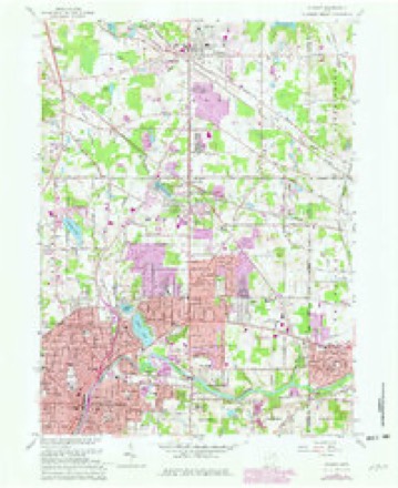
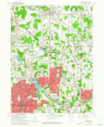
14 topographic sheets cover this place, the earliest surveyed in 1906 and the latest in 1994. It stands in Cuyahoga Falls City. It lies in ZIP code area 44221. The Survey maps it on the Hudson quadrangle. 51,114 people lived here at the 2020 count. It stands 1,024 feet above sea level.
Population over time
2 figuresCuyahoga Falls grew from 49,652 to 51,114 between 2010 and 2020. These are the recorded population figures Wikidata holds for this place, reached through the Geographic Names Information System number this page is keyed on rather than by name, so they belong to this place and not to another of the same name. Most are census counts, but not all are: an early figure may be a founding or settlement estimate. The change column is computed, and is left blank where more than 20 years separate a figure from the one before it, because a gap that long is not a change between two counts.
| Year | People | Change |
|---|---|---|
| 2010 | 49,652 | |
| 2020 | 51,114 | +1,462 (+3%) |
Then and now
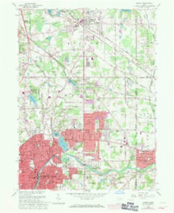
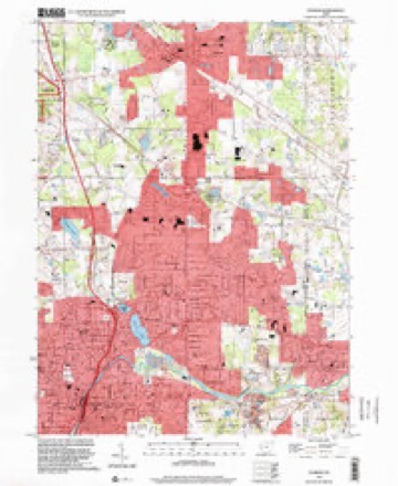
1906 to 1994The same ground, surveyed 88 years apart. Drag the handle to wipe between them. Both sheets are United States Geological Survey originals; neither has been altered.
Compare 1906 against another survey:
Topographic sheets covering this place
14 sheetsMatched by testing this settlement's coordinate against the published boundary of every sheet in the United States Geological Survey's historical collection. Each opens the scanned sheet at the Survey.
- 1906 USGS Kent quadrangle1:62500
- 1906 USGS Kent quadrangle1:62500
- 1953 USGS Hudson quadrangle1:24000
- 1956 USGS Cleveland quadrangle1:250000
- 1956 USGS Cleveland quadrangle1:250000
- 1956 USGS Cleveland quadrangle1:250000
- 1962 USGS Cleveland quadrangle1:250000
- 1963 USGS Hudson quadrangle1:24000
- 1963 USGS Hudson quadrangle1:24000
- 1963 USGS Hudson quadrangle1:24000
- 1963 USGS Hudson quadrangle1:24000
- 1986 USGS Cleveland South quadrangle1:100000
- 1994 USGS Cleveland South quadrangle1:100000
- 1994 USGS Hudson quadrangle1:24000






In the county-history sources
86,643 words on this townshipHistory of Summit County, with an Outline Sketch of Ohio, published 1881 names this settlement in its chapter on Cuyahoga Falls City. These are the passages that mention it, exactly as the scans read.
William Wetmore was born in Middletown, Conn., September 15, 1771. He was a descendant of Thomas Wetmore, one of the proprietors of Middletown, who purchased the site of the Indians in 1662. He removed to Ohio in July, 1804, and built the second house that was erected in what was afterward Stow Township. It stood about twenty rods eastwardly of the northeast corner of Lot 36. In 1808, Stow Township was organized, and he was elected a Justice of the Peace. In August of that year, the county of Portage being organized he was appointed Clerk of the Court at Kavenna. He afterward resigned the office, moved back to Stow and settled on his farm. He died at his residence on the east bank of Silver Lake, October 27, 1827. Henry Newberry was born in Windsor, Conn., in January, 1783. In 1814, soon after the death of his father, he came to Ohio, as before stated, to look at his possessions in the Western wilds. He first lived at Silver Lake two years, having moved there, as previously mentioned, in 1824, and then took up his residence at the Falls. He died in 1854, in the stone house, afterward the residence of James H. Cooke. Such, in brief, are the biographies of the founders of Cuyahoga Falls.*
Passage source: History of Summit County, with an Outline Sketch of Ohio, published 1881.
The town of Cuyahoga Falls was first laid out in 1825, by Elkanah Richardson. It was subsequently re-surveyed, platted and recorded by Birdsey Booth. It was located in the townships of Stow and Tallmadge, and included all of the present platted village except so much as has since been platted east of the Cuyahoga River and north of the Tallmadge Township line. The part last mentioned was platted and recoi'ded by R. A. Ashman, Count}' Surveyor, in 1837. The original proprietors were Henr^' Newberr}', Joshua Stow and William Wetmore. The proprietor of the addition was Joseph Hale. No allotment has been made to the original plat except the one of 1837. That part lying in the township of Stow was owned b}' Stow and Wetmore ; that part included in Tallmadge was the propert}' of Newberr^'.
Passage source: History of Summit County, with an Outline Sketch of Ohio, published 1881.
The name of the village is derived from the falls in the Cuyahoga River, to be seen within its limits. The stream has cut a channel into the sandstone from eighty to one hundred feet in depth. This deep-cut channel extends over two miles. In it ai"e the falls. The name first given to the village was Manchester ; but, as there were many towns of that name in the Union, and the falls of the river were seen to
Passage source: History of Summit County, with an Outline Sketch of Ohio, published 1881.
Machine-read from a century-old scan, so expect the errors a machine makes: misspelled names, dropped words, stray characters.
Read the whole chapter on Cuyahoga Falls City - it names this place 101 more 101 times.
Fires near this place
2 since 1999Regional context, not property-specific evidence. The federal wildfire occurrence database lists 2 fires within 5 miles of Cuyahoga Falls between 1999 and 2014, burning about 2 acres in total. 1 started naturally. None was recorded as arson. Distance is straight-line from the map coordinates, so a fire counted here may appear on a neighbouring settlement's page as well.
| Reported cause | Fires |
|---|---|
| Missing data/not specified/undetermined | 1 |
| Natural | 1 |
The most recent of them, most recent first, with the day each was reported and the service that recorded it.
| Date | Cause | Size | Reported by | Name on the report |
|---|---|---|---|---|
| 27 April 2014 | Missing data/not specified/undetermined | under an acre | Cuyahoga Valley National Park | CANYON TRAIL |
| 31 March 1999 | Natural | 2.0 acres | Cuyahoga Valley National Park | ONEIL |
Settlements close enough to share some of these fires:
Specimens collected near this place
12 of 830 shownRegional context, not property-specific evidence. Museums hold 830 specimens collected within 10 miles of Cuyahoga Falls between 1867 and 1975: 709 Animalia, 72 Plantae, 47 Fungi, 1 Unrecorded, 1 Bacteria. 12 distinct Species records are shown. Collected by (no collector listed), A. Black, A. Woolman and others. Each is a physical object with a catalogue number, and each entry opens the museum's record. This is what was collected and kept, not a survey of what lives here - nothing can be concluded from a species being absent.
| Image | Species | Year | Collected by | Where, as recorded |
|---|---|---|---|---|
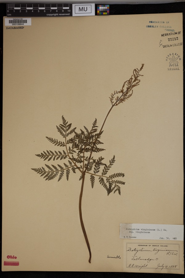 | Botrychium virginianum subsp. virginianum | 1888 | Wright, A.A. | Tallmadge. |
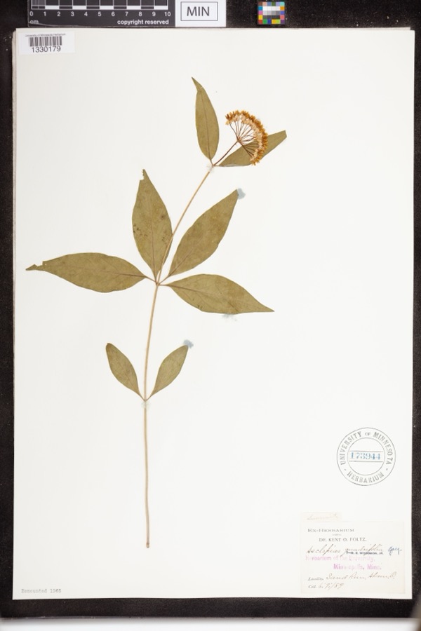 | Asclepias quadrifolia Jacq. | 1889 | Foltz, Kent O. | Sand Run Park; Akron |
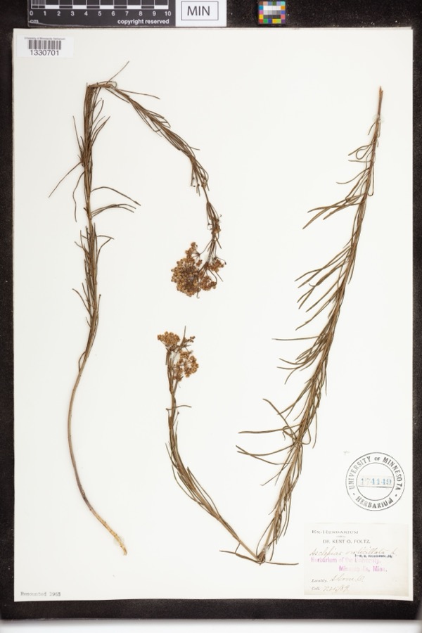 | Asclepias verticillata L. | 1889 | not recorded | Akron |
 | Accipiter striatus velox (A.Wilson, 1812) | 1867 | Collector(s): James Lee Peters | Akron |
 | Dryopteris carthusiana (Vill.) H.P.Fuchs | 1880 | F. O. Payne | Akron |
 | Buteo lineatus lineatus (Gmelin, 1788) | 1887 | B. Sanford | Hudson |
 | Hydrastis canadensis L. | 1888 | E.L. Sturtevant II | |
 | Lonicera dioica L. | 1888 | K. O. Foltz | |
 | Penstemon hirsutus (L.) Willd. | 1888 | K. O. Foltz | |
 | Carex pensylvanica Lam. | 1889 | Foltz, K.O. | Akron |
 | Gymnosporangium juniperi-virginianae Schwein. | 1889 | Reade M. C. | Hudson |
 | Peltandra virginica (L.) Schott | 1889 | Foltz, Kent O. | Akron; Blue Pond |
All 830 specimens within 10 miles, at the Global Biodiversity Information Facility.
Mines and quarries near this place
10 of 14 shownRegional context, not property-specific evidence. The federal mineral resources record lists 14 workings within 5 miles of Cuyahoga Falls: 11 past producers, 3 producers. 3 still produce. What was taken out: Sand and Gravel, Construction. Distance is straight-line from the map coordinates, so a quarry counted here may appear on a neighbouring settlement's page as well.
| Where | Site | Commodity | Status | Recorded |
|---|---|---|---|---|
| Alden Pit | Sand and Gravel, Construction | Past Producer | ||
| Arlington Pit | Sand and Gravel, Construction | Past Producer | Sedimentary | |
| Herbruck Trucking Pit | Sand and Gravel, Construction | Past Producer | Sedimentary | |
| Herbruck Trucking Pit | Sand and Gravel, Construction | Past Producer | ||
| Herms Pit | Sand and Gravel, Construction | Past Producer | Sedimentary | |
| Herms Pit | Sand and Gravel, Construction | Past Producer | ||
| J.P. Pollo Pit | Sand and Gravel, Construction | Past Producer | Sedimentary | |
| J.P. Pollo Pit | Sand and Gravel, Construction | Past Producer | ||
| Lerkis Pit & Plant | Sand and Gravel, Construction | Producer | ||
| Plant Number 2 | Sand and Gravel, Construction | Past Producer |
Storms near this place
48 since 1997Regional context, not property-specific evidence. The National Weather Service names Cuyahoga Falls in 48 storm reports between 1997 and 2025: 25 hail, 20 thunderstorm wind, 1 lightning, 1 flash flood. No death or injury is recorded in these reports. Each account below is quoted exactly as the forecast office filed it, from the NOAA Storm Events Database, and each date opens the federal record of that event.
| When | Event | Place named | Harm | What the report says |
|---|---|---|---|---|
| June 2008 | Hail | Cuyahoga Falls | $300,000 | Nickel to golf ball size hail lasted for several minutes. Many vehicles were reported damaged by the hail. |
| May 2011 | Thunderstorm Wind | Cuyahoga Falls | $100,000 | Local media reported that thunderstorm winds damaged roofs and gutters on a few industrial buildings. |
| May 2003 | Flash Flood | Cuyahoga Falls | $100,000 | Thunderstorms dumped two to three inches of rain on Cuyahoga Falls in a short period of time. Lowland and street flooding occurred with water as much as three feet deep on some roads. Several cars were stranded in the flood waters and a few buildings sustained minor damage. |
| August 1997 | Lightning | Cuyahoga Falls | $80,000 | Lightning struck a tree and was conducted to a house. The resulting fire caused considerable damage. |
| May 2010 | Thunderstorm Wind | Cuyahoga Falls | $75,000 | Thunderstorm winds downed a large tree. The tree struck a home and caused enough damage for the house to be uninhabitable. |
| May 2011 | Thunderstorm Wind | Cuyahoga Falls | $50,000 | Thunderstorm winds downed numerous trees. Some homes were damaged as a result of the downed trees. |
| May 2004 | Thunderstorm Wind | Cuyahoga Falls | $40,000 | Thunderstorm winds estimated at 60 mph downed several trees. At least one home was damaged by fallen trees. |
| March 2017 | Thunderstorm Wind | Cuyahoga Falls | $15,000 | Thunderstorm winds toppled a large tree. The fallen tree damaged part of a roof of a house. |
| May 2011 | Thunderstorm Wind | Cuyahoga Falls | $10,000 | Thunderstorm winds downed several trees. |
| May 2011 | Thunderstorm Wind | Cuyahoga Falls | $8,000 | Thunderstorm winds downed a large tree and several large tree branches. The downed tree fell onto a home and destroyed the porch. |
| July 2005 | Thunderstorm Wind | Cuyahoga Falls | $8,000 | A few trees and power lines were reported down. |
| July 2014 | Thunderstorm Wind | Cuyahoga Falls | $6,000 | Summit County Emergency Manager reported thunderstorm winds brought trees down in Cuyahoga Falls. |
| May 2011 | Hail | Cuyahoga Falls | $5,000 | Thunderstorms produced nickel to quarter sized hail. |
| April 2003 | Thunderstorm Wind | Cuyahoga Falls | $5,000 | Thunderstorm winds downed one tree and several large limbs. |
| June 2016 | Thunderstorm Wind | Cuyahoga Falls | $4,000 | The media relayed a report of 2 trees with large limbs brought down by thunderstorm winds, one of which was on Julien Ave. |
| July 2007 | Thunderstorm Wind | Cuyahoga Falls | $4,000 | A tree and large limbs were reported down. |
| May 2004 | Thunderstorm Wind | Cuyahoga Falls | $4,000 | Thunderstorm winds downed a couple of large trees. |
| April 2006 | Hail | Cuyahoga Falls | $3,000 | Quarter size hail was observed. |
| August 2003 | Thunderstorm Wind | Cuyahoga Falls | $3,000 | Thunderstorm winds downed one tree and one large limb. |
| May 2004 | Hail | Cuyahoga Falls | $2,000 | Quarter size hail was observed. |
| May 2004 | Hail | Cuyahoga Falls | $2,000 | Quarter size hail was observed. |
| July 2002 | Thunderstorm Wind | Cuyahoga Falls | $2,000 | Thunderstorm winds downed a large tree and several limbs. |
| June 2025 | Thunderstorm Wind | Cuyahoga Falls | - | Numerous trees downed in Cuyahoga Falls. |
| August 2024 | Thunderstorm Wind | Cuyahoga Falls | - | Several trees downed on the north side of Akron. |
| April 2023 | Thunderstorm Wind | Cuyahoga Falls | - | Roof blown off church at corner of Broad Boulevard and Second Street in Cuyahoga Falls. |
| August 2021 | Thunderstorm Wind | Cuyahoga Falls | - | Tree fell onto garage just southwest of downtown Cuyahoga Falls. A large tree limb was snapped near the intersection of Howe Avenue and Tallmadge Road, just southeast of downtown Cuyahoga Falls. |
| June 2020 | Flood | Cuyahoga Falls | - | Three locations on Howe Rd in Cuyahoga falls flooded with roads closed and barricaded. Street flooding was also reported in Tallmadge. Rainfall up to 5/hr over Tallmadge, with 1.64 in 35 minutes. |
| June 2016 | Hail | Cuyahoga Falls | - | Nickel sized hail was observed. |
| July 2015 | Hail | Cuyahoga Falls | - | Hail the size of pennies was observed. |
| May 2014 | Hail | Cuyahoga Falls | - | Quarter sized hail was reported. |
| July 2013 | Hail | Cuyahoga Falls | - | Penny sized hail was observed. |
| September 2012 | Hail | Cuyahoga Falls | - | Quarter sized hail was observed. |
| September 2012 | Hail | Cuyahoga Falls | - | Nickel sized hail was observed. |
| July 2012 | Hail | Cuyahoga Falls | - | Nickel sized hail was observed. |
| August 2011 | Hail | Cuyahoga Falls | - | Penny sized hail was observed. |
| November 2011 | Hail | Cuyahoga Falls | - | Penny sized hail was observed. |
| June 2010 | Thunderstorm Wind | Cuyahoga Falls | - | A trained spotter measured a 62 mph thunderstorm wind gust. |
| June 2008 | Hail | Cuyahoga Falls | - | Penny to nickel size hail was observed. |
| July 2008 | Hail | Cuyahoga Falls | - | Penny size hail was observed. |
| April 2006 | Hail | Cuyahoga Falls | - | Penny size hail was observed. |
| April 2006 | Hail | Cuyahoga Falls | - | Penny size hail was observed. |
| April 2006 | Hail | Cuyahoga Falls | - | Penny size hail was observed in Cuyahoga Falls, Stow, and Akron. |
| April 2006 | Hail | Cuyahoga Falls | - | Penny size hail was observed. |
| May 2005 | Hail | Cuyahoga Falls | - | Half dollar size hail was observed. |
| April 2004 | Hail | Cuyahoga Falls | - | Quarter size hail was observed. |
| May 2019 | Hail | Cuyahoga Falls | - | no account filed |
| June 2008 | Hail | Cuyahoga Falls | - | no account filed |
| April 1998 | Hail | Cuyahoga Falls | - | no account filed |
Nearest settlements
The eight closest, with where each one stands in the county. Distances are straight-line, computed from the Geographic Names Information System coordinates.
| Map | Place | Distance | Sheets |
|---|---|---|---|
| Iron Bridge (historical) | 1.8 miles | 21 | |
| Bettes Corners | 2.2 miles | 16 | |
| North Akron | 2.3 miles | 22 | |
| Silver Lake | 2.4 miles | 14 | |
| Munroe Falls | 2.5 miles | 14 | |
| Forest Hill | 2.6 miles | 16 | |
| Stow | 2.9 miles | 14 | |
| Tallmadge | 3.2 miles | 16 |
Elsewhere
Matched on this settlement's Geographic Names Information System number rather than its name, so it cannot be a different place of the same name in another state.
| Wikipedia article on Cuyahoga Falls | An encyclopaedic summary. Its text is share-alike, so it is linked here rather than copied. |
| Wikidata item Q531958 | The structured record the population and elevation above come from. Public domain (CC0). |
Provenance
This settlement is recorded in the Geographic Names Information System as feature 1048646. The sheet list is computed by point-in-boundary test against the United States Geological Survey's historical topographic inventory. Both are works of the United States government and carry no copyright under 17 U.S.C. 105.
Wildfire. Short, Karen C. 2022. Spatial wildfire occurrence data for the United States, 1992-2020 [FPA_FOD_20221014]. 6th Edition. Fort Collins, CO: Forest Service Research Data Archive. https://doi.org/10.2737/RDS-2013-0009.6 Collected with United States Government funding and usable without additional permissions or fees.
Specimens. Global Biodiversity Information Facility (GBIF), https://www.gbif.org/. Only records licensed CC0 or CC BY are used. Records licensed CC BY-NC are excluded because this site carries advertising. Images are checked individually and any whose licence is non-commercial, no-derivatives or unreadable is refused.
Mines and quarries. USGS Mineral Resources Data System (MRDS) https://mrdata.usgs.gov/mrds/ A work of the United States government, no copyright under 17 U.S.C. 105.
Storms. NOAA National Centers for Environmental Information, Storm Events Database https://www.ncei.noaa.gov/stormevents/ A work of the United States government, no copyright under 17 U.S.C. 105. Narratives are quoted verbatim from the National Weather Service report and are not edited or summarised.