 Block
Block
Upper Sandusky, Ohio
10 topographic sheets cover this place, the earliest surveyed in 1907 and the latest in 1986. It stands in Crane Township. It lies in ZIP code area 43351. The Survey maps it on the Upper Sandusky quadrangle.
Research this city
This curated hub for Wyandot County, Ohio brings together the page's documented record links, visible map or image evidence where published, and routes to related local records.
What is documented here?
Use the page's provenance and linked records to distinguish the source material from the site's navigation and summaries.
How should I cite it?
Open the original record, preserve its repository and identifier, then use the citation tool for this page as a path back to the source.
Where should I go next?
Follow the county or state hub for related places and records, then use the guide for a source-aware research sequence.
Then and now
1907 to 1986The same ground, surveyed 79 years apart. Drag the handle to wipe between them. Both sheets are United States Geological Survey originals; neither has been altered.

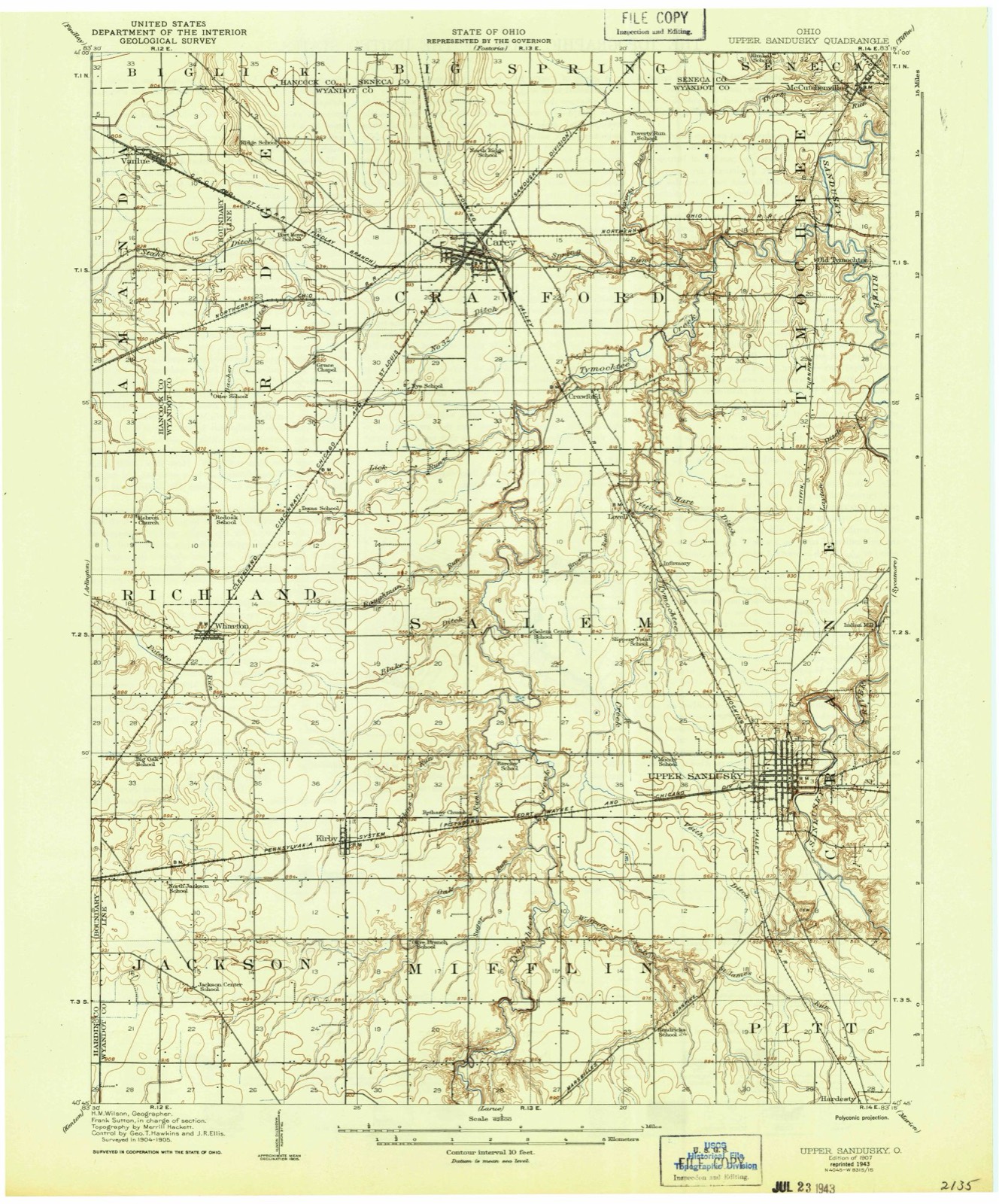
Topographic sheets covering this place
10 sheetsMatched by testing this settlement's coordinate against the published boundary of every sheet in the United States Geological Survey's historical collection. Each opens the scanned sheet at the Survey.
- 1907 USGS Upper Sandusky quadrangle1:62500
- 1950 USGS Marion quadrangle1:250000
- 1960 USGS Upper Sandusky quadrangle1:24000
- 1960 USGS Upper Sandusky quadrangle1:24000
- 1962 USGS Marion quadrangle1:250000
- 1966 USGS Marion quadrangle1:250000
- 1966 USGS Marion quadrangle1:250000
- 1966 USGS Marion quadrangle1:250000
- 1986 USGS Marion quadrangle1:100000
- 1986 USGS Marion quadrangle1:100000







In the county-history sources
218 words on this townshipPast and Present of Wyandot County Ohio, published 1913 names this settlement in its chapter on Crane Township. These are the passages that mention it, exactly as the scans read.
- The surface of the township is level and the soil remarkably fertile. The increase of population has been gradual. Among its points of interest which are shown to strangers are the Old Mission church, the Nine Oaks, Crawford's battle ground, on Section 17, just north of Upper Sandusky,
Passage source: Past and Present of Wyandot County Ohio, published 1913.
Machine-read from a century-old scan, so expect the errors a machine makes: misspelled names, dropped words, stray characters.
Read the whole chapter on Crane Township - it names this place 3 more 3 times.
Specimens collected near this place
12 of 261 shownRegional context, not property-specific evidence. Museums hold 261 specimens collected within 10 miles of Upper Sandusky between 1885 and 1975: 243 Animalia, 15 Fungi, 3 Plantae. 12 distinct Species records are shown. Collected by Acker, G., Allen, J. M., Blyth & Katz and others. Each is a physical object with a catalogue number, and each entry opens the museum's record. This is what was collected and kept, not a survey of what lives here - nothing can be concluded from a species being absent.
| Image | Species | Year | Collected by | Where, as recorded |
|---|---|---|---|---|
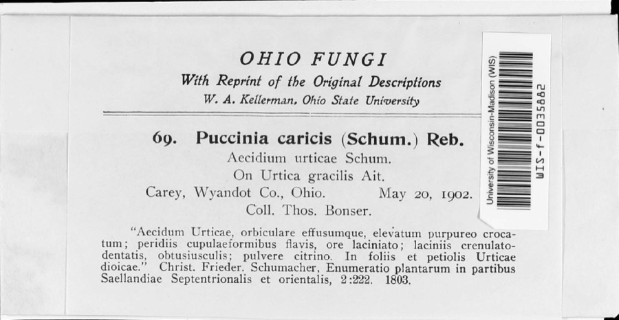 | Puccinia caricina DC. | 1902 | T. Bonser | |
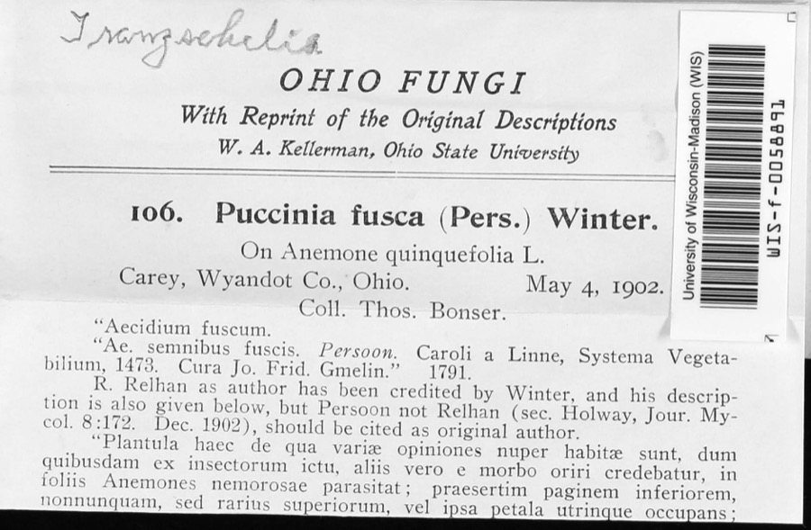 | Tranzschelia fusca (Wallr.) Dietel | 1902 | Thos. Bonser | |
 | Hister abbreviatus Fabricius, 1775 | 1885 | not recorded | Crane |
 | Margarinotus faedatus (J.E.LeConte, 1845) | 1885 | not recorded | Crane |
 | Phyllachora graminis (Pers.) Fuckel | 1900 | Bonser Thos. | Wyandot Co. |
| Phyllachora vulgata Theiss. & Syd. | 1900 | Thos. Bouser | Big Spring Prairie | |
 | Corvus brachyrhynchos brachyrhynchos C.L.Brehm, 1822 | 1901 | Thos A. Bonser | Carey, S. of |
 | Puccinia eatoniae Arthur | 1901 | Bouser Thomas? | Wyandot Co. |
| Puccinia fusca Wallr. | 1901 | Bouser Thomas | Wyandot Co. | |
 | Puccinia podophylli Schwein. | 1901 | Bowser Thomas | Wyandot Co. |
| Uncinula macrospora Peck | 1901 | T. A. Bonser | ||
 | Alasmidonta marginata Say, 1818 | 1915 | Goodrich, Calvin | Upper Sandusky |
All 261 specimens within 10 miles, at the Global Biodiversity Information Facility.
Mines and quarries near this place
5 within 5 milesRegional context, not property-specific evidence. The federal mineral resources record lists 5 workings within 5 miles of Upper Sandusky: 3 producers, 2 past producers. 3 still produce. What was taken out: Stone, Crushed/Broken, Sand and Gravel, Construction, Clay. Distance is straight-line from the map coordinates, so a quarry counted here may appear on a neighbouring settlement's page as well.
| Where | Site | Commodity | Status | Recorded |
|---|---|---|---|---|
| Claycraft Pit & Plant | Clay | Producer | ||
| H and M Sand & Gravel Pit | Sand and Gravel, Construction | Producer | ||
| Kuenzli Quarries Co. | Sand and Gravel, Construction | Past Producer | ||
| Kuenzli Quarry | Stone, Crushed/Broken | Past Producer | ||
| Mccarthy Stone Quarry | Stone, Crushed/Broken | Producer |
Storms near this place
60 of 61 shownRegional context, not property-specific evidence. The National Weather Service names Upper Sandusky in 61 storm reports between 1993 and 2026: 39 thunderstorm wind, 17 hail, 3 flash flood, 1 funnel cloud. The reports record 1 death. Each account below is quoted exactly as the forecast office filed it, from the NOAA Storm Events Database, and each date opens the federal record of that event.
| When | Event | Place named | Harm | What the report says |
|---|---|---|---|---|
| July 2006 | Flood | Upper Sandusky | 1 killed | Heavy rains on July 12th through the 14th caused Tymochtee Creek to go into flood in western Wyandot County. State Route 53 was flooded by up to 6 feet of water approximately four miles west of Upper Sandusky near the intersection of Township Road 103. A 46 male apparently drove his truck into the flood waters around 2 am on July 14th. The man was later found deceased about 200 feet north of the highway. His truck was found completely submerged in the flood waters. |
| August 2011 | Hail | Upper Sandusky | $500,000 | Thunderstorms produced a swath of large hail across the Upper Sandusky area. Some of the hail was as large as baseballs. Hundreds of vehicles and dozens of homes were damaged by this hail. |
| May 2011 | Hail | Upper Sandusky | $150,000 | Golf ball sized hail was reported in Upper Sandusky. Many vehicles and a few homes sustained damage from the hail. |
| April 2013 | Thunderstorm Wind | Upper Sandusky | $100,000 | Dispatch reported that four semi trucks were blown over along with numerous power lines and trees down across Upper Sandusky. |
| June 2006 | Thunderstorm Wind | Upper Sandusky | $100,000 | Severe thunderstorms moved across Wyandot County during the afternoon hours of June 22nd and produced wind gusts estimated to be around 70 mph. Many trees and large limbs were downed across the county. Utility poles and lines were also reported down at several locations. Many reports came from the Upper Sandusky area where several buildings sustained roof and siding damage. Three semi trucks were blown over on U.S. 23 in Upper Sandusky. |
| May 2008 | Thunderstorm Wind | Upper Sandusky | $75,000 | Thunderstorm downburst winds damaged a farm nine miles west of Upper Sandusky. Two barn buildings were heavily damaged. A house nearby sustained roof damage. A large tree on the property was also toppled. |
| November 1998 | Thunderstorm Wind | Upper Sandusky | $40,000 | Trees and power lines were downed and roofs were damaged. |
| March 2026 | Thunderstorm Wind | Upper Sandusky | $35,000 | Barn destroyed along County Road 110 on the northwest side of Upper Sandusky. Damage was related to a line of thunderstorms. |
| June 2008 | Thunderstorm Wind | Upper Sandusky | $30,000 | Several trees were reported down, one of which fell onto a house. |
| May 2001 | Thunderstorm Wind | Upper Sandusky | $30,000 | Thunderstorm winds downed two trees and several large tree limbs. One of the trees landed on a house and caused minor structural damage. Fallen tree limbs also damaged two cars. |
| November 2013 | Thunderstorm Wind | Upper Sandusky | $25,000 | Thunderstorm winds downed some utility poles causing power outages. |
| July 2013 | Thunderstorm Wind | Upper Sandusky | $25,000 | Thunderstorm winds downed many trees across the county. |
| April 2011 | Thunderstorm Wind | Upper Sandusky | $20,000 | Thunderstorm winds damaged a barn and tore part of a roof off of a house. |
| May 2004 | Thunderstorm Wind | Upper Sandusky | $20,000 | Thunderstorm winds tore the roof off of a barn approximately three miles east of Upper Sandusky. A couple trees were also downed. |
| April 2023 | Thunderstorm Wind | Upper Sandusky | $16,000 | Numerous trees downed, one house sustained damage, and a barn had its roof blown off in Upper Sandusky. Most of Upper Sandusky lost power. |
| June 2015 | Thunderstorm Wind | Upper Sandusky | $15,000 | Thunderstorm winds snapped two utility poles. |
| February 2008 | Flash Flood | Upper Sandusky | $15,000 | Heavy rain fell causing several feet of water to cover roadways throughout the area. State Route 53 west of Upper Sandusky was reported as being washed out during the early morning hours of the 6th. |
| August 2007 | Thunderstorm Wind | Upper Sandusky | $15,000 | Thunderstorm winds downed several trees. |
| July 1999 | Thunderstorm Wind | Upper Sandusky | $15,000 | Two cars were damaged by falling trees. |
| May 2011 | Hail | Upper Sandusky | $10,000 | Quarter size hail was reported with this thunderstorm. |
| June 2004 | Thunderstorm Wind | Upper Sandusky | $10,000 | Thunderstorm winds downed a few trees and large limbs near Upper Sandusky. |
| August 2003 | Thunderstorm Wind | Upper Sandusky | $10,000 | Thunderstorm winds downed a few trees. |
| June 1996 | Flash Flood | Upper Sandusky | $10,000 | no account filed |
| August 2011 | Thunderstorm Wind | Upper Sandusky | $6,000 | Thunderstorm winds downed several large tree limbs. |
| June 2004 | Thunderstorm Wind | Upper Sandusky | $6,000 | Thunderstorm winds downed one tree and several large limbs. |
| May 2017 | Thunderstorm Wind | Upper Sandusky | $5,000 | Thunderstorm winds downed at least 4 trees in the Upper Sandusky area. |
| April 2006 | Thunderstorm Wind | Upper Sandusky | $5,000 | Thunderstorms damaged a barn three miles southwest of Upper Sandusky. |
| August 2002 | Thunderstorm Wind | Upper Sandusky | $5,000 | Thunderstorm winds downed two trees. |
| August 2000 | Thunderstorm Wind | Upper Sandusky | $5,000 | Thunderstorm winds downed a few trees. |
| July 2000 | Thunderstorm Wind | Upper Sandusky | $5,000 | Thunderstorm winds downed several trees in Upper Sandusky. |
| August 1993 | Hail | Upper Sandusky | $5,000 | no account filed |
| June 2004 | Thunderstorm Wind | Upper Sandusky | $3,000 | Thunderstorm winds downed one tree and one large limb. |
| June 1998 | Thunderstorm Wind | Upper Sandusky | $3,000 | Trees were downed. |
| December 1998 | Thunderstorm Wind | Upper Sandusky | $3,000 | Large limbs and at least one tree were downed north of Upper Sandusky. |
| June 2008 | Thunderstorm Wind | Upper Sandusky | $2,000 | Thunderstorm winds downed several large tree limbs. |
| August 2007 | Thunderstorm Wind | Upper Sandusky | $2,000 | Several trees were reported down. |
| May 2005 | Thunderstorm Wind | Upper Sandusky | $2,000 | An 18 inch diameter tree was reported down just north of Upper Sandusky. In Sycamore, there were several reports of trees down. |
| July 1997 | Thunderstorm Wind | Upper Sandusky | $2,000 | no account filed |
| May 2018 | Thunderstorm Wind | Upper Sandusky | $1,000 | Thunderstorm winds downed a couple trees in the Upper Sandusky area. |
| June 2010 | Thunderstorm Wind | Upper Sandusky | $1,000 | Thunderstorm winds downed a large tree limb. |
| June 2007 | Thunderstorm Wind | Upper Sandusky | $1,000 | Two large trees were reported down. |
| March 2026 | Thunderstorm Wind | Upper Sandusky | - | Large tree limbs downed in Upper Sandusky. Damage was related to a line of thunderstorms. |
| August 2024 | Thunderstorm Wind | Upper Sandusky | - | Tree limbs downed in Upper Sandusky. |
| May 2022 | Thunderstorm Wind | Upper Sandusky | - | Multiple 8-inch to 12-inch diameter trees downed in Upper Sandusky. |
| November 2020 | Thunderstorm Wind | Upper Sandusky | - | Multiple trees and power lines down across Wyandot County, including Upper Sandusky. |
| March 2012 | Hail | Upper Sandusky | - | Penny sized hail was observed. |
| May 2012 | Hail | Upper Sandusky | - | Penny sized hail was reported. |
| July 2012 | Hail | Upper Sandusky | - | Nickel sized hail was observed. |
| May 2010 | Hail | Upper Sandusky | - | Penny sized hail was observed. |
| April 2009 | Hail | Upper Sandusky | - | Nickel size hail was observed. |
| April 2006 | Hail | Upper Sandusky | - | Penny size hail was observed east of Upper Sandusky. |
| June 2006 | Hail | Upper Sandusky | - | Nickel size hail was observed. |
| May 2006 | Hail | Upper Sandusky | - | Penny size hail was observed. |
| April 2005 | Hail | Upper Sandusky | - | Penny size hail was observed. |
| September 2005 | Thunderstorm Wind | Upper Sandusky | - | A few large limbs were reported down. |
| May 2004 | Hail | Upper Sandusky | - | Penny size hail was observed. |
| September 1999 | Funnel Cloud | Upper Sandusky | - | Law enforcement officials spotted a funnel cloud two miles northwest of Upper Sandusky moving southeast at approximately 15 mph. The funnel persisted for several minutes but did not ever come in contact with the ground. |
| May 1998 | Flash Flood | Upper Sandusky | - | Heavy thunderstorm rain caused flooding on State Route 182 and County Roads 56 and 124. |
| June 1998 | Hail | Upper Sandusky | - | no account filed |
| May 1997 | Hail | Upper Sandusky | - | no account filed |
Newspapers printed here
0 digitised pages3 papers published in this town, digitised by the Library of Congress and free to read: 0 issues, 0 pages. Every page is searchable, so a name or a street can be looked for directly in what the town printed about itself at the time.
| Newspaper | Published |
|---|---|
| The Democratic Pioneer | 1845 to 1853 |
| Wyandot County Republican | 1869 to 1903 |
| The Wyandot Pioneer | 1853 to 1868 |
What the paper printed
29,928 wordsFront pages of the local paper, read from the Library of Congress scans: 6 issues spread across its run from 1845 to 1853, 29,928 words in total. Each is reproduced on its own page, exactly as the recogniser returned it.
These pages read less well than anything else here, and the number is worth stating: about three words in four come through cleanly, against nine in ten for the building records. An 1896 broadsheet sets eight-point type in seven columns on microfilm, which is the hardest thing in this archive to read by machine. We tested our own recognisers against the Library's and they were not better, so the Library's text is what appears, with the wholly unreadable columns removed. Read it as a guide to what the paper covered, and follow the link to the scan before quoting anything.
| Issue | Paper | Length |
|---|---|---|
| 1845-09-12 | The Democratic Pioneer | 3,863 words |
| 1845-11-28 | The Democratic Pioneer | 4,508 words |
| 1845-12-26 | The Democratic Pioneer | 1,126 words |
| 1853-07-14 | The Wyandot Pioneer | 6,700 words |
| 1853-08-31 | The Wyandot Pioneer | 6,713 words |
| 1853-12-08 | The Wyandot Pioneer | 7,018 words |
Nearest settlements
The eight closest, with where each one stands in the county. Distances are straight-line, computed from the Geographic Names Information System coordinates.
| Map | Place | Distance | Sheets |
|---|---|---|---|
| Mononcue | 0.7 miles | 10 | |
| South Park | 0.8 miles | 10 | |
| Douglass (historical) | 3.1 miles | 12 | |
| Lovell | 5.1 miles | 10 | |
| Smithville | 5.5 miles | 11 | |
| Bowsherville (historical) | 6.2 miles | 11 | |
| Harpster | 6.2 miles | 11 | |
| Edenville | 6.5 miles | 12 |
Provenance
This settlement is recorded in the Geographic Names Information System as feature 1065414. The sheet list is computed by point-in-boundary test against the United States Geological Survey's historical topographic inventory. Both are works of the United States government and carry no copyright under 17 U.S.C. 105.
Specimens. Global Biodiversity Information Facility (GBIF), https://www.gbif.org/. Only records licensed CC0 or CC BY are used. Records licensed CC BY-NC are excluded because this site carries advertising. Images are checked individually and any whose licence is non-commercial, no-derivatives or unreadable is refused.
Mines and quarries. USGS Mineral Resources Data System (MRDS) https://mrdata.usgs.gov/mrds/ A work of the United States government, no copyright under 17 U.S.C. 105.
Storms. NOAA National Centers for Environmental Information, Storm Events Database https://www.ncei.noaa.gov/stormevents/ A work of the United States government, no copyright under 17 U.S.C. 105. Narratives are quoted verbatim from the National Weather Service report and are not edited or summarised.