BlockBefore
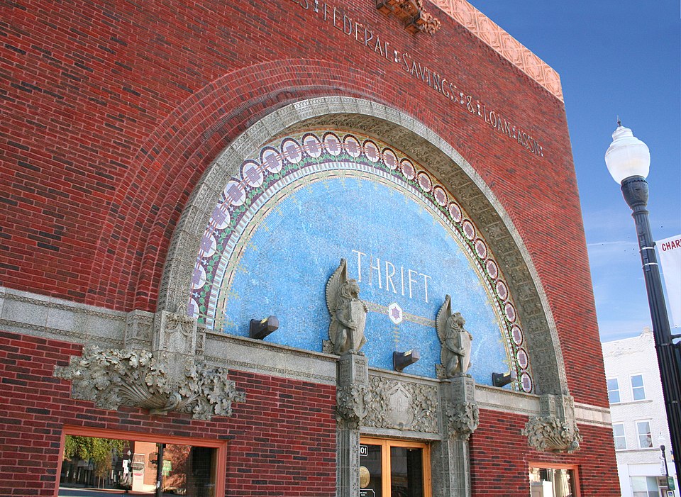
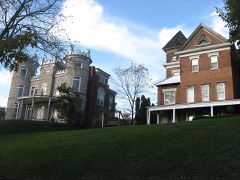
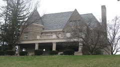
Photograph of People's Federal Savings and Loan Association
Photograph by Unknown, Public domain. Via Wikimedia Commons.

People's Federal Savings and Loan Association

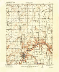
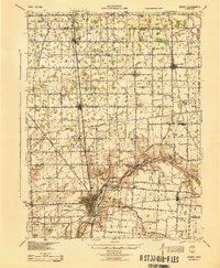
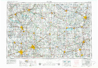
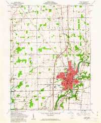
A National Historic Landmark. Built in 1917. Listed on the National Register of Historic Places in 1972. 6 historic topographic surveys show this location, the earliest from 1913.

From the record

“The People's Federal Savings and Loan Association is a historic bank building at 101 East Court Street in Sidney, Ohio, designed by Chicago architect Louis Sullivan. It was designed and built in 1917 for use by Peoples Federal Savings and Loan Association, which still operates out of it.”

Wikipedia article People's Federal Savings and Loan Association, CC BY-SA 4.0.

One of 20 National Register listings published here for Shelby County · listed in 1972 · category: Building · built in 1917, by Louis Sullivan · a National Historic Landmark.

Sources: the Wikipedia article · the case file at the National Archives · the National Register database, National Park Service · the Wikipedia article

The listing

  • National Historic Landmark. The highest federal designation, held by about 2,600 places in the country against roughly 100,000 Register listings.
  • What is counted as historic. The nomination lists 1 building as contributing to the listing.
  • Address. 101 E. Court St., Sidney, 45365
  • When was it listed? 1972-06-05
  • Category. building
  • Township. Clinton township
  • When was it built? 1917
  • Architect. Louis Sullivan
  • National Register reference number. 72001042 - the number the National Park Service assigned this property when it was listed, and the key its nomination file is catalogued under at the National Archives.

The ground it stands on

1,015 words

The chapter on Clinton Township in History of Shelby County, Ohio, and Representative Citizens, published 1913 names Sidney. This is what it says, exactly as the scans read.

Clinton township is drained by the Great Miami river, which enters at the northeast corner and flows south by west, and then, running southwest, becomes for a distance of about two miles the boundary line between Clinton and Orange township. Side by side with the river flows the Miami feeder with its water supply, which it carries to the canal at Lockington. Tawawa creek enters the Miami opposite Sidney, coming from the east, while another small tributary, flowing in the same direction, joins the large stream about a mile south of the mouth of the Tawawa. Three small streams enter the Miami from the west within the bounds of the township.

Passage source: History of Shelby County, Ohio, and Representative Citizens, published 1913.

Ordered, that it (the township) be divided into three districts (road); Sidney, No. 1 ; Plum Creek, No. 2 ; and Mile Creek, No. 3. No. 1 to work the road from the ford below Ruckman's mill to the public square in Sidney, the road leading to Hardin, and the one from Dingmansburg to Sidney. No. 2 to work the road from the public spuare on the road that leads up the river past Wm. Johnston's and Talbert's to the township line, and the Plum Creek road to the township line. No. 3 to work the road that leads from Sidney past Rufus Carey's to the township line, and the road from where it intersects the aforesaid road leading past Mr. Levalley's as far as the township line. John Blake supervisor district No. 1, N. Coleman of district No. 2, and a supervisor to be elected in No. 3.

Passage source: History of Shelby County, Ohio, and Representative Citizens, published 1913.

Machine-read from a century-old scan, so expect the errors a machine makes: misspelled names, dropped words, stray characters.

Read the whole chapter on Clinton Township - 1,015 words on its settlement, mills, schools and churches.

Specimens collected near this property

12 of 225 shown

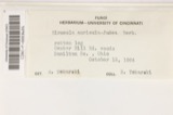
Regional context, not property-specific evidence. Museums hold 225 specimens collected within 10 miles of People's Federal Savings and Loan Association between 1897 and 1967: 185 Animalia, 21 Fungi, 18 Plantae, 1 Unrecorded. 12 distinct Species records are shown. Collected by A. R. Gaufin, A.R. Gaufin, A.R. Gaufin, H.H. Ross and others. Each is a physical object with a catalogue number, and each entry opens the museum's record. This is what was collected and kept, not a survey of what lives here - nothing can be concluded from a species being absent.

Image SpeciesYear Collected by Where, as recorded
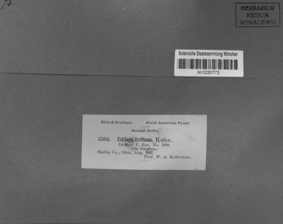
Specimen of Sorghum MoenchSorghum Moench1897Kellerman, W.A.Shelby Co., Ohio.
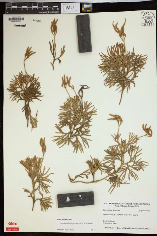
Specimen of Diphasiastrum digitatum (Dill. ex A.Braun) HolubDiphasiastrum digitatum (Dill. ex A.Braun) Holub1902Grover, F.O.Opens woods, N. Amherst, near F & D Quarry
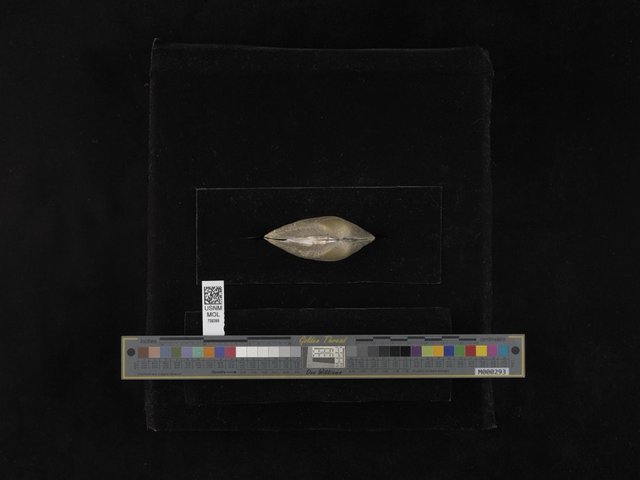
Specimen of Fusconaia flava (Rafinesque, 1820)Fusconaia flava (Rafinesque, 1820)1939not recordedMiami River
unnamed1897WA KellermanShelby County
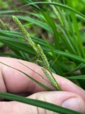
A photograph of the species Carex shortiana, not of this specimenCarex shortiana Dewey & Torr.1897Wetzstein, A.
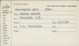
A photograph of the species Cercosporina apii, not of this specimenCercosporina apii (Fresen.) Miura1897Selby A. D.Kirkwood
Sorosporium reilianum (J.G.Kühn) McAlpine1897W. A. Kellerman
A photograph of the species Sphacelotheca reiliana, not of this specimenSphacelotheca reiliana (J.G.Kühn) G.P.Clinton1897Kellerman W. A.Shelby Co.
A photograph of the species Ustilago reiliana, not of this specimenUstilago reiliana J.G.Kühn1897Kellerman, W.A.Shelby County, Ohio.
A photograph of the species Accipiter cooperii, not of this specimenAccipiter cooperii (Bonaparte, 1828)1904Henninger, W. F. (Walther Frederick)New Bremen, Shelby, Ohio, USA
A photograph of the species Hirneola auricula-judae, not of this specimenHirneola auricula-judae (Bull.) Berk.1909Fisher G. ClydeSidney
A photograph of the species Gymnosporangium juniperi-virginianae, not of this specimenGymnosporangium juniperi-virginianae Schwein.1914Russell A. B.Sidney

All 225 specimens within 10 miles, at the Global Biodiversity Information Facility.

Mines and quarries near this property

9 within 5 miles

Regional context, not property-specific evidence. The federal mineral resources record lists 9 workings within 5 miles of People's Federal Savings and Loan Association: 4 past producers, 3 producers, 1 plant, 1 unknown. 4 still produce. What was taken out: Sand and Gravel, Construction, Stone, Crushed/Broken, Limestone, General. Distance is straight-line from the map coordinates, so a quarry counted here may appear on a neighbouring settlement's page as well.

Where SiteCommodity StatusRecorded
Rock Run QuarryLimestone, GeneralPast ProducerSedimentary
Rock Run QuarryStone, Crushed/BrokenPast Producer
Spring Creek QuarryStone, Crushed/BrokenProducer
Morelock PitSand and Gravel, ConstructionProducer
Norelock PitSand and Gravel, ConstructionPast ProducerSedimentary
Plant Number 2 and PitSand and Gravel, ConstructionPast ProducerSedimentary
Port Jefferon QuarrySand and Gravel, ConstructionProducer
Sidney Sand & Gravel Pit No 2Sand and Gravel, ConstructionPlant
Staley Farm QuarrySand and Gravel, ConstructionUnknown

Every working recorded in Shelby County

Storms near this property

60 of 111 shown

Regional context, not property-specific evidence. The National Weather Service names Sidney, the town this property stands in, in 111 storm reports between 1994 and 2025: 66 thunderstorm wind, 22 hail, 15 flood, 4 flash flood. The reports record 1 death. Each account below is quoted exactly as the forecast office filed it, from the NOAA Storm Events Database, and each date opens the federal record of that event.

WhenEvent Place namedHarm What the report says
July 2022LightningSidney1 killedA truck driver was killed by lightning along I-75 while fixing a mechanical issue with his truck. M50OU.
July 1994Thunderstorm WindSidney$50,000A grain silo and trees were downed on State Route 705.
April 1995Thunderstorm WindSidney$30,000Trees were downed, and a 60 by 60 foot pole barn was destroyed.
August 2009Thunderstorm WindSidney$23,000Thunderstorm winds caused damage to trees, a roof on a mobile home, and windows. Nickel to quarter size hail was also reported.
April 2006Thunderstorm WindSidney$20,000Three homes and a barn sustained structural damage. A business on Schenk Road had part of its roof removed.
April 2007Thunderstorm WindSidney$15,000Two barns had their tin roofs removed and a wooden fence was downed around a pool along Hardin-Wapakoneta Road. Several trees and power poles were also knocked down in this vicinity.
June 2006Thunderstorm WindSidney$15,000Numerous trees and large limbs were downed across the northern half of the county. One tree fell on a vehicle and another on a house in Sidney, causing minor damage to both.
July 2003Thunderstorm WindSidney$15,000Several homes were damaged by falling trees. Numerous trees and limbs were knocked down, and a few road signs were blown over. A 63 mph gust was measured in Anna.
July 2003Thunderstorm WindSidney$15,000Trees and limbs were downed. Fifteen homes and a few automobiles sustained minor damage from fallen trees.
August 2000Thunderstorm WindSidney$15,000Thunderstorm winds downed trees, some of which fell across roads and on cars.
June 2008HailSidney$12,000no account filed
July 2023Thunderstorm WindSidney$10,000A tree fell onto a car.
July 2015Thunderstorm WindSidney$10,000Four power poles were knocked down along State Route 47.
August 2000Thunderstorm WindSidney$10,000Numerous trees and power lines downed.
July 1998Thunderstorm WindSidney$10,000Trees downed.
November 1996Thunderstorm WindSidney$10,000no account filed
May 2025Thunderstorm WindSidney$8,000Multiple trees as well as some power lines were downed. In the same area, lightning struck a utility pole, causing a nearby tree to catch on fire.
July 2025Thunderstorm WindSidney$6,000Multiple trees were downed along Main Street, taking out several power lines.
July 2002Thunderstorm WindSidney$6,000A few trees were blown down. Minor damage occurred at the EMA building.
June 2025Thunderstorm WindSidney$5,000Several large trees were downed on the south side of Sidney, including on Franklin and Ohio Avenues.
March 2011FloodSidney$5,000Roads were closed across the area due to heavy rainfall and previous snow melt. Flooding began around 0754 EST on February 28th and ended around 0900 on March 2nd. Damage estimates for February were around five-thousand dollars.
February 2011FloodSidney$5,000Roads were closed across the area due to heavy rainfall and previous snow melt. Flooding began around 0754 EST on February 28th and ended around 0900 EST on March 2nd. Damage estimates for March were around five-thousand dollars.
March 2007FloodSidney$5,000Many roads were flooded throughout the county.
July 2006FloodSidney$5,000Cooper and Cisco Roads were flooded. Several cars were flooded in a parking lot at the Shelby County Fairgrounds.
April 2000Thunderstorm WindSidney$5,000Trees knocked down.
May 1999Thunderstorm WindSidney$5,000Large trees were blown over as well as a semitrailer on Interstates 75 and 274.
June 1994Thunderstorm WindSidney$5,000Trees were downed.
June 1994Thunderstorm WindSidney$5,000Trees were downed, some on power lines.
June 2008HailSidney$5,000no account filed
August 1994Thunderstorm WindSidney$5,000no account filed
November 2005Thunderstorm WindSidney$4,000Large limbs to 2.5 feet in diameter were knocked down along Main Street and Russel Road.
August 2024Thunderstorm WindSidney$3,000A tree fell on a power line.
May 2022Thunderstorm WindSidney$3,000A few trees were downed.
May 2020Thunderstorm WindSidney$3,000Several trees were downed in the Sidney area.
June 2020Thunderstorm WindSidney$3,000A couple of trees were knocked down in the Sidney area. A tree was also knocked down near Port Jefferson.
August 2019Thunderstorm WindSidney$3,000Trees were knocked down.
August 2019Thunderstorm WindSidney$3,000A healthy tree of unknown size was knocked down onto a vehicle along South Miami Avenue.
July 2013Thunderstorm WindSidney$3,000Several trees were downed or uprooted near Port Jefferson Road and Terrace Drive due to thunderstorm winds.
July 2012Thunderstorm WindSidney$3,000Trees were downed on the west end of Sydney due to damaging thunderstorm winds. Power outages were also reported.
March 2007FloodSidney$3,000A couple of roads were flooded and closed.|
May 2006Thunderstorm WindSidney$3,000Trees were knocked down.
August 2005Thunderstorm WindSidney$3,000Large limbs were downed.
July 2003Thunderstorm WindSidney$3,000Several trees were knocked down.
July 2003Thunderstorm WindSidney$3,000Trees were downed on Miami River Road.
May 2003Thunderstorm WindSidney$3,000Several tress were knocked down.
February 1999Thunderstorm WindSidney$3,000Trees knocked down.
July 1999Thunderstorm WindSidney$3,000Trees downed.
June 2025Thunderstorm WindSidney$2,000A tree was downed on a power line on South Ohio Street.
June 2020Thunderstorm WindSidney$2,000Several trees were knocked down on Foraker Avenue.
June 2017Thunderstorm WindSidney$2,000One tree was knocked down on the courthouse square in Sidney. The tree damaged a nearby flag pole.
June 2010Flash FloodSidney$2,000Numerous streets were flooded due to heavy rainfall.
October 2010Thunderstorm WindSidney$2,000Trees were reported down due to damaging thunderstorm winds.
April 2007Thunderstorm WindSidney$2,000Power lines were blown down from the thunderstorm winds.
July 2006Thunderstorm WindSidney$2,000A couple of trees were knocked down along Sidney-Plattsville and McCloskey School Roads.
June 2004Thunderstorm WindSidney$2,000Two trees were downed.
May 2002Thunderstorm WindSidney$2,000Two trees were downed.
August 2023Thunderstorm WindSidney$1,000A large tree was downed along a roadway.
June 2020Thunderstorm WindSidney$1,000A portion of a large tree was knocked down in the 800 block of South Miami Avenue.
June 2016Thunderstorm WindSidney$1,000A tree was reported down at Custenborder Field Park.
August 2016Thunderstorm WindSidney$1,000One tree was knocked down in Orange Township.

Every storm recorded in Shelby County

Maps showing this location

6 surveys

United States Geological Survey topographic sheets whose coverage includes this point. Matched by taking the coordinate the National Park Service records for this property, then testing that coordinate against the published boundary of every sheet.

From the nomination file

2,020 words on record

When this property was proposed for the National Register, someone wrote the case for it: what the building is, and why it matters. That document is a federal record in the public domain. It is quoted below word for word, never summarised. The text was read off the scanned case file by machine, so the occasional stray character is the recogniser's and the 1970s typewriter's.

Statement of significance

The People's Savings & Loan Association Bank, erected in 1917, was one of "architecture of democracy" in America, and designed his Chicago skyscrapers ated electric lighting, ventilation and air conditioning long before it was vast talents on small commissions and was to die in poverty, for his dream of an original American architecture, one which would abandon forever the early 20th century.

1895, Sullivan designed three skyscrapers, several industrial buildings and "Their color, brilliance and gaiety entirely put in the shade the thin, awkward and wan examples of the country builder, and to the same degree the ment, by its intricacy and vitality, compels the interest of the commoner their lives have been contemptuous of or oblivious to architecture." directors was somewhat disturbed by the unfamiliarity of the style, and Commerce Engineering losophy Communications Transportation Religion/Phi Aboriginal Science Music Agriculture itarian Theater Education Sculpture Conservation Social/Human- directors outlined for him in informal conference their requirements for two residences before receiving a commission to design the National Farmers' to be straightforward in their structural systems, yet exquisite in detail.

Read the complete 2,020-word case file.

The whole case file for this property - 2,020 words, 12 pages, reproduced complete.

Quoted from the National Register nomination for reference 72001042, 12 pages, held by the National Archives in Record Group 79. See the catalogue record.

Listed places nearby

6 within 8 miles

Other National Register properties close enough to walk or drive between, ordered by distance from this one. Both positions come from the same geocoding pass that matched these properties to their map sheets.

Photograph PropertyDistance Listed
Sidney Courthouse Square Historic Districtunder 500 feet1980
Sidney Walnut Avenue Historic District0.3 miles1983
Whitby Mansion0.5 miles1976
Sidney Waterworks And Electric Light Building0.5 miles1978
Fulton Farm0.7 miles1979
Port Jefferson School4.6 miles1982

Sources for this property

National Archives recordThe nomination case file for reference 72001042 in Record Group 79.
Wikipedia articleCommunity-written account of this property, licensed CC BY-SA.
Shelby CountyAll 20 listed properties in this county.

Provenance

  • Listing record. National Park Service National Register of Historic Places, listed-properties dataset, current to 2026-05-22.
  • Map join. Address geocoded through the United States Census geocoder, then tested against the published boundary of every sheet in the USGS Historical Topographic Map Collection.
  • How this page is made. Listing fields come from federal records; map-sheet coverage is a labelled coordinate-to-boundary calculation, not a source-field claim.
  • Specimens. Global Biodiversity Information Facility (GBIF), https://www.gbif.org/. Only records licensed CC0 or CC BY are used. Records licensed CC BY-NC are excluded because this site carries advertising. Images are checked individually and any whose licence is non-commercial, no-derivatives or unreadable is refused.
  • Mines and quarries. USGS Mineral Resources Data System (MRDS) https://mrdata.usgs.gov/mrds/ A work of the United States government, no copyright under 17 U.S.C. 105.
  • Storms. NOAA National Centers for Environmental Information, Storm Events Database https://www.ncei.noaa.gov/stormevents/ A work of the United States government, no copyright under 17 U.S.C. 105. Narratives are quoted verbatim from the National Weather Service report and are not edited or summarised.