Listed on the National Register of Historic Places in
1979. A historic map-sheet match is not published yet. The record needs a coordinate-quality review before it can be joined to a sheet boundary.
From the record
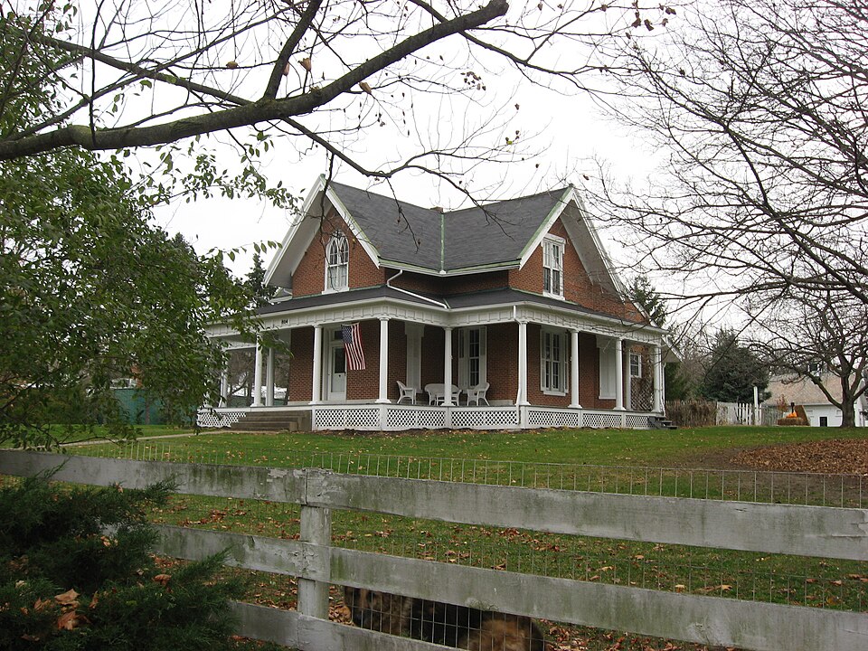
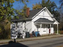
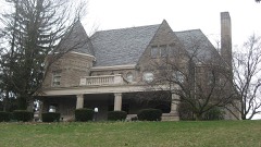
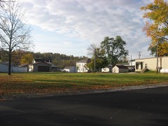
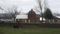
“The Fulton Farm, also known as "River Bend Farm," is a historic farmstead in Shelby County, Ohio, United States. Located on the southern side of the city of Sidney, the farm is composed of five buildings spread out over an area of approximately 2 acres (0.81 ha).”
Wikipedia article Fulton Farm, CC BY-SA 4.0.
one of 19 National Register listings in Shelby County · listed in 1979 · category: Building · one of 1 National Historic Landmarks in Shelby County.
National Register reference number.79001947- the number the National Park Service assigned this property when it was listed, and the key its nomination file is catalogued under at the National Archives.
What happened here
An account from the chapter on Clinton township, The inset identifies its exact
source book and publication year.
Less than nine centuries since, the historic period of the Western Continent - the new world - was ushered in. Let us pause a moment and recall the achievements of the actors in the great drama of discover}', settlement, colonization, and nationality. With our own territory extending from the Atlantic to the Pacific, and from the great cool lakes to the broad warm gulf, it also embraces a separate territory bordering the Frozen Ocean and clasping hands with the great Asiatic Continent, almost linking that continent with British North America.
The chapter on Clinton Township in History of Shelby County, Ohio, published 1883 names Sidney. This is what it says, exactly as the scans read.
This county is situated in the second tier of counties from the boundary line between Indiana and Ohio, and about half-way of the State from north to south. It is bounded on the north by Auglaize County', on the east by Logan and Champaign, on the south by Miami, and on the west by Darke and Auglaize. The county seat is Sidney. The water-shed between the Maumee and Miami River systems is partly in the northern part of this county. The road known ns the Kettler turnpike, in a general way, may be regarded ns marking the line of the water shed, at least for some miles of its course, nearest the Loramie Reservoir. The watershed bears to the northeast, after leaving this county, into Hardin and Wyandot counties.
At Cincinnati, low water in the Ohio River is four hundred and thirtytwo feet above tide-water, and the water in the Sidney feeder is five hundred and twelve feet above low water in the Ohio, or nine hundred and forty-four feet above tide-water. The greatest elevation yet measured in the county is one hundred and thirty-four feet, on the Tawawa turnpike, east of the Miami River. The line between this county and Champaign, on this turnpike, is one hundred and twenty-one feet above the water in the feeder. The greatest elevation on the line of the Stewart turnpike is one hundred and twenty-one feet, and on the line between Shelby and Logan counties one hundred and eleven feet above the water in the canal. On the Infirmary turnpike the greatest elevation is eightv-seven feet, and at the end of this road, on the line between this county ami Miami, it is forty feet below the level of the canal. On the St. Marys turnpike, about two miles from Sidney, the highest point is reached at one hundred and twelve feet above the water in the canal. The bottom of the reservoir is about eight feet above the water in the canal. The main canal extends entirely across the county, running in a northwesterly direction from a point on the southern boundary line about midway of the county, from east to west. The Sidney feeder is twelve miles in length, and extends from Port Jefferson to Lockington, and is the channel through which the water from the great reservoir at Lewistown reaches the summit level of the canal. The Sidney feeder and the main canal above Lockington are on the same level, and the, water from the Lewistown reservoir flows indifferently north or south. The summitlevel of the Miami and Erie Canal is, therefore, the same as that of the Sidney feeder - nine hundred and forty-four feet above the level of the sea. The highest land in the county (so far as any measurements have extended) is one thousand anil seventy-eight feet above tide-water, and six hundred and forty-six feet above low water in the Ohio River at Cincinnati. To aid in the comparison of the elevations in this county with other portions of the State, I will here give a few measurements taken from Prof. Orton's Report of the Geology of Highland County, in the volume for 1870, p. 258. At the head-waters of the Scioto and Miami rivers, in Logan County, an elevation is given, on the authority of Col. C. Whittlesey* of one thousand three hundred and forty-four feet, which is two hundred and sixty-six feet greater than any in Shelby County. A measurement still greater is given of a summit in Richland County, one thousand three hundred and eighty-nine feet above the level of the sea. The highest land in the Stale, so far as known, is a point. about three miles northeast of Bellefontaine. Its elevation above the sea, as determined by Prof. F. C. Hill, for the Geological Survey, is fifteen hundred and forty-four feet. The summit-level of the canal in this county is four hundred feet lower than the water-shed between the Miami and Scioto rivers in Logan County. This statement will show the resources of the canal for water supply in this direction. The surface drainage and spring-water of a surface of about nine hundred square miles, must be available at the head-waters of the Miami as a supply for the canal above the summit-level - one-half of which, with other resources, would float a tonnage greater than was ever floated in the canal.
Regional context, not property-specific
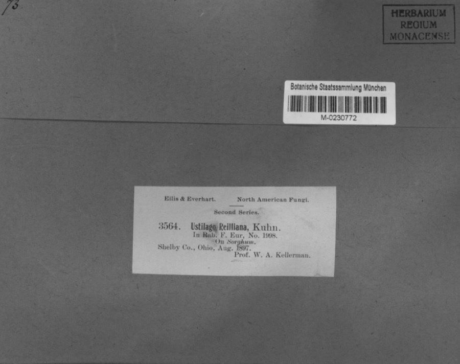
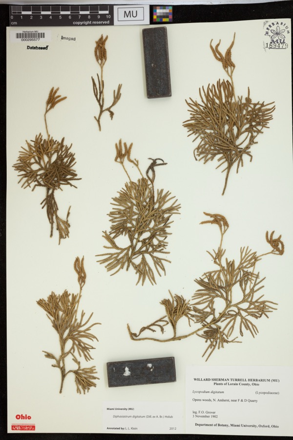
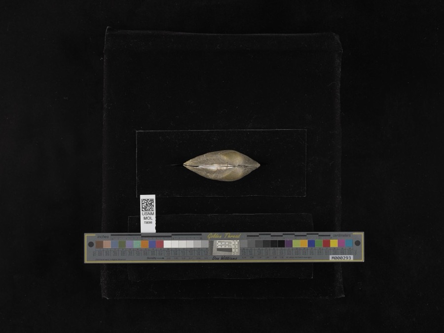
evidence. Museums hold 225 specimens
collected within 10 miles of Fulton Farm between 1897 and
1967: 185 Animalia, 21 Fungi, 18 Plantae, 1 Unrecorded. 12 distinct Species records are shown.
Collected by A. R. Gaufin, A.R. Gaufin, A.R. Gaufin, H.H. Ross and others. Each is a
physical object with a catalogue
number, and each entry opens the museum's record. This is what was
collected and kept, not a survey of what lives here - nothing can be
concluded from a species being absent.
Regional context, not property-specific
evidence. The federal mineral resources record lists
7 workings within 5 miles of Fulton Farm: 3 past producers, 2 producers, 1 plant, 1 unknown.
3 still produce. What was taken out: Sand and Gravel, Construction, Stone, Crushed/Broken, Limestone, General. Distance is straight-line from the
map coordinates, so a quarry counted here may appear on a neighbouring
settlement's page as well.
Regional context, not property-specific
evidence. The National Weather Service names
Sidney, the town this property stands in, in 111 storm reports between 1994 and 2025: 66 thunderstorm wind, 22 hail, 15 flood, 4 flash flood.
The reports record 1 death. Each account below is quoted exactly as the forecast office
filed it, from the NOAA Storm Events Database, and each date
opens the federal record of that event.
Two barns had their tin roofs removed and a wooden fence was downed around a pool along Hardin-Wapakoneta Road. Several trees and power poles were also knocked down in this vicinity.
Numerous trees and large limbs were downed across the northern half of the county. One tree fell on a vehicle and another on a house in Sidney, causing minor damage to both.
Several homes were damaged by falling trees. Numerous trees and limbs were knocked down, and a few road signs were blown over. A 63 mph gust was measured in Anna.
Roads were closed across the area due to heavy rainfall and previous snow melt. Flooding began around 0754 EST on February 28th and ended around 0900 on March 2nd. Damage estimates for February were around five-thousand dollars.
Roads were closed across the area due to heavy rainfall and previous snow melt. Flooding began around 0754 EST on February 28th and ended around 0900 EST on March 2nd. Damage estimates for March were around five-thousand dollars.
No historic map-sheet match is published
for this property yet. That does not mean no map exists. This record needs
a coordinate-quality review before it can be joined to a sheet boundary.
Browse the county's mapped places while that work is
pending.
From the nomination file
1,701 words on record
When this property was proposed for the
National Register, someone wrote the case for it: what the building is,
and why it matters. That document is a federal record in the public domain.
It is quoted below word for word, never summarised. The text was read off the scanned case file by machine, so the
occasional stray character is the recogniser's and the 1970s
typewriter's.
Description of the property
Located to the leit rear, or northeast corner, is a one-story late nineteenth century has eight course brick walls and a slate a 2/2 fixed Gothic window. The six bay north facing has single light fixed windows, a CONDITION DATE MOVED UNALTERED XEXCELLENT XALTERED CHECK ONE board siding. Adjoining these two additions on the south side is another one-story enclosed summer porch; headers.Further east is a one-story porch addition, small in scale and built with wood. has two gables, each having paired Gothic traceried windows with 5/4 lights and limestone north gable has a finial and pendant, while the south gable has finial alone.The five bay _DETERIORATED XORIGINAL SITE - UNEXPOSED from the Fulton farm.At the rear of the original building isa small fruit cellar.
-FAIR -GOOD the porch is framed by plain Roman Doric wood colus and has triglyph-1ike decorations The wooden chicken house, dating from the nineteenth century, sits atop a cinderblock roof. with asphalt shingles, metal ridging, interior corbeled chirmeys, and decorative lightning in the entablature. spiral staircase; this woodwork was built from black walnut trees which were probably cut the gable is a door with a muntined Gothic transom and radiating headers. The carriage The gables in the half-story above have contrasting window treatments.The north facing narrow rectangular 4/lDHS windows with mullion and a limestone lintel with label.The The three bay east side has a similar entry door and1/1DHS windows.The four bay south -RUINS AREAS OF
Statement of significance
/ARCHITECT Isaac T. Fulton STATEMENT OF SIGNIFICANCE Iarmer and active in the County. In October 1055 he hosted the Shelby County Agricultural County Agricultural Association. After Fulton's death (1865 or 1866) the homestead went In 1894 John Loughlin purchased the site as a country summer cottage. Loughlin was a on an assembly line set up. At the time, the plant was the most modern and largest pro- Despite the plant's modernity and loughlin's acclaimed managerial ability, the Mary Le Ley City' has ever done more to further its interests and bring prosperity to the city and its people...." 5 continuity.
ART X1800-1899 EDUCATION SIGNIFICANCE PERIOD SCIENCE XAGRICULTURE LITERATURE THEATER 1700-1799 INVENTION MILITARY 1900- INDUSTRY 1500-1599 _EXPLORATION/SETTLEMENT _PREHISTORIC of its association with the agricultural and poultry industry. The Fulton home is one of _POLITICS/GOVERNMENT _PHILOSOPHY _TRANSPORTATION outbuildings in this style is also significant for maintaining that architectural tury the site received national attention because the Mary L.
Poultry Plant occupied the _COMMUNICATIONS Society's Fifth Annual Fair on his farm and five years later he became a trustee of the Fulton's choice of the Gothic Revival style for his house is noteworthy for this In 1896 Loughlin let a contract for the construction of his newest business enter- the most ornate pre-Civil War farmhouses extant in this county.At the turn of the cen- through the hands of John Duncan and Samuel Strahlem. _CONSERVATION _ENGINEERING -1600-1699 _1400-1499 - SOCIAL/HUMANITARIAN -ECONOMICS _SCULPTURE - RELIGION -MUSIC -LAW The Fulton farm,also know as River Bend, is a significant Shelby County site because daily.
The plant was so imaginative that the railroads ran nunerous sunmer exeursions bringing thousands of people from afar to visit the site.3 Fulton was a well-lmown local style never attained a real popularity in western Ohio.
Quoted from the National Register nomination
for reference 79001947, 20 pages, held by the National Archives in Record
Group 79. See the
catalogue record.
Listed places nearby
6 within 8 miles
Other National Register properties close
enough to walk or drive between, ordered by distance from this one. Both
positions come from the same geocoding pass that matched these properties
to their map sheets.
Listing record. National Park Service National Register of Historic Places, listed-properties dataset, current to 2026-05-22.
Map join. Address geocoded through the United States Census geocoder, then tested against the published boundary of every sheet in the USGS Historical Topographic Map Collection.
How this page is made. Listing fields come from federal records; map-sheet coverage is a labelled coordinate-to-boundary calculation, not a source-field claim.
Specimens. Global Biodiversity Information Facility (GBIF), https://www.gbif.org/. Only records licensed CC0 or CC BY are used. Records licensed CC BY-NC are excluded because this site carries advertising. Images are checked individually and any whose licence is non-commercial, no-derivatives or unreadable is refused.
Mines and quarries. USGS Mineral Resources Data System (MRDS) https://mrdata.usgs.gov/mrds/ A work of the United States government, no copyright under 17 U.S.C. 105.
Storms. NOAA National Centers for Environmental Information, Storm Events Database https://www.ncei.noaa.gov/stormevents/ A work of the United States government, no copyright under 17 U.S.C. 105. Narratives are quoted verbatim from the National Weather Service report and are not edited or summarised.
 Block
Block