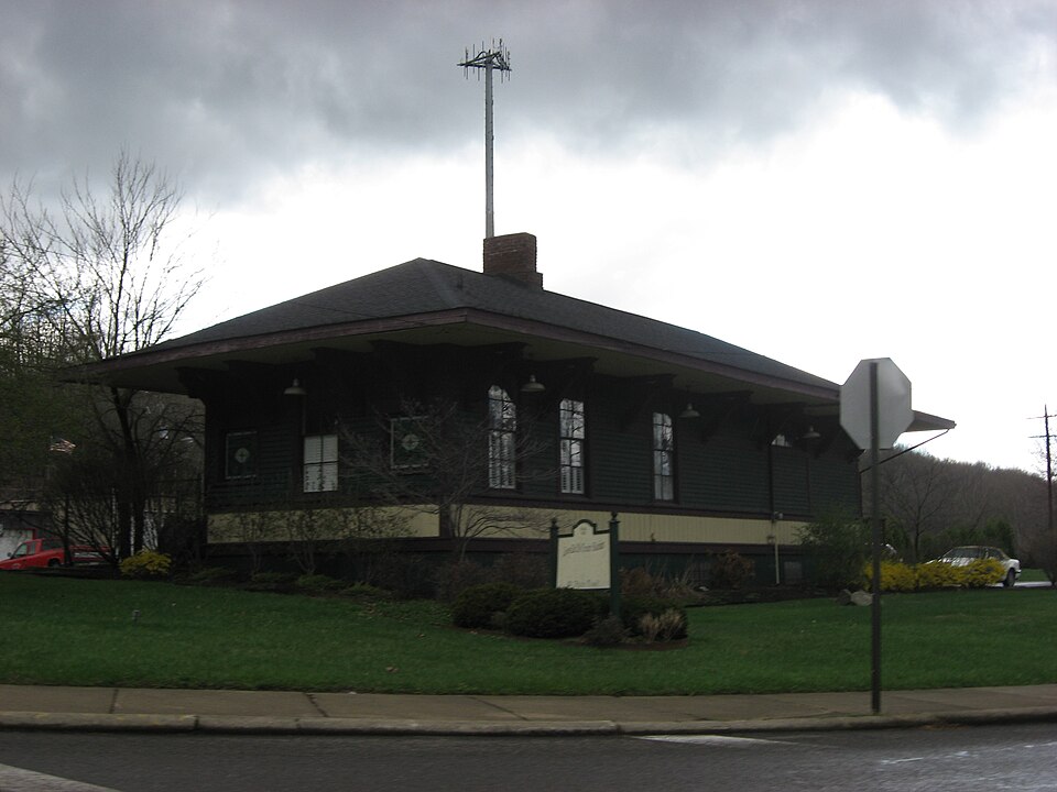
Listed on the National Register of Historic Places in
1976. A historic map-sheet match is not published yet. The record needs a coordinate-quality review before it can be joined to a sheet boundary.
From the record
one of 59 National Register listings in Mahoning County · listed in 1976 · category: Building.
National Register reference number.76001480- the number the National Park Service assigned this property when it was listed, and the key its nomination file is catalogued under at the National Archives.
Fires near this property
10 since 2010
Regional context, not property-specific
evidence. The
federal wildfire occurrence database
lists 10 fires within 5 miles of Lowellville Railroad Station between
2010 and 2020, burning about 6 acres in total. None started naturally. None was recorded as arson.
Distance is straight-line from the map coordinates, so a fire counted
here may appear on a neighbouring settlement's page as well.
Reported cause
Fires
Debris and open burning
8
Equipment and vehicle use
1
Missing data/not specified/undetermined
1
The most recent of
them, most recent first, with the day each was reported and the service
that recorded it.
Regional context, not property-specific
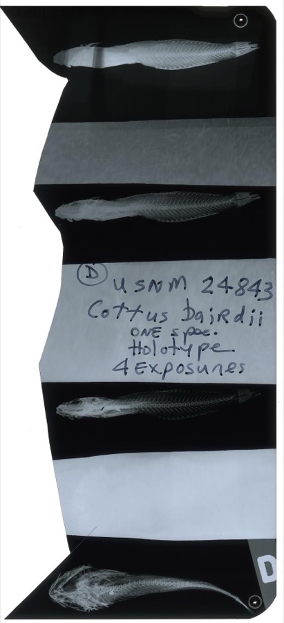
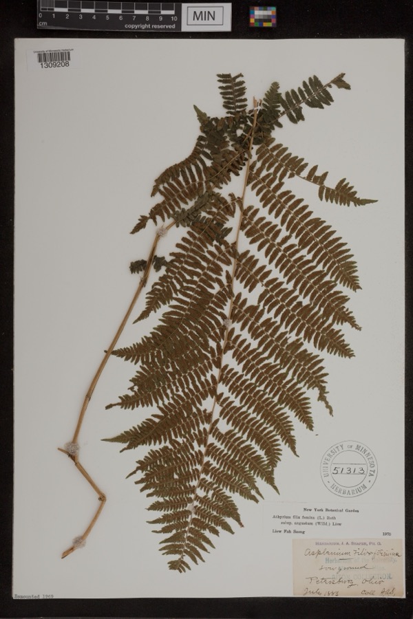
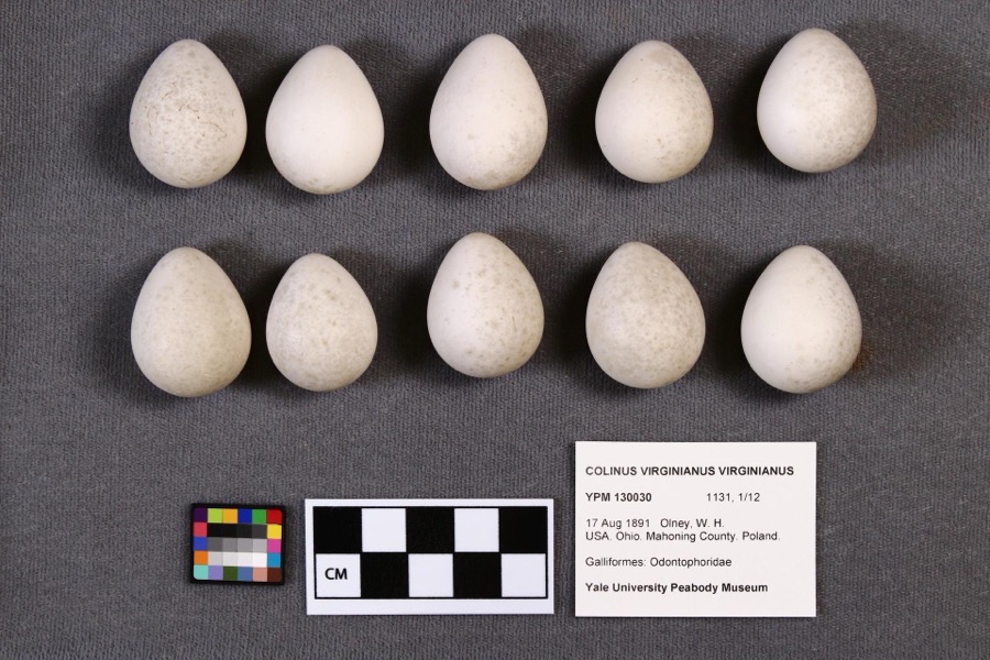
evidence. Museums hold 343 specimens
collected within 10 miles of Lowellville Railroad Station between 1853 and
1974: 182 Animalia, 159 Plantae, 1 Fungi, 1 Chromista. 12 distinct Species records are shown.
Collected by A.E. Daugherty, B Withers, Baird, S. F. and others. Each is a
physical object with a catalogue
number, and each entry opens the museum's record. This is what was
collected and kept, not a survey of what lives here - nothing can be
concluded from a species being absent.
Regional context, not property-specific
evidence. The federal mineral resources record lists
3 workings within 5 miles of Lowellville Railroad Station: 2 past producers, 1 producer.
1 still produces. What was taken out: Stone, Crushed/Broken, Limestone, General. Distance is straight-line from the
map coordinates, so a quarry counted here may appear on a neighbouring
settlement's page as well.
Regional context, not property-specific
evidence. The National Weather Service names
Lowellville, the town this property stands in, in 5 storm reports between 2001 and 2015: 2 thunderstorm wind, 2 hail, 1 tornado.
No death or injury is recorded in these reports. Each account below is quoted exactly as the forecast office
filed it, from the NOAA Storm Events Database, and each date
opens the federal record of that event.
A weak F2 tornado touched down near Lowellville in eastern Mahoning County. The tornado had a intermittent damage path approximately four miles in length and 75 yards in width. Two homes, one business and two garages suffered significant damage with around a dozen other homes sustaining minor damage.
No historic map-sheet match is published
for this property yet. That does not mean no map exists. This record needs
a coordinate-quality review before it can be joined to a sheet boundary.
Browse the county's mapped places while that work is
pending.
From the nomination file
1,588 words on record
When this property was proposed for the
National Register, someone wrote the case for it: what the building is,
and why it matters. That document is a federal record in the public domain.
It is quoted below word for word, never summarised. The text was read off the scanned case file by machine, so the
occasional stray character is the recogniser's and the 1970s
typewriter's.
Description of the property
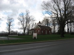
a stone foundation which has been repaired and reinforced in places CONDITION DESCRIPTION UNEXPOSED FAIR UNALTERED Stick Style. tongue-and-groove boards, is all original, though deteriorated. together with the horizontal board at the level of the brackets, projection for the telegraph office on the south side.Ithstands on rebuilt with modern concrete.The site slopes away slightly from This is a small railroad passenger depot structure of frame The framing of all of the exterior door and window openings, The east end houses the passenger waiting room.There is one door on the south side.Between these two areas is the ticket and telegraph office. The interior room finish, with vertical wall are faced with awainscoting of vertical boards.
Above that the wall treatment is horizontal clapboard.The wide overhanging It is reached by wide doors on the west end and the south side. roof eaves are supported on long diagonal brackets.The roof is construction.It is a plain long rectangle in shape, with a slight CHECK ONE the roadbed of the tracks.The lower three feet of the outside is handled in such a way as to indicate an affinity with the alow hip.The west end of the building is the baggage room. with cement.The platform and steps at the west end have been AREAS OF
Statement of significance
MAR 1 7 1976 NATIONAL 1400-1499 1500-1599 1600-1699 ARCHEOLOGY-HISTORIC PERIOD ART THEATER PHILOSOPHY SCULPTURE BUILDER/ARCHITECT AGRICULTURE INDUSTRY PREHISTORIC ARCHITECTURE EXPLORATION/SETTLEMENT REGISTER SIGNIFICANCE MILITARY LITERATURE LAW ARCHEOLOGY-PREHISTORIC RECEIVED Youngstown and Pittsburg Railroad connecting the Great Lakes with 1900- functional and attractive but without pretension. The railroad was the Lawrence Division of the Ashtabula, _ENGINEERING INVENTION Lowellville is at the southeasternmost end of an industrial city of Lowellville and is currently used for storage.A local type of small town railroad station, built to serve an important Pennsylvania and Ohio Canal in 1840.Its industrial growth began community effort has been directed to studying its adaptive use.
Because coal,iron and limestone were all readily available in This is ap modest example in good condition of the vanishing _CONSERVATION it did not achieve any size or importance until the opening of the the Pittsburg industrial area.This line later became a part of the The foothills of the Alleghenies rise on either side of the town, which out the nineteenth century and into the twentieth. of the Pennsylvania System.The station has been acquired by the with the construction of the Lowellville blast furnace in 1845.
industrial town of the Mahoning Valley.Its architectural design is -COMMUNICATIONS SRR - ECONOMICS _1700-1799 _EDUCATION lies in.the Mahoning Valley.Although the site was settled in 1800, - RELIGION _COMMERCE -MUSIC Pittsburg, Fort Wayne and Chicago Railroad, and still later a part the nearby mountains, the iron industry thrived in the valley through- district twenty-five miles long which includes Youngstown and Warren. Joseph G. Butler, Jr., History of Youngstown and the Mahoning Valley (Chicago, 1921), I, 511-513, 762.
Quoted from the National Register nomination
for reference 76001480, 14 pages, held by the National Archives in Record
Group 79. See the
catalogue record.
Listed places nearby
6 within 8 miles
Other National Register properties close
enough to walk or drive between, ordered by distance from this one. Both
positions come from the same geocoding pass that matched these properties
to their map sheets.
Listing record. National Park Service National Register of Historic Places, listed-properties dataset, current to 2026-05-22.
Map join. Address geocoded through the United States Census geocoder, then tested against the published boundary of every sheet in the USGS Historical Topographic Map Collection.
How this page is made. Listing fields come from federal records; map-sheet coverage is a labelled coordinate-to-boundary calculation, not a source-field claim.
Wildfire. Short, Karen C. 2022. Spatial wildfire occurrence data for the United States, 1992-2020 [FPA_FOD_20221014]. 6th Edition. Fort Collins, CO: Forest Service Research Data Archive. https://doi.org/10.2737/RDS-2013-0009.6 Collected with United States Government funding and usable without additional permissions or fees.
Specimens. Global Biodiversity Information Facility (GBIF), https://www.gbif.org/. Only records licensed CC0 or CC BY are used. Records licensed CC BY-NC are excluded because this site carries advertising. Images are checked individually and any whose licence is non-commercial, no-derivatives or unreadable is refused.
Mines and quarries. USGS Mineral Resources Data System (MRDS) https://mrdata.usgs.gov/mrds/ A work of the United States government, no copyright under 17 U.S.C. 105.
Storms. NOAA National Centers for Environmental Information, Storm Events Database https://www.ncei.noaa.gov/stormevents/ A work of the United States government, no copyright under 17 U.S.C. 105. Narratives are quoted verbatim from the National Weather Service report and are not edited or summarised.
 Block
Block