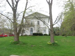
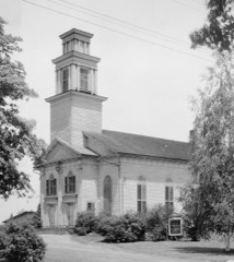
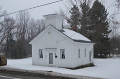
Listed on the National Register of Historic Places in
1987. A historic map-sheet match is not published yet. The record needs a coordinate-quality review before it can be joined to a sheet boundary.
From the record
“About two weeks after the birth of Thompson's daughter, in 1801, Isaac Thompson and his son, James, located a lot of land in Richmond, near the ,mouth of Grand river. While working on their land two Indians came to their house in Middlefield, acting in a cowardly, sneaking manner, peering through the bracks of the house, talking low, and conducting themselves badly.”
Pioneer and General History of Geauga County, with Sketches of Some of the Pioneers and Prominent Men (1880). Machine-read text.
one of 11 National Register listings in Geauga County · listed in 1987 · category: Building.
National Register reference number.87001213- the number the National Park Service assigned this property when it was listed, and the key its nomination file is catalogued under at the National Archives.
There were one or two families living in Mentor at this time. The name of one of the families was Parker. In the January following this date, their son, John Thompson, was born. They remained in Mentor until the tenth or fifteenth of March, 1799, when Isaac informed his son James that they must get back to the Ohio river; Mentor was no place for them ; the country would never be settled; there was no outlet to the ocean, and consequently the place was only fit for wild beasts and Indians. Soon after this the whole family started for the Ohio river. The previous summer the State road had been surveyed through from Pittsburgh to the mouth of Grand river. The family followed the line of the road by the marked trees, to the point now known as Johnson's corners, in Middlefield. Here a man by the name of Hill, with his wife, and a Mr. Lemoin, had built their cabins, a little southwest of the corners, upon land now owned by H. B. Johnson, and they followed trapping.
The Thompson family stopped here for the night. In the morning the men went out and took a look at the country. After a day or two they were so favorably impressed with the country, and being sick and tired of moving, they decided to settle. Selecting a site on lot twenty-nine, about twenty-five rods east of the Methodist Episcopal church, they erected a house, the first of any size in the township, and the workmen were Isaac and James Thompson, Hill and Lemoin. Soon after the Thompsons arrived, Hill and his wife left for parts unknown. Lemoin lived with the Thompsons a short time, and he left also, leaving the new -settlers the only white people in the township. Consequently, Isaac Thompson and family were the first permanent settlers of Middlefield.
Regional context, not property-specific
evidence. The
federal wildfire occurrence database
lists 1 fire within 5 miles of Batavia House between
2019 and 2019, burning about 1 acres in total. None started naturally. None was recorded as arson.
Distance is straight-line from the map coordinates, so a fire counted
here may appear on a neighbouring settlement's page as well.
Reported cause
Fires
Missing data/not specified/undetermined
1
The most recent of
them, most recent first, with the day each was reported and the service
that recorded it.
Regional context, not property-specific
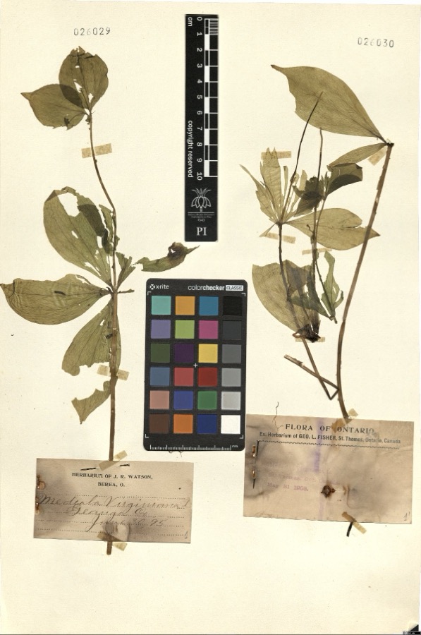
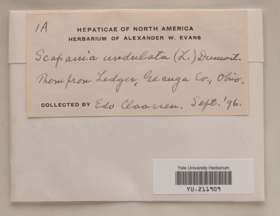
evidence. Museums hold 651 specimens
collected within 10 miles of Batavia House between 1887 and
1975: 544 Animalia, 102 Plantae, 5 Fungi. 12 distinct Species records are shown.
Collected by A. M. Evans, A. N. Rood, A.E. Daugherty and others. Each is a
physical object with a catalogue
number, and each entry opens the museum's record. This is what was
collected and kept, not a survey of what lives here - nothing can be
concluded from a species being absent.
Regional context, not property-specific
evidence. The National Weather Service names
Middlefield, the town this property stands in, in 22 storm reports between 1995 and 2025: 12 thunderstorm wind, 7 hail, 2 tornado, 1 flash flood.
The reports record 4 injuries. Each account below is quoted exactly as the forecast office
filed it, from the NOAA Storm Events Database, and each date
opens the federal record of that event.
The tornado touched down near the Aims Department store just north of route 87 and moved northeast downing trees. An apartment complex suffered minor roof and structural damage. The tornado then moved into a residential neighborhood. Four homes were destroyed as the roofs were removed and each house lost one or two walls. Several outbuildings were also destroyed. About 12 other homes suffered minor to moderate damage. The tornado lifted just northeast of route 608 causing additional tree damage and minor damage to a few structures. Injuries were minor and consisted of lacerations and bruises. One woman was knocked unconscious by flying debris.
Starting around 520 PM on the evening of the 27th storms associated with a cold front moving through the region produced torrential rain over the Middlefield area. Between 545 and 715 PM 4.13 of rain fell as reported by the CoCoRaHS observer in Middlefield. It was this heavy rain that caused the Tare Creek to overcome it's banks and flood a retirement community and an apartment complex. This was the first ever reported incident of the creek flooding the retirement home which was built in 1965. The flood waters filled the basement with seven feet of water and resulted in evacuations. Further downstream sat an apartment complex where the Fire Department performed water rescues of 8 residents. The flood waters were estimated at eight inches deep in the apartments. An additional 0.9 of rain fell between 8 PM and 8 AM but no additional flash flooding resulted. Numerous homes in the community had flooded basements.
An EF0 tornado touched down in rural Geauga County about three miles northeast of Middlefield. The initial touchdown occurred just northeast of the intersection of Hayes and Nauvoo Roads in Middlefield Township. The tornado continued south southeast for nearly two and a half miles before crossing into Trumbull County. The tornado strengthened to EF1 intensity as it approached State Route 87. Two mobile homes along State Route 87 just west of Bundysburg Road and the Trumbull County line were damaged. One of the mobile homes was overturned and the second lost roofing and walls. No injuries were reported. The damage path appears to have been intermittent with numerous trees and limbs snapped. The damage path in Geauga County was no more than 25 yards in width. Upon exiting Geauga County, this tornado continued for another mile and a half in Trumbull County before dissipating.
Thunderstorms produced quarter to golf ball size hail. Numerous vehicles and homes were damaged by the hail. The large hail also damaged crops in the area.
No historic map-sheet match is published
for this property yet. That does not mean no map exists. This record needs
a coordinate-quality review before it can be joined to a sheet boundary.
Browse the county's mapped places while that work is
pending.
From the nomination file
1,958 words on record
When this property was proposed for the
National Register, someone wrote the case for it: what the building is,
and why it matters. That document is a federal record in the public domain.
It is quoted below word for word, never summarised. The text was read off the scanned case file by machine, so the
occasional stray character is the recogniser's and the 1970s
typewriter's.
Statement of significance
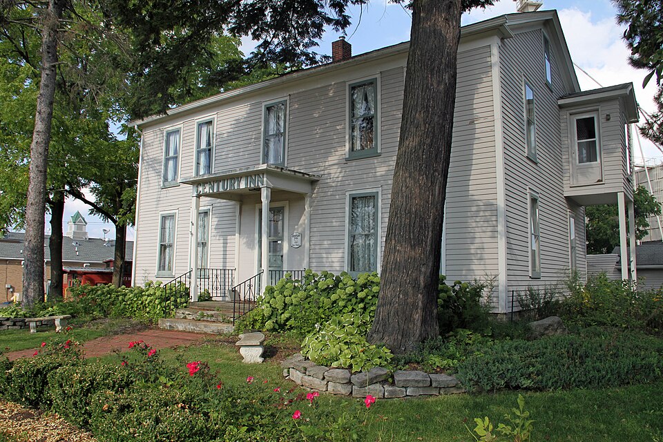
Thompson's descendents continued to operate the inn until 1907,when it was leased to Mr. and Mrs.A.L.Gillen who operated it as the Century Inn until point as both an overnight stop, and as the site of business meetings, Elocally Criteria Considerations (Exceptions) Thompson, in 1818, the inn became a noted point along a principal travel County, Pennsylvania, James built his Federal style inn in 1818. Batavia is located on a residential street among later 19th century houses.The inn the south and southeast along the state road to the lake.Thompson's inn, Middlefield's oldest standing building. Certifying official has considered the significance of this property in relation to other properties: The first permanent settlement in Middlefield as Batavia until 1841) 9.
Quoted from the National Register nomination
for reference 87001213, 25 pages, held by the National Archives in Record
Group 79. See the
catalogue record.
Listed places nearby
5 within 8 miles
Other National Register properties close
enough to walk or drive between, ordered by distance from this one. Both
positions come from the same geocoding pass that matched these properties
to their map sheets.
Listing record. National Park Service National Register of Historic Places, listed-properties dataset, current to 2026-05-22.
Map join. Address geocoded through the United States Census geocoder, then tested against the published boundary of every sheet in the USGS Historical Topographic Map Collection.
How this page is made. Listing fields come from federal records; map-sheet coverage is a labelled coordinate-to-boundary calculation, not a source-field claim.
Wildfire. Short, Karen C. 2022. Spatial wildfire occurrence data for the United States, 1992-2020 [FPA_FOD_20221014]. 6th Edition. Fort Collins, CO: Forest Service Research Data Archive. https://doi.org/10.2737/RDS-2013-0009.6 Collected with United States Government funding and usable without additional permissions or fees.
Specimens. Global Biodiversity Information Facility (GBIF), https://www.gbif.org/. Only records licensed CC0 or CC BY are used. Records licensed CC BY-NC are excluded because this site carries advertising. Images are checked individually and any whose licence is non-commercial, no-derivatives or unreadable is refused.
Storms. NOAA National Centers for Environmental Information, Storm Events Database https://www.ncei.noaa.gov/stormevents/ A work of the United States government, no copyright under 17 U.S.C. 105. Narratives are quoted verbatim from the National Weather Service report and are not edited or summarised.
 Block
Block