 Block
Brodhead, Wisconsin
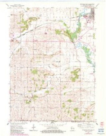
18 topographic sheets cover this place, the earliest surveyed in 1893 and the latest in 1981. It stands in Brodhead City. It lies in ZIP code area 53520. The Survey maps it on the Brodhead West quadrangle. 3,274 people lived here at the 2020 count. It stands 794 feet above sea level.
On record in Brodhead
Buildings and businesses the archive holds for this place. Each opens its own page, with the source record it came from.
On the National Register 2 records
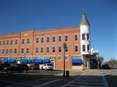 Exchange Square Historic Districtlisted 1984
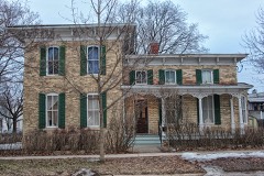 Francis West Smith Houselisted 1979
Topographic sheets covering this place
8 surveys from 18 printed sheetsMatched by testing this settlement's coordinate against the published boundary of every sheet in the United States Geological Survey's historical collection. Each opens the scanned sheet at the Survey.
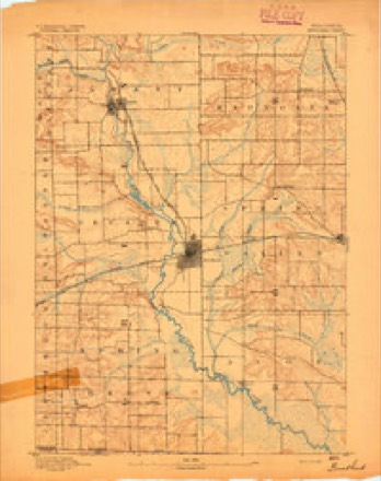
- 1893 USGS Brodhead quadrangle1:62500, 5 printings
- 1954 USGS Rockford quadrangle1:250000
- 1955 USGS Rockford quadrangle1:250000
- 1958 USGS Rockford quadrangle1:250000, 4 printings
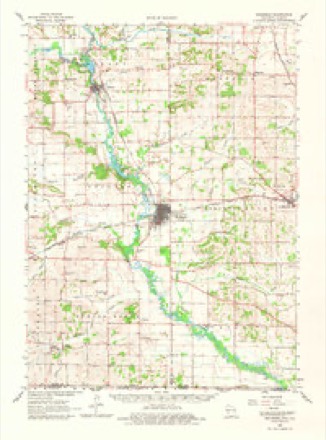
- 1962 USGS Brodhead quadrangle1:62500, 2 printings
- 1962 USGS Brodhead West quadrangle1:24000, 3 printings
- 1963 USGS Rockford quadrangle1:250000
- 1981 USGS Monroe quadrangle1:100000





What happened here
An account from the chapter on Brodhead city. The inset identifies its exact source book and publication year.
Wagon And Carriage Manufacturers
The first to manufacture wagons at Brodhead was William Spencer, who commenced here in 1857. He manufactured a few wagons and continued in the busiiK'ss until the war broke out, when he enlisted in the 18th Wisconsin regiment, and went into the service. At the battle of Sliiloh he was severely wounded; removed
In the county-history sources
22,119 words on this townshipHistory of Green County, Wisconsin, published 1884 names this settlement in its chapter on Brodhead City. These are the passages that mention it, exactly as the scans read.
In the extreme eastern portion of Green county lies the village of Brodhead - one of the most important business centers in the southern part of the State. It is beautifully located, on an undulating prairie, which extends eastward from the Sugar river. The civil town in which the village is located is one of the banner subdivisions of Green county. The Sugar river, which winds its course to the west of the village, furnishes excellent water privileges here, which have been utilized, and now comprise a valuable concomitant of the village in propelling a vast amount of machinery. The inhabitants here are almost wholly Americans - people from the New England and northern States, who have brought with them the culture and refinement of the eastern States, the absence of which, in some portions of the west, is so painfully apparent. Brodhead is by no means an old town, yet a quarter of a century and more has passed since its inception. Almost a generation has come and gone since Brodhead became a fixed fact. While there is nothing remarkable in the changes that have been wrought, there is a great deal to occupy the attention of the historian and attract the interest of the reader.
Passage source: History of Green County, Wisconsin, published 1884.
The plat of Brodhead covers all of section 25, and portions of sections 24 and 36, township 2 north, range 9 east. The Mineral Point branch of the Chicago, Milwaukee & St. Paul Railway passes through the village from east to west, and a branch of that line of railway has been extended from this place to Albany. The Sugar river touches the northwest corner
Passage source: History of Green County, Wisconsin, published 1884.
Early in 1856 E. D. Clinton, agent for the Milwaukee & Mississippi Railroad, started west from Janesville to secure the right of way for the railroad through Green county, and also get subscriptions for stock. Arriving in the eastern part of the county, he went to Decatur to see what he could do in the way of "inducement" for the railroad. He received no encouragement there, however, neither as to right of way or taking stock. At that time Decatur was quite an important point. The stage road from Janesville to Monroe passed through the village, and this was the commercial center of all this country, there being a number of stores, a hotel, wagon, blacksmith, shoe and other shops, a postoffice, and all the concomitants of a healthy, thriving village. Here it was supposed the railroad must come, and the people of Decatur did not imagine that the railroad could afford to leave them in the cold. Deacon Clinton negotiated with them for some time, but could not arrive at anything satisfactory. He then visited several villages in this region, and held public meetings in many of the school houses. He finally arrived at the present site of Brodhead, and determined, if possible, to secure a site and right of way here. The owners of the land here - John L. Thomas, I. F. Mack and Erastus Smith - refused to donate right of way and depot grounds; but offered to sell three-fourths of the land, and proposed then that all the owners give their share. This was agreed to, and after negotiations closed and the bargain was completed the proprietors of Brodhead were: Edward Brodhead, of Milwaukee, then chief engineer of the railroad; E. D. Clinton, John P. Dixon, of Janesville, John L. McNair, I. F. Mack, Erastus Smith and John L. V. Thomas. The town proprietors donated the railroad company a right of way and depot grounds. The village was platted into lots and blocks by the railroad company's surveyor in 1856, the original plat occupying all of section 25; eight blocks on section 36, and four blocks on section 24, Since that time additions have been made by Mr. Pierce and J. P. Dixon on the north; E. D. Clinton on the south; and Day & West on the west.
Passage source: History of Green County, Wisconsin, published 1884.
Machine-read from a century-old scan, so expect the errors a machine makes: misspelled names, dropped words, stray characters.
Read the whole chapter on Brodhead City - it names this place 67 more 67 times.
Fires near this place
14 since 2018Regional context, not property-specific evidence. The federal wildfire occurrence database lists 14 fires within 5 miles of Brodhead between 2018 and 2020, burning about 12 acres in total. None started naturally. 1 was recorded as arson. Distance is straight-line from the map coordinates, so a fire counted here may appear on a neighbouring settlement's page as well.
| Reported cause | Fires |
|---|---|
| Debris and open burning | 7 |
| Smoking | 3 |
| Power generation/transmission/distribution | 1 |
| Arson/incendiarism | 1 |
| Equipment and vehicle use | 1 |
| Missing data/not specified/undetermined | 1 |
The most recent of them, most recent first, with the day each was reported and the service that recorded it.
| Date | Cause | Size | Reported by | Name on the report |
|---|---|---|---|---|
| 29 June 2020 | Missing data/not specified/undetermined | 1.0 acres | Wisconsin Department of Natural Resources | 68 |
| 20 June 2018 | Power generation/transmission/distribution | 1.0 acres | Wisconsin Department of Natural Resources | 105 |
| 17 June 2020 | Equipment and vehicle use | 1.0 acres | Wisconsin Department of Natural Resources | 60 |
| 29 April 2018 | Debris and open burning | 5.0 acres | Wisconsin Department of Natural Resources | 78 |
| 23 April 2018 | Smoking | under an acre | Wisconsin Department of Natural Resources | 74 |
| 22 April 2018 | Debris and open burning | under an acre | Wisconsin Department of Natural Resources | 72 |
| 15 April 2019 | Debris and open burning | under an acre | Wisconsin Department of Natural Resources | 19034 |
| 12 April 2018 | Debris and open burning | 1.0 acres | Wisconsin Department of Natural Resources | 64 |
Settlements close enough to share some of these fires:
Mines and quarries near this place
5 within 5 milesRegional context, not property-specific evidence. The federal mineral resources record lists 5 workings within 5 miles of Brodhead: 3 past producers, 1 producer, 1 unknown. 1 still produces. What was taken out: Stone, Crushed/Broken, Sand and Gravel, Construction, Stone. Distance is straight-line from the map coordinates, so a quarry counted here may appear on a neighbouring settlement's page as well.
| Where | Site | Commodity | Status | Recorded |
|---|---|---|---|---|
| Coles Quarry | Stone | Unknown | ||
| Egan Pit | Sand and Gravel, Construction | Producer | ||
| Knight Quarry | Stone, Crushed/Broken | Past Producer | ||
| Rock County Highway Department | Stone, Crushed/Broken | Past Producer | ||
| State Right of Way Quarry | Stone, Crushed/Broken | Past Producer |
Storms near this place
35 since 1994Regional context, not property-specific evidence. The National Weather Service names Brodhead in 35 storm reports between 1994 and 2023: 12 thunderstorm wind, 10 hail, 7 flood, 3 funnel cloud. No death or injury is recorded in these reports. Each account below is quoted exactly as the forecast office filed it, from the NOAA Storm Events Database, and each date opens the federal record of that event.
| When | Event | Place named | Harm | What the report says |
|---|---|---|---|---|
| March 2023 | Tornado (EF0) | Brodhead | $200,000 | Tornado started just south of Decatur Lake and tracked to the north through Decatur Lake Golf Course, causing some minor tree damage. Further to the north, a barn had roof damage with a number of sheets of metal lofted off of the building. Tornado tracked into a small portion of Rock County before disapating. |
| May 2012 | Thunderstorm Wind | Brodhead | $100,000 | The Green County Emergency Manager reported $100,000 of damage from severe thunderstorm winds 4 miles southwest of Brodhead. The damage included 2 barns/sheds with one losing it's roof to the powerful winds. The severe winds peeled siding off of one home, and broke windows and pushed in the door on another home. |
| March 2013 | Flood | Brodhead | $15,000 | The Sugar River near Brodhead crested at 7.25 feet, 2.25 feet above flood stage, at 1200 pm CDT on March 12th. |
| April 2002 | Thunderstorm Wind | Brodhead | $15,000 | no account filed |
| June 1996 | Flash Flood | Brodhead | $15,000 | no account filed |
| June 2013 | Flood | Brodhead | $10,000 | The river gauge on the Sugar River in Brodhead remained above flood stage from the afternoon of June 24th into early July. The creek experienced moderate flooding, cresting at 8.86 feet at 2:00 AM CDT on June 28th, which is 3.86 feet above flood stage. |
| June 2006 | Thunderstorm Wind | Brodhead | $10,000 | Trees down. |
| July 2013 | Thunderstorm Wind | Brodhead | $7,000 | Law enforcement officials reported trees blown down by thunderstorm wind gusts estimated up to 60 mph (58 knots) in Brodhead. |
| June 2017 | Thunderstorm Wind | Brodhead | $6,000 | Around 6 pine trees were knocked down as a thunderstorms moved through the area. |
| February 2018 | Flood | Brodhead | $5,000 | The Sugar River reached moderate flood stage, cresting at 9.59 feet in Brodhead. There is widespread flooding of lowland and agricultural land in the Brodhead area. Floodwaters cover roads about 6 miles downstream into the Avon Township of Rock County. Floodwaters are over Highway T which is on the border of Green and Rock Counties. |
| July 2017 | Flood | Brodhead | $5,000 | The Sugar River at Brodhead crested at 8.72 ft., which is moderate flood stage. There is widespread agricultural land flooding in the Brodhead area. Some roads are either closed or experience minor flooding, including Ten Eyck Rd. Downstream, floodwaters are over County Road T which is the border of Green and Rock County. |
| April 2013 | Flood | Brodhead | $5,000 | The Sugar River near Brodhead experienced minor flooding, cresting at 7.02 feet, or 2.02 feet over the flood stage of 5 feet, at 4 AM CDT on April 12th. |
| April 1997 | Thunderstorm Wind | Brodhead | $5,000 | no account filed |
| March 2005 | Thunderstorm Wind | Brodhead | $2,000 | Large trees and road signs were damaged. |
| October 2018 | Flood | Brodhead | $1,000 | The Sugar River at Brodhead reached moderate flood stage, cresting at 8.63 ft. There is widespread agricultural and lowland flooding in the Brodhead area. Floodwaters are over Highway T which is on the border of Green and Rock County. |
| August 2018 | Flood | Brodhead | $1,000 | The Sugar River reached moderate flood stage, cresting at 9.29 feet in Brodhead during the early afternoon of August 23rd. There is widespread flooding of lowland and agricultural land in the Brodhead area. Floodwaters cover roads about 6 miles downstream into the Avon Township of Rock County. Floodwaters are over Highway T which is on the border of Green and Rock Counties. |
| May 2004 | Lightning | Brodhead | $1,000 | no account filed |
| May 1998 | Thunderstorm Wind | Brodhead | $1,000 | no account filed |
| May 2005 | Hail | Brodhead | $500 | A windshield was broken. |
| June 2011 | Thunderstorm Wind | Brodhead | - | In the Brodhead area, powerful thunderstorm winds uprooted a few dozen trees and broken branches fell on and snapped several power lines. |
| June 2010 | Thunderstorm Wind | Brodhead | - | General public reported a swath of downed trees from Martintown to northwest of Brodhead. Scattered pockets of felled trees were reported in a band about 3 miles wide. |
| July 2010 | Funnel Cloud | Brodhead | - | A trained spotter reported a rotating funnel cloud 7 miles southwest of Brodhead. |
| August 2010 | Thunderstorm Wind | Brodhead | - | County sheriff deputies reported trees and power lines were blown down by the strong thunderstorm gusts. |
| May 2006 | Thunderstorm Wind | Brodhead | - | Trees down. |
| September 2015 | Hail | Brodhead | - | no account filed |
| September 2010 | Hail | Brodhead | - | no account filed |
| June 2009 | Hail | Brodhead | - | no account filed |
| June 2008 | Hail | Brodhead | - | no account filed |
| May 2004 | Funnel Cloud | Brodhead | - | no account filed |
| August 2003 | Hail | Brodhead | - | no account filed |
| October 2001 | Hail | Brodhead | - | no account filed |
| June 2000 | Funnel Cloud | Brodhead | - | no account filed |
| August 2000 | Hail | Brodhead | - | no account filed |
| June 1998 | Hail | Brodhead | - | no account filed |
| May 1994 | Hail | Brodhead | - | no account filed |
Nearest settlements
The eight closest, with where each one stands in the county. Distances are straight-line, computed from the Geographic Names Information System coordinates.
| Map | Place | Distance | Sheets |
|---|---|---|---|
| Cardinal Crest | 0.5 miles | 18 | |
| Decatur | 2.2 miles | 17 | |
| Clarence (historical) | 2.2 miles | 18 | |
| Albany | 7.0 miles | 17 | |
| Juda | 7.2 miles | 15 | |
| Oakley | 8.0 miles | 18 | |
| Mineral Point (historical) | 8.0 miles | 17 | |
| Twin Grove | 10.7 miles | 15 |
Elsewhere
Matched on this settlement's Geographic Names Information System number rather than its name, so it cannot be a different place of the same name in another state.
| Wikipedia article on Brodhead | An encyclopaedic summary. Its text is share-alike, so it is linked here rather than copied. |
| Wikidata item Q662275 | The structured record the population and elevation above come from. Public domain (CC0). |
Provenance
This settlement is recorded in the Geographic Names Information System as feature 1562229. The sheet list is computed by point-in-boundary test against the United States Geological Survey's historical topographic inventory. Both are works of the United States government and carry no copyright under 17 U.S.C. 105.
Wildfire. Short, Karen C. 2022. Spatial wildfire occurrence data for the United States, 1992-2020 [FPA_FOD_20221014]. 6th Edition. Fort Collins, CO: Forest Service Research Data Archive. https://doi.org/10.2737/RDS-2013-0009.6 Collected with United States Government funding and usable without additional permissions or fees.
Mines and quarries. USGS Mineral Resources Data System (MRDS) https://mrdata.usgs.gov/mrds/ A work of the United States government, no copyright under 17 U.S.C. 105.
Storms. NOAA National Centers for Environmental Information, Storm Events Database https://www.ncei.noaa.gov/stormevents/ A work of the United States government, no copyright under 17 U.S.C. 105. Narratives are quoted verbatim from the National Weather Service report and are not edited or summarised.