 Block
Decatur, Wisconsin
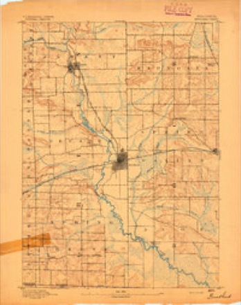
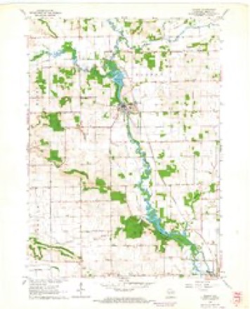
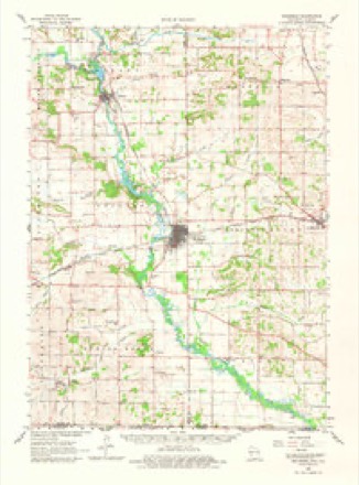
17 topographic sheets cover this place, the earliest surveyed in 1893 and the latest in 1981. It stands in Decatur town. It lies in ZIP code area 53520. It stands on Norwegian Creek. The Survey maps it on the Albany quadrangle.
Topographic sheets covering this place
8 surveys from 17 printed sheetsMatched by testing this settlement's coordinate against the published boundary of every sheet in the United States Geological Survey's historical collection. Each opens the scanned sheet at the Survey.
- 1893 USGS Brodhead quadrangle1:62500, 5 printings
- 1954 USGS Rockford quadrangle1:250000
- 1955 USGS Rockford quadrangle1:250000
- 1958 USGS Rockford quadrangle1:250000, 4 printings
- 1962 USGS Albany quadrangle1:24000, 2 printings
- 1962 USGS Brodhead quadrangle1:62500, 2 printings
- 1963 USGS Rockford quadrangle1:250000
- 1981 USGS Monroe quadrangle1:100000





What happened here
An account from the chapter on Decatur town. The inset identifies its exact source book and publication year.
Early Dats In Decatur, By I. F. Mack
"Your favor of the 10th inst., was received at my office during a weeks confinement at my home from a very severe attack of winter cholera. I am now in poor condition to either write or think. You can learn from my son, residing in Brodhead, inanj^ facts of Decatur's early history, and also from the iMessrs.
In the county-history sources
12,393 words on this townshipHistory of Green County, Wisconsin, published 1877 names this settlement in its chapter on Decatur Town. These are the passages that mention it, exactly as the scans read.
The history of Decatur begins with the history of Centre ville, " a paper city " laid out in 1836 on the west bank of Sugar river, within half a mile of the place where the village of Decatur arose some years later. Upon the plat of Centreville, which was exhibited in Milwaukee, Detroit, and the eastern cities, were represented steamboats, churches, warehouses, and blocks of stores. Thus portrayed, the place was the cause of inanv a yearning for a western home, and a brisk sale of high priced business lots and four acre out lots began. Careful, prosperous farmers and tradesmen, wealthy speculators, and penny-saving laborers all embraced the opportunity to make a good investment, and purchased real estate in what the agents called the growing, bustling city of Centreville. One by one the purchasers learned that they were the victims of a fraud, that their land was no better than might have been bought at the government price. And so undesirable did it seem, when the unsettled state of the country was made known, that although their titles were unquestionably good, yet, so far as can be ascertained, not one of the purchasers of Centreville lots ever claimed a foot of the much lauded city, or ever settled within the limits of Decatur township. The place had indeed been surveyed and divided, as the plat showed, but the red stakes marking these divisions were the only marks of their presence which wThite men had ever left in the so-called city. Possibly too, though its social advantages were hardly of the kind to attract immigrants from the east, the city wTas as populous as its owners had claimed, for it was an Indian hunting ground. Here were found the marks of Indian labor which endured longest in Green County. The remains of an Indian council house and blacksmith shop could be seen here until 1847, when they were destroyed by a prairie fire. In one place in this vicinity, the first settlers found an acre or two of holes dug in the sand, which it is supposed the Indians had used as store houses for their corn; and Mr. Wm. Jones found, on attempting to cultivate one of their old corn fields, that they had entirely exhausted the soil. Aside from the arrow heads which are occasionally turned up by the plow, few relics of the Indian are ever found in Green County. Mr. Jonas Shook remembers seeing an Indian burying ground north of Dayton in 1837, and in '41 Messrs. John B. Perry and brother, Thos. Gillett, and others opened some mounds on "lost prairie," a little east of the village of Exeter, and found bones that it seemed to them must have belonged to a race of giants. The mounds were in two rows, one row on each side of the opening or prairie, with twentyfive mounds in one row and twenty-six in the other.
Passage source: History of Green County, Wisconsin, published 1877.
The first settlers in Decatur township settled on Jordan prairie, near the Little Jordan creek. The first claim was that of John Moore of Ohio, made in 1839 on section twenty. In the following year he was joined by his sonin-law, Thos. Chambers, by John J. Dawson, and by Samuel Rowe. The first person born in the township was Caroline Chambers, born in 1840. In 1841 Robert Mattox and E. T. Fleek settled on section seventeen. In the winter of iS4i-'2, a post office was established, which the postmaster, Mr. Moore, named Decatur, in
Passage source: History of Green County, Wisconsin, published 1877.
To Decatur belongs the honor of having the first bridge in the county. It was built in 1842, a little northeast of the site of the village of Decatur, at the place where the river was crossed by the Indian trail from Sand Prairie to the northern part of the county, and by the territorial road from Janesville to Galena. The next settler, Win. Jones, came in 1842. Soon after his arrival he built on Sugar river, section fifteen, the first saw mill in the township. The first grist mill was built by Edson and Brown, but was not begun until 1S49. In i842-'3-'4, Donald Johnson, David Bigelow, Wm.
Passage source: History of Green County, Wisconsin, published 1877.
Machine-read from a century-old scan, so expect the errors a machine makes: misspelled names, dropped words, stray characters.
Read the whole chapter on Decatur Town - it names this place 36 more 36 times.
Fires near this place
12 since 2018Regional context, not property-specific evidence. The federal wildfire occurrence database lists 12 fires within 5 miles of Decatur between 2018 and 2020, burning about 5 acres in total. None started naturally. None was recorded as arson. Distance is straight-line from the map coordinates, so a fire counted here may appear on a neighbouring settlement's page as well.
| Reported cause | Fires |
|---|---|
| Debris and open burning | 6 |
| Smoking | 3 |
| Power generation/transmission/distribution | 1 |
| Equipment and vehicle use | 1 |
| Missing data/not specified/undetermined | 1 |
The most recent of them, most recent first, with the day each was reported and the service that recorded it.
| Date | Cause | Size | Reported by | Name on the report |
|---|---|---|---|---|
| 29 June 2020 | Missing data/not specified/undetermined | 1.0 acres | Wisconsin Department of Natural Resources | 68 |
| 20 June 2018 | Power generation/transmission/distribution | 1.0 acres | Wisconsin Department of Natural Resources | 105 |
| 17 June 2020 | Equipment and vehicle use | 1.0 acres | Wisconsin Department of Natural Resources | 60 |
| 24 April 2018 | Debris and open burning | under an acre | Wisconsin Department of Natural Resources | 201820 |
| 23 April 2018 | Smoking | under an acre | Wisconsin Department of Natural Resources | 74 |
| 22 April 2018 | Debris and open burning | under an acre | Wisconsin Department of Natural Resources | 72 |
| 15 April 2019 | Debris and open burning | under an acre | Wisconsin Department of Natural Resources | 19034 |
| 12 April 2018 | Debris and open burning | 1.0 acres | Wisconsin Department of Natural Resources | 64 |
Settlements close enough to share some of these fires:
Mines and quarries near this place
3 within 5 milesRegional context, not property-specific evidence. The federal mineral resources record lists 3 workings within 5 miles of Decatur: 2 past producers, 1 unknown. None of them still produces. What was taken out: Stone, Crushed/Broken, Stone. Distance is straight-line from the map coordinates, so a quarry counted here may appear on a neighbouring settlement's page as well.
| Where | Site | Commodity | Status | Recorded |
|---|---|---|---|---|
| Coles Quarry | Stone | Unknown | ||
| Knight Quarry | Stone, Crushed/Broken | Past Producer | ||
| State Right of Way Quarry | Stone, Crushed/Broken | Past Producer |
Nearest settlements
The eight closest, with where each one stands in the county. Distances are straight-line, computed from the Geographic Names Information System coordinates.
| Map | Place | Distance | Sheets |
|---|---|---|---|
| Brodhead | 2.2 miles | 18 | |
| Cardinal Crest | 2.4 miles | 18 | |
| Clarence (historical) | 3.1 miles | 18 | |
| Albany | 5.2 miles | 17 | |
| Juda | 5.9 miles | 15 | |
| Mineral Point (historical) | 6.1 miles | 17 | |
| Oakley | 8.0 miles | 18 | |
| Twin Grove | 10.0 miles | 15 |
Provenance
This settlement is recorded in the Geographic Names Information System as feature 2760452. The sheet list is computed by point-in-boundary test against the United States Geological Survey's historical topographic inventory. Both are works of the United States government and carry no copyright under 17 U.S.C. 105.
Wildfire. Short, Karen C. 2022. Spatial wildfire occurrence data for the United States, 1992-2020 [FPA_FOD_20221014]. 6th Edition. Fort Collins, CO: Forest Service Research Data Archive. https://doi.org/10.2737/RDS-2013-0009.6 Collected with United States Government funding and usable without additional permissions or fees.
Mines and quarries. USGS Mineral Resources Data System (MRDS) https://mrdata.usgs.gov/mrds/ A work of the United States government, no copyright under 17 U.S.C. 105.