 Block
Eden, Wisconsin
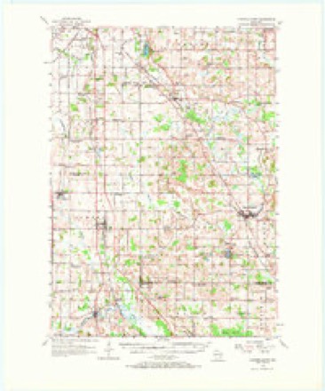
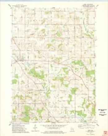
9 topographic sheets cover this place, the earliest surveyed in 1955 and the latest in 1980. It stands in Eden town. It lies in ZIP code area 53019. The Survey maps it on the Eden quadrangle.
Topographic sheets covering this place
5 surveys from 9 printed sheetsMatched by testing this settlement's coordinate against the published boundary of every sheet in the United States Geological Survey's historical collection. Each opens the scanned sheet at the Survey.
- 1955 USGS Campbellsport quadrangle1:62500, 2 printings
- 1957 USGS Madison quadrangle1:250000, 3 printings
- 1960 USGS Madison quadrangle1:250000, 2 printings
- 1974 USGS Eden quadrangle1:24000
- 1980 USGS Fond Du Lac quadrangle1:100000



In the county-history sources
10,440 words on this townshipThe History of Fond Du Lac County, Wisconsin, published 1880 names this settlement in its chapter on Eden Town. These are the passages that mention it, exactly as the scans read.
In a southeasterly direction from Fond du Lac, bounded on the north by Empire, east by Osceola, south by Ashford and west by Byron, lies the town of Eden - named after the habitation of our first parents. Two ridges of limestone, suitable for building material, extend north and south through the town. Otherwise the surface is gently undulating, and was originally composed of prairies, wide hay mirshes, rather small oak openings and limited belts of heavy timber. In early days, wild plums, cranberries, grapes and crab-apples grew in abundance and were unusually large and edible. The highest point of land in Fond du Lac County is said to be on Section 16 in this town, being 352 feet above Lake Winnebago and about five hundred feet above Lake Michigan. There are several large springs in Eden, and several lakes, in which fish and waterfowl, in season, are abundant. The soil is not alike in all sections, but is generally of a deep, rich loam, with a subsoil of limestone gravel. Farmers can follow almost any branch of agriculture with equal and satisfactory success. The town is well watered by springs, lakes, the West Branch of Milwaukee River, and other small streams, some of which flow north and some south. The lake in which the branch of Milwaukee River takes its rise, flowing nearly south, has another outlet on the north, which flows into Lake Winnebago : and streams in the south part find their way into the Gulf of Mexico, through Rock and Mississippi Rivers.
Passage source: The History of Fond Du Lac County, Wisconsin, published 1880.
The mounds, pottery, earthenware and various peculiar articles found in this town, make itj a peculiarly rich and interesting field for the archteologist. These i-elics of an ancient and extinct race have been found in no other town in this vicinity in such profusion and variety.
Passage source: The History of Fond Du Lac County, Wisconsin, published 1880.
Joseph Carr is generally conceded to be the first permanent settler in what is now Eden, though he did not enter the first land. In November, 1845, he began building a log house, which was the foundation for the first settlement in the town. In February following, Samuel Rand and Peter Vandervoort came with their families, and immediately put up log houses. The first crops were raised in 1847, and they were of such abundance as to exceed the most sanguine expectations of the hopeful settlers. That fall, settlers began to arrive rapidly, or select locations on which to locate in the spring. Therefore, in April. 1848, by authority of an act passed March 11, 1848, a meeting was held at the house of Peter Vandervoort and town officers chosen. Peter Vandervoort was chosen Chairman, and Samuel Rand Town Clerk. The year before, or some time before, a meeting was held to name the town. The proceedings are thus recorded: "Adam Holiday, an eccentric character, arose to propose a name. After commenting on the many beauties of the place, the richness of the soil, the abundance of fruits and flowers, and the beautiful woods and fields, he remarked that Adam dwelt in the garden of Eden, and that there were holy days there." Therefore, amid some merriment, the town was named Eden.
Passage source: The History of Fond Du Lac County, Wisconsin, published 1880.
Machine-read from a century-old scan, so expect the errors a machine makes: misspelled names, dropped words, stray characters.
Read the whole chapter on Eden Town - it names this place 37 more 37 times.
Fires near this place
16 since 2018Regional context, not property-specific evidence. The federal wildfire occurrence database lists 16 fires within 5 miles of Eden between 2018 and 2020, burning about 63 acres in total. None started naturally. None was recorded as arson. Distance is straight-line from the map coordinates, so a fire counted here may appear on a neighbouring settlement's page as well.
| Reported cause | Fires |
|---|---|
| Debris and open burning | 10 |
| Missing data/not specified/undetermined | 5 |
| Smoking | 1 |
The most recent of them, most recent first, with the day each was reported and the service that recorded it.
| Date | Cause | Size | Reported by | Name on the report |
|---|---|---|---|---|
| 11 July 2018 | Debris and open burning | under an acre | Wisconsin Department of Natural Resources | 62 |
| 6 May 2020 | Smoking | 1.0 acres | Wisconsin Department of Natural Resources | 2020033 |
| 6 May 2018 | Missing data/not specified/undetermined | under an acre | Wisconsin Department of Natural Resources | 43 |
| 30 April 2018 | Debris and open burning | 15 acres | Wisconsin Department of Natural Resources | 40 |
| 3 April 2018 | Debris and open burning | under an acre | Wisconsin Department of Natural Resources | 28 |
| 29 April 2018 | Debris and open burning | under an acre | Wisconsin Department of Natural Resources | 38 |
| 29 April 2018 | Debris and open burning | 3.0 acres | Wisconsin Department of Natural Resources | 37 |
| 31 March 2019 | Debris and open burning | under an acre | Wisconsin Department of Natural Resources | 16 |
Settlements close enough to share some of these fires:
Mines and quarries near this place
9 within 5 milesRegional context, not property-specific evidence. The federal mineral resources record lists 9 workings within 5 miles of Eden: 5 producers, 2 past producers, 1 unknown, 1 plant. 6 still produce. What was taken out: Sand and Gravel, Construction, Limestone, Dimension, Stone, Dimension, Calcium. Distance is straight-line from the map coordinates, so a quarry counted here may appear on a neighbouring settlement's page as well.
| Where | Site | Commodity | Status | Recorded |
|---|---|---|---|---|
| Buechel Stone Center | Stone, Dimension | Producer | ||
| Eden Quarry & Mill | Calcium | Plant | ||
| Eden Stone Company Inc Eden Quarry | Limestone, Dimension | Producer | ||
| Fon Du Lac Quarry | Limestone, Dimension | Past Producer | ||
| Rademann Stone & Landscape Co | Limestone, Dimension | Producer | ||
| Byron Pit | Sand and Gravel, Construction | Past Producer | ||
| Gobels Pit | Sand and Gravel, Construction | Unknown | ||
| Majerus Pit | Sand and Gravel, Construction | Producer | ||
| Reischke Pit | Sand and Gravel, Construction | Producer |
Storms near this place
12 since 1997Regional context, not property-specific evidence. The National Weather Service names Eden in 12 storm reports between 1997 and 2018: 5 hail, 3 tornado, 2 thunderstorm wind, 2 funnel cloud. No death or injury is recorded in these reports. Each account below is quoted exactly as the forecast office filed it, from the NOAA Storm Events Database, and each date opens the federal record of that event.
| When | Event | Place named | Harm | What the report says |
|---|---|---|---|---|
| September 2002 | Tornado (F1) | Eden | $750,000 | A tornado, rated as F1 with winds of about 78 to 87 knots (90 to 100 mph) damaged three, large, cover-all, dairy barns. Severe damage was noted on the western-most barn. In addition, some trees were uprooted or had limbs ripped off. The three barns were part of Fond du Lac's largest dairy farm. Luckily, only one of the 1400 dairy cows was injured. |
| August 2010 | Thunderstorm Wind | Eden | $75,000 | Law enforcement officials reported a 100-year old barn was blown down by thunderstorm wind gusts estimated at 50 knots (58 mph). |
| June 1997 | Thunderstorm Wind | Eden | $75,000 | no account filed |
| August 2015 | Hail | Eden | $1,000 | Minor hail damage to vehicles. |
| August 2018 | Tornado (EF1) | Eden | - | Tornado was 1 of 19 tornadoes that occurred across central to east central Wisconsin on the afternoon of August 28th. This tornado went southeast of the Village of Eden and crossed Hwy 45. Widespread straight line winds caused significant tree and crop damage across the county as well. |
| June 2003 | Tornado (F0) | Eden | - | A short-lived, weak tornado was videotaped by a storm chaser east-southeast of the city of Fond du Lac up on the ridge locally known as "The Ledge." This tornado spun up on the east side of Rienzi Cemetery, about one-half mile east of the intersection of County Trunk Highway K and Rienzi Rd., and moved north-northeast to just north of the intersection of County Trunk T and Artesian Rd in the vicinity of Taycheedah Creek. Only minor vegetative damage was noted to trees and grasses. |
| June 2017 | Hail | Eden | - | no account filed |
| June 2011 | Hail | Eden | - | no account filed |
| April 2008 | Hail | Eden | - | no account filed |
| May 2006 | Hail | Eden | - | no account filed |
| June 2003 | Funnel Cloud | Eden | - | no account filed |
| August 2000 | Funnel Cloud | Eden | - | no account filed |
Nearest settlements
The eight closest, with where each one stands in the county. Distances are straight-line, computed from the Geographic Names Information System coordinates.
| Map | Place | Distance | Sheets |
|---|---|---|---|
| Marblehead | 1.4 miles | 9 | |
| Hamilton (historical) | 5.2 miles | 9 | |
| Byron | 5.6 miles | 9 | |
| Waucousta | 6.0 miles | 9 | |
| Dotyville | 6.7 miles | 12 | |
| Fond du Lac | 7.1 miles | 13 | |
| Ashford | 7.4 miles | 9 | |
| South Byron | 7.7 miles | 9 |
Provenance
This settlement is recorded in the Geographic Names Information System as feature 1564440. The sheet list is computed by point-in-boundary test against the United States Geological Survey's historical topographic inventory. Both are works of the United States government and carry no copyright under 17 U.S.C. 105.
Wildfire. Short, Karen C. 2022. Spatial wildfire occurrence data for the United States, 1992-2020 [FPA_FOD_20221014]. 6th Edition. Fort Collins, CO: Forest Service Research Data Archive. https://doi.org/10.2737/RDS-2013-0009.6 Collected with United States Government funding and usable without additional permissions or fees.
Mines and quarries. USGS Mineral Resources Data System (MRDS) https://mrdata.usgs.gov/mrds/ A work of the United States government, no copyright under 17 U.S.C. 105.
Storms. NOAA National Centers for Environmental Information, Storm Events Database https://www.ncei.noaa.gov/stormevents/ A work of the United States government, no copyright under 17 U.S.C. 105. Narratives are quoted verbatim from the National Weather Service report and are not edited or summarised.