 Block
From the record
13 National Register listings published here.
Sources: the county history on the Internet Archive · the National Register database, National Park Service
52 topographic sheets cover 32 settlements here, and 13 properties are on the National Register of Historic Places.
13 National Register listings published here.
Sources: the county history on the Internet Archive · the National Register database, National Park Service
Every property in this county listed on the National Register of Historic Places, with the year it was listed and the federal nomination document.
| Photograph | Property | Type | Listed | Reference |
|---|---|---|---|---|
| Ariston Cafe | building | 2006 | 06000380 | |
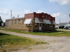 | Belvidere Cafe, Motel and Gas Station | building | 2007 | 07000060 |
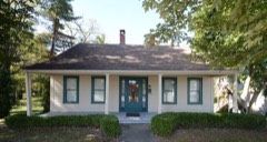 | George Blackman House | building | 1986 | 86003180 |
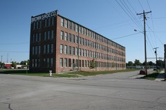 | Brown Shoe Company Factory | building | 2006 | 06001019 |
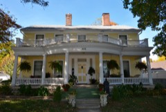 | Freeman-Brewer-Sawyer House | building | 1992 | 92001536 |
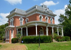 | Samuel Moody Grubbs House | building | 1990 | 90000156 |
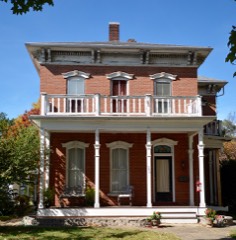 | Hayward-Hill House | building | 1980 | 80001399 |
 | Litchfield Elks Lodge No. 654 | building | 1995 | 95000195 |
 | Litchfield Public Library | building | 1999 | 99000165 |
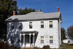 | Manske-Niemann Farm | district | 2003 | 03000065 |
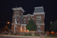 | Montgomery County Courthouse | building | 1994 | 94001266 |
| Route 66, Litchfield to Mount Olive | structure | 2001 | 01001312 | |
| Lewis H. Thomas House | building | 1983 | 83003586 |
Every wildfire the federal occurrence database records inside this county: 25 of them, burning about 267 acres. 1 started naturally and 1 was recorded as arson. Each settlement page carries the fires within five miles of it.
| Reported cause | Fires |
|---|---|
| Debris and open burning | 13 |
| Missing data/not specified/undetermined | 8 |
| Natural | 1 |
| Arson/incendiarism | 1 |
| Recreation and ceremony | 1 |
| Equipment and vehicle use | 1 |
The five largest, by the area the report gives. None of them was recorded as arson.
| Date | Cause | Size | Reported by | Name on the report |
|---|---|---|---|---|
| 15 March 2014 | Debris and open burning | 80 acres | Illinois Division of Forestry Resources | 0011-14 |
| 20 March 2014 | Debris and open burning | 80 acres | Illinois Division of Forestry Resources | 0014-14 |
| 15 April 2003 | Debris and open burning | 50 acres | Illinois State Fire Marshal's Office | not named |
| 12 April 2014 | Debris and open burning | 10 acres | Illinois Division of Forestry Resources | 0021-14 |
| 20 March 2014 | Debris and open burning | 8.0 acres | Illinois Division of Forestry Resources | 0013-14 |
| 11 February 2007 | Missing data/not specified/undetermined | 6.0 acres | Illinois Division of Forestry Resources | not named |
| 1 November 2010 | Equipment and vehicle use | 6.0 acres | Illinois Division of Forestry Resources | BROKERING |
| 20 March 2014 | Debris and open burning | 5.0 acres | Illinois Division of Forestry Resources | 0014-38 |
Every settlement page carries the fires within five miles of it - see the settlement index below.
The NOAA Storm Events Database holds 417 reports for this county, causing 3 deaths, 18 injuries and about $2,256,504 in recorded property damage. Each settlement page carries the reports that name it.
| Kind of event | Reports |
|---|---|
| Thunderstorm Wind | 200 |
| Hail | 136 |
| Tornado | 55 |
| Flash Flood | 21 |
| Lightning | 2 |
| Heavy Rain | 2 |
| Flood | 1 |
The most serious of them, by death, then injury, then recorded damage. The accounts are quoted exactly as the forecast office filed them.
| When | Event | Place named | Harm | What the report says |
|---|---|---|---|---|
| April 1956 | Tornado (F1) | not stated | 2 killed, $25,000 | no account filed |
| June 1999 | Tornado (F3) | Raymond | 1 killed, 4 hurt | no account filed |
| March 1976 | Tornado (F3) | not stated | 4 hurt, $250,000 | no account filed |
| April 1964 | Tornado (F2) | not stated | 4 hurt, $25,000 | no account filed |
| January 1950 | Tornado (F3) | not stated | 3 hurt, $250,000 | no account filed |
| November 1994 | Thunderstorm Wind | Witt | 1 hurt, $3,300 | A mobile home was blown over injuring a man inside. Several grain bins and small sheds were damaged with numerous power lines down. Reported by SKYWARN spotters and a local newspaper. |
| July 2017 | Thunderstorm Wind | Nokomis | 1 hurt | Thunderstorm winds blew over an occupied mobile home. The occupant sustained minor injuries. Also, numerous trees, tree limbs and power lines were blown down. A couple of trees fell onto homes causing minor to moderate damage around town. |
| July 2002 | Lightning | Hillsboro | 1 hurt | no account filed |
| May 1990 | Tornado (F2) | not stated | $250,000 | no account filed |
| May 1982 | Tornado (F3) | not stated | $250,000 | no account filed |
| May 1978 | Tornado (F2) | not stated | $250,000 | no account filed |
| March 1961 | Tornado (F1) | not stated | $250,000 | no account filed |
| March 1961 | Tornado (F1) | not stated | $250,000 | no account filed |
| May 2006 | Tornado (F1) | Farmersville | $100,000 | A tornado touched down 4.6 miles east northeast of Farmersville (Montgomery County in St. Louis CWA). It traveled to the southeast destroying one machine shed and damaging three other machine sheds. Two barns and two homes sustained damage as well. Debris from the machine sheds were tossed a quarter of a mile downwind from their initial locations. The tornado then crossed into Christian County (Central Illinois's CWA) south of the intersection of 3050N and the county line. No injuries were reported. |
| May 1996 | Lightning | Waggoner | $80,000 | no account filed |
| March 2022 | Tornado (EF1) | Waggoner | $50,000 | A brief tornado touched down on the evening of March 5th, 2022 just south of Farmersville, IL. The tornado first touched down near East 2nd Road, where it did damage to a one story residence. At this location, the tornado ripped the roof off the garage of a home and the awning off the front porch. The tornado continued northeast, doing some minor damage to a farm building just west of Interstate 55. As it crossed Interstate 55, it blew over a semi truck on the highway. The tornado continued east of Interstate 55, doing substantial damage to some large farm buildings along Morrisonville Avenue and East 4th Road. From there, the tornado began to weaken as it struck a newly constructed hog farm along East 5th Road, before quickly lifting near Macoupin Creek. Overall, the tornado was rated EF-1 with a path length of 3.89 miles and a max path width of 40 yards. No deaths or injuries were reported. |
| June 2022 | Thunderstorm Wind | Litchfield Muni Arpt | $30,000 | Widespread wind damage occurred across the southern portions of Montgomery County. Numerous trees, tree limbs and power lines were blown down in Litchfield, Hillsboro and Coffeen. In Litchfield, a large tree branch landed on a house causing moderate roof damage. |
| April 1987 | Tornado (F1) | not stated | $25,000 | no account filed |
| November 1955 | Tornado (F1) | not stated | $25,000 | no account filed |
| March 2023 | Thunderstorm Wind | Hillsboro | $20,000 | Thunderstorm winds uprooted several large trees and snapped a couple of large trees about 12 feet off the ground in Oak Grove Cemetery. |
| June 2022 | Thunderstorm Wind | Raymond | $20,000 | Thunderstorm winds caused widespread tree damage between Raymond and the Witt/Nokomis area. Numerous trees, tree limbs and some power lines were blown down. |
| March 2023 | Tornado (EF0) | Waggoner | $15,000 | As the tornado moved into Montgomery County, it crossed Interstate 55. On the east side of the interstate, south of Morrisonville Ave, the tornado caused minor damage to tree limbs along a hedge line before crossing East nth Rd, continuing northeast. Soon after, the tornado crossed Morrisonville Ave and struck a small metal machine shed on the northern side of the road. The tornado lofted debris across East 5th Rd into a field and drainage canal before lifting at 6:53 PM. In Montgomery County the tornado was rated EF0 with a max wind speed of 80 mph. The path length was 5.48 miles and a max path width of 150 yards. Overall, the tornado was rated EF0 with a max wind speed of 80 mph. The path length was 6.33 miles and a max path width of 150 yards. No deaths or injuries were reported. No deaths or injuries were reported. |
| August 2022 | Thunderstorm Wind | White Oak | $12,000 | Thunderstorm winds blew a road sign over near the north bound lanes of I-55 about 4 miles north of Farmersville. Also, a semi was blown over on I-55 just north of Farmersville. No injuries were reported. |
| August 2022 | Thunderstorm Wind | Litchfield Muni Arpt | $10,000 | Thunderstorm winds blew down several power lines around town as well as numerous large tree limbs. |
| December 2021 | Thunderstorm Wind | Coffeen | $10,000 | Thunderstorm winds blew down several trees and caused minor damage to a machine shed in Coffeen. Also, several power lines around town in Fillmore. |
| August 2024 | Thunderstorm Wind | Farmersville | $8,800 | The northwest portion of Farmersville was impacted by a localized downburst with winds estimated around 70 mph. Several large trees were snapped, numerous branches and a power pole were down, and several metal outbuildings sustained damage to garage doors or siding. |
| July 1995 | Thunderstorm Wind | Coffeen | $8,300 | A cooperative observer reported large trees down, a damaged grain bin, and a damaged siloh near Walshville. Power lines and road signs were blown down near Coffeen. Large trees were also toppled, one of which fell and heavily damaged a mobile home and nearby house. |
| May 1995 | Tornado (F1) | Nokomis | $8,200 | A tornado struck three farms briefly just east of Nokomis doing significant damage to several outbuildings. One farm lost a machine shed and a grain bin. Homes on the farms suffered superficial roof damage. The tornado was only on the ground for a few minutes. |
| May 2024 | Thunderstorm Wind | Litchfield | $5,000 | Thunderstorm winds knocked a tree atop a mobile home, knocked numerous limbs down, and flattened an estimated acre of wheat field on the south side of Litchfield. |
| February 2023 | Thunderstorm Wind | Wenonah | $5,000 | Thunderstorm winds blew down several large tree limbs and caused some minor shingle damage to the roof of the house. |
| June 2022 | Thunderstorm Wind | Farmersville | $5,000 | Thunderstorm winds blew down numerous large tree limbs around town. Some of the limbs briefly blocked streets. |
| August 2021 | Thunderstorm Wind | Nokomis | $5,000 | Several trees were snapped off in town. |
| July 1995 | Thunderstorm Wind | Walshville | $3,300 | A cooperative observer reported large trees down, a damaged grain bin, and a damaged siloh near Walshville. Power lines and road signs were blown down near Coffeen. Large trees were also toppled, one of which fell and heavily damaged a mobile home and nearby house. |
| August 1974 | Tornado (F2) | not stated | $2,500 | no account filed |
| August 2021 | Thunderstorm Wind | Hillsboro | $2,000 | Thunderstorm winds blew over a large tree on the north side of Hillsboro. |
| December 2021 | Thunderstorm Wind | Nokomis | $1,000 | Thunderstorm winds blew down a large tree in town. |
| June 2008 | Flash Flood | Waggoner | $1,000 | Up to two inches of rain fell on already saturated soils in Montgomery county. Water was over several roads in the Raymond area including Illinois Route 48 west of Raymond. |
| July 1995 | Thunderstorm Wind | Raymond | $300 | Large trees and power lines were blown down across much of the county. |
| June 1995 | Thunderstorm Wind | Raymond | $300 | Winds gusted to 70 mph uprooting several trees. |
| July 1995 | Thunderstorm Wind | Raymond | $200 | Large trees and power lines were blown down across much of the county. |
| November 1994 | Thunderstorm Wind | Hillsboro | $200 | Several large trees were blown down in the Hillsboro area with smaller branches knocked off in Litchfield. |
| May 1995 | Thunderstorm Wind | Hillsboro | $104 | Trees and power lines were blown down. A house also sustained heavy structural damage to the roof. |
| January 2026 | Thunderstorm Wind | Irving | - | Thunderstorm winds caused sporadic damage from Hillsboro northeastward to the Shelby/Montgomery/Christian county line. Municipalities include Irving, where a power pole was downed near McCords Trail and IL 16 along the Union Pacific railroad, Witt, Coalton, Nokomis, and Ohlman. |
| March 2026 | Tornado (EF1) | Schram City | - | A brief tornado touched down on the Hillsboro Country Club where it produced minor damage to a home. The tornado then travelled northeast where it damaged trees, an outbuilding, and electrical poles. The tornado dissipated just north of White Ave west of Irving. |
| March 2026 | Tornado (EF1) | Irving | - | A tornado touched down near Irving Road and North 17th Ave where it blew over a farm auger and lofted debris nearly a half mile to the southwest. The tornado then hit Witt directly where it lofted a carport and damaged multiple roofs and trees in town. The tornado tracked along State Route 16 into Coalton where it nearly completely removed the roof of a mobile home. From there, it turned nearly due north and entered the northwest portion of Nokomis. Although most of the damage done was to trees, the tornado did blow over an outdoor football scoreboard and ripped off portions of the local high school's roof. |
| March 2026 | Tornado (EF1) | Nokomis | - | A tornado touched down on the east side of Nokomis where it produced tree damage before exiting town to the northeast. The tornado tracked along State Route 16 past Ohlman, collapsing older farm outbuildings and lofting the debris well to the northeast. The tornado then continued into Christian County (ILX). |
| March 2026 | Thunderstorm Wind | Coffeen | - | Thunderstorm winds downed a tree south of Coffeen. This tree blocked a road. |
| March 2026 | Thunderstorm Wind | Butler | - | Thunderstorm winds damaged an old barn, a car, and a sheet metal roof from an outbuilding. |
| March 2026 | Tornado (EF0) | Walshville | - | The tornado moved into Montgomery County from Macoupin County, where it caused minor damage to a home on W County Line Road. The tornado then took on a near due northerly track as it occluded and caused minor tree damage before it dissipated completely just north of Saint Johns Ave. |
| March 2026 | Tornado (EF1) | Walshville | - | A tornado touched down near Niemanville Trail and trekked northeast, producing mostly tree damage in its path. At its strongest the tornado was able to produce minor damage to farm outbuildings and break wooden power poles. The tornado dissipated just east of East 8th Road. |
| April 2026 | Thunderstorm Wind | Mc Vey | - | Thunderstorm winds blew a semi-truck onto the median of I-55. |
| April 2026 | Flash Flood | Wenonah | - | Heavy rain flooded roads along East 23rd Road outside of Nokomis. |
| May 2025 | Thunderstorm Wind | Butler | - | Thunderstorm winds downed trees near Route 16 and Route 127. |
| May 2025 | Thunderstorm Wind | Taylor Spgs | - | Thunderstorm winds uprooted a few small trees in Taylor Springs. |
| May 2025 | Thunderstorm Wind | Barnett | - | Thunderstorm winds caused the walls of a brick outbuilding to collapse after its roof was ripped off. |
| July 2025 | Thunderstorm Wind | Nokomis | - | Thunderstorm winds knocked multiple trees onto power lines in Nokomis. |
| March 2024 | Hail | Litchfield Muni Arpt | - | Large hail up to two inches in diameter fell in an area from Litchfield northeastward towards Lake Lou Yaeger. |
| August 2023 | Thunderstorm Wind | Coffeen | - | Thunderstorm winds blew down several trees along County Road 1600E north of Coffeen. |
| August 2023 | Thunderstorm Wind | Raymond | - | KTVI provided a report of winds gusting to an estimated 60 mph along the leading edge of a thunderstorm. |
| April 2023 | Thunderstorm Wind | Litchfield Muni Arpt | - | Thunderstorm winds blew down a couple of trees just west of Litchfield. |
The Survey's mineral resources record lists 11 workings inside this county. 5 still produce and 6 are closed or unrecorded. Each settlement page carries the workings within five miles of it.
| Commodity | Workings |
|---|---|
| Stone, Crushed/Broken | 7 |
| Stone | 2 |
| Zinc | 1 |
| Clay | 1 |
The least common of them first, because a county's hundredth gravel pit says nothing its first ten did not.
| Where | Site | Commodity | Status | Recorded |
|---|---|---|---|---|
| (Facility) Hillsboro Zinc Smelter | Zinc | Plant | ||
| Fork Creek Shale Exposure | Clay | Prospect | ||
| Hillsboro Pit | Stone | Past Producer | ||
| Montgomery County Pit | Stone | Past Producer | ||
| Central Ill. Stone Quarry and Mill | Stone, Crushed/Broken | Producer | ||
| Kiggins Crushed Stone Co. Quarry | Stone, Crushed/Broken | Past Producer | ||
| Limestone Prospect | Stone, Crushed/Broken | Occurrence | ||
| Litchfield Quarry | Stone, Crushed/Broken | Past Producer | ||
| Msc Yard #15. | Stone, Crushed/Broken | Producer | ||
| Nokomis Quarry and Mill | Stone, Crushed/Broken | Producer | ||
| Tri-County Stone Company Quarry | Stone, Crushed/Broken | Producer |
Past and Present of Montgomery County, Illinois devotes a chapter to each township: its boundaries and streams, who settled it and when, the mills, the schools and the churches. All 3 are reproduced here in full. Each row shows the township's own shape and where it lies in the county, drawn from the Census Bureau's boundary. Which settlements belong to which township is computed from that same boundary, not taken from the book.
| Shape and position in the county | Township | Settlements in it | Length | Sections |
|---|---|---|---|---|
| Butler Grove Township | Butler | 9,254 words | 3 | |
| Walshville Township | Walshville | 18,235 words | 1 | |
| Zanesville Township | Shop Creek, Zanesville | 6,325 words | 0 |
Named settlements recorded in the Geographic Names Information System, each with the topographic sheets covering it. Villages, hamlets and abandoned places alike. Each is shown with the nearest named watercourse or landform and the survey quadrangle it falls on.
Fillmore Consolidated township · 62032 · On Lanes Branch · Fillmore quadrangle
11 sheets, 1947 to 1998
Hillsboro township · 62049 · On Cress Creek · Hillsboro quadrangle
10 sheets, 1947 to 1982
Fillmore Consolidated township · 62032 · On Lanes Branch · Fillmore quadrangle
11 sheets, 1947 to 1998
Hillsboro township · 62049 · On Cress Creek · Hillsboro quadrangle
10 sheets, 1947 to 1982
Hillsboro township · 62049 · On Cress Creek · Hillsboro quadrangle
10 sheets, 1947 to 1982
Fillmore Consolidated township · 62032 · On Piatt Creek · Fillmore quadrangle
11 sheets, 1947 to 1998
Walshville township · 62091 · On East Branch Lake Fork · Sorento North quadrangle
12 sheets, 1915 to 1998