 Block
New Boston, Illinois
15 topographic sheets cover this place, the earliest surveyed in 1935 and the latest in 1991. It stands in New Boston Township. It lies in ZIP code area 61272. It stands on Eliza Creek. The Survey maps it on the Joy quadrangle. 613 people lived here at the 2020 count. It stands 571 feet above sea level.
Research this city
On record in New Boston
Buildings and businesses the archive holds for this place. Each opens its own page, with the source record it came from.
On the National Register 5 records
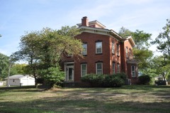 Gideon Ives Houselisted 2000
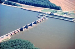 Lock and Dam No. 17 Historic Districtlisted 2004
 James S. Thompson Houselisted 2002
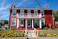 Levi Willits Houselisted 1995
- Verdurettelisted 2021
Population over time
2 figuresNew Boston fell from 683 to 613 between 2010 and 2020. These are the recorded population figures Wikidata holds for this place, reached through the Geographic Names Information System number this page is keyed on rather than by name, so they belong to this place and not to another of the same name. Most are census counts, but not all are: an early figure may be a founding or settlement estimate, and an estimate published within five years of a census is left out. The change column is computed, and is left blank where more than 20 years separate a figure from the one before it, because a gap that long is not a change between two counts.
| Year | People | Change |
|---|---|---|
| 2010 | 683 | |
| 2020 | 613 | -70 (-10%) |
Topographic sheets covering this place
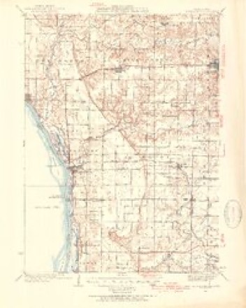
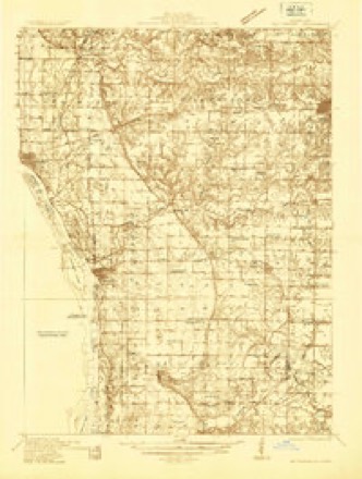
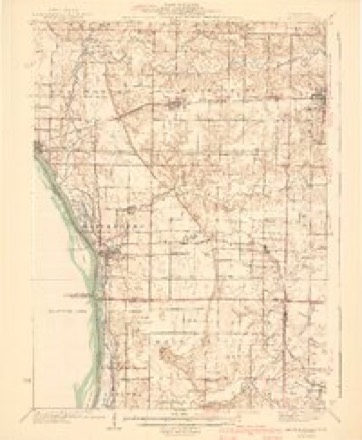
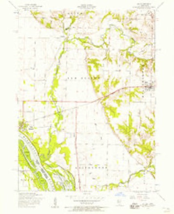
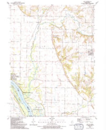
10 surveys from 15 printed sheetsMatched by testing this settlement's coordinate against the published boundary of every sheet in the United States Geological Survey's historical collection. Each opens the scanned sheet at the Survey.
- 1935 USGS Keithsburg quadrangle1:62500, 3 printings
- 1935 USGS Keithsburg quadrangle1:48000
- 1941 USGS Keithsburg quadrangle1:62500, 2 printings
- 1953 USGS Joy quadrangle1:24000, 2 printings
- 1958 USGS Davenport quadrangle1:250000, 2 printings
- 1961 USGS Davenport quadrangle1:250000
- 1962 USGS Davenport quadrangle1:250000
- 1984 USGS Aledo quadrangle1:100000
- 1989 USGS Aledo quadrangle1:100000
- 1991 USGS Joy quadrangle1:24000





What happened here
An account from the chapter on New Boston township. The inset identifies its exact source book and publication year.
Iay Island Lilie
In 1 88 1 during the flood Bay Island was seriously damaged. William Drury of this township owned a large park, in which he kept elk, deer and buffalo. On one occasion an elk killed one of his valuable colts, estimated to be worth about five hundred dollars. Ballard's Hall was finished and ready for use in December, 1 88 1 .
In the county-history sources
85,538 words on this townshipHistory of Mercer County : Together with Biographical Matter, Statistics, Etc., Gathered from Mattter Furnished by the Mercer County Historical Society, Interviews with Old Settlers, County, Township and Other Records, and Extracts from Files of Papers, Pamphlets, and Such Other Sources As Have Been Available : Containing Also a Short History of Henderson County, published 1882 names this settlement in its chapter on New Boston Township. These are the passages that mention it, exactly as the scans read.
Tlie township of New Boston embraces congressional to-^aiship 14 north, and ranges 5 and 6 west, extending to the Mississippi river. The eastern part is undulating and contains a depth and richness of soil unexcelled in the county. The westeiTi part of the township is level, containing a narrow strip of sandy soil, in some places almost destitute of vegetation ; between this strip and the undulating region of the east the bottom land is extremely fertile and })roduces heavy crops.
The township has a somewhat interesting railroad history, to which we shall refer more fully farther on. The Galva and Keithsburg branch of the Chicago, Burlington & Quincy enters the township on section 2-i and takes a diagonal course to the to\vn of New Boston, a branch running to Keithsburg from a point on section 27, thereby giving a southern outlet and southern connections.
To Mr. William Denison and his son John W. belong the honor of planting the first settlement in the township, as well as in the county. They were Pennsylvanians, and came directly fi-om Wa}Tie county, Indiana, ha%nng previously lived for a short time in Ohio. They settled near the site of the present town of New Boston in ] 827, and there lived in close and friendly relations with the Indians who at that time frequented the place. The \'icinity offered many attractions to the Indians in the shape of hunting and fishing ; and, indeed, at the present time it has more than a local celebrity in this respect.
Machine-read from a century-old scan, so expect the errors a machine makes: misspelled names, dropped words, stray characters.
Read the whole chapter on New Boston Township - it names this place 98 more 98 times.
Fires near this place
3 since 2013Regional context, not property-specific evidence. The federal wildfire occurrence database lists 3 fires within 5 miles of New Boston between 2013 and 2016, burning under an acre in total. None started naturally. None was recorded as arson. Distance is straight-line from the map coordinates, so a fire counted here may appear on a neighbouring settlement's page as well.
| Reported cause | Fires |
|---|---|
| Recreation and ceremony | 3 |
The most recent of them, most recent first, with the day each was reported and the service that recorded it.
| Date | Cause | Size | Reported by | Name on the report |
|---|---|---|---|---|
| 1 July 2016 | Recreation and ceremony | under an acre | Port Louisa National Wildlife Refuge | SPRING SLOUGH |
| 7 December 2014 | Recreation and ceremony | under an acre | Port Louisa National Wildlife Refuge | KSB CAMPFIRE |
| 8 November 2013 | Recreation and ceremony | under an acre | Port Louisa National Wildlife Refuge | KSB NATURAL OUT 2 |
Settlements close enough to share some of these fires:
Mines and quarries near this place
1 within 5 milesRegional context, not property-specific evidence. The federal mineral resources record lists 1 working within 5 miles of New Boston: 1 occurrence. None of them still produces. What was taken out: Stone, Crushed/Broken. Distance is straight-line from the map coordinates, so a quarry counted here may appear on a neighbouring settlement's page as well.
| Where | Site | Commodity | Status | Recorded |
|---|---|---|---|---|
| Limestone Prospect | Stone, Crushed/Broken | Occurrence |
Storms near this place
38 since 1998Regional context, not property-specific evidence. The National Weather Service names New Boston in 38 storm reports between 1998 and 2026: 17 flood, 11 hail, 5 thunderstorm wind, 4 tornado. No death or injury is recorded in these reports. Each account below is quoted exactly as the forecast office filed it, from the NOAA Storm Events Database, and each date opens the federal record of that event.
| When | Event | Place named | Harm | What the report says |
|---|---|---|---|---|
| April 2003 | Hail | New Boston | $500,000 | no account filed |
| April 2003 | Hail | New Boston | $500,000 | no account filed |
| April 2003 | Hail | New Boston | $150,000 | no account filed |
| September 2016 | Flood | New Boston | $100,000 | Heavy rainfall of 4 to over 10 inches over significant areas from 21 to 23 September in extreme North Central and Northeast Iowa moved downstream causing the Mississippi River to rise above major flood stage levels. ||Keithsburg rose above its major flood stage level of 17.0 feet on September 30th, 2016 around 10 AM CST. It crested around 17.8 feet on October 2nd, 2016. It fell below major flood stage on October 4th around 4 AM CST. |
| September 2016 | Flood | New Boston | $100,000 | Heavy rainfall of 4 to over 10 inches over significant areas from 21 to 23 September in extreme North Central and Northeast Iowa moved downstream causing the Mississippi River to rise above major flood stage levels. ||New Boston rose above its major flood stage level of 18.5 feet on September 30th, 2016. It crested around 19.23 feet at approximately 1 PM CDT on October 2nd, 2016.|It fell below major flood stage on October 4th around 6 pm CST. |
| May 2003 | Tornado (F0) | New Boston | $100,000 | no account filed |
| June 1998 | Tornado (F1) | New Boston | $5,000 | no account filed |
| August 2003 | Hail | New Boston | $3,000 | no account filed |
| April 2026 | Thunderstorm Wind | New Boston | - | Multiple downed tree branches, up to 3 inches in diameter. Porta-potty blown over. The time was estimated from radar data. |
| June 2025 | Tornado (EF1) | New Boston | - | This EF1 tornado with peak estimated wind speed of 100 MPH developed over New Boston and persisted for a short time after departing town to the northeast. Concentrated damage in town included a roof blown off a downtown masonry building and numerous trees uprooted or snapped. |
| April 2025 | Tornado (EF0) | New Boston | - | This short-lived EF-0 tornado brought tree damage, including a large uprooted tree, and a small outbuilding damaged. The peak estimated winds were 85 mph. |
| July 2024 | Flood | New Boston | - | The Mississippi River at New Boston rose above its major flood stage of 18.5 feet around 5 PM on July 2 and crested at 20.82 feet on July 11th. The river fell back below flood stage 3 Pm on July 20th. |
| July 2024 | Thunderstorm Wind | New Boston | - | A public report of a a large section of a tree snapped off and fell on a car. |
| April 2023 | Flood | New Boston | - | The Mississippi River at New Boston rose above its major flood stage of 18.5 feet during the early morning hours of April 26th, The river continued to rise to 20.6 feet late in the day on April 30th.|The Mississippi River at Keithsburg rose above its major flood stage of 17.0 feet during the early morning hours of April 26th and continued to rise to 18.88 feet by the end of the month. |
| July 2022 | Thunderstorm Wind | New Boston | - | Law enforcement passed along a report of trees down along 76th Street. The time of the event was estimated using radar. |
| August 2021 | Thunderstorm Wind | New Boston | - | Roof damaged and power is out. |
| March 2019 | Flood | New Boston | - | Heavy rain and snow melt across the region caused the Mississippi River at Lock and Dam 16 near Illinois City to to rise above major flood stage of 18 feet on March 22nd. The Mississippi River at Keithsburg rose above major flood stage on the same day and remained there through the end of the month. The river remained above major flood stage through the end of the month. The river crested around 20.8 feet during the early morning hours of the 24th, into the early morning hours of the 25th. |
| May 2019 | Flood | New Boston | - | The Mississippi River at New Boston Lock and Dam 17 began the month above its major flood stage of 18.5 feet. The river stage at the beginning of the month was 22.39 feet. The river would rise to a crest of 23.59 feet beginning on May 3rd. This crest is preliminary the 4th highest crest. The river fell below major flood stage around 1 AM on May 14th. |
| May 2019 | Flood | New Boston | - | The Mississippi River at Keithsburg (KHBI2) began the month above its major flood stage of 17 feet. The river stage at the beginning of the month was 20.6 feet. The river would rise to a crest of 21.97 feet May 3rd. This crest is preliminary the 4th highest crest. The river fell below major flood stage around the morning of May 14th. |
| May 2019 | Flood | New Boston | - | The Mississippi River at New Boston Lock and Dam 17 hovered near major flood stage from around May 21st to the 24th, then rose above its major flood stage of 18.5 feet during the morning of May 25th and continued into June. The river crested in June, with the stage rising to 24.1 feet at the end of May 31st. |
| April 2019 | Flood | New Boston | - | River levels continued to run high during the month of April. Heavy rain across the area caused the Mississippi River at New Boston, Illinois to rise above its major flood stage of 18.5 feet early in the evening of the 25th, and the rise continued through the end of the month. |
| July 2017 | Thunderstorm Wind | New Boston | - | Local law enforcement reported a tree was down. |
| October 2016 | Flood | New Boston | - | Heavy rainfall of 4 to over 10 inches over significant areas from 21 to 23 September in extreme North Central and Northeast Iowa moved downstream|causing the Mississippi River to rise above major flood stage levels.|Keithsburg rose above its major flood stage level of 17.0 feet on September 30th, 2016 around 10 AM CST. It crested around 17.8 feet on October 2nd,|2016. It fell below major flood stage on October 4th around 4 AM CST. For damage information please see September Storm Data. |
| April 2014 | Hail | New Boston | - | A public report of quarter to golf ball sized hail that lasted for 10 minutes. This report was delayed. |
| June 2013 | Flood | New Boston | - | Heavy rain across the region late in the month of May led to rises along the Mississippi River above major flood stage at New Boston and Keithsburg. The Mississippi River at New Boston rose above the major flood stage of 18.5 feet during the early afternoon of the 2nd and fell below 18.5 feet late in the day of the 9th. The Mississippi River at Keithsburg rose above the major flood stage of 17 feet during the afternoon of the 2nd and fell below 17 feet early in the morning of the 10th. |
| June 2013 | Flood | New Boston | - | Heavy rains farther to the north during the last two of June led to rises on the Mississippi River to above major flood stage at both New Boston and Keithsburg. Both New Boston and Keithsburg rose above their major flood stages of 18.5 feet and 17 feet respectively during the early morning hours of the 28th and remained there through the end of the month. |
| April 2010 | Hail | New Boston | - | Non-severe hail (<1.0) fell in New Boston, IL around 615 pm April 4. |
| October 2010 | Flood | New Boston | - | The river rose above flood stage at New Boston LD17 on October 2 at 806 pm cst and fell below flood stage on October 14 at 300 am cst. Moderate flooding occurred with the crest reaching 17.02 feet on October 7 at 700 am cst. Flood stage is 15 feet. |
| May 2008 | Flood | New Boston | - | The Mississippi River at New Boston was over its major flood stage level from 12:00 am May 1 until 1:00 pm May 7. |
| May 2008 | Flood | New Boston | - | The Mississippi River at Keithsburg was over its major flood stage level from 12:00 am May 1 until 10:00 am May 8. |
| June 2008 | Hail | New Boston | - | Nickel-sized hail fell in New Boston, IL at 7:40 pm June 12. |
| June 2007 | Hail | New Boston | - | Nickel size hail covered the ground. |
| May 2001 | Flood | New Boston | - | Heavy rain of near 3 inches brought Edwards river out of it's bank near New Boston. |
| March 2016 | Hail | New Boston | - | no account filed |
| April 2013 | Hail | New Boston | - | no account filed |
| April 2008 | Flood | New Boston | - | no account filed |
| April 2003 | Hail | New Boston | - | no account filed |
| July 2003 | Funnel Cloud | New Boston | - | no account filed |
Nearest settlements
The eight closest, with where each one stands in the county. Distances are straight-line, computed from the Geographic Names Information System coordinates.
| Map | Place | Distance | Sheets |
|---|---|---|---|
| Arpee | 2.8 miles | 15 | |
| Mannon | 4.7 miles | 15 | |
| Keithsburg | 5.7 miles | 13 | |
| Joy | 6.4 miles | 15 | |
| Ogle | 7.4 miles | 13 | |
| Petersville | 8.1 miles | 15 | |
| Eliza | 8.8 miles | 15 | |
| Millersburg | 10.6 miles | 15 |
Elsewhere
Matched on this settlement's Geographic Names Information System number rather than its name, so it cannot be a different place of the same name in another state.
| Wikipedia article on New Boston | An encyclopaedic summary. Its text is share-alike, so it is linked here rather than copied. |
| Wikidata item Q575792 | The structured record the population and elevation above come from. Public domain (CC0). |
Provenance
This settlement is recorded in the Geographic Names Information System as feature 414383. The sheet list is computed by point-in-boundary test against the United States Geological Survey's historical topographic inventory. Both are works of the United States government and carry no copyright under 17 U.S.C. 105.
Wildfire. Short, Karen C. 2022. Spatial wildfire occurrence data for the United States, 1992-2020 [FPA_FOD_20221014]. 6th Edition. Fort Collins, CO: Forest Service Research Data Archive. https://doi.org/10.2737/RDS-2013-0009.6 Collected with United States Government funding and usable without additional permissions or fees.
Mines and quarries. USGS Mineral Resources Data System (MRDS) https://mrdata.usgs.gov/mrds/ A work of the United States government, no copyright under 17 U.S.C. 105.
Storms. NOAA National Centers for Environmental Information, Storm Events Database https://www.ncei.noaa.gov/stormevents/ A work of the United States government, no copyright under 17 U.S.C. 105. Narratives are quoted verbatim from the National Weather Service report and are not edited or summarised.