Ohio & Erie Canal, Links Lake Erie at Cleveland & Ohio River at Portsmouth, Peninsula
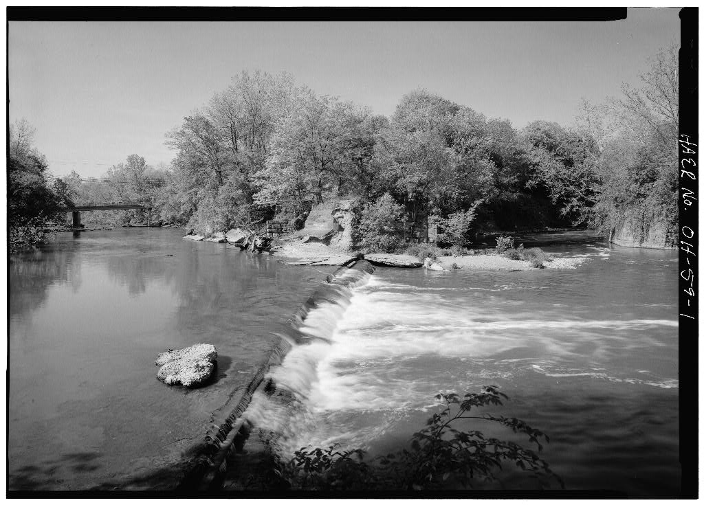
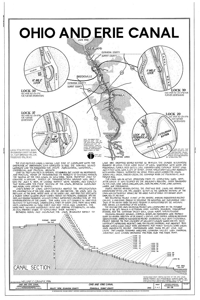
Ohio & Erie Canal, Links Lake Erie at Cleveland & Ohio River at Portsmouth, Peninsula, Summit County, OH. Surveyed as HAER OHIO,77-PEN.V,5-, with 1 photograph, 1 measured drawing and a 2,791-word written history.
From the record
“The Ohio and Erie Canal, linking Lake Erie at Cleveland with the Ohio River at Portsmouth, Ohio, was completed in The 308-mile inland waterway laid the foundation for Ohio's agricultural, industrial, commercial, and political growth.”
Written record, HAER OHIO,77-PEN.V,5- survey. Machine-read text.
surveyed by the federal HAER program as HAER OHIO,77-PEN.V,5- · the record runs 2791 words · one of 65 surveyed structures published for this county.
1 photograph and 1 measured drawing from the federal survey record, Library of Congress.
Location
87 words
Source document
Quoted word for word from HAER OHIO,77-PEN.V,5-.
Not written, edited or summarised by this site.
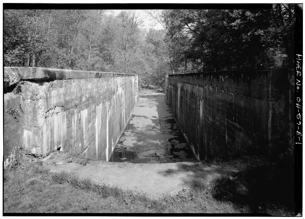
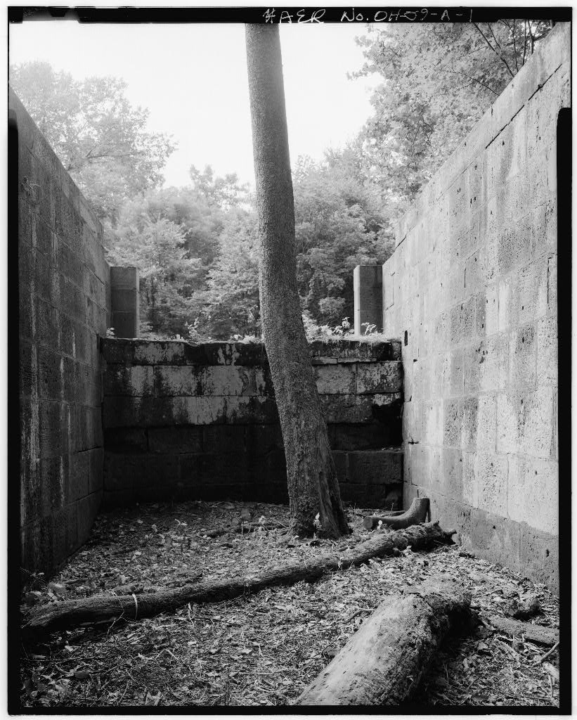
Lock No. 39 - West side of Canal Road, feet north of Stone Road, Valley View Ohio UTM: Cleveland South Quadrangle Lock No. 38 - Hillside and Canal Roads, Valley View, Ohio UTM: Northfield Quadrangle Tinkers Creek Aqueduct - Canal Road and Tinkers Creek Valley View, Ohio UTM: Northfield Quadrangle Lock No. 37 - Canal and Fitzwater roads, Valley View, Ohio UTM: Northfield Quadrangle Lock No. 29 and Peninsula Aqueduct - at Cuyahoga River 600 feet north of State Route Peninsula, Ohio UTM: Date of Construction: Reconstructed
Significance
98 words
Source document
Quoted word for word from HAER OHIO,77-PEN.V,5-.
Not written, edited or summarised by this site.
The Ohio and Erie Canal, linking Lake Erie at Cleveland with the Ohio River at Portsmouth, Ohio, was completed in The 308-mile inland waterway laid the foundation for Ohio's agricultural, industrial, commercial, and political growth. That section of canal between Akron and Cleveland was the first to open in there, the rapid drop in elevation -- nearly 400 feet in 38 miles -- required the construction of 44 locks. The structures documented in this report are among the best preserved. Today, the Ohio and Erie Canal forms the principal historical feature of the Cuyahoga Valley National Recreation Area.
Written history
2506 words
The headings the report itself prints. Each one jumps to where it begins.
Source document
Quoted word for word from HAER OHIO,77-PEN.V,5-.
Not written, edited or summarised by this site.
Carol Poh Miller, February It is understood that access to this material rests on the condition that should any of it be used in any form or by any means, the author of such material and the Historic American Engineering Record of the National Park Service at all times be given proper credit. OHIO AND ERIE CANAL HAER NO. OH-59 PAGE 2 The Ohio and Erie Canal, linking Lake Erie at Cleveland with the Ohio River at Portsmouth, was completed in The 306-mile inland waterway laid the foundation for Ohio's agricultural, industrial, commercial, and political growth. Ohio in was rich in natural resources but lacked a cheap and practical means of transporting its products to Eastern markets. The success of the Erie Canal in New York State prompted Ohio to consider a similar system of transportation.
Ground was broken on July 4, at Licking Summit near Newark, and exactly two years later, the first section of the canal between Cleveland and Akron was opened to traffic. Construction A Board of Canal Commissioners, established by law February 4, supervised the survey and construction of the canal. On February 7, the Board appointed David S. Bates, formerly of the Erie Canal, as principal engineer for the State; and Samuel Farrer and William M.. Price as resident engineers. Price supervised construction of the northern section of the canal. On May 5, Nathan S.
Roberts, a civil engineer employed by the Board, reported on the most advantageous route for the canal: "We first examined the Cuyahoga and Tuscarawas route, we find that this line is located on ground very favorable for a Canal being mostly along alluvial bottoms, or on plains of soil composed of sandy or gravely loams which can in most places be excavated by the plough and scraper which is the best way of construction the Banks of a Canal." The following day, The Board resolved that "the route by way of the Tuscarawas Valley, Portage Summit and the Cuyahoga Valley to Lake Erie presents the strongest claims to the consideration of the State, that the public interest will be more effectually promoted by its adoption and that it be and is 2 therefore established as the Line of Canal." Construction of the canal was divided into sections, with each section let as a single contract.
Bids were invited usually through advertisements in OHIO AND ERIE CANAL HAER NO. OH-59 PAGE 3 newspapers. Resident engineer Price estimated the cost of each section and certified the amount of work done by the contractor. The contractor was paid by the State, and he, in turn, paid his laborers and/or subcontractors. Much of the work on the canal was done by local farmers eager to supplement their incomes with cash, and by immigrants newly arrived from Ireland and, to a lesser 3 extent, Germany. This system was far from perfect. Many inexperienced contractors and subcontractors bid on contracts at prices lower than they could afford. Many of these later abandoned the job, forcing the Board to re-let the contract and so causing both extra expense and the loss of time.
Such was the case with several 4 of these sections of the canal located in the Cuyahoga Valley (see below.) By the summer of there was upwards of laborers at work on the canal between Cleveland and Kendal, Stark County. Men and horses were the prime movers. Horse-drawn plows and scrapers were supplemented by men with picks and shovels. Summer rains and the marshy terrain were conducive to the outbreak of malaria, typhoid fever, and typhus, and working conditions were marked by the prevalence of disease. Contracts in the Department of Public Works archives at the Ohio Historical Society document the contractors for each section of the canal and the specifications for construction.
Working on the sections and structures that are the subject of this report were the following: OHIO AND ERIE CANAL HAER NO. OH- 5 9 PAGE 4 SECTION
Date of Contract Contractor
Sec. 91, inclu. Lock No. 39 Harpersfield, Ohio McFarlane & Sec. 86 & 105 Samuel inclu. Lock Roseter, John C. Pease No. 38 Paul Snyder Sec. 82, 99, 102 Southworth, & inclu. Holley, New York Locks No. 37 & 40 Sept. 7, Contract for construct- ion of lock rescinded May 4, re-let May 16, Sept. 10, Contract re-let for completion Oct. 10, Sept. 8, William A. Harper, Alexander William Van Stephen Snyder, Harvey Wellman Augus tus Sec. 84, inclu. aqueduct over John Flinn Tinkers Creek Sept. 17, Leander Ransom & Sec. 52 & 53, John Flinn, inclu. Locks No. Rochester, New York 29 & 30 & aqueduct at Peninsula Morace July 13, John Johnson & Contract re-let for & aqueduct, May 9, Contract re-let for completion of Sec. 52 & 53, Nov. 3, Alanson Sweet & completion of Locks Wood William Stow, Jr.
OHIO AND ERIE CANAL HAER NO. OH-59 PAGE 5 In summary, specifications for construction were as follows: Vegetation was to be grubbed and dug up in a swath at least 60 feet wide. Canal and banks were to be constructed and formed, by excavation or embankment, "so that the water may in all places be at least forty feet wide in the canal at the surface, twenty-six feet wide at the bottom, and four feet deep." The towing path was to be at least 10 feet wide. In all cases of embankment, trees, bushes, etc., were to be cut close to the ground and removed from a space at least 45 feet wide on each side of the center of the canal. Locks were to be constructed with a chamber 90 feet long and 15 feet wide.
Lock walls, to be of solid masonry laid in water cement, were to be five feet thick at the bottom and four feet thick at the top water line, with buttresses firmly connected with the main wall. Further specifications for the stonework and lock foundations can be found in the sample contract included with this report (see Appendix). Between Akron and Cleveland, the canal descended rapidly to Lake Erie, dropping nearly 400 feet in 38 miles. The change in elevation required 44 locks. The crossing of Mill Creek, Tinkers Creek, the Cuyahoga River (at Peninsula), and Furnace Run required aqueducts. Locks were built of local stone--both Independence Township and Peninsula were underlaid by a ledge of high-quality sandstone--with white oak foundations, floors, and gates.
Aqueducts commonly had wooden trunks supported on stone piers. Operation and Subsequent History The Ohio and Erie Canal was in active operation from the opening of navigation in July until after which it was eclipsed by the railroads. Principal goods transported by canal were wheat, corn, oats, coal, OHIO AND ERIE CANAL HAER NO. OH- 5 9 PAGE 6 iron ore, pork, flour, lard, whisky, lumber, and merchandise.8 _. - r J The canal gave rise to small settlements clustered about the locks, and, where the fall was sufficient, to water-powered industries. Thus, at Lock No. 37 in Independence, Robert and Andrew Alexander erected a gristmill in while a sawmill 9 reputedly operated nearby at Lock No.
38 as early as Throughout the nineteenth century, the Ohio and Erie Canal was periodically rehabilitated. The aqueducts, especially, required frequent rebuilding. The Tinkers Creek Aqueduct was rebuilt in Following flood damage, new aqueduct was built "several chains to the north" in and the aqueduct was again rebuilt in and The aqueduct at Peninsula was rebuilt in and again in A new towpath bridge was built in and between and the span was substantially rebuilt and reinforced. Lock No.
29, adjacent to the aqueduct, was reconstructed in In the Ohio Legislature passed an act leasing the State's canals to a private company for a term of 10 years at an annual rental of The lease was subsequently renewed for another 10 years, but was forfeited on December 1, The canals were returned to the State in a greatly deteriorated condition, and over the next two decades the canals were operated at a loss and various sections were abandoned. In addition to tolls, the principal source of revenue from the canals were the lease of land and water power and the sale of land. In the early years tolls had provided nearly all canal revenue; by however, traffic had declined so precipitously that leases of water power and privileges furnished almost 90 percent of total canal 11 receipts.
OHIO AND ERIE CANAL HAER NO. OH-59 PAGE 7 The and saw protracted debate over the future of Ohio's canals. In the platforms of both parties contained planks in favor of the preservation and rehabilitation of the canal system. It is apparent, however, that by this date legislators valued the canals not as a system of transportation but as an incentive to the development of industries along the canal. In the Ohio Senate voted an appropriation of for for the reconstruction of the Northern Division of the Ohio and Erie Canal, extending from Dresden (Wuskingum County) to Cleveland.
Early the following year Paul was appointed engineer in charge of the improvement, and the State entered into contracts with Murphy & Miles, of Columbus, to furnish cement; the King Bridge Company, of Cleveland, to construct steel aqueducts with wooden trunks at Mill Creek, Tinkers Creek, and at Peninsula; the Atlantic Foundry Company to furnish rods, wicket plates, and other cast-iron fittings; Alexander Adamson to furnish spikes, bolts, and other fittings of wrought iron or steel; and George W. Carmichael & Company for work on Locks 36 to 42. Finally, D. E. Sullivan & Son, of Columbus, was hired to dredge the canal between Locks No. 22 and 42. On December 1, Paul reported that Locks No. 29, 37, 38 and 39 (among others) had been rebuilt.
The abutments of the Peninsula Aqueduct were being rebuilt from bedrock up, and the widths of the aqueducts had been increased two feet at Peninsula and four feet at the other two. The Peninsula Aqueduct, formerly two spans of 39 feet each, was made into a single span of 85 feet by 14 removing the center pier. A map showing the location and cost of improvements to structures in the Northern Division of the canal during shows the OHIO AND ERIE CANAL HAER NO. OH-59 PAGE 8 following expenditures: 15 Peninsula Aqueduct Lock 29 Lock 37 Tinkers Creek Aqueduct Lock 38 Lock 39 The great flood of March brought Ohio's canal era to an end. Rain began Sunday, March and continued almost without stop through Wednesday, March 26the.
That day, the Cleveland Plain Dealer reported that the canal, which in normal times was 300 to 500 yards from the Cuyahoga River, was merged with it into a single raging torrent. From the Portage Summit at Akron north to Brecksville the canal was destroyed. Only that section from Brecksville to Cleveland, which furnished dates to several important industries, was considered salvageable. Following the flood, the eight-mile section of canal between Brecksville and Cleveland was restored and leashed to the American Steel & Wire Company (later U.S. Steel). Since at least the canal had supplied water for industrial use to that company, first for the Newburgh Steel Works, then for the American Steel & Wire plant, later called the Cuyahoga Works of U.S. Steel.
Lease of the canal water to industry remains an important factor in its preservation. Today, a new American Steel & Wire Company (a new steel fabricating firm bought the Cuyahoga Works of U.S. Steel in including the rights to the historic name) maintains the canal and a feeder dam at Brecksville that diverts water from the Cuyahoga River into the canal. South of Brecksville, the canal is largely dry and, in some places, thickly overgrown with trees and brush. The locks can still be found, however, and with persistence, the canal route can be traced. Fortunately, a proposal to use I o the canal right of way for a Cleveland-to-Akron freeway did not materialize, and today that section of the canal is the principal historical feature of the Cuyahoga Valley National Recreation Area.
Certainly the canal's short life, and its eclipse by the railroads, could OHIO AND ERIE CANAL HAER NO. OH-59 PAGE 9 not have been foreseen. In there were 375 miles of railroad in Ohio; by there were nearly three thousand. The significance of the canal to this development is evident by the fact that from the opening of navigation in July until just preceding the Civil War, the tonnage transported on the canal exerted a tremendous influence on the commercial and agricultural prosperity of the State, while the abundance of water power led to the 19 investment of significant capital in manufactures along the canals. Finally, the Ohio and Erie Canal contributed spectacularly both to population growth and the general economic development of the regions it served.
Endnotes Records of the Department of Public Works, Series Record No. 1, Minutes and Directors' Journal, Ohio Historical Society, Columbus, Ohio. 2 Ibid. 3 Ohio State Archaeological and Historical Society, History of the Ohio Canals: Their Construction, Cost. Use and Partial Abandonment (Columbus, 0.; Fred J. Heer, pp. 26. Also see Ernest M. Teagarden, "Builders of the Ohio Canal, Inland Seas 19 (Summer 4 History of the Ohio Canals , p. 23. 5 Teagarden, "Builders of the Ohio Canal," pp. 97, On July 31, William H. Price certified completion of the work "excepting a defectively laid upper floor," for which was deducted from the contractors' pay.
The contractors agreed "to found and erect a good substantial aqueduct over Tinkers Creek...the abutments & pier of which shall be built of good substantial stone properly laid and cemented with water cement, with a wood trunk, & a foundation of good sound durable square timber under the while." o History of the Ohio Canals , p. 43. > 9 Crisfield Johnson, History of Cuyahoga County. Ohio (Cleveland: Ensign & Co., p. U.S. Department of the Interior, National Park Service, Historic Structure Report: Ohio and Erie Canal , by Harlan Unrau and Nick Scrattish, August pp. 11 History of the Ohio Canals , pp. OHIO AND ERIE CANAL HAER NO. OH-59 PAGE 10 12 Ibid. . pp. 13 Contracts, Records of the Department of Public Works, Series Ohio Historical Society, Columbus, Ohio.
14 Historic Structure Report , pp. The dimensions of the Tinkers Creek and Peninsula aqueducts as reconstructed in were as follows; Tinkers Creek Peninsula Length of trunk 95 feet 102 feet Space between face of " 85 " abutments Waterway 22 " 18 " Towpath 8 " 8 " Number of spans 2 " 1 " Profile and Map of the Ohio Canal Showing Progress and Cost of Improvements, compiled under the direction of Chase. E. Perkins, Chief Engr. Public Works of Ohio, Ohio Historical Society, Columbus, Ohio. Historic Structure Report , p. File drawings, American Steel & Wire Company, Cleveland, Ohio. Among the early engineering drawings still extant is one for a "Canal Pumping House - 1 Cleveland Press . April 12, 19 History of the Ohio Canals , pp. 43,
The original filed report, and the sheets the survey produced. Those published here appear above.
Also surveyed in Peninsula
14 records
The federal surveyors worked through Peninsula building by building. These are the other structures
they measured and filed a report on, longest report first.
 Block
Block