 Block
From the record
28 National Register listings published here.
Sources: the National Register database, National Park Service
59 topographic sheets cover 38 settlements here, and 28 properties are on the National Register of Historic Places.
28 National Register listings published here.
Sources: the National Register database, National Park Service
Every property in this county listed on the National Register of Historic Places, with the year it was listed and the federal nomination document.
| Photograph | Property | Type | Listed | Reference |
|---|---|---|---|---|
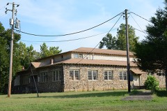 | Aggie Hall | building | 1992 | 92001115 |
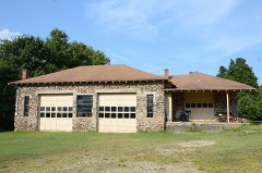 | Aggie Workshop | building | 1992 | 92001113 |
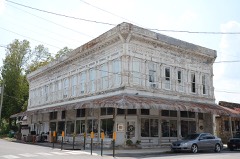 | J.C. Berry's Dry Goods Store | building | 2003 | 03000468 |
| Bruno School Building | building | 1992 | 92001112 | |
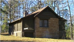 | Buffalo River State Park | building | 1988 | 78003461 |
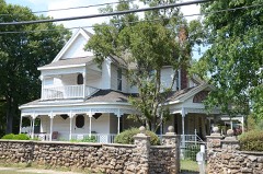 | Carter-Jones House | building | 1987 | 87000979 |
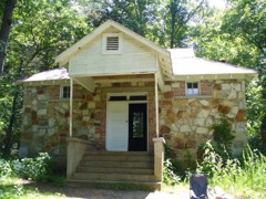 | Cold Springs School | building | 1992 | 92001494 |
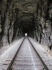 | Cotter Tunnel | structure | 2007 | 07000961 |
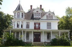 | Cowdrey House | building | 1978 | 78000609 |
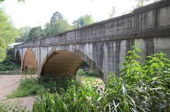 | Crooked Creek Bridge | structure | 2010 | 09001253 |
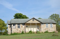 | Eros School Building | building | 1992 | 92001110 |
| Estes-Williams American Legion Hut #61 | building | 2001 | 01000111 | |
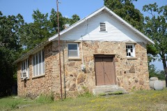 | Fairview School Building | building | 1992 | 92001116 |
| Flippin City Jail | building | 2023 | 100008565 | |
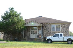 | Hirst-Mathew Hall | building | 1992 | 92001114 |
| William Jasper Johnson House | building | 2018 | 100002949 | |
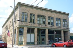 | Layton Building | building | 1978 | 78000610 |
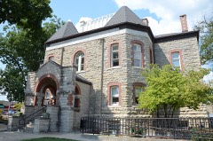 | Marion County Courthouse | building | 1994 | 94000471 |
| Mountain Village 1890 | district | 2023 | 100008598 | |
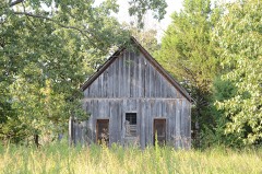 | Pea Ridge School Building | building | 1993 | 93000486 |
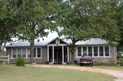 | Pyatt School Building | building | 1992 | 92001111 |
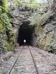 | Pyatt Tunnel | structure | 2007 | 07000953 |
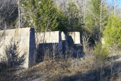 | Rush Historic District | district | 1987 | 87000105 |
| US 62 Bridge over Crooked Creek | structure | 2000 | 00000632 | |
| WPA Privy | building | 2024 | 100010838 | |
| Yellville West Overpass | structure | 2024 | 100010839 |
Every wildfire the federal occurrence database records inside this county: 601 of them, burning about 19,613 acres. 20 started naturally and 273 were recorded as arson. Each settlement page carries the fires within five miles of it.
| Reported cause | Fires |
|---|---|
| Arson/incendiarism | 273 |
| Missing data/not specified/undetermined | 169 |
| Debris and open burning | 111 |
| Natural | 20 |
| Equipment and vehicle use | 16 |
| Recreation and ceremony | 6 |
| Smoking | 4 |
| Misuse of fire by a minor | 2 |
The five largest, by the area the report gives. 6 of them were set deliberately.
| Date | Cause | Size | Reported by | Name on the report |
|---|---|---|---|---|
| 30 December 2005 | Natural | 1,631 acres | Buffalo National River | DUCKHEAD |
| 18 January 2015 | Arson/incendiarism | 1,350 acres | Buffalo National River | JACKSON'S RIDGE |
| 8 March 2013 | Debris and open burning | 1,200 acres | Buffalo National River | SLICK ROCK HOLLOW |
| 1 April 2003 | Arson/incendiarism | 775 acres | Arkansas Forestry Commission | not named |
| 12 April 1998 | Arson/incendiarism | 590 acres | Arkansas Forestry Commission | not named |
| 9 February 2007 | Arson/incendiarism | 556 acres | Buffalo National River | DEAD HORSE |
| 5 April 2004 | Arson/incendiarism | 481 acres | Arkansas Forestry Commission | MONARCH |
| 1 February 2003 | Arson/incendiarism | 450 acres | Buffalo National River | ROSE RIDGE |
Every settlement page carries the fires within five miles of it - see the settlement index below.
The NOAA Storm Events Database holds 341 reports for this county, causing 10 deaths, 48 injuries and about $40,145,000 in recorded property damage. Each settlement page carries the reports that name it.
| Kind of event | Reports |
|---|---|
| Thunderstorm Wind | 143 |
| Hail | 126 |
| Flash Flood | 38 |
| Tornado | 23 |
| Heavy Rain | 4 |
| Flood | 4 |
| Lightning | 3 |
The most serious of them, by death, then injury, then recorded damage. The accounts are quoted exactly as the forecast office filed them.
| When | Event | Place named | Harm | What the report says |
|---|---|---|---|---|
| November 1985 | Tornado (F3) | not stated | 3 killed, 13 hurt, $25,000,000 | no account filed |
| May 1961 | Tornado (F3) | not stated | 3 killed, 9 hurt, $2,500,000 | no account filed |
| May 2024 | Tornado (EF2) | Eros | 3 killed | The Boone-Marion County tornado continued into Marion County from Boone County, paralleling just south of US Highway 62, near Pyatt.|Marion County EM reported three fatalities from this tornado.|Extensive tree damage was observed across several county roads,|and a few mobile homes were tossed and destroyed on Marion County|Road 4010. After crossing Marion County Road 4010, the tornado|path width increased to its widest point, and likely maintained a|maximum path width of around 2000 yards for a few miles, via|satellite imagery, as it moved through the Crooked Creek Valley.|Extensive tree damage was observed along and around Crooked|Creek, and moderate damage to the second level of a tin home was|found as well. The tornado kept moving northeast, snapping most|trees in its path as it crossed Crooked Creek multiple times and|eventually, Marion County Road 4006, where it moved over the Snow|Access Campground Area. The tornado then crossed US Highway|62 again near the small municipality of Snow, causing minor to|moderate damage to a few homes around the area. As the tornado|crossed US Highway 62, the path width began to decrease, and it|began moving more eastward. Mainly tree damage was observed to|the north of US Highway 62, and eventually it crossed State|Highway 125, and Marion County Road 3032, where more|extensive tree damage was observed, and another mobile home,|which was untethered, was lofted and completely destroyed. The|tornado continued to move east-northeast, causing mostly tree|damage, before eventually dissipating to the northwest of Summit.|This tornado tracked across two counties and was rated an EF3 with maximum estimated wind speeds|of up to 145 mph. |
| January 2005 | Flash Flood | Rush | 1 killed | An elderly couple was returning to their home and found a low water crossing on Rush Creek flooded. They decided not to try and cross in their truck. They got out of the truck and attempted to cross the creek on foot at an old road bed that crossed the creek nearby. The water was too swift and they were swept downstream. The 88 year old man survived, but his 87 year old wife did not. |
| December 1971 | Tornado (F3) | not stated | 8 hurt, $250,000 | no account filed |
| April 1996 | Tornado (F2) | Yellville | 6 hurt, $1,000,000 | no account filed |
| July 2018 | Thunderstorm Wind | Buffalo Point | 4 hurt | Trees were blown down on RV campers at Buffalo Point. Four people were injured. |
| August 1976 | Tornado | not stated | 2 hurt, $250,000 | no account filed |
| February 2023 | Tornado (EF2) | Verona | 2 hurt, $200,000 | Damage consisted of a couple of houses losing roofing material, barns/sheds damaged or destroyed, and numerous trees uprooted or snapped. The trees blocked half a dozen roads, including Highway 65 which was closed temporarily. The most substantial damage was a house moved from its foundation and then partially collapsing. We would like to thank Searcy and Marion County Emergency Management for assistance with the survey. |
| May 1961 | Tornado (F3) | not stated | 1 hurt, $2,500,000 | no account filed |
| February 2008 | Tornado (EF1) | Ware'S Chapel | 1 hurt, $1,750,000 | A Red Cross survey indicated that 3 houses had major damage, 5 had minor damage, and 5 others were affected. In addition, 3 mobile homes were destroyed, 3 had major damage, and 2 had minor damage. Numerous trees and power lines were blown down as well. The tornado continued into Baxter County, just east-southeast of Cotter. |
| February 2019 | Tornado (EF1) | Ralph | 1 hurt, $100,000 | This tornado developed on the west side of State Hwy 14 before crossing that highway and continuing further northeast. Trees were uprooted or snapped and utility poles where knocked down along its path, along with damage to a home along County Road 6089. This tornado continued towards Crestwood Terrace Road where it damaged some mobile homes before dissipating shortly afterwards. |
| April 2003 | Tornado (F1) | Peel | 1 hurt | A weak tornado touched down 3.2 miles southwest of Peel and traveled to the northeast before lifting 1.7 miles northeast of Peel. The tornado damaged a church with a wall bowed out. Damage also occurred to the ceiling in the sanctuary. A travel trailer was also overturned with several homes suffering roof damage, mostly due to fallen trees or tree limbs. Also, a 60 by 40 foot shed was totally destroyed, with doors blown off a few turkey houses. Power lines and power poles were downed along with dozens of very large trees. Two vehicle were smashed by fallen trees. A woman was injured when her mobile home flipped over and was destroyed. |
| August 2012 | Thunderstorm Wind | Bull Shoals | $3,000,000 | One boat dock was overturned onto another dock, and several additional boat docks were damaged. Dozens of boats were damaged or destroyed; some of the boats sank. Trees and power lines were blown down. |
| March 2008 | Flash Flood | Bull Shoals Lake Wes | $1,000,000 | Water rescues were performed by helicopter half way between Flippin and Fairview just off Arkansas Highway 178. Many low water crossings were flooded in the county. Arkansas Highway 235 was flooded near Bruno. There was one rescue from a home in Pyatt. |
| August 2013 | Flash Flood | Peel | $550,000 | Several streets in Flippin flooded. Low-water crossings on Marion County Roads 3010, 3021, and 3022 were impassable with more than a foot of water over them. Numerous county roads and bridges suffered damage. |
| May 2011 | Flood | Peel | $500,000 | Some of the campsites around Bull Shoals Lake were closed due to flooding. Part of the Buffalo National River was closed due to flooding, flood damage, and debris piles. |
| March 1983 | Tornado (F2) | not stated | $250,000 | no account filed |
| March 1961 | Tornado (F1) | not stated | $250,000 | no account filed |
| April 2011 | Flood | Peel | $200,000 | Widespread areal flooding occurred. |
| February 2023 | Thunderstorm Wind | Bruno | $100,000 | Damage to homes were reported along with downed power lines. This was possibly a tornado. |
| October 2009 | Flood | Price Place | $100,000 | Flooding damaged many county roads. |
| August 2012 | Thunderstorm Wind | Bull Shoals Lake Wes | $75,000 | Docks were damaged and trees were blown down. |
| January 2020 | Thunderstorm Wind | Yellville | $50,000 | Several trees and power lines were blown and some were on homes and vehicles. Several outbuildings were also damaged. |
| August 2015 | Thunderstorm Wind | Bull Shoals Lake Wes | $50,000 | Some docks were damaged near Blue Water Resort on Bull Shoals Lake. |
| August 2014 | Flash Flood | Monarch | $50,000 | Excessive rainfall caused flash flooding, which washed out or damaged 20 county roads. County dump trucks were called out to begin road repairs. The Monarch area received 3.5 inches of rain in one hour. |
| June 2014 | Thunderstorm Wind | Bull Shoals | $50,000 | Trees and power lines were blown down in the Bull Shoals area, blocking Arkansas 178 and numerous county roads. |
| April 1994 | Thunderstorm Wind | Peel | $50,000 | Thunderstorm winds destroyed three barns and downed some power lines. |
| April 2010 | Tornado (EF1) | Price Place | $40,000 | An EF1 tornado caused roof and siding damage to six homes at Price Place. Numerous trees were uprooted or snapped. The tornado exited Marion County, Arkansas, north-northeast of Price Place and crossed into Ozark County, Missouri, south-southeast of Pontiac. |
| October 2014 | Thunderstorm Wind | Flippin | $25,000 | Many power lines were blown down. |
| August 2012 | Thunderstorm Wind | Yellville | $25,000 | Several large trees were blown down, with one of the trees landing on a house. |
| March 2010 | Hail | Flippin | $25,000 | Half dollar to ping pong ball size hail fell for about 2 minutes, damaging some vehicles. |
| April 2008 | Thunderstorm Wind | Flippin | $25,000 | A barn was destroyed on County Road 5014. |
| June 2007 | Lightning | Yellville | $25,000 | Lightning struck the county courthouse. There was damage to the outside of the building, as well as several computers inside the courthouse. |
| March 2020 | Thunderstorm Wind | Eros | $20,000 | Damage was reported at the Bruno-Pyatt school. |
| May 2017 | Thunderstorm Wind | Lakeway | $20,000 | Public and Emergency manager initially reported damage to a farm in the Lakeway area. NWS Storm Survey was sent out to determine if it was straight-line winds or a tornado and were determined to be the former. Wind gust speeds were estimated to be approximately 80 mph. Several trees were uprooted or snapped on and near the property. Additionally, a few outbuildings sustained damage. One lost a roof while another had a trees thrown on it. A trailer was also tipped over from the winds. |
| December 2013 | Flash Flood | Peel | $20,000 | Several county roads were under water. |
| May 2015 | Flash Flood | Summit | $15,000 | A car was trapped in rising water over County Road 7095 west of Summit in Marion County. |
| July 2013 | Thunderstorm Wind | Bruno | $15,000 | Trees were blown down, with two of the trees landing on houses. |
| March 2008 | Flash Flood | Peel | $15,000 | The low water bridges were covered and some gates were closed over the roads. |
| March 2017 | Thunderstorm Wind | Flippin | $10,000 | Part of a roof was removed from a home and some vehicles were damaged. |
| June 2014 | Flash Flood | Summit | $10,000 | Flash flooding occurred in the Yellville area. There was an unofficial measurement of 1.90 inches of rain in 40 minutes. Streets were flooded and low-water crossings had to be barricaded. Water entered the County Courthouse basement and the Courthouse Annex. |
| April 2001 | Thunderstorm Wind | Flippin | $8,000 | Two buildings sustained minor wind damage from severe thunderstorms that moved through the area. |
| May 2020 | Thunderstorm Wind | Flippin Aprt | $5,000 | Numerous trees were blown down across the western portions of the county, some blocking roads. A school building sustained minor damage. |
| August 2011 | Thunderstorm Wind | Fairview | $5,000 | A severe thunderstorm blew trees down. |
| July 2010 | Thunderstorm Wind | Bull Shoals Lake Wes | $5,000 | Several trees were blown down near Highway 125 Park and north of Peel. |
| July 2010 | Flash Flood | Summit | $2,000 | There were multiple reports of street flooding in Yellville. |
| September 2009 | Flash Flood | Bull Shoals Lake Eas | $2,000 | Minor flooding occurred on county roads near Bull Shoals. |
| October 2007 | Lightning | Bull Shoals | $2,000 | Lightning knocked down a large tree. The tree caused minor damage to the garage of a house. |
| May 2017 | Hail | Bull Shoals Lake Eas | $1,000 | Several cars were dented and shingles were damaged on some homes. |
| March 2026 | Hail | Dodd City | - | Quarter-sized hail fell in the community of Dodd City. |
| March 2026 | Hail | Bull Shoals | - | Quarter-sized hail fell near the town of Bull Shoals with a significant amount of hail falling leading to a few hail drifts. |
| April 2025 | Hail | Yellville | - | Ping-pong ball-sized hail fell in the town of Yellville, report via MPing. |
| April 2025 | Flash Flood | Flippin Aprt | - | Road flooded and impassable at Denton Ferry and Wildcat Shoals Road. |
| August 2025 | Thunderstorm Wind | Oakland | - | The roof of a covered deck was blown off of a home in Oakland. |
| March 2024 | Thunderstorm Wind | Rea Vly | - | Multiple power poles were broken near Rea Valley. |
| May 2024 | Thunderstorm Wind | Snow | - | Multiple trees were blown down throughout Marion County. |
| May 2024 | Thunderstorm Wind | Bull Shoals | - | Numerous trees were blown down near the Bull Shoals Dam covering portions of Marion and Baxter Counties. |
| May 2024 | Hail | Dodd City | - | Quarter-sized hail fell in the town of Dodd City. |
| May 2024 | Tornado (EF1) | Ralph | - | The Briarcliff Tornado began just west of AR Hwy 14 on Marion County Road|5002 and Abbey Lane, snapping and uprooting trees. The tornado|continued across AR Hwy 14 to Marion County Road 6014 and|6011 where it caused minor roof damage to some homes and|continued to snap and uproot trees. On Backway Road, a double-|wide shifted off its foundation a few feet and had a large tree|fall on it. Across the street, an outbuilding sustained damage to|the roof and flooring. The tornado continued towards Hand|Mountain where the path width increased significantly to in|excess of 1000 yards, snapping and uprooting numerous trees, and|then crossed the White River into Baxter County, followed by Fulton County. |
The Survey's mineral resources record lists 219 workings inside this county. 5 still produce and 214 are closed or unrecorded. Each settlement page carries the workings within five miles of it.
| Commodity | Workings |
|---|---|
| Zinc | 145 |
| Lead | 86 |
| Lead, Zinc | 37 |
| Sand and Gravel, Construction | 16 |
| Stone | 8 |
| Stone, Crushed/Broken | 4 |
| Zinc, Lead | 2 |
| Iron | 1 |
| Tungsten | 1 |
| Boron-Borates | 1 |
| Barium-Barite | 1 |
The least common of them first, because a county's hundredth gravel pit says nothing its first ten did not.
| Where | Site | Commodity | Status | Recorded |
|---|---|---|---|---|
| Beaty Mine | Boron-Borates | Past Producer | ||
| Corbin Iron Deposit | Iron | Occurrence | ||
| Corbin Lead Deposit | Lead, Barium-Barite | Occurrence | ||
| Omeara Prospect | Tungsten, Zinc | Occurrence | ||
| Unknown | Zinc, Lead | Unknown | ||
| Unknown | Zinc, Lead | Unknown | ||
| Flippin Quarry | Stone, Crushed/Broken | Producer | ||
| Flippin Quarry | Stone, Crushed/Broken | Unknown | ||
| Jefferson Quarry | Stone, Crushed/Broken | Unknown | ||
| Lowery Quarry-Eros Location | Stone, Crushed/Broken | Past Producer | ||
| Unknown Quarry | Stone | Unknown | ||
| Unknown Quarry | Stone | Unknown | ||
| Unknown Quarry | Stone | Unknown | ||
| Unknown Quarry | Stone | Unknown | ||
| Unknown Quarry | Stone | Unknown | ||
| Unknown Quarry | Stone | Unknown | ||
| Unknown Quarry | Stone | Unknown | ||
| Unknown Quarry | Stone | Unknown | ||
| A Ogden | Sand and Gravel, Construction | Past Producer | ||
| Ck Oper | Sand and Gravel, Construction | Past Producer | ||
| Crooked Creek Pit & Plant | Sand and Gravel, Construction | Producer | ||
| Gravel Pit | Sand and Gravel, Construction | Unknown | ||
| Gravel Pit | Sand and Gravel, Construction | Unknown | ||
| Gravel Pit | Sand and Gravel, Construction | Unknown | ||
| Gravel Pit | Sand and Gravel, Construction | Unknown | ||
| J W Hudson | Sand and Gravel, Construction | Past Producer | ||
| Jefferson Gravel Pit | Sand and Gravel, Construction | Unknown | ||
| Jewell D | Sand and Gravel, Construction | Past Producer | ||
| Kenneth Mcdowell Pit | Sand and Gravel, Construction | Past Producer | ||
| Lowery | Sand and Gravel, Construction | Past Producer | ||
| Marion County Pit | Sand and Gravel, Construction | Producer | ||
| Marion County Pit | Sand and Gravel, Construction | Producer | ||
| Marion County Pit & Plant | Sand and Gravel, Construction | Producer | ||
| Marion County Pitark Highway Dept | Sand and Gravel, Construction | Unknown | ||
| Bear Hill Mine | Lead, Zinc | Unknown | ||
| Big Buck Prospect | Lead, Zinc | Occurrence | ||
| Big Elephant Mine | Lead, Zinc | Unknown | ||
| Boat Creek | Lead, Zinc | Unknown | ||
| Broome County | Lead, Zinc | Unknown | ||
| Cincinnati Bill Mine | Lead, Zinc | Unknown | ||
| Copperhead | Lead, Zinc | Unknown | ||
| Dry Bone | Lead, Zinc | Unknown | ||
| Durham Prospect | Lead, Zinc | Occurrence | ||
| Erie Ozark Mine | Lead, Zinc | Unknown | ||
| Foxden | Lead, Zinc | Unknown | ||
| Frost | Lead, Zinc | Unknown | ||
| Governor Eagle | Lead, Zinc | Unknown | ||
| Hoffman Prospect | Lead, Zinc | Occurrence | ||
| Lead Drift | Lead, Zinc | Unknown | ||
| Lion Hill Mine | Lead, Zinc | Past Producer | ||
| Lost Bell | Lead, Zinc | Unknown | ||
| Markle Mine | Lead, Zinc | Past Producer | 1891 | |
| Mitchell Mine | Lead, Zinc | Occurrence | Galena, Smithsonite, Sphalerite | |
| Monkey Hill Mine | Lead, Zinc | Unknown | ||
| Nokomis | Lead, Zinc | Unknown | ||
| North Star Mine | Lead, Zinc | Unknown | ||
| Pigeon Roost | Lead, Zinc | Unknown | ||
| Unknown | Lead, Zinc | Occurrence | ||
| Unknown | Lead, Zinc | Unknown | ||
| Unknown | Lead, Zinc | Unknown | ||
| Unknown | Lead, Zinc | Unknown | ||
| Unknown | Lead, Zinc | Unknown | ||
| Unknown | Lead, Zinc | Unknown | ||
| Unknown | Lead, Zinc | Unknown | ||
| Unknown | Lead, Zinc | Unknown | ||
| Unknown | Lead, Zinc | Unknown | ||
| Unknown | Lead, Zinc | Unknown | ||
| Unknown | Lead, Zinc | Unknown | ||
| Unknown | Lead, Zinc | Unknown | ||
| Unknown | Lead, Zinc | Unknown | ||
| Unknown Group of Claims | Lead, Zinc | Occurrence | ||
| Anglo-American Prospect | Lead, Zinc | Occurrence | ||
| Arthur of Nancy J. Mine | Lead, Zinc | Unknown | ||
| Bardeen Prospect | Lead, Zinc | Occurrence | ||
| Ben Harrison Mine | Lead, Zinc | Occurrence | Galena | |
| Ben Harrison Mine | Lead, Zinc | Unknown | ||
| Big Bell Mine | Lead, Zinc | Unknown | ||
| Big Buffalo Mine | Lead, Zinc | Unknown | ||
| Big Elephant Mine | Lead, Zinc | Unknown | ||
| Big Saddle Prospect | Lead, Zinc | Occurrence | ||
| Big Star Mine | Lead, Zinc | Unknown | ||
| Bill Parks Prospect | Lead, Zinc | Occurrence | ||
| Black Bear Prospect | Lead, Zinc | Occurrence | ||
| Blankenship Prospect | Lead, Zinc | Occurrence | ||
| Blue Flag Mine | Lead, Zinc | Unknown | ||
| Bonnie Blue Mine | Lead, Zinc | Unknown | ||
| Booth Mine | Lead, Zinc | Unknown | ||
| Buffalo Claim | Zinc, Lead | Occurrence | Unknown | |
| Cane Spring Mine | Lead, Zinc | Unknown | ||
| Carbonate Point Prospect | Lead, Zinc | Occurrence | ||
| Chickasaw Mine | Lead, Zinc | Unknown | ||
| Christie Prospect | Lead | Occurrence | ||
| Climax Mine | Lead, Zinc | Unknown | ||
| Cobert Prospect | Lead, Zinc | Occurrence | ||
| Compound Mine | Lead, Zinc | Unknown | ||
| Cromwell & Caddy | Lead, Zinc | Unknown | ||
| Dyson Prospect | Lead, Zinc | Occurrence | ||
| Fullbright Prospect | Lead, Zinc | Occurrence | ||
| George Washington Prospect | Lead, Zinc | Occurrence | ||
| Getzendener Prospect | Lead, Zinc | Occurrence | ||
| Good Luck Prospect | Lead, Zinc | Occurrence | ||
| Great Eastern Prospect | Lead, Zinc | Occurrence | ||
| Green Horn Prospect | Lead, Zinc | Occurrence | ||
| Groundhog Mine | Lead, Zinc | Unknown | ||
| High Peak Claim | Lead | Occurrence | ||
| Highup Mine | Lead, Zinc | Unknown | ||
| Homestake Prospect | Lead, Zinc | Occurrence | ||
| Houck Mine | Lead, Zinc | Unknown | ||
| Hyland Deposit | Lead | Occurrence | ||
| Ida Lead & Zinc Mine | Zinc, Lead | Past Producer | ||
| Ike Emery Prospect | Lead, Zinc | Occurrence | ||
| Iola Mine | Lead, Zinc | Occurrence | Galena, Sphalerite | |
| Irish Taylor | Lead | Occurrence | ||
| Keystone Prospect | Lead, Zinc | Occurrence | ||
| Little Star Prospect | Lead, Zinc | Occurrence | ||
| Lockhart Mine | Lead, Zinc | Unknown | ||
| Lost Bell Claim | Zinc, Lead | Occurrence | Smithsonite, Sphalerite | |
| Lucky Dutchman Prospect | Lead, Zinc | Occurrence | ||
| Major Durham | Zinc, Lead | Occurrence | Hydrozincite, Smithsonite, Sphalerite | |
| Marble Falls Prospect | Lead, Zinc | Occurrence | ||
| Marguerite Mine | Lead, Zinc | Unknown | ||
| Maxwell Mine | Lead, Zinc | Unknown | ||
| Mcgregor Prospect | Lead, Zinc | Occurrence | ||
| Morgan Prospect | Lead, Zinc | Occurrence | ||
| Ohio Mine | Lead, Zinc | Unknown | ||
| Old Lead Mine | Lead, Zinc | Unknown | ||
| Onwata #1 | Lead, Zinc | Unknown | ||
| Phillips Mine | Lead, Zinc | Unknown | ||
| Pigeon Roost Mine | Zinc, Lead | Occurrence | Sphalerite | |
| Pilot Rock Mine | Zinc, Lead | Occurrence | Smithsonite, Sphalerite | |
| Potts Mine | Lead, Zinc | Unknown | ||
| Red Bird Mine | Lead, Zinc | Unknown | ||
| Reynolds Mine | Lead, Zinc | Unknown | ||
| Rising Sun Mine | Lead, Zinc | Unknown | ||
| Robinson Prospect | Lead, Zinc | Occurrence | ||
| Round Mtn Prospect | Lead, Zinc | Occurrence | ||
| Roy Prospect | Lead, Zinc | Occurrence | ||
| S.P.King Prospect | Lead, Zinc | Occurrence | ||
| Salina Mine | Lead, Zinc | Unknown | ||
| Sam Hill Mine | Lead, Zinc | Unknown | ||
| San Juan Prospect | Lead, Zinc | Occurrence | ||
| Savers Prospect | Lead, Zinc | Occurrence | ||
| Stillwell Prospect | Lead, Zinc | Occurrence | ||
| Summit Home Plrospect | Lead, Zinc | Occurrence | ||
| Tallow Clay Prospect | Lead, Zinc | Occurrence | ||
| Tarkiln Mine | Lead, Zinc | Unknown | ||
| Thomas Barclay Prospect | Lead, Zinc | Occurrence | ||
| Tolliner Prospect | Lead, Zinc | Occurrence | ||
| Twinkling Star Prospect | Lead, Zinc | Occurrence | ||
| Uncle Sam Prosplect | Lead, Zinc | Occurrence | ||
| Water Creek Prospect | Lead, Zinc | Occurrence | ||
| Watson Prospect | Lead, Zinc | Occurrence | ||
| White Owl Claim | Zinc, Lead | Occurrence | Smithsonite, Sphalerite | |
| Willett Mine | Lead, Zinc | Unknown | ||
| Willow Springs Mine | Lead, Zinc | Unknown | ||
| Yankee Boy Claim | Lead, Zinc | Occurrence | Unknown | |
| Albert and Jessie Mines | Zinc | Occurrence | Sphalerite | |
| Arkansas Wonder | Zinc | Occurrence | Hemimorphite, Smithsonite, Sphalerite | |
| Barnes Mines | Zinc | Occurrence | Smithsonite, Sphalerite | |
| Bear Hill Mine | Zinc | Past Producer | Sphalerite | |
| Beatty Mine | Zinc | Past Producer | 1890 | |
| Ben Carney | Zinc | Past Producer | ||
| Beulah | Zinc | Past Producer | ||
| Big Buffalo | Zinc | Occurrence | Smithsonite, Sphalerite | |
| Big Elephant | Zinc | Occurrence | Galena, Sphalerite | |
| Big Star Mine | Zinc | Occurrence | Sphalerite | |
| Blue John Prospect | Zinc | Past Producer | ||
| Bonanza Mine | Zinc | Past Producer | ||
| Bull Shoal Mine | Zinc | Occurrence | Smithsonite, Sphalerite | |
| Capps | Zinc | Past Producer | ||
| Cincinnati | Zinc | Past Producer | Galena, Smithsonite | |
| Clear Jackmine | Zinc | Occurrence | Smithsonite, Sphalerite | |
| Dillard Prospect | Zinc | Occurrence | ||
| Dixie Girl Mine | Zinc | Past Producer | ||
| Dolly-Agnes | Zinc | Past Producer | ||
| East Star Claim | Zinc | Occurrence | Surface/Underground | |
| Edna Bee | Zinc | Past Producer | ||
| Full Moon Mine | Zinc | Occurrence | ||
| Golden City Shaft | Zinc | Occurrence | Sphalerite | |
| Governor Eagles Mine. | Zinc | Occurrence | Sphalerite | |
| Great Eastern | Zinc | Occurrence | ||
| Gregory Mine | Zinc | Occurrence | Smithsonite, Sphalerite | |
| Hiawatha Claim | Zinc | Occurrence | Sphalerite | |
| Hunt, Malloy and Blevins | Zinc | Past Producer | Unknown | |
| Interstate Mng & Lead Co. Deposit 1 | Zinc | Occurrence | ||
| Interstate Mng & Lead Co. Deposit 2 | Zinc | Occurrence | ||
| Iola Mine | Zinc | Past Producer | ||
| Leader | Zinc | Past Producer | ||
| Legal Tender Mines | Zinc | Occurrence | Smithsonite, Sphalerite | |
| Lenon & Layton Prospect | Zinc | Occurrence | Sphalerite | |
| Little Buffalo | Zinc | Occurrence | Sphalerite | |
| Lonnie Roy | Zinc | Past Producer | ||
| Marble Falls Mine | Zinc | Occurrence | Smithsonite, Sphalerite | |
| Markle | Zinc | Past Producer | ||
| Mattie May Mine | Zinc | Past Producer | ||
| Mcintosh | Zinc | Past Producer | ||
| Mine #16 | Zinc | Past Producer | ||
| Mitchell Property | Zinc | Occurrence | Smithsonite, Sphalerite | |
| Monte Cristo | Zinc | Past Producer | ||
| Morning Star | Zinc | Past Producer | ||
| Nischwitz Mine | Zinc | Past Producer | ||
| North Pole | Zinc | Unknown | ||
| North Star Mine | Zinc | Occurrence | Smithsonite | |
| Old Wood Mine | Zinc | Occurrence | Smithsonite, Sphalerite | |
| Olympia Shaft | Zinc | Unknown | ||
| Philadeslphia | Zinc | Past Producer | ||
| Pilot Rock | Zinc | Past Producer | ||
| Post Boy | Zinc | Occurrence | Hemimorphite, Sphalerite | |
| Prince Fred Mine | Zinc | Past Producer | ||
| Rattlesnake | Zinc | Past Producer | ||
| Red Cloud | Zinc | Past Producer | ||
| Rush Creek | Zinc | Unknown | ||
| Silver Hollow | Zinc | Past Producer | ||
| Susquehanna Mine | Zinc | Past Producer | ||
| The Famous | Zinc | Occurrence | Smithsonite, Sphalerite | |
| Thetford Prospect | Zinc | Past Producer | ||
| Turkey Mountain | Zinc | Past Producer | ||
| White Eagle | Zinc | Past Producer | ||
| Yellow Rose | Zinc | Past Producer |
Named settlements recorded in the Geographic Names Information System, each with the topographic sheets covering it. Villages, hamlets and abandoned places alike. Each is shown with the nearest named watercourse or landform and the survey quadrangle it falls on.
Marion County township · 72687 · Yellville quadrangle
16 sheets, 1893 to 1985
No longer a settlement
Marion County township · 72633 · On East Fork Hampton Creek · Bruno quadrangle
16 sheets, 1893 to 1985
Marion County township · 72619 · On Strawberry Creek · Bull Shoals quadrangle
18 sheets, 1893 to 1985
Marion County township · 72687 · Near Coldwater Hollow · Maumee quadrangle
17 sheets, 1893 to 1985
Marion County township · 72687 · Near Bald Jesse · Yellville quadrangle
16 sheets, 1893 to 1985
Marion County township · 72687 · Near Angel Springs Hollow · Pyatt quadrangle
15 sheets, 1893 to 1985
Marion County township · 72682 · Near Davis Hollow · Maumee quadrangle
17 sheets, 1893 to 1985
Marion County township · 72687 · On Georges Creek · Pyatt quadrangle
15 sheets, 1893 to 1985
Marion County township · 72634 · Near Hand Mountain · Buffalo City quadrangle
18 sheets, 1890 to 1985
Marion County township · 72687 · On Big Creek · Big Flat quadrangle
18 sheets, 1890 to 1985
No longer a settlement
Marion County township · 72687 · Near Silver Hollow · Cozahome quadrangle
16 sheets, 1893 to 1985
No longer a settlement
Marion County township · 72687 · On Moccasin Creek · Cotter SW quadrangle
17 sheets, 1893 to 1985
No longer a settlement
Marion County township · 72687 · Near Pine Mountain · Cotter NW quadrangle
17 sheets, 1893 to 1985
Marion County township · 72687 · Near Salina Hollow · Peel quadrangle
16 sheets, 1893 to 1985
Marion County township · 65733 · Near Turnbull Hollow · Peel quadrangle
16 sheets, 1893 to 1985
No longer a settlement
Marion County township · 72687 · Near Peter Hollow · Cozahome quadrangle
16 sheets, 1893 to 1985
Marion County township · 72661 · Near Oak Hollow · Bull Shoals quadrangle
18 sheets, 1893 to 1985
Marion County township · 72634 · Near Hathaway Hollow · Buffalo City quadrangle
18 sheets, 1890 to 1985
Marion County township · 72668 · Near Willow Spring Hollow · Peel quadrangle
16 sheets, 1893 to 1985
Marion County township · 65761 · Near Plum Hollow · Cotter NW quadrangle
17 sheets, 1893 to 1985
Marion County township · 65729 · On Wolf Creek · Bull Shoals quadrangle
18 sheets, 1893 to 1985
Marion County township · 72672 · On Sugar Orchard Creek · Bruno quadrangle
16 sheets, 1893 to 1985
Marion County township · 72634 · On Valley Branch · Rea Valley quadrangle
17 sheets, 1893 to 1985
Marion County township · 72687 · Near Cold Spring Hollow · Rea Valley quadrangle
17 sheets, 1893 to 1985
Marion County township · 72634 · On Mitchell Creek · Cotter SW quadrangle
17 sheets, 1893 to 1985
No longer a settlement
Marion County township · 72677 · On Hampton Branch · Cotter SW quadrangle
17 sheets, 1893 to 1985
Marion County township · 72687 · Near Coldwater Hollow · Cozahome quadrangle
16 sheets, 1893 to 1985
No longer a settlement
Marion County township · 72633 · Near Anderson Flat · Saint Joe quadrangle
16 sheets, 1893 to 1985
Marion County township · 72687 · On East Prong Town Branch · Yellville quadrangle
16 sheets, 1893 to 1985
The vanished settlements of Marion County: the places named above that are no longer on the map.