 Block
Block
Eaton, Ohio
11 topographic sheets cover this place, the earliest surveyed in 1911 and the latest in 1986. It stands in Eaton City. It lies in ZIP code area 45320. The Survey maps it on the Eaton South quadrangle. 8,375 people lived here at the 2020 count. It stands 1,040 feet above sea level.
Research this city
This curated hub for Preble County, Ohio brings together the page's documented record links, visible map or image evidence where published, and routes to related local records.
What is documented here?
Use the page's provenance and linked records to distinguish the source material from the site's navigation and summaries.
How should I cite it?
Open the original record, preserve its repository and identifier, then use the citation tool for this page as a path back to the source.
Where should I go next?
Follow the county or state hub for related places and records, then use the guide for a source-aware research sequence.
Population over time
2 figuresEaton fell from 8,407 to 8,375 between 2010 and 2020. These are the recorded population figures Wikidata holds for this place, reached through the Geographic Names Information System number this page is keyed on rather than by name, so they belong to this place and not to another of the same name. Most are census counts, but not all are: an early figure may be a founding or settlement estimate. The change column is computed, and is left blank where more than 20 years separate a figure from the one before it, because a gap that long is not a change between two counts.
| Year | People | Change |
|---|---|---|
| 2010 | 8,407 | |
| 2020 | 8,375 | -32 (-0%) |
Then and now
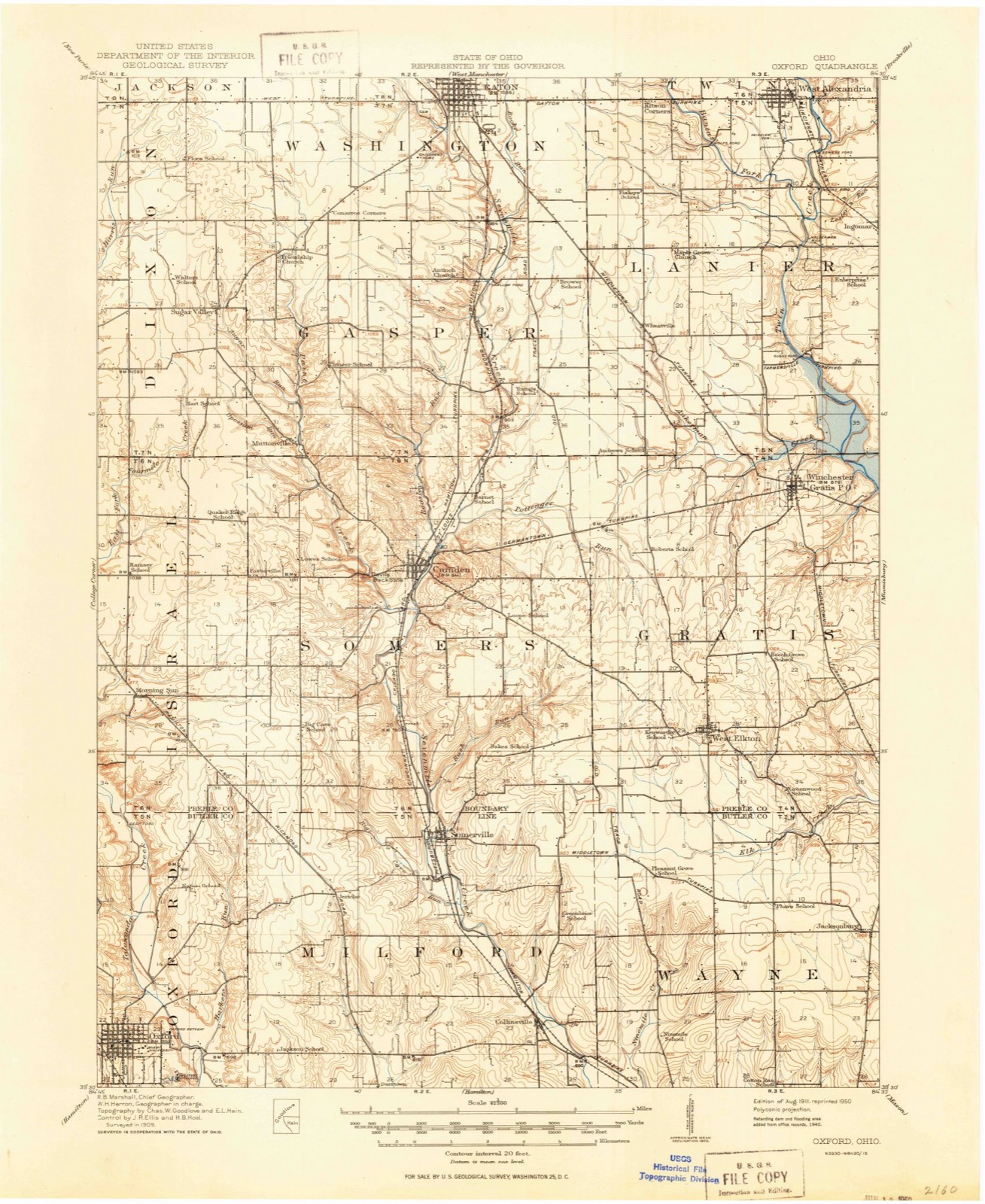
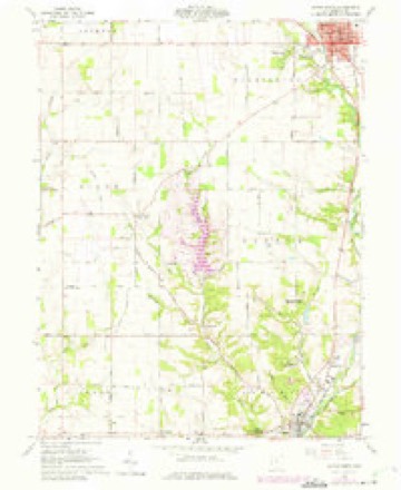
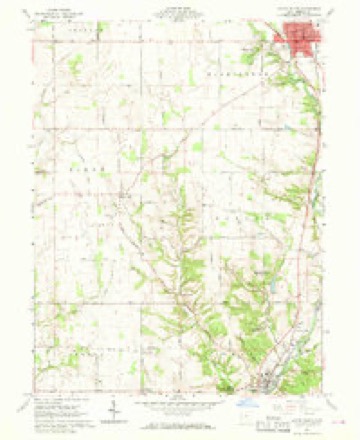
1911 to 1986The same ground, surveyed 75 years apart. Drag the handle to wipe between them. Both sheets are United States Geological Survey originals; neither has been altered.

Compare 1911 against another survey:
Topographic sheets covering this place
11 sheetsMatched by testing this settlement's coordinate against the published boundary of every sheet in the United States Geological Survey's historical collection. Each opens the scanned sheet at the Survey.
- 1911 USGS Oxford quadrangle1:62500
- 1953 USGS Cincinnati quadrangle1:250000
- 1953 USGS Cincinnati quadrangle1:250000
- 1953 USGS Cincinnati quadrangle1:250000
- 1957 USGS Cincinnati quadrangle1:250000
- 1960 USGS Eaton South quadrangle1:24000
- 1960 USGS Eaton South quadrangle1:24000
- 1960 USGS Eaton South quadrangle1:24000
- 1960 USGS Eaton South quadrangle1:24000
- 1986 USGS Dayton quadrangle1:100000
- 1986 USGS Dayton quadrangle1:100000






In the county-history sources
1,164 words on this townshipHistory of Preble County Ohio, published 1881 names this settlement in its chapter on Eaton City. These are the passages that mention it, exactly as the scans read.
In laying before our patrons the history of Preble county, the publishers wish not only to return thanks to all who have given them encouragement in their undertaking and assistance in carrying out their plans, but to make especial acknowledgment of services afforded, and courtesies extended by many citizens of Eaton and of the various townships of the county. Some measure of assistance in collecting and compiling the materials which compose this volume, it is safe to say, has been Fully that number of people have been interviewed by our historians received from, at least, a thousand persons. and note-collectors. While we wish all to feel themselves the recipients. of our gratitude, we desire also to address our thanks personally to a few individuals who have been qualified and enabled, through the possession of, or ability to secure information upon, certain single topics, to lend the members of our writing corps invaluable aid. To the clergy generally, the editors of the several newspapers and the always painstaking and obliging county officials we extend our sincerest thanks for many favors received. Among individuals we feel it our duty even at the risk of being invidious, to mention gratefully-as those from whom important assistance has been secured, Thomas J. Larsh, esq., Judge John V. Campbell, Levin T. McCabe, Judge Curry, S. H. Hubbell, R. G. D. Mc- Kemy, Jacob Chambers, Alfred Demy, C. W. Moore, Frank Mitchell, Dr. F. M. Michael and Robert W. Quinn, esq., all of Eaton, as well as Col. George D. Hendricks and Joseph D. Tracey, late of the same place, and that old-time and always esteemed citizen-of Eaton, now and for many years a resident of Indianapolis - Mr. George Bruce. To the late Dr. W. H. H. B. Minor, whose death has occurred since the inception of this ' work, we have been largely indebted for facts in connection with the history of Eaton.
Passage source: History of Preble County Ohio, published 1881.
Machine-read from a century-old scan, so expect the errors a machine makes: misspelled names, dropped words, stray characters.
Photographs
1 photograph,Taken for the Office of War Information and the Farm Security Administration, who photographed the country between 1935 and 1944. Works of United States government photographers, with no known restriction on use. Each opens its catalogue record.
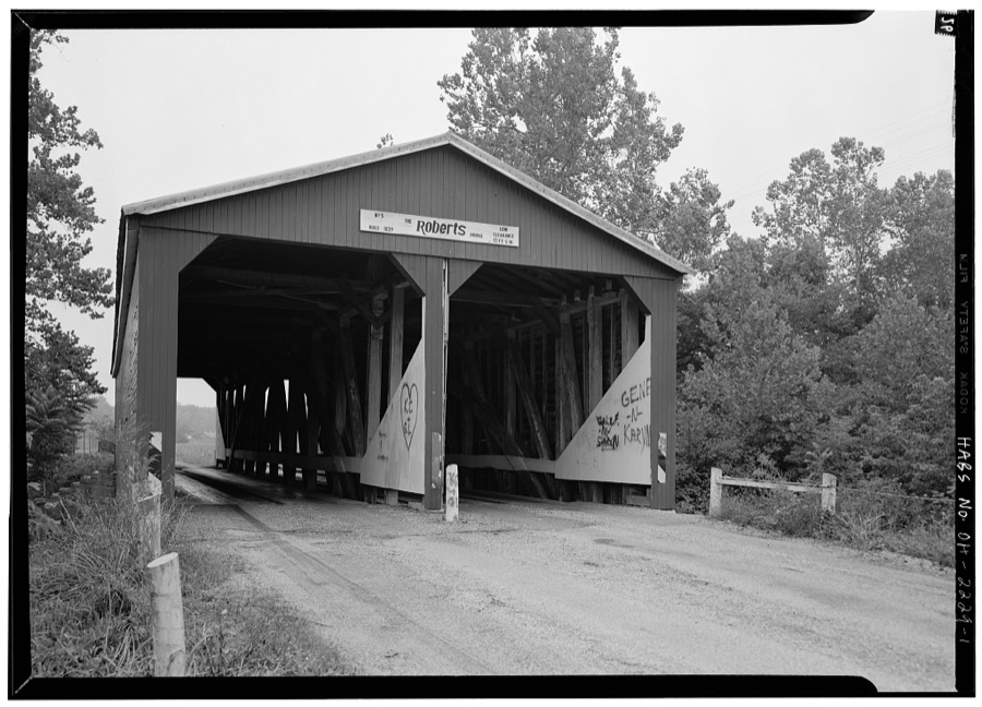
Unattributed, . Library of Congress
Specimens collected near this place
12 of 890 shownRegional context, not property-specific evidence. Museums hold 890 specimens collected within 10 miles of Eaton between 1877 and 1974: 819 Animalia, 46 Fungi, 25 Plantae. 12 distinct Species records are shown. Collected by A.R. Gaufin, H.H. Ross, Arden R. Gaufin, B. Fink and others. Each is a physical object with a catalogue number, and each entry opens the museum's record. This is what was collected and kept, not a survey of what lives here - nothing can be concluded from a species being absent.
| Image | Species | Year | Collected by | Where, as recorded |
|---|---|---|---|---|
 | Fagus grandifolia Ehrh. | 1877 | Matthes,B. | USA, Ohio, Hamilton County, Camden |
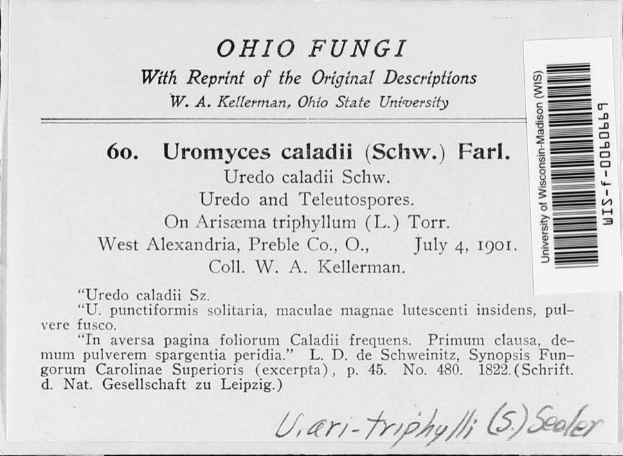 | Uromyces ari-triphylli (Schwein.) Seeler | 1901 | W. A. Kellerman | West Alexandria |
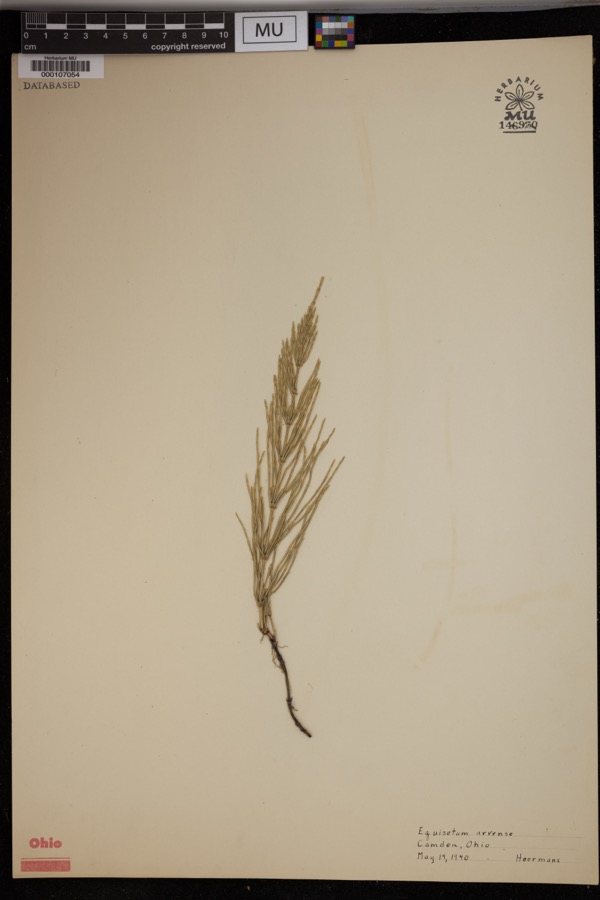 | Equisetum arvense L. | 1940 | Hoermans | Camden. |
 | Uria lomvia lomvia (Linnaeus, 1758) | 1896 | Stewart, R. T. (Robert T.) | Israel Twp, Fairhaven, Preble, Ohio, USA |
 | Phyllosticta Pers., 1818 | 1901 | W. A. Kellerman | |
 | Puccinia circaeae Pers. | 1901 | W. A. Kellerman | West Alexandria |
 | Septoria oenotherae Westend. | 1901 | W. A. Kellerman | |
 | Uromyces caladii (Schwein.) Farl. | 1901 | W. A. Kellerman | West Alexandria |
 | Porella platyphylla (L.) Pfeiff. | 1910 | Braun, Lucy E. | |
 | Collybia zonata (Peck) Sacc. | 1911 | Overholts, L. O. | Camden |
 | Crinipellis zonata (Peck) Sacc. | 1911 | L. O. Overholts | Camden |
 | Gymnopus dryophilus (Bull.) Murrill | 1911 | L. O. Overholts | Camden |
All 890 specimens within 10 miles, at the Global Biodiversity Information Facility.
Storms near this place
60 of 75 shownRegional context, not property-specific evidence. The National Weather Service names Eaton in 75 storm reports between 1994 and 2023: 43 thunderstorm wind, 19 hail, 10 flash flood, 2 flood. No death or injury is recorded in these reports. Each account below is quoted exactly as the forecast office filed it, from the NOAA Storm Events Database, and each date opens the federal record of that event.
| When | Event | Place named | Harm | What the report says |
|---|---|---|---|---|
| March 2020 | Flash Flood | Eaton | $30,000 | Rapidly rising water caused a portion of a basement wall to collapse, flooding the lowest level of the structure. |
| August 2015 | Thunderstorm Wind | Eaton | $30,000 | Fifteen or more large trees were knocked down near Eaton High School. An equipment trailer and a marching band tower were blown over by high wind, and there was damage to fencing at the athletic complex. Also, shingle damage occurred to roofs along Hillcrest Drive from wind and hail. |
| May 2008 | Thunderstorm Wind | Eaton | $20,000 | A two story 100 foot by 100 foot barn was destroyed. A camper was blown into the road near the intersection of US Route 35 and Wayne Trace Road just east of Eaton. |
| May 2022 | Thunderstorm Wind | Eaton | $15,000 | A tree fell onto a car. |
| April 2010 | Thunderstorm Wind | Eaton | $15,000 | A gas station canopy was blown over due to thunderstorm winds. |
| June 2015 | Thunderstorm Wind | Eaton | $12,000 | Twelve power poles were snapped along State Route 122. |
| June 2015 | Thunderstorm Wind | Eaton | $12,000 | Twelve power poles were snapped along State Route 122. |
| June 2021 | Thunderstorm Wind | Eaton | $10,000 | Several trees and power lines were downed in the Eaton area. |
| May 2008 | Thunderstorm Wind | Eaton | $10,000 | A roof was peeled off of a barn, and a few trees were downed. |
| May 2011 | Thunderstorm Wind | Eaton | $8,000 | A truck was overturned due to damaging thunderstorm winds. |
| July 2006 | Flood | Eaton | $7,000 | Numerous roads were flooded and closed. Several homes had flooding in their basements. |
| May 1999 | Thunderstorm Wind | Eaton | $6,000 | A gust of 60 mph was measured by a trained spotter with wind equipment. Also, several trees were knocked down in Camden. |
| July 2023 | Thunderstorm Wind | Eaton | $5,000 | A few trees were downed near the intersection of State Route 127 and Consolidated Road. |
| June 2012 | Thunderstorm Wind | Eaton | $5,000 | A tree fell and knocked down a power pole and line due onto a highway due to damaging thunderstorm winds. Numerous tree limbs were also down in town. |
| March 2011 | Flood | Eaton | $5,000 | Several roads were flooded due to heavy rainfall. |
| July 2000 | Flash Flood | Eaton | $5,000 | Over 2 inches of rain fell in just a few hours causing roads to become flooded. |
| April 1994 | Thunderstorm Wind | Eaton | $5,000 | Trees were downed by winds measured at 60 mph. |
| July 2023 | Thunderstorm Wind | Eaton | $3,000 | A few trees were downed. |
| December 2021 | Thunderstorm Wind | Eaton | $3,000 | Several trees were downed in the Eaton area. |
| June 2020 | Flash Flood | Eaton | $3,000 | Widespread flooding was reported with some cars under water. |
| July 2016 | Thunderstorm Wind | Eaton | $3,000 | Multiple trees were downed in the city of Eaton. |
| June 2015 | Thunderstorm Wind | Eaton | $3,000 | Several large trees were knocked down at the Eaton Country Club. |
| June 2015 | Thunderstorm Wind | Eaton | $3,000 | Several power poles knocked down on Route 122. |
| June 2012 | Thunderstorm Wind | Eaton | $3,000 | Large trees were reported down due to damaging thunderstorm winds. |
| June 2008 | Thunderstorm Wind | Eaton | $3,000 | A few trees were downed. |
| May 2005 | Thunderstorm Wind | Eaton | $3,000 | Trees and power lines were knocked down near the intersection of US Route 40 and Gettysburg Road. |
| June 2005 | Thunderstorm Wind | Eaton | $3,000 | A few large limbs were downed. |
| May 2004 | Thunderstorm Wind | Eaton | $3,000 | Trees and power lines were downed. |
| June 2002 | Thunderstorm Wind | Eaton | $3,000 | Large tree limbs were downed with patio furniture destroyed at a residence. |
| June 2001 | Flash Flood | Eaton | $3,000 | Street flooding reported in town |
| February 1999 | Thunderstorm Wind | Eaton | $3,000 | Trees and power poles were knocked down. |
| August 1998 | Thunderstorm Wind | Eaton | $3,000 | Numerous large limbs downed. |
| November 2020 | Thunderstorm Wind | Eaton | $2,000 | A few trees were downed on the south side of Eaton. |
| August 2019 | Thunderstorm Wind | Eaton | $2,000 | Some lights and signs were damaged on a few buildings along U.S. 127 North. |
| June 2015 | Thunderstorm Wind | Eaton | $2,000 | Power poles were knocked down on U.S. Route 35 near the Henny Penny Corporation. |
| May 2004 | Thunderstorm Wind | Eaton | $2,000 | Two trees were knocked down. |
| June 2001 | Flash Flood | Eaton | $2,000 | A few streets flooded in and around town |
| December 2015 | Thunderstorm Wind | Eaton | $1,500 | One large tree was knocked down. |
| December 2015 | Thunderstorm Wind | Eaton | $1,500 | One large tree was knocked down. |
| June 2022 | Thunderstorm Wind | Eaton | $1,000 | A large tree was downed on Eaton Gettysburg Road. |
| July 2020 | Thunderstorm Wind | Eaton | $1,000 | A healthy 18 to 24 inch diameter tree was uprooted. |
| February 2017 | Thunderstorm Wind | Eaton | $1,000 | One foot diameter tree, which was at least 60 feet tall, was knocked down on Antioch Road. |
| July 2017 | Thunderstorm Wind | Eaton | $1,000 | Numerous tree limbs were downed. |
| July 2017 | Thunderstorm Wind | Eaton | $1,000 | A large tree was downed near State Route 122. |
| June 2014 | Flash Flood | Eaton | $1,000 | Flash flooding was reported along Vine Street due to heavy rainfall. |
| July 2012 | Thunderstorm Wind | Eaton | $1,000 | Several trees were reported down due to damaging thunderstorm winds. |
| April 2011 | Heavy Rain | Eaton | $1,000 | Roads were closed due to high water from heavy rainfall. |
| September 2006 | Hail | Eaton | $1,000 | no account filed |
| June 2016 | Thunderstorm Wind | Eaton | $500 | One large branch was downed. |
| July 2016 | Thunderstorm Wind | Eaton | $500 | A tree was downed onto Maple Street. |
| June 2015 | Thunderstorm Wind | Eaton | $500 | Two large limbs were knocked down. |
| March 2020 | Flash Flood | Eaton | - | Water was running over Waynes Trace Road. |
| June 2020 | Flash Flood | Eaton | - | A manhole cover was being pushed up by water in Eaton. |
| April 2018 | Flash Flood | Eaton | - | Water was covering the road. |
| April 2018 | Flash Flood | Eaton | - | Water was covering the road. |
| June 2009 | Hail | Eaton | - | One and three quarter inch to two inch hail fell in Eaton. Reported by spotters and public. |
| September 2000 | Thunderstorm Wind | Eaton | - | A 65 mph wind gust was reported by a spotter. |
| July 2020 | Hail | Eaton | - | no account filed |
| July 2016 | Hail | Eaton | - | no account filed |
| April 2012 | Hail | Eaton | - | no account filed |
Newspapers printed here
0 digitised pages5 papers published in this town, digitised by the Library of Congress and free to read: 0 issues, 0 pages. Every page is searchable, so a name or a street can be looked for directly in what the town printed about itself at the time.
| Newspaper | Published |
|---|---|
| The Democratic Press | 1860 to 1865 |
| The Eaton Democrat | 1875 to 1903 |
| Eaton Weekly Democrat | 1866 to 1875 |
| Preble County Democrat | 1857 to 1859 |
| Eaton Democrat | 1843 to 1856 |
What the paper printed
109,178 wordsFront pages of the local paper, read from the Library of Congress scans: 22 issues spread across its run from 1847 to 1887, 109,178 words in total. Each is reproduced on its own page, exactly as the recogniser returned it.
These pages read less well than anything else here, and the number is worth stating: about three words in four come through cleanly, against nine in ten for the building records. An 1896 broadsheet sets eight-point type in seven columns on microfilm, which is the hardest thing in this archive to read by machine. We tested our own recognisers against the Library's and they were not better, so the Library's text is what appears, with the wholly unreadable columns removed. Read it as a guide to what the paper covered, and follow the link to the scan before quoting anything.
| Issue | Paper | Length |
|---|---|---|
| 1847-07-22 | Eaton Democrat | 2,839 words |
| 1856-12-19 | Eaton Democrat | 2,608 words |
| 1857-01-08 | Preble County Democrat | 4,417 words |
| 1857-03-26 | Preble County Democrat | 5,043 words |
| 1857-06-11 | Preble County Democrat | 4,445 words |
| 1857-08-20 | Preble County Democrat | 5,338 words |
| 1857-11-05 | Preble County Democrat | 5,116 words |
| 1870-04-07 | Eaton Weekly Democrat | 2,369 words |
| 1870-06-02 | Eaton Weekly Democrat | 6,940 words |
| 1870-07-28 | Eaton Weekly Democrat | 7,805 words |
| 1870-10-13 | Eaton Weekly Democrat | 7,903 words |
| 1873-12-25 | Eaton Weekly Democrat | 5,627 words |
| 1860-08-30 | The Democratic Press | 4,262 words |
| 1860-09-20 | The Democratic Press | 3,210 words |
| 1860-10-18 | The Democratic Press | 5,172 words |
| 1860-11-08 | The Democratic Press | 3,160 words |
| 1860-12-27 | The Democratic Press | 3,626 words |
| 1875-06-03 | The Eaton Democrat | 6,051 words |
| 1875-07-29 | The Eaton Democrat | 5,129 words |
| 1875-09-16 | The Eaton Democrat | 6,027 words |
| 1875-11-11 | The Eaton Democrat | 5,353 words |
| 1887-06-30 | The Eaton Democrat | 6,738 words |
Nearest settlements
The eight closest, with where each one stands in the county. Distances are straight-line, computed from the Geographic Names Information System coordinates.
| Map | Place | Distance | Sheets |
|---|---|---|---|
| Oklahoma (historical) | 2.9 miles | 8 | |
| Ransom | 3.0 miles | 10 | |
| Sampleville | 3.2 miles | 10 | |
| Lake Lakengren | 4.9 miles | 11 | |
| Wheatville | 5.0 miles | 10 | |
| Brennersville | 5.1 miles | 8 | |
| New Hope | 5.2 miles | 8 | |
| Sugar Valley | 5.4 miles | 11 |
Elsewhere
Matched on this settlement's Geographic Names Information System number rather than its name, so it cannot be a different place of the same name in another state.
| Wikipedia article on Eaton | An encyclopaedic summary. Its text is share-alike, so it is linked here rather than copied. |
| Wikidata item Q1000148 | The structured record the population and elevation above come from. Public domain (CC0). |
Provenance
This settlement is recorded in the Geographic Names Information System as feature 1040043. The sheet list is computed by point-in-boundary test against the United States Geological Survey's historical topographic inventory. Both are works of the United States government and carry no copyright under 17 U.S.C. 105.
Specimens. Global Biodiversity Information Facility (GBIF), https://www.gbif.org/. Only records licensed CC0 or CC BY are used. Records licensed CC BY-NC are excluded because this site carries advertising. Images are checked individually and any whose licence is non-commercial, no-derivatives or unreadable is refused.
Storms. NOAA National Centers for Environmental Information, Storm Events Database https://www.ncei.noaa.gov/stormevents/ A work of the United States government, no copyright under 17 U.S.C. 105. Narratives are quoted verbatim from the National Weather Service report and are not edited or summarised.