 Block
Block
Sidney, Ohio
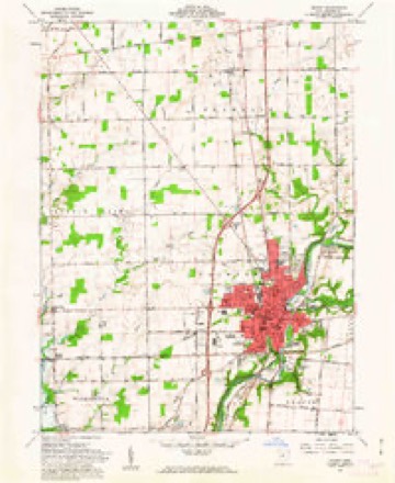
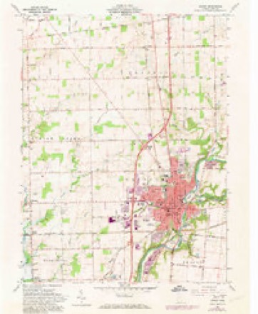
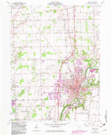
15 topographic sheets cover this place, the earliest surveyed in 1913 and the latest in 1986. It stands in Clinton Township. It lies in ZIP code area 45365. It stands on Starrett Run. The Survey maps it on the Sidney quadrangle. 20,589 people lived here at the 2020 count. It stands 951 feet above sea level.
Research this city
This curated hub for Shelby County, Ohio brings together the page's documented record links, visible map or image evidence where published, and routes to related local records.
What is documented here?
Use the page's provenance and linked records to distinguish the source material from the site's navigation and summaries.
How should I cite it?
Open the original record, preserve its repository and identifier, then use the citation tool for this page as a path back to the source.
Where should I go next?
Follow the county or state hub for related places and records, then use the guide for a source-aware research sequence.
Population over time
2 figuresSidney fell from 21,229 to 20,589 between 2010 and 2020. These are the recorded population figures Wikidata holds for this place, reached through the Geographic Names Information System number this page is keyed on rather than by name, so they belong to this place and not to another of the same name. Most are census counts, but not all are: an early figure may be a founding or settlement estimate. The change column is computed, and is left blank where more than 20 years separate a figure from the one before it, because a gap that long is not a change between two counts.
| Year | People | Change |
|---|---|---|
| 2010 | 21,229 | |
| 2020 | 20,589 | -640 (-3%) |
Then and now
1913 to 1986The same ground, surveyed 73 years apart. Drag the handle to wipe between them. Both sheets are United States Geological Survey originals; neither has been altered.

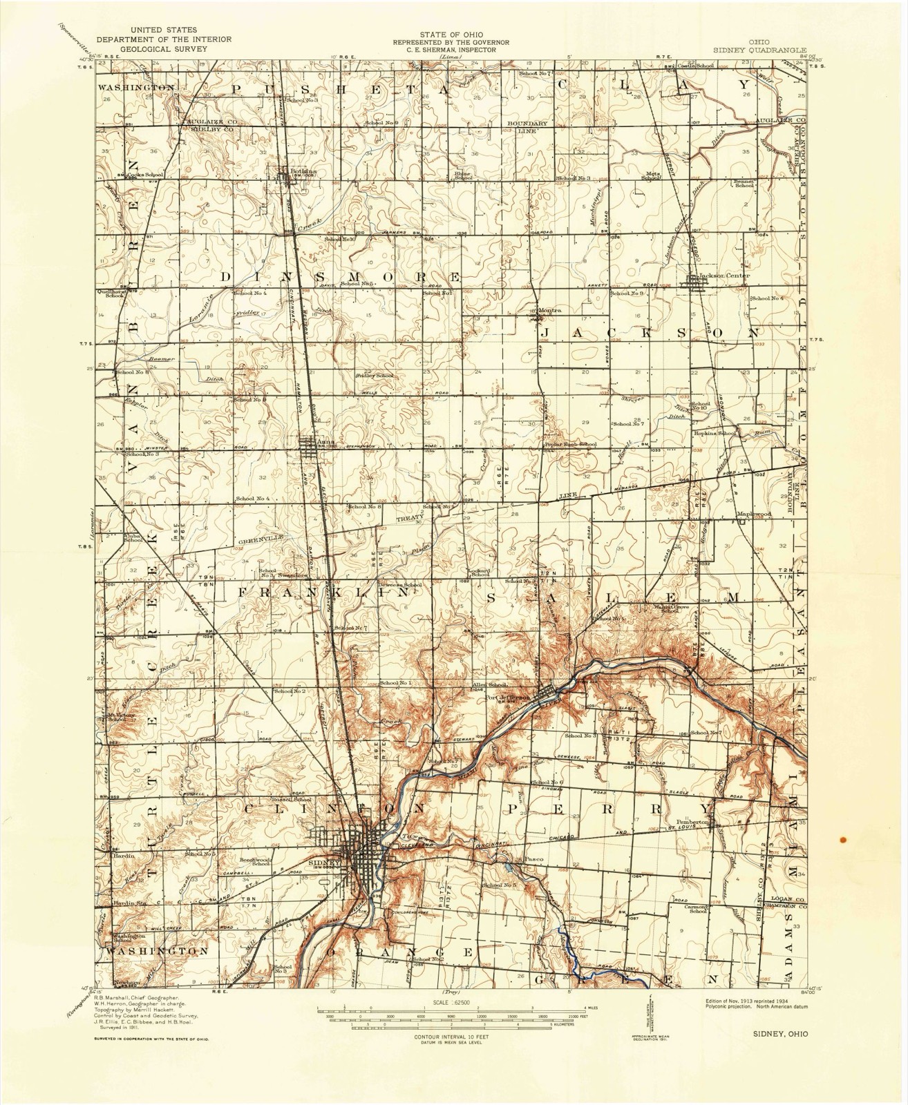
Topographic sheets covering this place
15 sheetsMatched by testing this settlement's coordinate against the published boundary of every sheet in the United States Geological Survey's historical collection. Each opens the scanned sheet at the Survey.
- 1913 USGS Sidney quadrangle1:62500
- 1913 USGS Sidney quadrangle1:62500
- 1944 USGS Sidney quadrangle1:62500
- 1953 USGS Muncie quadrangle1:250000
- 1953 USGS Muncie quadrangle1:250000
- 1953 USGS Muncie quadrangle1:250000
- 1953 USGS Muncie quadrangle1:250000
- 1953 USGS Muncie quadrangle1:250000
- 1956 USGS Muncie quadrangle1:250000
- 1961 USGS Sidney quadrangle1:24000
- 1961 USGS Sidney quadrangle1:24000
- 1961 USGS Sidney quadrangle1:24000
- 1986 USGS Piqua quadrangle1:100000
- 1986 USGS Piqua quadrangle1:100000
- 1986 USGS Piqua quadrangle1:100000









What happened here
An account from the chapter on Clinton township, The inset identifies its exact source book and publication year.
Introduction
Less than nine centuries since, the historic period of the Western Continent - the new world - was ushered in. Let us pause a moment and recall the achievements of the actors in the great drama of discover}', settlement, colonization, and nationality. With our own territory extending from the Atlantic to the Pacific, and from the great cool lakes to the broad warm gulf, it also embraces a separate territory bordering the Frozen Ocean and clasping hands with the great Asiatic Continent, almost linking that continent with British North America.
In the county-history sources
273,811 words on this townshipHistory of Shelby County, Ohio, published 1883 names this settlement in its chapter on Clinton Township. These are the passages that mention it, exactly as the scans read.
In the summer of 1002f Lief and his companions sailed southwesterly, until they saw land, flat along the shore, with snow-capped mountains at a distance from the sea. Farther south they found another country of heavy timber and no mountains. Here they rested a few hours, and t A Norse navigator, Herjulfson, sailing from Iceland to Greenland in the year 986 was driven by a storm to Newfoundland or Labrador, but after being driven about at length reached Greenland, without having landed in the new country of which he related marvellous stories.
Passage source: History of Shelby County, Ohio, published 1883.
This county is situated in the second tier of counties from the boundary line between Indiana and Ohio, and about half-way of the State from north to south. It is bounded on the north by Auglaize County', on the east by Logan and Champaign, on the south by Miami, and on the west by Darke and Auglaize. The county seat is Sidney. The water-shed between the Maumee and Miami River systems is partly in the northern part of this county. The road known ns the Kettler turnpike, in a general way, may be regarded ns marking the line of the water shed, at least for some miles of its course, nearest the Loramie Reservoir. The watershed bears to the northeast, after leaving this county, into Hardin and Wyandot counties.
Passage source: History of Shelby County, Ohio, published 1883.
At Cincinnati, low water in the Ohio River is four hundred and thirtytwo feet above tide-water, and the water in the Sidney feeder is five hundred and twelve feet above low water in the Ohio, or nine hundred and forty-four feet above tide-water. The greatest elevation yet measured in the county is one hundred and thirty-four feet, on the Tawawa turnpike, east of the Miami River. The line between this county and Champaign, on this turnpike, is one hundred and twenty-one feet above the water in the feeder. The greatest elevation on the line of the Stewart turnpike is one hundred and twenty-one feet, and on the line between Shelby and Logan counties one hundred and eleven feet above the water in the canal. On the Infirmary turnpike the greatest elevation is eightv-seven feet, and at the end of this road, on the line between this county ami Miami, it is forty feet below the level of the canal. On the St. Marys turnpike, about two miles from Sidney, the highest point is reached at one hundred and twelve feet above the water in the canal. The bottom of the reservoir is about eight feet above the water in the canal. The main canal extends entirely across the county, running in a northwesterly direction from a point on the southern boundary line about midway of the county, from east to west. The Sidney feeder is twelve miles in length, and extends from Port Jefferson to Lockington, and is the channel through which the water from the great reservoir at Lewistown reaches the summit level of the canal. The Sidney feeder and the main canal above Lockington are on the same level, and the, water from the Lewistown reservoir flows indifferently north or south. The summitlevel of the Miami and Erie Canal is, therefore, the same as that of the Sidney feeder - nine hundred and forty-four feet above the level of the sea. The highest land in the county (so far as any measurements have extended) is one thousand anil seventy-eight feet above tide-water, and six hundred and forty-six feet above low water in the Ohio River at Cincinnati. To aid in the comparison of the elevations in this county with other portions of the State, I will here give a few measurements taken from Prof. Orton's Report of the Geology of Highland County, in the volume for 1870, p. 258. At the head-waters of the Scioto and Miami rivers, in Logan County, an elevation is given, on the authority of Col. C. Whittlesey* of one thousand three hundred and forty-four feet, which is two hundred and sixty-six feet greater than any in Shelby County. A measurement still greater is given of a summit in Richland County, one thousand three hundred and eighty-nine feet above the level of the sea. The highest land in the Stale, so far as known, is a point. about three miles northeast of Bellefontaine. Its elevation above the sea, as determined by Prof. F. C. Hill, for the Geological Survey, is fifteen hundred and forty-four feet. The summit-level of the canal in this county is four hundred feet lower than the water-shed between the Miami and Scioto rivers in Logan County. This statement will show the resources of the canal for water supply in this direction. The surface drainage and spring-water of a surface of about nine hundred square miles, must be available at the head-waters of the Miami as a supply for the canal above the summit-level - one-half of which, with other resources, would float a tonnage greater than was ever floated in the canal.
Passage source: History of Shelby County, Ohio, published 1883.
Machine-read from a century-old scan, so expect the errors a machine makes: misspelled names, dropped words, stray characters.
Read the whole chapter on Clinton Township - it names this place 279 more 279 times.
Specimens collected near this place
12 of 225 shownRegional context, not property-specific evidence. Museums hold 225 specimens collected within 10 miles of Sidney between 1897 and 1967: 185 Animalia, 21 Fungi, 18 Plantae, 1 Unrecorded. 12 distinct Species records are shown. Collected by A. R. Gaufin, A.R. Gaufin, A.R. Gaufin, H.H. Ross and others. Each is a physical object with a catalogue number, and each entry opens the museum's record. This is what was collected and kept, not a survey of what lives here - nothing can be concluded from a species being absent.
| Image | Species | Year | Collected by | Where, as recorded |
|---|---|---|---|---|
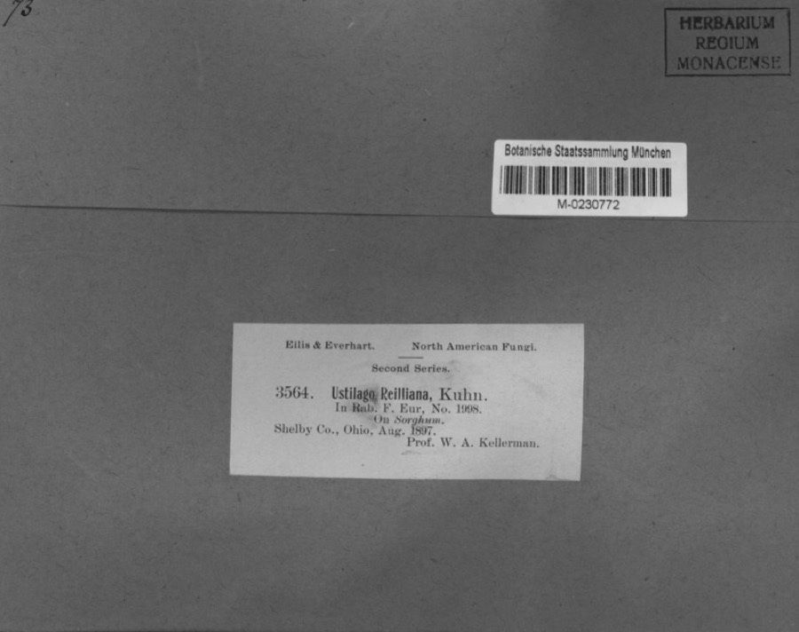 | Sorghum Moench | 1897 | Kellerman, W.A. | Shelby Co., Ohio. |
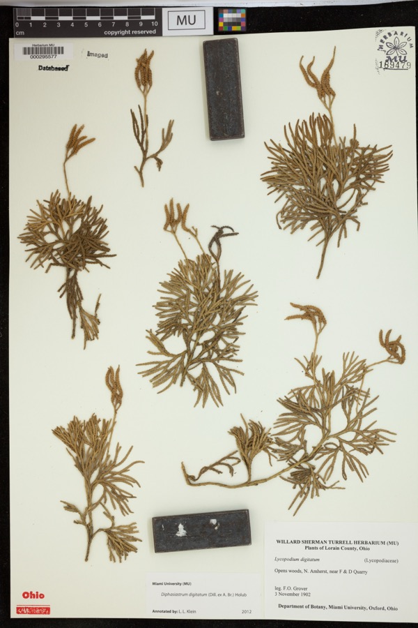 | Diphasiastrum digitatum (Dill. ex A.Braun) Holub | 1902 | Grover, F.O. | Opens woods, N. Amherst, near F & D Quarry |
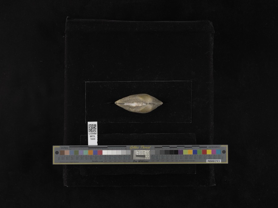 | Fusconaia flava (Rafinesque, 1820) | 1939 | not recorded | Miami River |
| unnamed | 1897 | WA Kellerman | Shelby County | |
 | Carex shortiana Dewey & Torr. | 1897 | Wetzstein, A. | |
 | Cercosporina apii (Fresen.) Miura | 1897 | Selby A. D. | Kirkwood |
| Sorosporium reilianum (J.G.Kühn) McAlpine | 1897 | W. A. Kellerman | ||
 | Sphacelotheca reiliana (J.G.Kühn) G.P.Clinton | 1897 | Kellerman W. A. | Shelby Co. |
 | Ustilago reiliana J.G.Kühn | 1897 | Kellerman, W.A. | Shelby County, Ohio. |
 | Accipiter cooperii (Bonaparte, 1828) | 1904 | Henninger, W. F. (Walther Frederick) | New Bremen, Shelby, Ohio, USA |
 | Hirneola auricula-judae (Bull.) Berk. | 1909 | Fisher G. Clyde | Sidney |
 | Gymnosporangium juniperi-virginianae Schwein. | 1914 | Russell A. B. | Sidney |
All 225 specimens within 10 miles, at the Global Biodiversity Information Facility.
Mines and quarries near this place
9 within 5 milesRegional context, not property-specific evidence. The federal mineral resources record lists 9 workings within 5 miles of Sidney: 4 past producers, 3 producers, 1 plant, 1 unknown. 4 still produce. What was taken out: Sand and Gravel, Construction, Stone, Crushed/Broken, Limestone, General. Distance is straight-line from the map coordinates, so a quarry counted here may appear on a neighbouring settlement's page as well.
| Where | Site | Commodity | Status | Recorded |
|---|---|---|---|---|
| Rock Run Quarry | Limestone, General | Past Producer | Sedimentary | |
| Rock Run Quarry | Stone, Crushed/Broken | Past Producer | ||
| Spring Creek Quarry | Stone, Crushed/Broken | Producer | ||
| Morelock Pit | Sand and Gravel, Construction | Producer | ||
| Norelock Pit | Sand and Gravel, Construction | Past Producer | Sedimentary | |
| Plant Number 2 and Pit | Sand and Gravel, Construction | Past Producer | Sedimentary | |
| Port Jefferon Quarry | Sand and Gravel, Construction | Producer | ||
| Sidney Sand & Gravel Pit No 2 | Sand and Gravel, Construction | Plant | ||
| Staley Farm Quarry | Sand and Gravel, Construction | Unknown |
Storms near this place
60 of 111 shownRegional context, not property-specific evidence. The National Weather Service names Sidney in 111 storm reports between 1994 and 2025: 66 thunderstorm wind, 22 hail, 15 flood, 4 flash flood. The reports record 1 death. Each account below is quoted exactly as the forecast office filed it, from the NOAA Storm Events Database, and each date opens the federal record of that event.
| When | Event | Place named | Harm | What the report says |
|---|---|---|---|---|
| July 2022 | Lightning | Sidney | 1 killed | A truck driver was killed by lightning along I-75 while fixing a mechanical issue with his truck. M50OU. |
| July 1994 | Thunderstorm Wind | Sidney | $50,000 | A grain silo and trees were downed on State Route 705. |
| April 1995 | Thunderstorm Wind | Sidney | $30,000 | Trees were downed, and a 60 by 60 foot pole barn was destroyed. |
| August 2009 | Thunderstorm Wind | Sidney | $23,000 | Thunderstorm winds caused damage to trees, a roof on a mobile home, and windows. Nickel to quarter size hail was also reported. |
| April 2006 | Thunderstorm Wind | Sidney | $20,000 | Three homes and a barn sustained structural damage. A business on Schenk Road had part of its roof removed. |
| April 2007 | Thunderstorm Wind | Sidney | $15,000 | Two barns had their tin roofs removed and a wooden fence was downed around a pool along Hardin-Wapakoneta Road. Several trees and power poles were also knocked down in this vicinity. |
| June 2006 | Thunderstorm Wind | Sidney | $15,000 | Numerous trees and large limbs were downed across the northern half of the county. One tree fell on a vehicle and another on a house in Sidney, causing minor damage to both. |
| July 2003 | Thunderstorm Wind | Sidney | $15,000 | Several homes were damaged by falling trees. Numerous trees and limbs were knocked down, and a few road signs were blown over. A 63 mph gust was measured in Anna. |
| July 2003 | Thunderstorm Wind | Sidney | $15,000 | Trees and limbs were downed. Fifteen homes and a few automobiles sustained minor damage from fallen trees. |
| August 2000 | Thunderstorm Wind | Sidney | $15,000 | Thunderstorm winds downed trees, some of which fell across roads and on cars. |
| June 2008 | Hail | Sidney | $12,000 | no account filed |
| July 2023 | Thunderstorm Wind | Sidney | $10,000 | A tree fell onto a car. |
| July 2015 | Thunderstorm Wind | Sidney | $10,000 | Four power poles were knocked down along State Route 47. |
| August 2000 | Thunderstorm Wind | Sidney | $10,000 | Numerous trees and power lines downed. |
| July 1998 | Thunderstorm Wind | Sidney | $10,000 | Trees downed. |
| November 1996 | Thunderstorm Wind | Sidney | $10,000 | no account filed |
| May 2025 | Thunderstorm Wind | Sidney | $8,000 | Multiple trees as well as some power lines were downed. In the same area, lightning struck a utility pole, causing a nearby tree to catch on fire. |
| July 2025 | Thunderstorm Wind | Sidney | $6,000 | Multiple trees were downed along Main Street, taking out several power lines. |
| July 2002 | Thunderstorm Wind | Sidney | $6,000 | A few trees were blown down. Minor damage occurred at the EMA building. |
| June 2025 | Thunderstorm Wind | Sidney | $5,000 | Several large trees were downed on the south side of Sidney, including on Franklin and Ohio Avenues. |
| March 2011 | Flood | Sidney | $5,000 | Roads were closed across the area due to heavy rainfall and previous snow melt. Flooding began around 0754 EST on February 28th and ended around 0900 on March 2nd. Damage estimates for February were around five-thousand dollars. |
| February 2011 | Flood | Sidney | $5,000 | Roads were closed across the area due to heavy rainfall and previous snow melt. Flooding began around 0754 EST on February 28th and ended around 0900 EST on March 2nd. Damage estimates for March were around five-thousand dollars. |
| March 2007 | Flood | Sidney | $5,000 | Many roads were flooded throughout the county. |
| July 2006 | Flood | Sidney | $5,000 | Cooper and Cisco Roads were flooded. Several cars were flooded in a parking lot at the Shelby County Fairgrounds. |
| April 2000 | Thunderstorm Wind | Sidney | $5,000 | Trees knocked down. |
| May 1999 | Thunderstorm Wind | Sidney | $5,000 | Large trees were blown over as well as a semitrailer on Interstates 75 and 274. |
| June 1994 | Thunderstorm Wind | Sidney | $5,000 | Trees were downed. |
| June 1994 | Thunderstorm Wind | Sidney | $5,000 | Trees were downed, some on power lines. |
| June 2008 | Hail | Sidney | $5,000 | no account filed |
| August 1994 | Thunderstorm Wind | Sidney | $5,000 | no account filed |
| November 2005 | Thunderstorm Wind | Sidney | $4,000 | Large limbs to 2.5 feet in diameter were knocked down along Main Street and Russel Road. |
| August 2024 | Thunderstorm Wind | Sidney | $3,000 | A tree fell on a power line. |
| May 2022 | Thunderstorm Wind | Sidney | $3,000 | A few trees were downed. |
| May 2020 | Thunderstorm Wind | Sidney | $3,000 | Several trees were downed in the Sidney area. |
| June 2020 | Thunderstorm Wind | Sidney | $3,000 | A couple of trees were knocked down in the Sidney area. A tree was also knocked down near Port Jefferson. |
| August 2019 | Thunderstorm Wind | Sidney | $3,000 | Trees were knocked down. |
| August 2019 | Thunderstorm Wind | Sidney | $3,000 | A healthy tree of unknown size was knocked down onto a vehicle along South Miami Avenue. |
| July 2013 | Thunderstorm Wind | Sidney | $3,000 | Several trees were downed or uprooted near Port Jefferson Road and Terrace Drive due to thunderstorm winds. |
| July 2012 | Thunderstorm Wind | Sidney | $3,000 | Trees were downed on the west end of Sydney due to damaging thunderstorm winds. Power outages were also reported. |
| March 2007 | Flood | Sidney | $3,000 | A couple of roads were flooded and closed.| |
| May 2006 | Thunderstorm Wind | Sidney | $3,000 | Trees were knocked down. |
| August 2005 | Thunderstorm Wind | Sidney | $3,000 | Large limbs were downed. |
| July 2003 | Thunderstorm Wind | Sidney | $3,000 | Several trees were knocked down. |
| July 2003 | Thunderstorm Wind | Sidney | $3,000 | Trees were downed on Miami River Road. |
| May 2003 | Thunderstorm Wind | Sidney | $3,000 | Several tress were knocked down. |
| February 1999 | Thunderstorm Wind | Sidney | $3,000 | Trees knocked down. |
| July 1999 | Thunderstorm Wind | Sidney | $3,000 | Trees downed. |
| June 2025 | Thunderstorm Wind | Sidney | $2,000 | A tree was downed on a power line on South Ohio Street. |
| June 2020 | Thunderstorm Wind | Sidney | $2,000 | Several trees were knocked down on Foraker Avenue. |
| June 2017 | Thunderstorm Wind | Sidney | $2,000 | One tree was knocked down on the courthouse square in Sidney. The tree damaged a nearby flag pole. |
| June 2010 | Flash Flood | Sidney | $2,000 | Numerous streets were flooded due to heavy rainfall. |
| October 2010 | Thunderstorm Wind | Sidney | $2,000 | Trees were reported down due to damaging thunderstorm winds. |
| April 2007 | Thunderstorm Wind | Sidney | $2,000 | Power lines were blown down from the thunderstorm winds. |
| July 2006 | Thunderstorm Wind | Sidney | $2,000 | A couple of trees were knocked down along Sidney-Plattsville and McCloskey School Roads. |
| June 2004 | Thunderstorm Wind | Sidney | $2,000 | Two trees were downed. |
| May 2002 | Thunderstorm Wind | Sidney | $2,000 | Two trees were downed. |
| August 2023 | Thunderstorm Wind | Sidney | $1,000 | A large tree was downed along a roadway. |
| June 2020 | Thunderstorm Wind | Sidney | $1,000 | A portion of a large tree was knocked down in the 800 block of South Miami Avenue. |
| June 2016 | Thunderstorm Wind | Sidney | $1,000 | A tree was reported down at Custenborder Field Park. |
| August 2016 | Thunderstorm Wind | Sidney | $1,000 | One tree was knocked down in Orange Township. |
Nearest settlements
The eight closest, with where each one stands in the county. Distances are straight-line, computed from the Geographic Names Information System coordinates.
| Map | Place | Distance | Sheets |
|---|---|---|---|
| Buckeye Terrace | 0.8 miles | 15 | |
| Lakeside Village | 1.7 miles | 15 | |
| Pasco | 2.9 miles | 15 | |
| Hickory Dell Estates | 3.0 miles | 16 | |
| Depew | 4.1 miles | 15 | |
| Port Jefferson | 4.5 miles | 15 | |
| Hardin | 4.6 miles | 15 | |
| Newbern | 5.1 miles | 15 |
Elsewhere
Matched on this settlement's Geographic Names Information System number rather than its name, so it cannot be a different place of the same name in another state.
| Wikipedia article on Sidney | An encyclopaedic summary. Its text is share-alike, so it is linked here rather than copied. |
| Wikidata item Q998626 | The structured record the population and elevation above come from. Public domain (CC0). |
Provenance
This settlement is recorded in the Geographic Names Information System as feature 1065321. The sheet list is computed by point-in-boundary test against the United States Geological Survey's historical topographic inventory. Both are works of the United States government and carry no copyright under 17 U.S.C. 105.
Specimens. Global Biodiversity Information Facility (GBIF), https://www.gbif.org/. Only records licensed CC0 or CC BY are used. Records licensed CC BY-NC are excluded because this site carries advertising. Images are checked individually and any whose licence is non-commercial, no-derivatives or unreadable is refused.
Mines and quarries. USGS Mineral Resources Data System (MRDS) https://mrdata.usgs.gov/mrds/ A work of the United States government, no copyright under 17 U.S.C. 105.
Storms. NOAA National Centers for Environmental Information, Storm Events Database https://www.ncei.noaa.gov/stormevents/ A work of the United States government, no copyright under 17 U.S.C. 105. Narratives are quoted verbatim from the National Weather Service report and are not edited or summarised.