Block
From the record
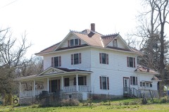
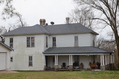
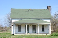
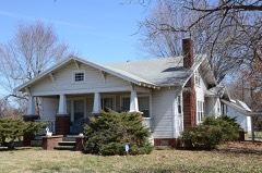
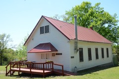
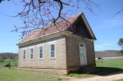
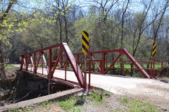
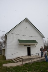
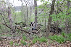
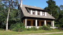
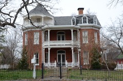
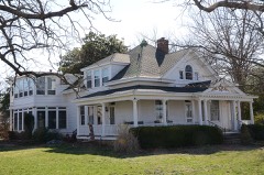
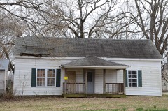
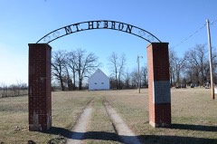
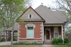
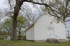
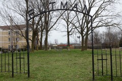
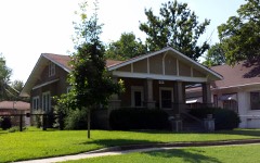
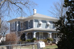
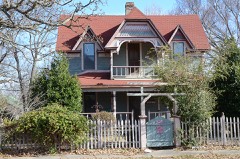
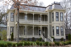
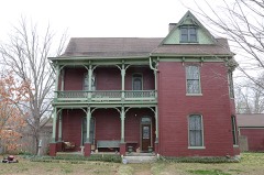
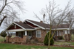
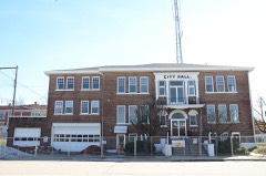
162 National Register listings published here.
Sources: the National Register database, National Park Service
93 topographic sheets cover 137 settlements here, and 162 properties are on the National Register of Historic Places.
162 National Register listings published here.
Sources: the National Register database, National Park Service
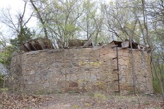
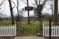
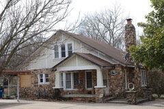
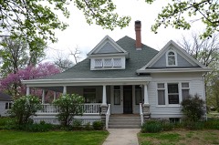
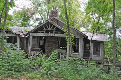
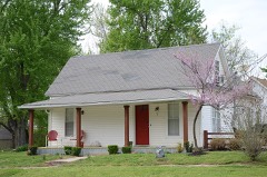
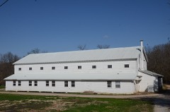
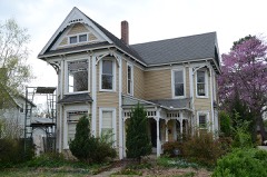
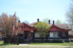
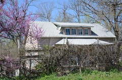
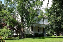
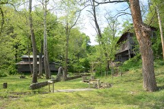
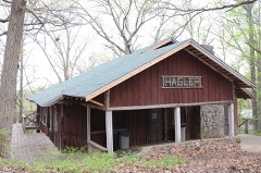
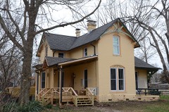
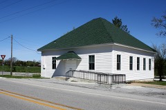
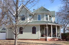
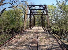
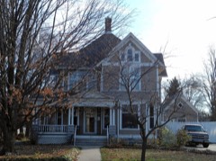
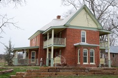
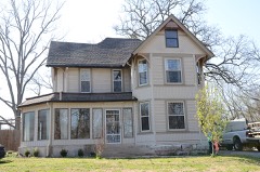
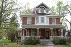
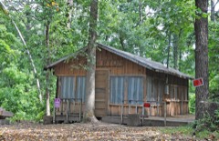
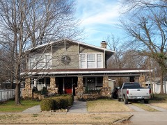
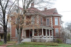
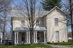
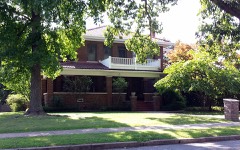
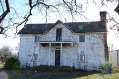
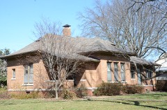
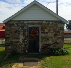
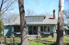
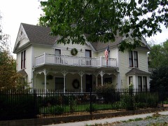
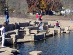
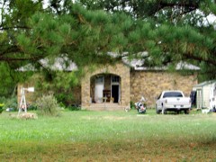
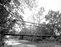
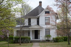
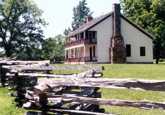
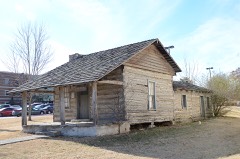
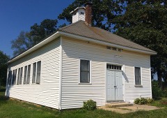
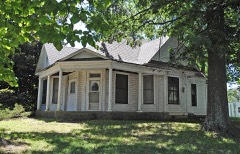
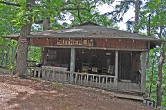
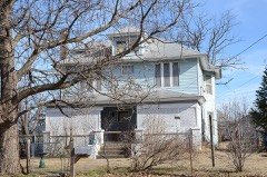
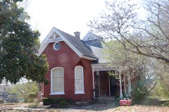
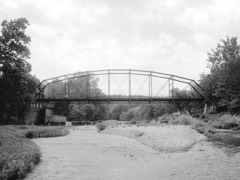
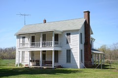
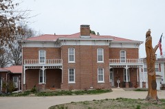
Every property in this county listed on the National Register of Historic Places, with the year it was listed and the federal nomination document.
Every wildfire the federal occurrence database records inside this county: 419 of them, burning about 12,437 acres. 22 started naturally and 142 were recorded as arson. Each settlement page carries the fires within five miles of it.
| Reported cause | Fires |
|---|---|
| Missing data/not specified/undetermined | 146 |
| Arson/incendiarism | 142 |
| Debris and open burning | 78 |
| Natural | 22 |
| Equipment and vehicle use | 13 |
| Smoking | 10 |
| Recreation and ceremony | 2 |
| Misuse of fire by a minor | 2 |
| Power generation/transmission/distribution | 2 |
| Railroad operations and maintenance | 1 |
| Fireworks | 1 |
The five largest, by the area the report gives. Five of them were set deliberately.
| Date | Cause | Size | Reported by | Name on the report |
|---|---|---|---|---|
| 5 August 2011 | Missing data/not specified/undetermined | 994 acres | Arkansas Forestry Commission | HONEY CREEK |
| 3 September 2011 | Arson/incendiarism | 875 acres | Arkansas Forestry Commission | BUTLER CREEK |
| 9 March 1996 | Arson/incendiarism | 706 acres | Pea Ridge National Military Park | ABOUT TIME |
| 23 February 1995 | Arson/incendiarism | 530 acres | Pea Ridge National Military Park | ROUNDTOP |
| 2 August 2012 | Natural | 380 acres | Arkansas Forestry Commission | not named |
| 12 March 2011 | Arson/incendiarism | 285 acres | Arkansas Forestry Commission | HOBBS |
| 25 March 2011 | Arson/incendiarism | 254 acres | Arkansas Forestry Commission | STORY JOHNSON |
| 19 November 2020 | Missing data/not specified/undetermined | 221 acres | Arkansas Forestry Commission | not named |
Every settlement page carries the fires within five miles of it - see the settlement index below.
The NOAA Storm Events Database holds 1,226 reports for this county, causing 14 deaths, 54 injuries and about $161,503,050 in recorded property damage. Each settlement page carries the reports that name it.
| Kind of event | Reports |
|---|---|
| Thunderstorm Wind | 533 |
| Hail | 466 |
| Flash Flood | 128 |
| Tornado | 69 |
| Lightning | 16 |
| Flood | 14 |
The most serious of them, by death, then injury, then recorded damage. The accounts are quoted exactly as the forecast office filed them.
| When | Event | Place named | Harm | What the report says |
|---|---|---|---|---|
| May 2011 | Flash Flood | Gallitin | 4 killed | Three to five inches of rain fell across much of Benton County, resulting in numerous flooded roads. A vehicle was driven into at least four feet of flood water flowing across Shinn Spring Road and was washed downstream. On the 25th, the vehicle was recovered by divers in 10 feet of water in Butler Creek just upstream of its confluence with the Illinois River and about one mile downstream of where the vehicle entered the creek. The bodies of one woman and two children were found in the backseat of the car. Another woman who was in the vehicle was never recovered. |
| August 2022 | Flash Flood | Bentonville Muni Arp | 2 killed | Two boys playing in shallow flood water in a retention area, wandered close to a storm drain, and were pulled under the water. A woman immediately dove into the water to attempt to rescue the boys, and managed to save one of them. The other boy was recovered by first responders, but died at the hospital. The woman was also recovered by first responders, and was taken to a hospital where she was on life support for several days. She later died from her injuries sustained in the drowning. |
| April 2011 | Flash Flood | Bella Vista | 2 killed | Widespread heavy rainfall resulted in many county roads becoming flooded and closed. A vehicle was driven around a barricade and was washed off Opal Road at a low water bridge. Two people died in this vehicle. |
| May 2008 | Thunderstorm Wind | Siloam Spgs | 1 killed, 1 hurt, $200,000 | Thunderstorm winds estimated at 70 miles an hour blew down trees, power lines, and large tree limbs throughout town. One large tree fell on a mobile home and crushed it. A 15 year old girl was killed in the mobile home and a 10 year old boy was injured by the tree. The wind also destroyed a business and damaged several homes in town. |
| October 2019 | Thunderstorm Wind | Monte Ne | 1 killed, 1 hurt, $75,000 | Strong thunderstorm wind uprooted trees, one of which fell through a home. A man was killed by the fallen tree. |
| May 2024 | Thunderstorm Wind | Monte Ne | 1 killed, $50,000 | Strong thunderstorm wind blew down large trees, one of which fell through a manufactured home, killing one of its occupants. |
| May 2024 | Flood | Bella Vista | 1 killed | A kayaker launched into Little Sugar Creek in Bella Vista, and was drowned in the dangerously high and fast water flow. Search and rescue efforts recovered his body on the 28th, when the water flow became safe enough to deploy boats to aid in the search, which up until then had only involved a foot search, ATVs, and drones along the creek. |
| May 2024 | Flood | Bella Vista | 1 killed | A swimmer went into Little Sugar Creek in Bella Vista, and was drowned in the dangerously high and fast water flow. Search and rescue efforts recovered her body on the 28th, when the water flow became safe enough to deploy boats to aid in the search, which up until then had only involved a foot search, ATVs, and drones along the creek. |
| June 2015 | Lightning | Beaver Lake | 1 killed | Three people were on a boat fishing when it was struck by lightning. One of the three people died from the lightning strike. |
| March 2006 | Tornado (F3) | Cherokee City | 12 hurt, $5,000,000 | The second tornado moved into western Benton County (from Delaware County, Oklahoma) south of Highway 12, where damage suggested the tornado strengthened considerably. A mobile home was destroyed, a pickup truck was rolled and destroyed, and several homes sustained major damage to their roofs near Bloomfield, where damage was rated at F2. Damage was more extensive in and around Gentry and Centerton where 75 homes were damaged or destroyed. Damage in this area was rated F3. Twelve people were injured by the tornado.See Storm Data for Oklahoma, Eastern for details regarding the Delaware County segment of this tornado. |
| May 1973 | Tornado (F2) | not stated | 4 hurt, $250,000 | no account filed |
| October 1970 | Tornado (F3) | not stated | 4 hurt, $250,000 | no account filed |
| January 2008 | Thunderstorm Wind | Pea Ridge | 4 hurt, $100,000 | Thunderstorm winds estimated at 80 miles an hour destroyed two mobile homes. Four people had to be extricated from the debris. |
| March 1954 | Tornado (F3) | not stated | 4 hurt, $2,500 | no account filed |
| May 2024 | Tornado (EF3) | Cherokee City | 2 hurt, $6,000,000 | This is the second segment of a two-segment tornado. The tornado intensified and widened as it moved into Benton County, across Coon Hollow Road and Carlton Drive, where homes and outbuildings were destroyed and tree damage was extensive. Several homes were destroyed and trees were stubbed and debarked on Highway 102. The tornado then turned north-northeast, remained stationary for several minutes north of Highway 102 (based on radar data), and then dissipated near Mt Zion Road. About 60 homes and businesses were damaged or destroyed by the tornado. This tornado produced a tornadic debris signature from KINX, KSRX, and KSGF WSR-88Ds. Based on this damage, maximum estimated wind in this segment of the tornado was 145 to 155 mph. |
| December 2010 | Tornado (EF2) | Trident | 2 hurt, $200,000 | This segment is the third of six segments of this long-track tornado. The tornado severely damaged a couple permanent homes, destroyed a mobile home, destroyed barns, snapped or uprooted numerous trees, and snapped power poles in this portion of Benton County. Two injuries occurred in the mobile home that was destroyed on Winwood Ranch Road. The maximum estimated wind speed based on this damage was 130 mph.||The tornado continued into Washington County, Arkansas. |
| October 2012 | Tornado (EF1) | Bentonville Muni Arp | 2 hurt, $100,000 | A tornado developed north-northeast of Cave Springs, east of Rainbow Road and south of Stony Brook Road. The tornado moved northeast across a subdivision snapping or uprooting a number of trees and damaging homes. About 450 yards wide, it then moved across a commercial area on the west side of Rogers where it removed part of the roof of a commercial building, blew large glass windows out of another commercial building, damaged a number of other buildings, snapped or uprooted a number of trees, and snapped power poles. Debris impacted a vehicle, impaling the windshield with a piece of 2x4 wood and shattering several of the windows. Two people were injured by glass and flying debris in the vehicle. Damage in this area indicated the wind speed in the tornado was as much as 90 to 100 mph. ||The tornado then crossed I-540 and went across another subdivision of homes. Many trees were snapped or uprooted and homes were damaged. Tree damage became less concentrated for a bit after the tornado crossed Highway 94, but was intermittently still in the EF-1 category. Damage northeast of Avoca was once again very concentrated with a number of snapped or uprooted trees as well as home and barn damage. It dissipated in the southern portion of the Pea Ridge National Military Park. |
| August 2006 | Thunderstorm Wind | Bentonville | 2 hurt, $50,000 | Thunderstorm winds estimated at 70 miles an hour damaged roofs, blew down trees, and damaged power lines. A home under construction was destroyed. A truck driver was injured when his truck was blown off a road. Another injury occurred when a portion of a brick wall was blown down onto a brick layer who was working on it. |
| May 2011 | Thunderstorm Wind | Rogers | 2 hurt, $10,000 | A tree was blown down onto a car injuring two people. |
| June 2014 | Lightning | Gentry | 2 hurt | Two people were struck and injured by lightning in the McDonald's parking lot. |
| May 2013 | Lightning | Rogers | 2 hurt | Two people were struck and injured by lightning while outside in a parking lot. Both victims were transported to the hospital. |
| September 1995 | Thunderstorm Wind | Lowell | 1 hurt, $3,500,000 | no account filed |
| January 2005 | Thunderstorm Wind | Centerton | 1 hurt, $250,000 | A microburst with winds estimated at 80 miles an hour struck the ground north of highway 102 near Centerton then spread quickly through the Turnbridge subdivision. This storm damaged two dozen homes with three sustaining major damage. A home located on the southwest corner of the subdivision lost a large part of its roof. Flying debris injured one person in that home. The debris from this home was blown northeast and east through the subdivision resulting in damage to a number of other homes. In addition to the damage in the subdivision, a number of trees were snapped or uprooted from Centerton to Bentonville. |
| July 2014 | Thunderstorm Wind | Pea Ridge | 1 hurt, $20,000 | Strong thunderstorm wind damaged the roofs of several homes. Large trees limbs were snapped from trees, one fell on a woman injuring her. |
| August 2009 | Lightning | Bentonville | 1 hurt, $2,000 | Lightning struck a vehicle, injuring a storm chaser who was filming the storms as they moved through northwest Arkansas. |
| October 2014 | Lightning | Gravette | 1 hurt | Lightning struck and injured a 43 year old man, who was taken to the hospital due to his injuries. |
| May 2004 | Lightning | Bentonville | 1 hurt | A man was struck by lightning while he was helping someone repair a car window. He was taken to the hospital where tests concluded he did not suffer any major damage. He did, however, suffer some vision problems and some pain in his joints during the next day or so. |
| July 2003 | Lightning | Bentonville | 1 hurt | A man was struck by lightning in the parking lot of a retail store. He was treated and recovered with no additional problems. |
| September 2001 | Lightning | Siloam Spgs | 1 hurt | A man was injured by lightning while on the telephone. The man was treated at a local hospital. |
| May 1999 | Lightning | Highfill | 1 hurt | A man was injured when lightning struck a company trailer that he was unloading at the Northwest Arkansas Regional Airport. |
| May 1998 | Lightning | Garfield | 1 hurt | A 16-year old girl was struck by lightning along Shaffer Road in Garfield. The victim was listed in stable condition next day. |
| May 2024 | Tornado (EF2) | Bentonville Muni Arp | $80,000,000 | This tornado developed along SE Walton Blvd, west of SE Dodson Road. It quickly widened as it crossed I-49 moving to the southeast. The tornado continued to widen as it turned east, then east-northeast, crossing S Dixieland Road and Highway 94 at over 1.5 miles wide. It moved northeast after crossing N Arkansas Street, and dissipated in the hilly terrain east of Grambling Road. Nearly 600 homes and businesses were damaged or destroyed by this tornado, and thousands of trees were snapped or uprooted. Many power poles were snapped. Based on this damage, maximum estimated wind in the tornado was 115 to 125 mph. |
| May 2024 | Thunderstorm Wind | Bella Vista | $20,000,000 | Strong thunderstorm wind damaged hundreds of homes, blew down numerous power poles, and uprooted many trees in a broad swath from northwest of Bentonville, across much of Bentonville, to near Little Flock. |
| March 2006 | Tornado (F2) | Bentonville | $10,000,000 | The supercell cycled again and produced a third tornado that moved through the southern portion of Bentonville and Little Flock damaging or destroying 125 homes. |
| October 2019 | Tornado (EF2) | Siloam Spgs | $6,000,000 | This tornado developed on the north side of Siloam Springs. It moved along Highway 412, and then across the southern portion of the Siloam Springs airport, as well as a housing subdivision east of the airport. The roof was blown off a business, many homes and businesses sustained roof damage, several hangars at the airport were damaged, numerous trees were uprooted, and power poles were snapped. The tornado became very large and moved east-northeast from the east side of Siloam Springs. The roof of a wood-framed permanent home was entirely removed, and a large, well-built, wood-framed outbuilding was destroyed on Andria Circle, which are the primary damage indicators that resulted in the EF-2 rating. These structures were on a hill, and nearby hardwood trees were snapped, homes were damaged with windows blown out and roof structures lifted off the frame of the house and set back down. The tornado continued to move east-northeast across Highfill and Cave Springs, and into Rogers. Numerous homes were damaged, outbuildings were destroyed, many power poles were blown down, and numerous trees were uprooted. A metal building structure that was open-aired on the south side sustained severe damage. Businesses in the Pinnacle Hills area of Rogers were damaged. From Rogers, the tornado moved northeast, crossing inlets of Beaver Lake before dissipating. Based on this damage, maximum estimated wind in the tornado was 110 to 120 mph. |
| March 2006 | Hail | Decatur | $2,500,000 | Large hail up to softball size caused extensive damage to nearly 600 homes and businesses. |
| June 1970 | Tornado (F3) | not stated | $2,500,000 | no account filed |
| May 2024 | Tornado (EF2) | Cherokee City | $2,000,000 | This was an anticyclonic tornado that was occurring simultaneously with another strong tornado northwest of Decatur. This tornado developed just west of WPA Road, south of Falling Springs Road. It moved southeast destroying outbuildings, snapping numerous trees and power poles, and damaging homes through Iva Road. It then turned east, and then northeast as it approached Highway 59. Homes were damaged, storage buildings were destroyed, and numerous trees were snapped. It moved northeast and dissipated after crossing Little John Road. About 20 homes and businesses were damaged or destroyed by the tornado. This tornado produced a tornadic debris signature from the KINX, KSRX, and KSGF WSR-88Ds. Based on this damage, maximum estimated wind in the tornado was 120 to 130 mph. |
| August 2013 | Flash Flood | Bentonville | $2,000,000 | Several city streets were closed due to widespread flooding. Significant damage to roads and bridges occurred in this portion of the county. At least six homes were damaged by flood waters. Numerous water rescues were necessary. |
| June 2000 | Flash Flood | Countywide | $1,200,000 | Heavy thunderstorms rains including 4.16 inches at Siloam Springs and 3.03 inches at Highfill caused widespread flooding across Benton county. The hardest hit places were Centerton and Siloam Springs where 21 and 18 homes were flooded respectively. A few homes were also flooded in Rogers and a few businesses were flooded in Decatur. The flooding also caused nearly $400,000 in damage to roads and bridges across the county. |
| August 2013 | Flash Flood | Gateway | $1,000,000 | Portions of Highways 62 and 37 were flooded with over four feet of water over them. Significant damage to roads and bridges resulted from the flooding. |
| August 2013 | Flash Flood | Bella Vista | $1,000,000 | Several streets were flooding near the visitor center in town. Significant damage to roads and bridges occurred in this portion of the county. |
| August 2013 | Flash Flood | Pea Ridge | $1,000,000 | Portions of Highway 265 were closed north of Pea Ridge due to flooding. Significant damage to roads and bridges occurred due to flooding in this portion of the county. |
| July 2004 | Flash Flood | Countywide | $1,000,000 | Heavy thunderstorm rains caused extensive flooding across Benton county. The high rainfall total in the county was 4.90 inches at Bentonville. Numerous roads were flooded including city street in Siloam Springs, Highway 59 near Sulphur Springs and Highway 94 just north of Rogers. County roads across the county received extensive damage from the flood waters with as many as four bridges washed out.Roads were not the only thing flooded. Thirty people were evacuated from an apartment complex in Rogers due to the flooding and the heavy rain caused a dike to break at Decatur causing the downtown part of the city to flood. |
| April 2001 | Thunderstorm Wind | Highfill | $1,000,000 | 99 mile an hour thunderstorm winds did serious damage to three hangars and a few planes at Northwest Arkansas Regional Airport. |
| February 1997 | Thunderstorm Wind | Rogers | $1,000,000 | no account filed |
| November 2024 | Tornado (EF2) | Rogers Muni Arpt | $900,000 | This tornado developed just south of Highway 62, damaging trees and apartment buildings. It moved north-northeast, crossing Highway 62, then moved northeast. It damaged a business and multiple homes, and uprooted trees as it approached N 13th Street. A home was severely damaged along N 13th Street, an outbuilding was damaged and trees were snapped. The tornado continued northeast, crossing Little Flock Drive and then Highway 94, and then dissipated after damaging the roofs of two homes on Yocum Road. Based on this damage, maximum estimated wind in the tornado was 110 to 115 mph. |
| March 2006 | Thunderstorm Wind | Bentonville Muni Arp | $750,000 | Thunderstorm wind, likely associated with the supercell's rear flank downdraft, destroyed a hangar and offices at the Bentonville Municipal airport. Wind damage also occurred at the high school where the roof was removed from the field house and scoreboards and light towers were destroyed. A number of homes were damaged. |
| May 2003 | Thunderstorm Wind | Bentonville | $700,000 | Thunderstorm winds estimated at 80 miles an hour did significant damage in Bentonville. The brick walls of part of a business were reduced to rubble as the winds were let in as its garage door was blown open.Nine homes in the southeast part of town's Walnut Ridge subdivision were damaged. Large tree limbs were blown down throughout the city with many of them knocking down power lines and causing power outages. |
| June 2025 | Tornado (EF1) | Highfill | $500,000 | This tornado developed just west of True Road, south of Daniels Road, where trees were uprooted. It moved northeast, severely damaging the northern portion of five chicken houses, and then crossed Daniels Road into a subdivision of homes. Several homes in the southeast section of this subdivision received significant structural damage to their roofs, and numerous others received minor damage to their roofs. The tornado continued to move east-northeast after it crossed Mason Valley Road, and uprooted trees near the intersection of Vaughn Road and Wagner Road, before dissipating. Based on this damage, maximum estimated wind in the tornado was 95 to 105 mph. |
| October 1993 | Tornado (F2) | Avoca | $500,000 | An F2 tornado touched down in Avoca and travelled about one and a half miles before it dissipated. While the tornado was on the ground, it damaged about ten homes. A mobile home and two chicken houses were completely destroyed. A large number of trees were also blown down. |
| May 2024 | Thunderstorm Wind | Bentonville Branch J | $300,000 | Strong thunderstorm wind damaged homes, destroyed boat docks and outbuildings, blew down power poles, and uprooted many trees in a broad swath from southeastern Rogers to near Pleasure Heights. |
| May 2024 | Thunderstorm Wind | Larue | $250,000 | Strong thunderstorm wind damaged homes, destroyed boat docks and outbuildings, blew down power poles, and uprooted many trees in a broad swath from Beaver Shores to Rocky Branch. |
| May 2024 | Hail | Bentonville | $250,000 | Tennis ball size hail damaged homes, businesses, and vehicles in and around Bentonville. |
| May 2020 | Hail | Rogers | $250,000 | Hail larger than baseball size damaged vehicles, homes, and businesses. |
| March 2008 | Flash Flood | Sulphur Spgs | $250,000 | Heavy rains caused flooding that washed out some unpaved roads across a large part of Benton County. As many as 80 roads were closed at one time. Water also entered some buidings. |
| May 1973 | Tornado (F2) | not stated | $250,000 | no account filed |
| April 2025 | Tornado (EF1) | Beaty | $200,000 | This tornado developed north of Highway 72 near Big Springs Road, where trees were uprooted and large tree limbs were snapped. The tornado moved east-southeast, crossing Jenkins Corner Road and then moved across the north side of Gravette. Trees were snapped or uprooted and numerous large tree limbs were snapped. Some trees fell onto homes. The tornado damaged the roofs of homes as it went across a neighborhood on Eagle Drive. It continued to uproot trees and snap numerous large tree limbs as it crossed Ridge Road, Bluebird Road, Fielding Road, and Highway 279, before it dissipated after crossing Galyean Stables Road, where it damaged more trees. Based on this damage, maximum estimated wind in the tornado was 95 to 105 mph. |
| May 2024 | Tornado (EF2) | Vaughn | $200,000 | This tornado developed over Paw Paw Hollow, south of Byers Road. It moved northeast, turned to the north-northeast, and then finally to the north and dissipated north of Bethlehem Road. It severely damaged a home, damaged about eight other homes, destroyed outbuildings, and snapped or uprooted numerous trees. Based on this damage, maximum estimated wind in the tornado was 115 to 125 mph. |
| May 2024 | Hail | Rogers Muni Arpt | $200,000 | Hail slightly larger than golf ball size damaged homes, businesses, and vehicles in and around Rogers. |
The Survey's mineral resources record lists 29 workings inside this county. 2 still produce and 27 are closed or unrecorded. Each settlement page carries the workings within five miles of it.
| Commodity | Workings |
|---|---|
| Sand and Gravel, Construction | 15 |
| Stone | 9 |
| Stone, Crushed/Broken | 4 |
| Silica, Sand and Gravel, Construction | 1 |
| Copper | 1 |
The least common of them first, because a county's hundredth gravel pit says nothing its first ten did not.
| Where | Site | Commodity | Status | Recorded |
|---|---|---|---|---|
| Jack Holt Quarries | Stone, Crushed/Broken, Silica, Sand and Gravel, Construction | Unknown | ||
| Page Mine | Copper | Prospect | ||
| Cherokee City Pit & Plant | Stone, Crushed/Broken | Producer | ||
| Independent Gravel Co | Stone, Crushed/Broken | Unknown | ||
| Siloam Springs Quarry | Stone, Crushed/Broken | Producer | ||
| Unk | Stone | Unknown | ||
| Unk | Stone | Unknown | ||
| Unk | Stone | Unknown | ||
| Unk | Stone | Unknown | ||
| Unk | Stone | Unknown | ||
| Unk | Stone | Unknown | ||
| Unk | Stone | Unknown | ||
| Unk | Stone | Unknown | ||
| Unk | Stone | Unknown | ||
| Rogers | Sand and Gravel, Construction | Past Producer | ||
| Unk | Sand and Gravel, Construction | Unknown | ||
| Unk | Sand and Gravel, Construction | Unknown | ||
| Unk | Sand and Gravel, Construction | Unknown | ||
| Unk | Sand and Gravel, Construction | Unknown | ||
| Unk | Sand and Gravel, Construction | Unknown | ||
| Unk | Sand and Gravel, Construction | Unknown | ||
| Unk | Sand and Gravel, Construction | Unknown | ||
| Unk | Sand and Gravel, Construction | Unknown | ||
| Unk | Sand and Gravel, Construction | Unknown | ||
| Unk | Sand and Gravel, Construction | Unknown | ||
| Unk | Sand and Gravel, Construction | Unknown | ||
| Unk | Sand and Gravel, Construction | Unknown | ||
| Unk | Sand and Gravel, Construction | Unknown | ||
| Unknown | Sand and Gravel, Construction | Unknown |
Named settlements recorded in the Geographic Names Information System, each with the topographic sheets covering it. Villages, hamlets and abandoned places alike. Each is shown with the nearest named watercourse or landform and the survey quadrangle it falls on.
Township 1 · 72756 · Near Standing Rock (historical) · War Eagle quadrangle
15 sheets, 1900 to 1985
Township 4 · 72714 · On McKisic Creek · Bentonville North quadrangle
18 sheets, 1899 to 1979
Township 4 · 72714 · On McKisic Creek · Bentonville North quadrangle
18 sheets, 1899 to 1979
Township 4 · 72734 · Cherokee City quadrangle
19 sheets, 1899 to 1979
No longer a settlement
Township 3 · 72732 · Near Round Mountain · Pea Ridge quadrangle
18 sheets, 1899 to 1979
No longer a settlement
Township 5 · 72713 · Bentonville South quadrangle
17 sheets, 1899 to 1979
No longer a settlement
Township 5 · 72713 · Centerton quadrangle
17 sheets, 1899 to 1979
No longer a settlement
Township 4 · 72736 · On Town Creek · Colcord NE quadrangle
18 sheets, 1899 to 1979
No longer a settlement
Township 4 · 72768 · Colcord NE quadrangle
18 sheets, 1899 to 1979
No longer a settlement
Township 4 · 72722 · On Wolf Creek · Gentry quadrangle
16 sheets, 1899 to 1979
No longer a settlement
Township 5 · 72745 · Bentonville South quadrangle
17 sheets, 1899 to 1979
No longer a settlement
Township 1 · 72756 · On Clifty Creek · Spring Valley quadrangle
14 sheets, 1900 to 1985
No longer a settlement
Township 4 · 72768 · Near Roundtop · Colcord NE quadrangle
18 sheets, 1899 to 1979
No longer a settlement
Township 4 · 72736 · On Wolf Creek · Gravette quadrangle
16 sheets, 1899 to 1979
No longer a settlement
Township 4 · 72714 · Near Pinion Hollow · Bentonville North quadrangle
18 sheets, 1899 to 1979
Township 4 · 72736 · On Spring Branch · Cherokee City quadrangle
19 sheets, 1899 to 1979
No longer a settlement
Township 3 · 72756 · Near Dream Valley · Rogers quadrangle
18 sheets, 1899 to 1979
No longer a settlement
Township 3 · 72732 · Near Elkhorn Mountain · Pea Ridge quadrangle
18 sheets, 1899 to 1979
Township 1 · 72758 · Bentonville South quadrangle
17 sheets, 1899 to 1979
No longer a settlement
Township 1 · 72745 · By Eden Bluff · Rogers quadrangle
18 sheets, 1899 to 1979
No longer a settlement
Township 4 · 72736 · On South Prong Spavinaw Creek · Gravette quadrangle
16 sheets, 1899 to 1979
No longer a settlement
Township 1 · 72758 · Bentonville South quadrangle
17 sheets, 1899 to 1979
No longer a settlement
Township 3 · 72732 · Near Gann Ridge · Garfield quadrangle
15 sheets, 1900 to 1985
No longer a settlement
Township 1 · 72756 · On Blackburn Creek · Rogers quadrangle
18 sheets, 1899 to 1979
No longer a settlement
Township 1 · 72756 · Near Standing Rock Hollow · War Eagle quadrangle
15 sheets, 1900 to 1985
Township 5 · 72745 · Near Callahan Mountain · Springdale quadrangle
18 sheets, 1899 to 1994
No longer a settlement
Township 3 · 72732 · Near Fishtrap Hollow · Garfield quadrangle
15 sheets, 1900 to 1985
Township 4 · 72768 · Colcord NE quadrangle
18 sheets, 1899 to 1979
No longer a settlement
Township 4 · 72736 · On South Prong Spavinaw Creek · Gravette quadrangle
16 sheets, 1899 to 1979
Township 3 · 72732 · Near Gann Ridge · Garfield quadrangle
15 sheets, 1900 to 1985
No longer a settlement
Township 4 · 72736 · On Spring Branch · Cherokee City quadrangle
19 sheets, 1899 to 1979
No longer a settlement
Township 4 · 72736 · Near Pawpaw Hollow · Gravette quadrangle
16 sheets, 1899 to 1979
No longer a settlement
Township 3 · 72756 · On Prairie Creek · Rogers quadrangle
18 sheets, 1899 to 1979
No longer a settlement
Township 1 · 72756 · On Shaddox Branch · War Eagle quadrangle
15 sheets, 1900 to 1985
Township 4 · 72715 · Hiwasse quadrangle
17 sheets, 1899 to 1979
No longer a settlement
Township 4 · 72747 · On Town Creek · Colcord NE quadrangle
18 sheets, 1899 to 1979
No longer a settlement
Township 4 · 72768 · Near Roundtop · Gravette quadrangle
16 sheets, 1899 to 1979
No longer a settlement
Township 1 · 72762 · Near Callahan Mountain · Springdale quadrangle
18 sheets, 1899 to 1994
Township 1 · 72758 · Near Monte Ne Valley · Rogers quadrangle
18 sheets, 1899 to 1979
No longer a settlement
Township 2 · 72714 · Bentonville North quadrangle
18 sheets, 1899 to 1979
No longer a settlement
Township 3 · 72732 · Near Hoot Owl Hollow · Garfield quadrangle
15 sheets, 1900 to 1985
Township 1 · 72764 · Near Callahan Mountain · Springdale quadrangle
18 sheets, 1899 to 1994
No longer a settlement
Township 5 · 72713 · On Little Osage Creek · Robinson quadrangle
17 sheets, 1899 to 1979
No longer a settlement
Township 3 · 72756 · Bentonville South quadrangle
17 sheets, 1899 to 1979
No longer a settlement
The vanished settlements of Benton County: the places named above that are no longer on the map.