 Block
Block
Miamisburg, Ohio
13 topographic sheets cover this place, the earliest surveyed in 1908 and the latest in 1986. It stands in Miami Township. It lies in ZIP code area 45342. It stands on Sycamore Creek. The Survey maps it on the Miamisburg quadrangle. 19,923 people lived here at the 2020 count. It stands 699 feet above sea level.
Population over time
2 figuresMiamisburg fell from 20,181 to 19,923 between 2010 and 2020. These are the recorded population figures Wikidata holds for this place, reached through the Geographic Names Information System number this page is keyed on rather than by name, so they belong to this place and not to another of the same name. Most are census counts, but not all are: an early figure may be a founding or settlement estimate. The change column is computed, and is left blank where more than 20 years separate a figure from the one before it, because a gap that long is not a change between two counts.
| Year | People | Change |
|---|---|---|
| 2010 | 20,181 | |
| 2020 | 19,923 | -258 (-1%) |
Then and now
1908 to 1986The same ground, surveyed 78 years apart. Drag the handle to wipe between them. Both sheets are United States Geological Survey originals; neither has been altered.

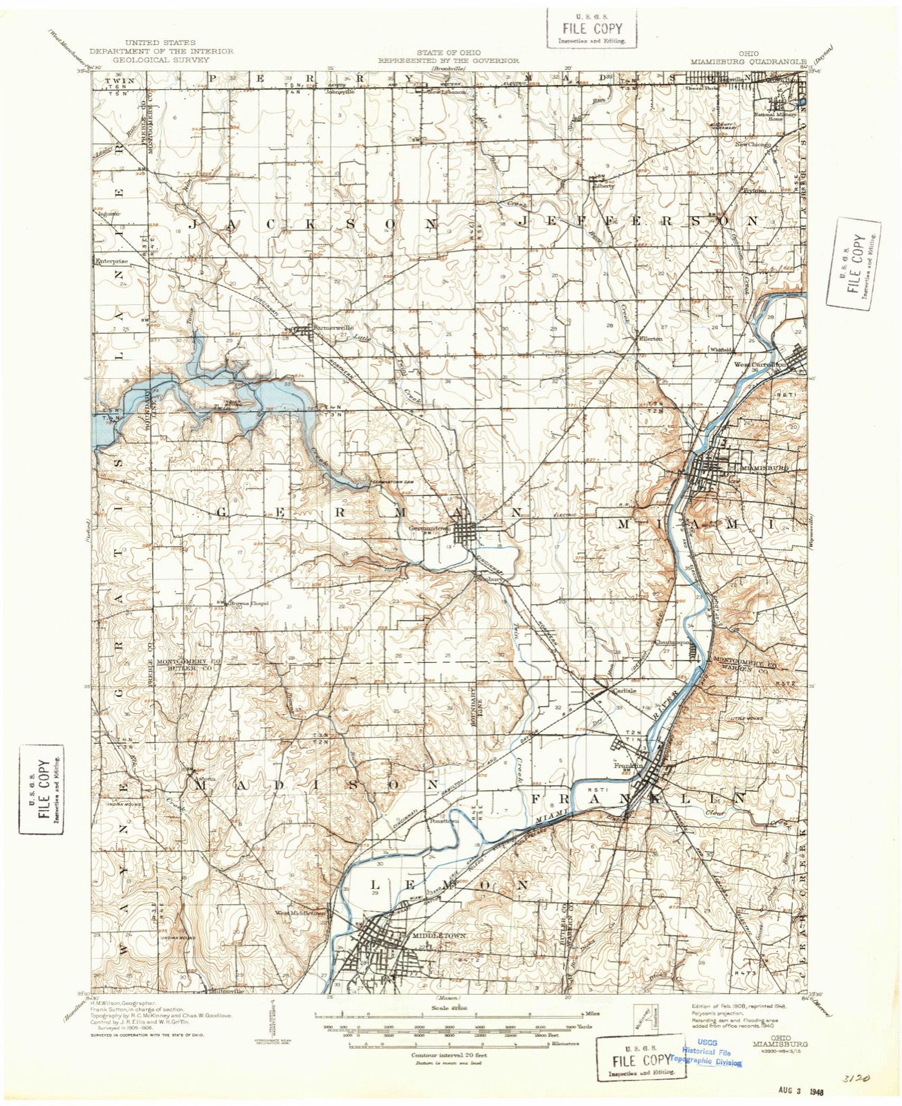
Topographic sheets covering this place
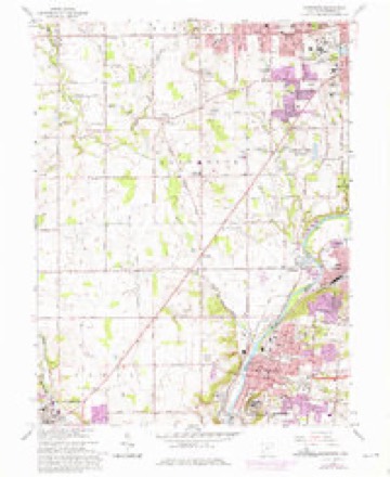
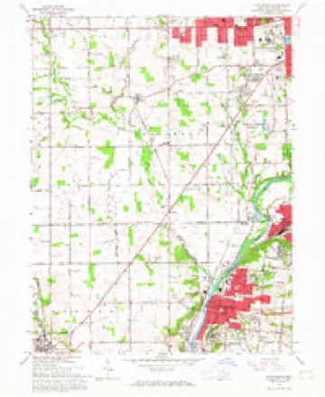
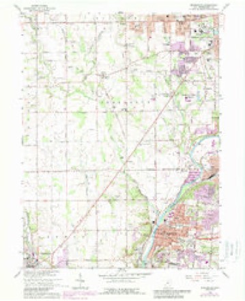
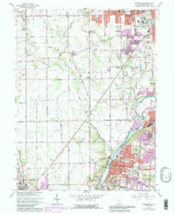
13 sheetsMatched by testing this settlement's coordinate against the published boundary of every sheet in the United States Geological Survey's historical collection. Each opens the scanned sheet at the Survey.
- 1908 USGS Miamisburg quadrangle1:62500
- 1953 USGS Cincinnati quadrangle1:250000
- 1953 USGS Cincinnati quadrangle1:250000
- 1953 USGS Cincinnati quadrangle1:250000
- 1955 USGS Miamisburg quadrangle1:24000
- 1955 USGS Miamisburg quadrangle1:24000
- 1957 USGS Cincinnati quadrangle1:250000
- 1965 USGS Miamisburg quadrangle1:24000
- 1965 USGS Miamisburg quadrangle1:24000
- 1965 USGS Miamisburg quadrangle1:24000
- 1965 USGS Miamisburg quadrangle1:24000
- 1986 USGS Dayton quadrangle1:100000
- 1986 USGS Dayton quadrangle1:100000






In the county-history sources
25,484 words on this townshipThe History of Montgomery County, Ohio, Containing a History of the County;, published 1882 names this settlement in its chapter on Miami Township. These are the passages that mention it, exactly as the scans read.
Water was let into the canal from the mill-race near the corner of Fift and Wyandot streets, Dayton, Friday evening, September 26, 1828. Most of j leaked through the embankment along the river at the bluffs in Van Bure Township ; and a break was made in the embankment there November 24 Wednesday, December 17, the packet Alpha, with a party of Dayton ladies an gentlemen, made a trip to Hole's Creek. With another Dayton party, she mad her next trip to Miamisburg, Monday, the 22d, and returned to Dayton on Wee -nesday; and made a second trip to Miamisburg on Christmas Day, returnin Friday.
Passage source: The History of Montgomery County, Ohio, Containing a History of the County;, published 1882.
The Great Miami Turnpike Company, to run from Dayton over the hills Carrollton, and on down the valley through Miamisburg, Franklin and Middlj town to its junction with the Cincinnati Pike at Sharon, was chartered in Marc 1837. Construction was commeneed in the summer of 1838.
Passage source: The History of Montgomery County, Ohio, Containing a History of the County;, published 1882.
IN the latter part of the year 1795, a surveying corps under the charge of Da iel C. Cooper, located a road through the dense forest up the east bank the Miami, from Fort Hamilton to the mouth of Mad River, and early in 171 the territory now embraced in this township began to be settled, as in ti year William Hole located on 150 acres of land in Section 25, east of t present town of Miamisburg. In the following winter his parents, Zackari and Phoebe (Clark) Hole, came from Virginia, accompanied by their farni and located on the same section as his son William. The children were follows: William, who married Ruth Crane; Daniel, who married Polly Deed Dr. John, a sketch of whom will be found in Washington Township; Zai ariah, who married Hannah Delay; Polly, who became the wife of David Yi zell; Sarah, who married a Mr. Eaton; Betsy, who became the wife of Jo Craig and Phoebe, who also married a man named Eaton. All were born : Virginia. In the summer of 1799, a block-house was erected on a part of Za< ariah Hole's land, around which was thrown a stockade for protection agai: the Indians, and this became known as " Hole's Station." It was soon rec< nized as a point of considerable importance, a kind of headquarters for all . vtj. came to this region while prospecting for or locating land. The elder H and wife died and were buried in the vicinity of the station, while the youn; members of the family subsequently removed to other portions of the com and State.
Passage source: The History of Montgomery County, Ohio, Containing a History of the County;, published 1882.
Machine-read from a century-old scan, so expect the errors a machine makes: misspelled names, dropped words, stray characters.
Read the whole chapter on Miami Township - it names this place 46 more 46 times.
Specimens collected near this place
12 of 382 shownRegional context, not property-specific evidence. Museums hold 382 specimens collected within 10 miles of Miamisburg between 1835 and 1975: 234 Animalia, 81 Plantae, 59 Fungi, 4 Chromista, 3 Protozoa, 1 Unrecorded. 12 distinct Species records are shown. Collected by ?, A JOHN, A JOHN AND W E DUELLMAN and others. Each is a physical object with a catalogue number, and each entry opens the museum's record. This is what was collected and kept, not a survey of what lives here - nothing can be concluded from a species being absent.
| Image | Species | Year | Collected by | Where, as recorded |
|---|---|---|---|---|
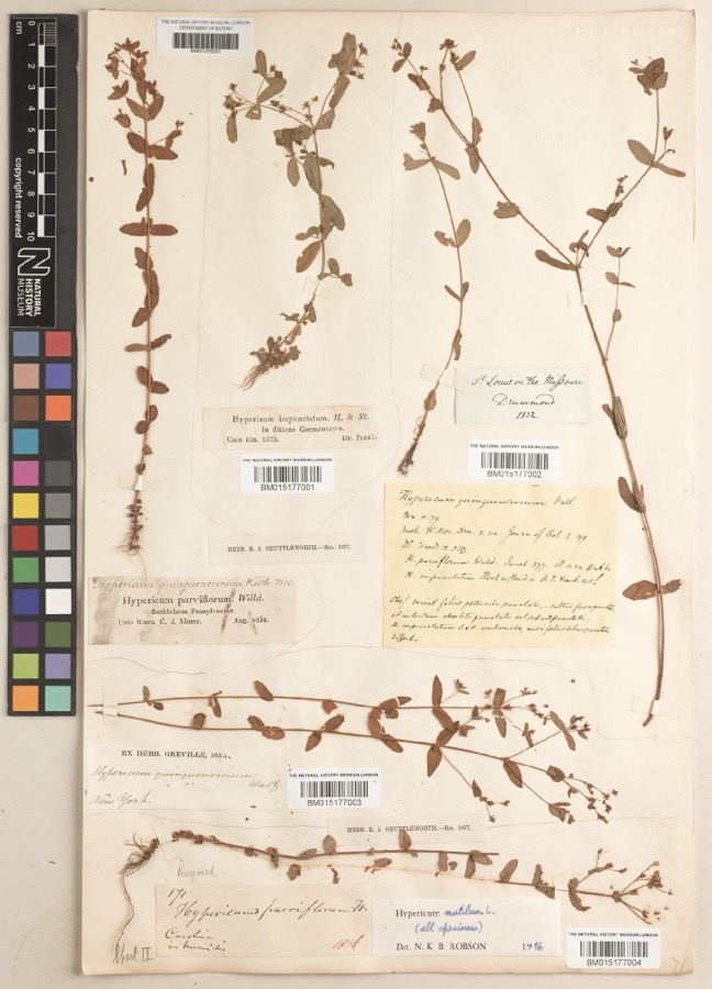 | Hypericum mutilum subsp. mutilum | 1835 | Joseph C. Frank | Germantown |
 | Ambrosia artemisiifolia L. | 1881 | Foerste AF | |
 | Geaster limbatus Fr. | 1883 | A. E. Foeerste | Dayton |
 | Platanthera leucophaea (Nutt.) Lindl. | 1836 | C. W. Short | Dayton |
 | Hydrophyllum macrophyllum Nutt. | 1838 | J. W. Van Cleve | Dayton |
 | Cassia marilandica L. | 1839 | Sanders, Alfred | Dayton |
 | Cynoglossum officinale L. | 1839 | not recorded | Dayton. Suburbs E. |
 | Iris versicolor L. | 1839 | not recorded | Dayton. 2 mi. south |
 | Nuphar advena (Aiton) Aiton | 1839 | Sanders, Mrs.; J.G. Haupt | Dayton |
 | Podophyllum peltatum L. | 1839 | Nagel, J.J.; J.G. Haupt | Dayton. 1 m. SE |
 | Polygala verticillata L. | 1839 | Sanders, Alfred [?] | 1 mile SE of Dayton |
 | Potentilla canadensis L. | 1839 | not recorded | Dayton. 1 mile south. |
All 382 specimens within 10 miles, at the Global Biodiversity Information Facility.
Mines and quarries near this place
8 within 5 milesRegional context, not property-specific evidence. The federal mineral resources record lists 8 workings within 5 miles of Miamisburg: 6 producers, 2 past producers. 6 still produce. What was taken out: Sand and Gravel, Construction. Distance is straight-line from the map coordinates, so a quarry counted here may appear on a neighbouring settlement's page as well.
| Where | Site | Commodity | Status | Recorded |
|---|---|---|---|---|
| Broadway Sand & Gravel Co. Pit #2 | Sand and Gravel, Construction | Producer | ||
| Carter & Webb Incorporated | Sand and Gravel, Construction | Producer | ||
| Hilltop Pit | Sand and Gravel, Construction | Producer | ||
| Number 1 Pit | Sand and Gravel, Construction | Past Producer | Sedimentary | |
| Weidle Sand & Gravel | Sand and Gravel, Construction | Producer | ||
| Weidle Sand and Gravel, Inc. Pit | Sand and Gravel, Construction | Past Producer | Sedimentary | |
| Weidle Sand and Gravel, Inc. Pit | Sand and Gravel, Construction | Producer | ||
| West Carrollton Aggregate No. 1 Pit | Sand and Gravel, Construction | Producer |
Storms near this place
33 since 1994Regional context, not property-specific evidence. The National Weather Service names Miamisburg in 33 storm reports between 1994 and 2025: 17 thunderstorm wind, 10 hail, 3 flash flood, 1 tornado. The reports record 2 injuries. Each account below is quoted exactly as the forecast office filed it, from the NOAA Storm Events Database, and each date opens the federal record of that event.
| When | Event | Place named | Harm | What the report says |
|---|---|---|---|---|
| May 2011 | Hail | Miamisburg | 2 hurt, $10,000 | Two individuals, one child and one adult, were injured by large hail while running for cover. A truck also sustained damage due to the hail. |
| July 2006 | Tornado (F1) | Miamisburg | $75,000 | A tornado touched down near the Dayton Mall to the east of Miamisburg and was on the ground for just under a mile. The tornado caused minor damage to a strip mall, a carpet business, a restaurant and a municipal bus outlet. A few trees were downed along the track of the tornado as well. |
| June 1994 | Thunderstorm Wind | Miamisburg | $50,000 | Trees were downed, some on power lines, cars, and structures. A house under construction collapsed in Germantown. |
| April 2025 | Thunderstorm Wind | Miamisburg | $10,000 | A large tree fell onto a house. |
| June 2008 | Flash Flood | Miamisburg | $7,000 | Numerous homes experienced basement flooding in Miamisburg. Several roads were flooded as well. |
| April 2006 | Hail | Miamisburg | $6,000 | no account filed |
| June 2015 | Thunderstorm Wind | Miamisburg | $5,000 | Numerous large limbs were knocked down. Winds were estimated at 60 to 65 mph. |
| June 2006 | Thunderstorm Wind | Miamisburg | $5,000 | Trees and large limbs four to six inches in diameter were knocked down in Miami Township. |
| April 2025 | Thunderstorm Wind | Miamisburg | $3,000 | A few trees were downed along West Central Avenue between Miamisburg and West Carrollton. |
| March 2020 | Thunderstorm Wind | Miamisburg | $3,000 | Several trees were downed near Manning Road and Bear Creek Road. |
| January 2018 | Thunderstorm Wind | Miamisburg | $3,000 | A few trees were downed in the Miamisburg area. |
| June 2004 | Thunderstorm Wind | Miamisburg | $3,000 | Trees were downed. |
| June 2020 | Thunderstorm Wind | Miamisburg | $2,000 | A tree fell onto some power lines in Miami Township. |
| July 2017 | Thunderstorm Wind | Miamisburg | $2,000 | Several large pieces of siding were stripped from a house. |
| July 2017 | Thunderstorm Wind | Miamisburg | $2,000 | Several large pieces of siding were stripped from a house. |
| June 2015 | Thunderstorm Wind | Miamisburg | $2,000 | A large tree was uprooted. |
| April 2007 | Hail | Miamisburg | $2,000 | no account filed |
| June 2014 | Flash Flood | Miamisburg | $1,000 | Two feet of moving water was reported over Vanguard Boulevard and Dayton-Cincinnati Pike due to heavy rainfall. |
| January 2012 | Flood | Miamisburg | $1,000 | Roads were reported flooded due to recent heavy rain. |
| August 2010 | Thunderstorm Wind | Miamisburg | $1,000 | Several large branches were reported down due to damaging thunderstorm winds. |
| June 2010 | Thunderstorm Wind | Miamisburg | $1,000 | Trees were reported down due to damaging thunderstorm winds. |
| June 2025 | Thunderstorm Wind | Miamisburg | $250 | Several large tree limbs were downed on Panjab Court. |
| June 2021 | Thunderstorm Wind | Miamisburg | $100 | A large tree limb was downed on South Main Street. |
| July 2019 | Thunderstorm Wind | Miamisburg | $100 | A small tree was downed on Cottage Avenue. |
| June 2015 | Flash Flood | Miamisburg | - | High water was reported over roadways. |
| April 2014 | Heavy Rain | Miamisburg | - | Drainage ditches were overflowing and ponding of water was occurring on some roadways due to heavy rainfall. |
| February 2025 | Hail | Miamisburg | - | no account filed |
| April 2015 | Hail | Miamisburg | - | no account filed |
| March 2012 | Hail | Miamisburg | - | no account filed |
| April 2010 | Hail | Miamisburg | - | no account filed |
| June 2009 | Hail | Miamisburg | - | no account filed |
| April 2006 | Hail | Miamisburg | - | no account filed |
| May 1998 | Hail | Miamisburg | - | no account filed |
Nearest settlements
The eight closest, with where each one stands in the county. Distances are straight-line, computed from the Geographic Names Information System coordinates.
| Map | Place | Distance | Sheets |
|---|---|---|---|
| Bridgeport | 0.5 miles | 13 | |
| Pineview Estates | 1.9 miles | 13 | |
| Whitfield | 2.2 miles | 13 | |
| Ellerton | 2.7 miles | 13 | |
| West Carrollton | 2.7 miles | 13 | |
| Shanersville | 3.3 miles | 14 | |
| Chautauqua | 3.7 miles | 13 | |
| Oakwood Village | 4.1 miles | 13 |
Elsewhere
Matched on this settlement's Geographic Names Information System number rather than its name, so it cannot be a different place of the same name in another state.
| Wikipedia article on Miamisburg | An encyclopaedic summary. Its text is share-alike, so it is linked here rather than copied. |
| Wikidata item Q993897 | The structured record the population and elevation above come from. Public domain (CC0). |
Provenance
This settlement is recorded in the Geographic Names Information System as feature 1085476. The sheet list is computed by point-in-boundary test against the United States Geological Survey's historical topographic inventory. Both are works of the United States government and carry no copyright under 17 U.S.C. 105.
Specimens. Global Biodiversity Information Facility (GBIF), https://www.gbif.org/. Only records licensed CC0 or CC BY are used. Records licensed CC BY-NC are excluded because this site carries advertising. Images are checked individually and any whose licence is non-commercial, no-derivatives or unreadable is refused.
Mines and quarries. USGS Mineral Resources Data System (MRDS) https://mrdata.usgs.gov/mrds/ A work of the United States government, no copyright under 17 U.S.C. 105.
Storms. NOAA National Centers for Environmental Information, Storm Events Database https://www.ncei.noaa.gov/stormevents/ A work of the United States government, no copyright under 17 U.S.C. 105. Narratives are quoted verbatim from the National Weather Service report and are not edited or summarised.