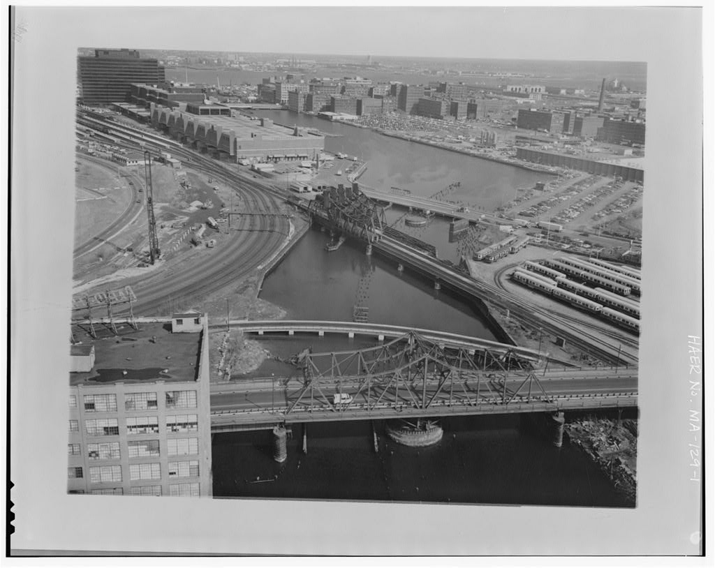
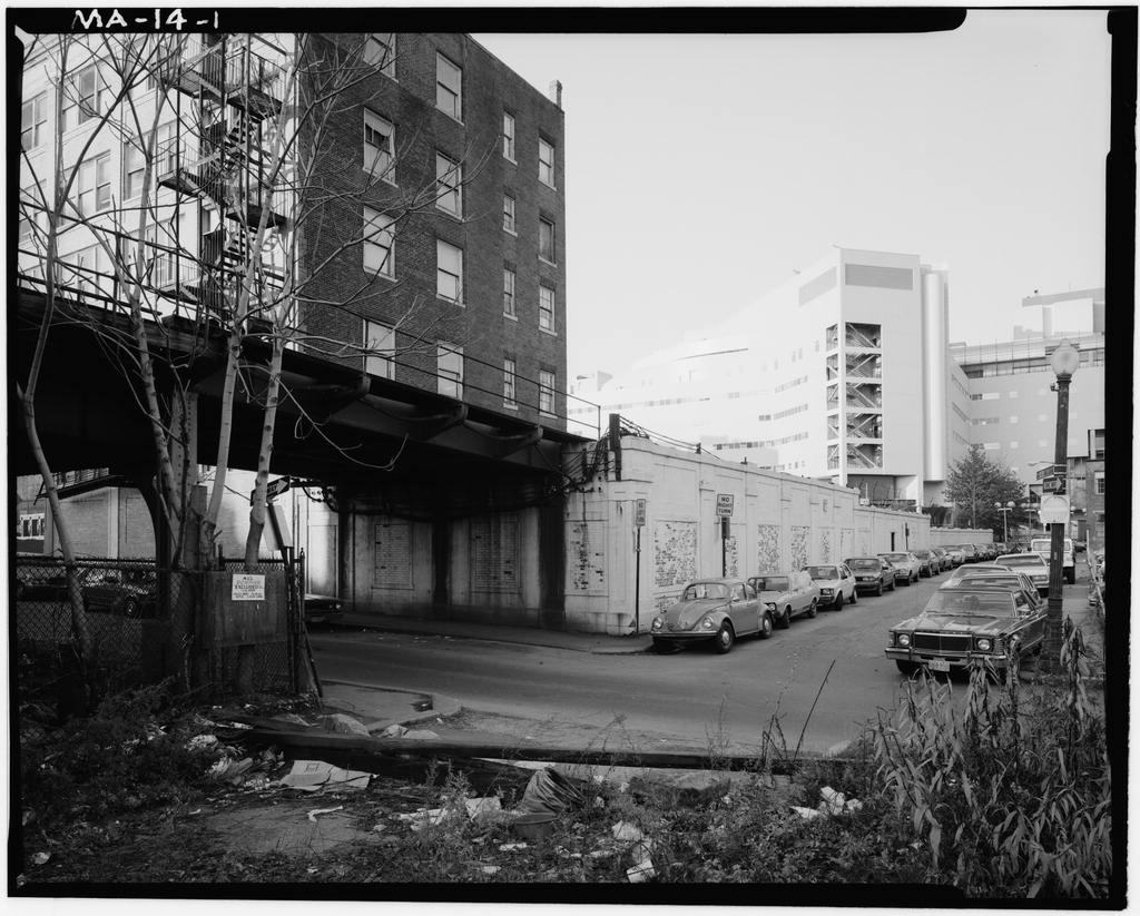
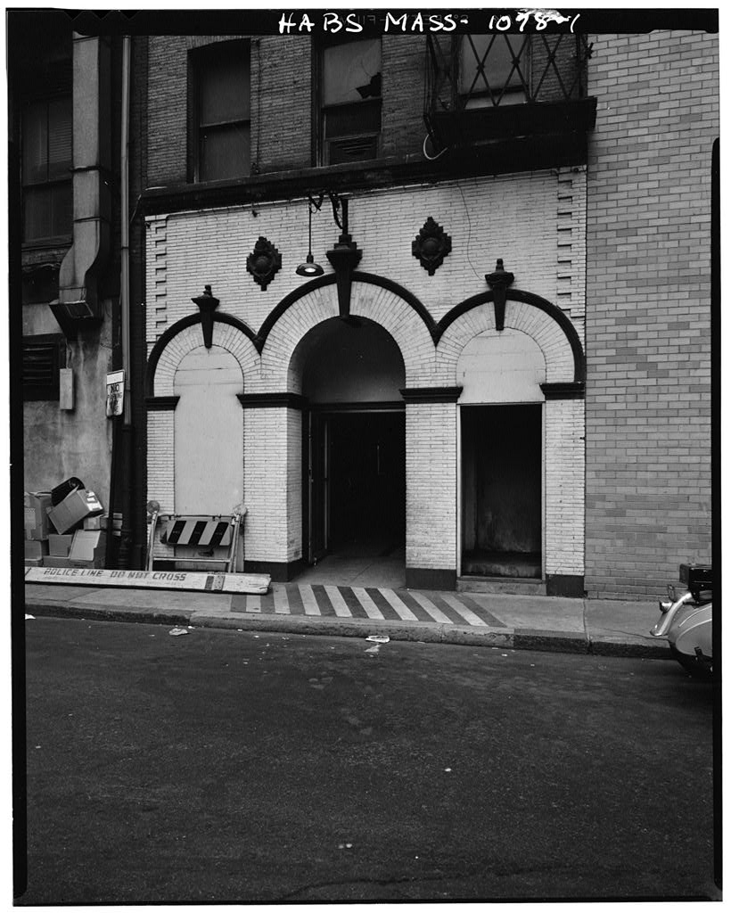
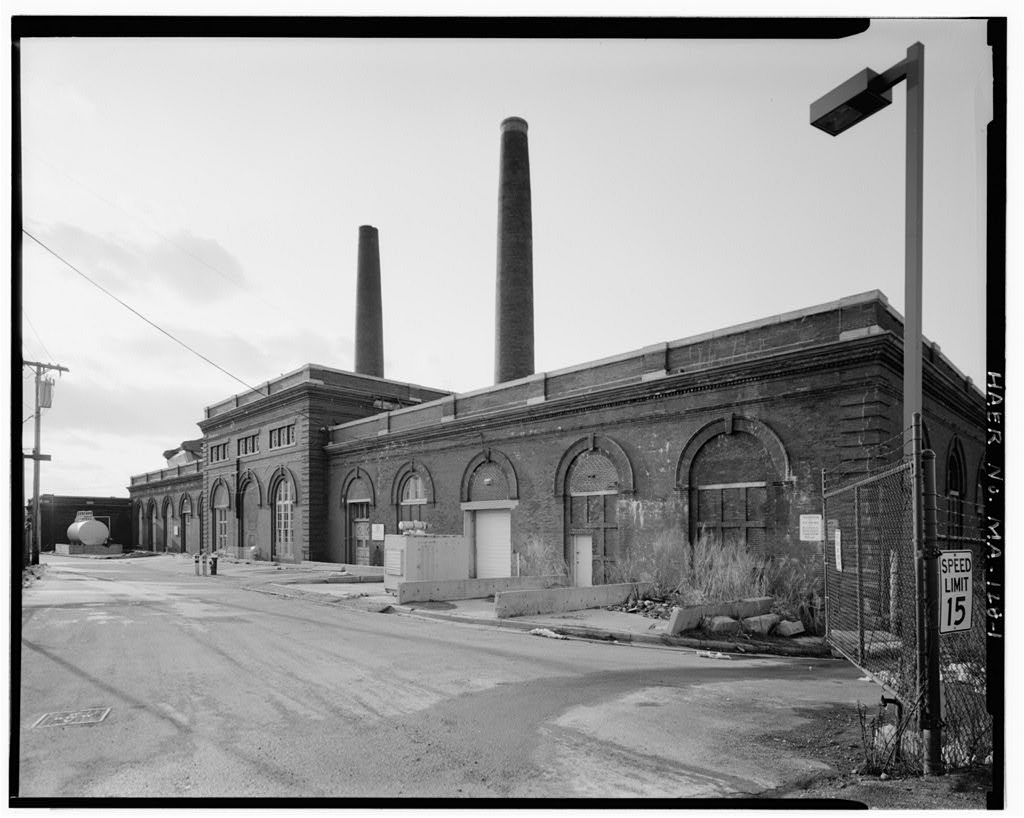
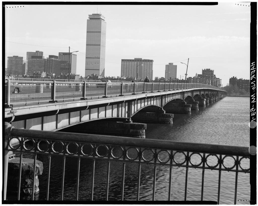
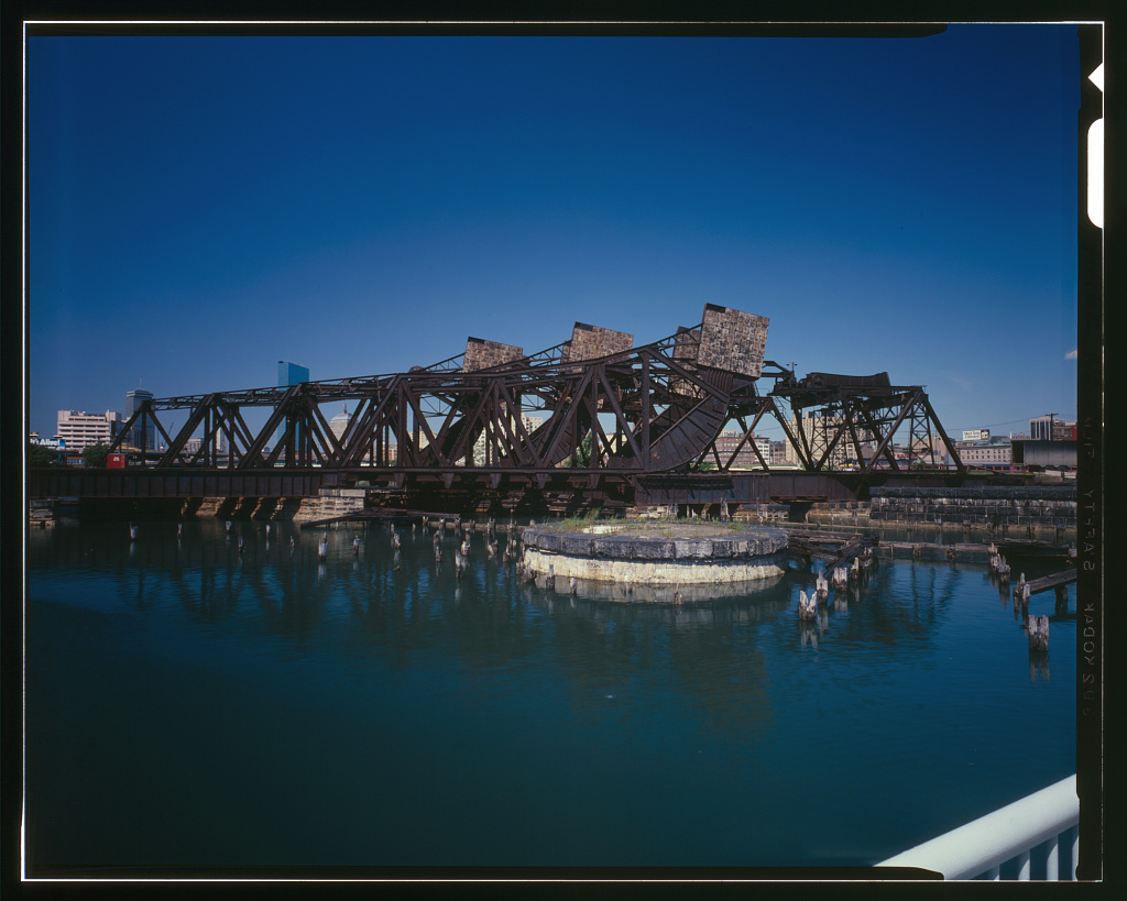
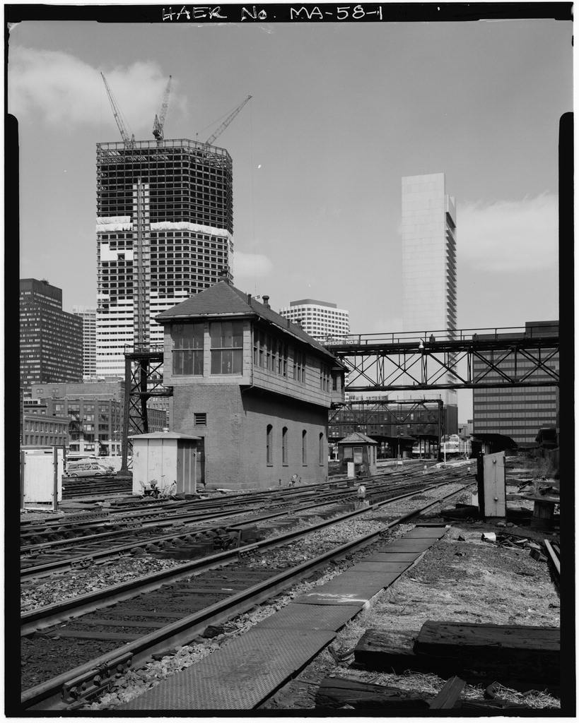
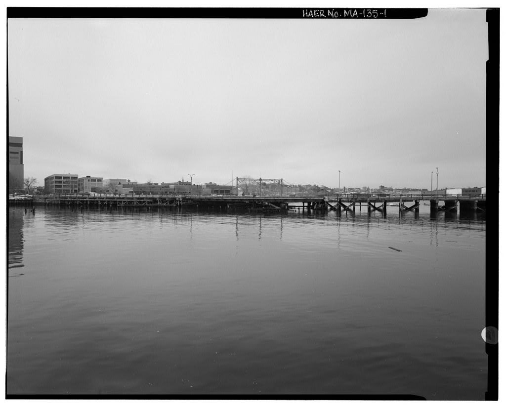
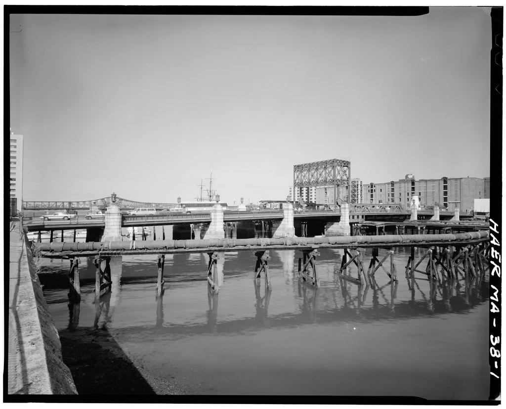
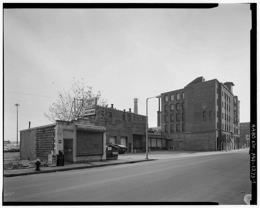
This mitigative documentation was undertaken in in accordance with a Memorandum of Agreement among the Massachusetts Highway Department, Massachusetts Historical Commission, Boston Landmarks Commission and the Advisory Council for Historic Preservation for the Central Artery/Tunnel Project. Jane Carolan, Architectural Historian and Project Manager; Peter H. Stott, Bridge Historian; Martin Stupich, Photographer and Connie Brown, Production; submitted to Maguire/Harris Joint Venture and Bechtel/Parsons Brinckerhoff for the Massachusetts Highway Department. BROADWAY BRIDGE HAER NO. MA-129 (Page 2) Introduction The original Broadway Bridge (Massachusetts Highway Department No.
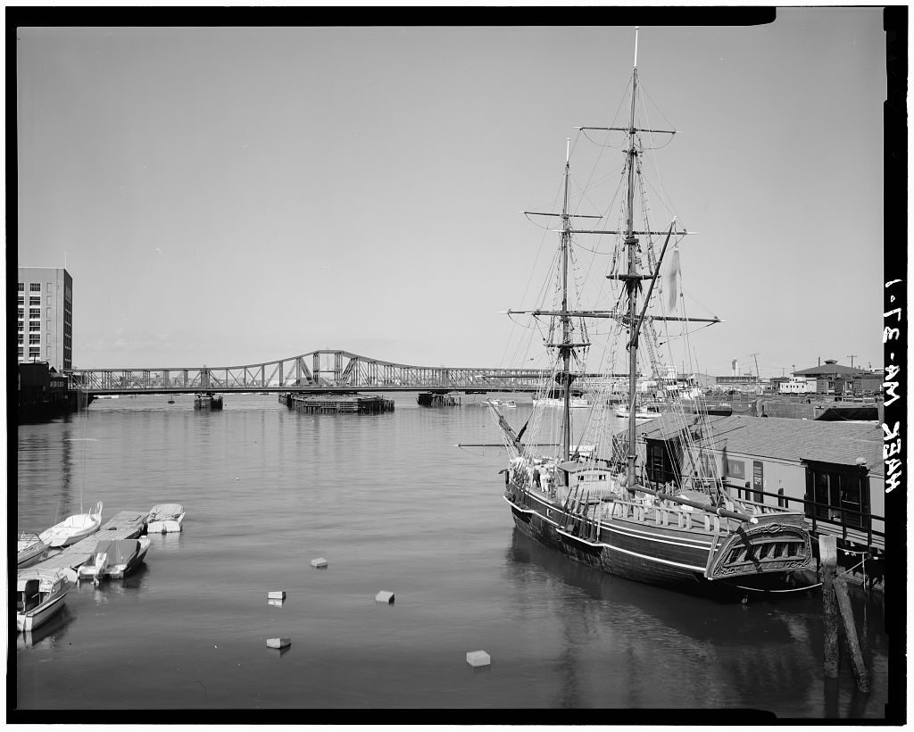
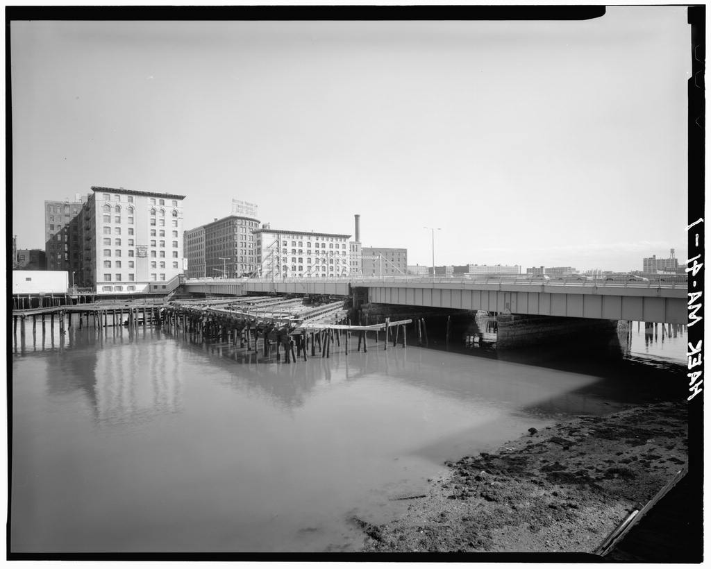
which spans Fort Point Channel, was completed in and was one of the first bridges in the City of Boston built under the jurisdiction of the City Engineer's office, which was previously charged with designing and building the city's water supply system. Due to a poor design, the bridge failed, and by the superstructure was almost totally rebuilt. In the approaches were replaced to provide greater clearance over railroad tracks in South Boston. In the drawspan was again replaced, this time due to the addition of street car tracks. Although much of the bridge has been substantially redesigned and rebuilt since the it is one of only four surviving center-bearing swing bridges within the Massachusetts Highway Department's bridge survey.
Historic Overview Fort Point Channel is a channelized waterway separating downtown Boston from South Boston. Today, the water passage terminates three hundred yards south of the Broadway Bridge crossing. In the eighteenth century, this waterway was a wide inlet leading to Roxbury Harbor, a large shallow body of water and mudflats fed by tides and, at its southern end, by Dorchester Brook. On the west was the neck of the Shawmut Peninsula, and on the east were the farms of Dorchester Neck (now South Boston). In the nineteenth century, as South Boston and Roxbury developed, this harbor experienced a series of names reflecting its changing use and public perception: Gallows Bay, South Bay, and South Cove.
In the years immediately preceding and following the Civil War, coal yards and heavy industry took advantage of both rail and water connections here to make the district a major industrial zone. Indeed, South Station, and its rail yards, which consolidated rail service from the south and west, was completed in and located just north of the Broadway Bridge. As commercial development spread along the Boston and South Boston shores, the channel leading to South Bay narrowed through a number of filling episodes.
In the first half of the nineteenth century, the name "Fort Point Channel" was given to the water passage, after the promontory near Rowe's Wharf, east of Fort Hill.1 Prior to the Civil War, there were frequent demands to fill in both South Cove and Fort Point Channel to gain more buildable land. But in the years following the Civil War, as the demand for coal, building supplies, and other bulk materials grew, commerce in both the cove and channel greatly increased. In as part of a program in harbor improvements, the Federal Government deepened the channel as far as the Congress Street Bridge. Today, Fort Point Channel effectively ends at West Fourth Street, and only a culvert beneath the road embankment there marks the spot where Dorchester Brook now flows into Fort Point Channel.
BROADWAY BRIDGE HAER NO. MA-129 (Page 3) Fort Point Channel is crossed by numerous bridges and at one time, nine bridges crossed the 1-1/4-mile channel concurrently. The first bridge was the South Boston Bridge, a foot long toll bridge built in on piles about 300 yards west of the present Broadway Bridge. Renamed and rebuilt as Dover Street in the alignment (with a new bridge .in still carries West Fourth Street over the railroad yards of the Massachusetts Bay Transportation Authority. The Broadway Bridge, first constructed in was the fourth highway bridge to be constructed across the channel. In the decade immediately following the Civil War, the topography of Boston experienced dramatic changes, as hills were leveled, streets widened, and grade levels raised.
The work was not a gradual evolution, but rather a concerted effort by the city, made possible by the passage in of the "Betterment Act. "The act gave the City Board of Aldermen broad authority to take property for the laying out of streets and improving Boston.2 Thomas W. Davies, the City Surveyor, was the individual responsible for coordinating much of this work, and his annual reports to the Mayor and Aldermen provide a first-hand glimpse of the work going on. In his annual report prepared in January he described the effects of the Betterment Act, which included the leveling of Fort Hill, surveys for the massive releveling of the Church Street district, the widening of Federal and Tremont streets, and other projects.
More surveys for street improvements were made in Davies wrote, "than have been made during any one year since the City Engineer's Office was established in "3 One of these projects was better access to South Boston from Boston proper. The plan called for the extension of Broadway from Federal Street [now Dorchester Avenue] in South Boston to Albany Street [in Boston proper; today Albany parallels the Southeast Expressway]. . .
thence to a point on Washington It called for a high grade crossing of Foundry Street, the Old Colony and Newport Railroad, Fort Point Channel, Lehigh Street [now under the Southeast Expressway] and the Boston and Albany Railroad bridges.4 Much of the structure was built on cast-iron columns, and the City Engineer likened it to the recently constructed Berkeley Street bridge over the Boston & Providence Railroad.5 Although the original bridge has been rebuilt, the essential features of that project, a long viaduct and a drawspan over Fort Point Channel, remain today. The Broadway Bridge connects Boston Proper with South Boston.
When the bridge was completed in South Boston was a heavily industrialized area with a large, Irish immigrant population, most of whom worked in the local factories. Prior to the nineteenth century, however, there was little activity in South Boston except for the role its geographical features played in the Revolutionary War, when Dorchester Heights was fortified and the British were turned back. In South Boston was annexed by the city of Boston, spurred in part by local real estate developers. In a street grid was laid out BROADWAY BRIDGE HAER NO.
MA-129 (Page 4) but little activity occurred until when the Free Bridge was opened connecting South Boston to Boston.6 Between about and South Boston's population rose from to Attracted by the water access of Fort Point channel and without being restricted by an existing residential neighborhood, heavy industry was able to grow without interference. This, in turn, attracted a large, mostly Irish, immigrant labor force. One of the earliest companies to be established (in the early was the Cyrus Alger Iron Company on Foundry Street at a location which would eventually be the foot of the Broadway Bridge. Alger produced iron products for building construction and machinery. By he was the largest iron producer in the country.
He shipped his goods via ship through Fort Point Channel and through the railroads that established rail and freight yards in South Boston. These included the Boston and Worcester Railroad and the Old Colony Railroad. Additional industries serviced and supplied by the ships of Fort Point Channel and the railroads included the Adams Machine Shop, manufacturers of heavy machinery such as printing presses, sugar mills and steam engines and Anderson Electric Company, an early manufacturer of electrical products including trolley poles, insulating systems for wires and switching equipment for telephones. Other industries in South Boston were locomotive manufacturers, iron steam ship builders, and builders of a variety of railroad related products.
Toward the latter pan of the nineteenth century the Boston Wharf Company was instrumental in filling, developing and building large wharves and factories along Fort Point Channel in South Boston. They were particularly active in the sugar, warehouse and real estate industries.7 South Boston still has a gritty air about it, mostly due to the many industrial structures standing, although the majority of industry had left. Rail yards have become parking lots, loft buildings have been turned into housing, but the residential areas have remained intact. In immediately surrounding the Broadway Bridge on the South Boston side, were the Boston and Worcester rail yard and Alger's iron foundry.
Although the iron foundry is gone, the rail yards are still intact and today are owned by the Massachusetts Bay Transit Authority (MBTA). The Boston side of the Broadway Bridge exited into an area called South Cove and later, the New York Streets. By the early South COVQ began to be filled with wharves and industrial activities such as distilleries. Small areas of the cove began to be filled in and wharves built and new streets laid out by Development was spurred by the building of the South Boston Bridge in and the Free Bridge in which directly connected the area with South Boston. In a large portion of South Cove was filled to provide space for the Boston and Worcester Railroad Terminal. Tenement housing was built on BROADWAY BRIDGE HAER NO. MA-129 (Page 5) some of this land as well.
In the more of the cove was filled, streets laid out and tenements built. By that time the Boston and Worcester Railroad had reached Albany and the railroad was renamed the Boston and Albany. In honor of that feat, the streets around the terminal were renamed after towns in New York State, hence the designation: New York Streets. In the Old Colony railroad also built a terminal in South Cove as well as a bridge over Fort Point Channel. By the mid-nineteenth century, South Cove was associated with railroads and immigrants. During the booming industrial years of the late nineteenth century, South Cove was populated by large immigrant populations including Irish, Eastern European, Italian and Armenians, most of whom worked on the railroads.
In the twentieth century, the area filled with Chinese. From through South Station was rebuilt and the western and southern railroads consolidated. This resulted in rerouting many of the railroad tracks through South Cove. In an urban renewal project completely removed the New York Streets and in the original Central Artery and then the extension of the Massachusetts Turnpike destroyed any remaining housing. Today the area is dominated by roadways and Amtrack tracks. The area immediately surrounding the Broadway Bridge approach was filled with rail yards until the and when the Central Artery and the Turnpike were constructed.8 The First Broadway Bridge. The story of the first Broadway Bridge is one of the most dramatic in the annals of bridge building in Boston.
It involved the careers of several nationally-known engineers, as well as the reputation of Boston's City Engineering office. It is also a revealing example of both the state of civil engineering in Boston city government and the unrestrained free-for-all that existed in bridge design and construction in the and Not until several catastrophic bridge failures had taken place did state and municipal authorities establish regulating commissions to approve bridge design and construction. Bridges, or even roads, were not the main concern of the City Engineer's Office when the first Broadway Bridge was commissioned. The office had been established in by a city ordinance providing for the care and management of the Boston Water Works.
Although the ordinance also required the Engineer to have charge of all plans of streets, and to perform such services as might be required by the Mayor and the Board of Aldermen, its emphasis was clearly on the maintenance and expansion of Boston's water supply. Given this concern, it is not surprising that for thirty-five years, the Chief Engineer was chosen from the ranks of water works engineers. The first City Engineer was E.S. Chesbrough later a nationally known water works engineer, who had overseen construction of Boston's Cochituate water system, the city's earliest water supply. BROADWAY BRIDGE HAER NO.
MA-129 (Page 6) The City Engineer in the late was Nathaniel Henry Crafts Crafts, who was named to the position in had been Chesbrough's assistant since His term of office saw the completion of the Chestnut Hill Reservoir, extension of the Boston water supply into Roxbury and Dorchester (with the annexation of those places by Boston), and the establishment of a separate high-service system to provide water to the higher elevatibns of metropolitan Boston.9 Responsibility for bridges seems to have come to the department only as an afterthought. In the city passed a new "Ordinance Relating to the Department of Engineering and Surveying.
"10Section 6 of the ordinance made it the duty of the City Engineer to make an examination, annually or oftener of all bridges and to report as to their condition. "This duty,"Crafts wrote, "isa new one, imposed upon this department, and, so far as the Report is concerned, has never been assigned to any department."11 The engineer went on to list all the bridges the city was then responsible for: three over Fort Point Channel to South Boston, and six to East Boston from Chelsea. The Broadway Bridge was one of the earliest bridge projects to be completed with the City Engineer's office. Probably the engineer with the most bridge experience in Crafts' department was T. Willis Pratt who was selected to be resident engineer for the Broadway Bridge.
Pratt is today best known for the "Pratt" truss, a very successful and widely used type of bridge truss which he patented in In the he patented portions of the retractile draw mechanism for moveable bridges, as an engineer in a city office, it may have been Pratt who popularized their use. Another engineer engaged by the city for the Broadway Bridge project was the consulting engineer, Clemens Herschel Born in Germany, Herschel graduated from Harvard's Lawrence Scientific School in and about opened an office in Boston as a consulting engineer. One of his first projects was the eye-bar suspension bridge which he designed with William Preston for the Boston Public Garden in still a prominent structure within that landscape.
Herschel was later known as a hydraulic engineer, but in his early years, his practice embraced all branches of civil engineering.13 Herschel had been asked to prepare plans and specifications for the Broadway Bridge, but before he could complete the design, a full set of plans and specifications were given to the department by the Moseley Iron Bridge Works Company of Roxbury. When the Moseley company presented their plans to the City Engineer, they were readily accepted and the department immediately advertised for proposals. After the proposals were received, the construction contract was awarded to the Moseley Iron Bridge Company. The Moseley Iron Bridge Works Company, organized by General Thomas W. H.
Moseley was one of a large number of new firms organized in the years during and immediately following the Civil War to use cast and wrought iron in bridge construction. Cast or wrought iron could be molded or rolled into a variety of shapes of great compressive strength, and with its introduction, first in conjunction with wood, and soon replacing it, BROADWAY BRIDGE HAER NO. MA-129 (Page 7) bridge design exploded into a variety of new configurations.14 At first builders were conservative, adopting iron to the traditional forms of wood and stone. As the spans grew longer and iron production increased during the Civil War, bridge companies sprang up across the country to build all-iron railroad and highway bridges.
The post-Civil War period was one of tremendous innovation in bridge design, but it was equally famous for its bridge failures, as iron came to be used increasingly by builders with little experience in its properties. In Moseley had patented an unusual tied arch design.15 By riveting strips of rolled wrought-iron into a hollow tube with triangular cross section, Moseley achieved compressive strength that was not possible with wrought-iron rods. Four years later, he organized the Moseley Iron Building Works, (variously listed as the "Moseley Iron Bridge Company" as the occasion warranted).
With his own rolling mill established on a railroad site south of Hyde Park, Moseley began producing bridges based on his patent design for locations throughout the east.16 (Until recently, two Moseley bowstring trusses carried local streets over the canals of Lawrence, Massachusetts.) The Broadway Bridge employed several Moseley trusses. City Engineer Crafts considered the bridge "one of the most important structures of the bridge kind [sic] ever erected in the city,"17and devoted twelve pages of his annual report to a detailed description of its features.
The design included a trussed arch over Foundry Street, a long viaduct on Phoenix columns, flanged wrought-iron segments, another trussed arch of 100-feet span over the railroad tracks, an 80-foot rim-bearing swing span over Fort Point Channel (also using Moseley arched trusses), a viaduct to Lehigh Street, and another trussed arch similar to that at Foundry Street over Lehigh Street. Altogether the structure was feet in length. The Phoenix columns were 12 inches in diameter and 1/4-inch thick, coated with a coal-pitch varnish. Work on the bridge was begun in At the end of December resident engineer Pratt wrote confidently that completion was only two months away.
The work had taken longer than originally predicted, and Pratt explained the delay: Owing to the very confident proposition of the contractor in the first instance, to finish the work on the first of December the impression on the public mind was that it was work of not much magnitude, for which a high price was to be paid. In reality, it is the greatest iron bridge ever undertaken in New England, embracing some of the most intricate engineering operations, requiring great care and prudence in conducting the preparations, and constant watchfulness at all times.18 Moseley, however, was no longer on the job. The unanticipated expense of the work had bankrupted the company, and the firm had surrendered its contract the previous September. 19 BROADWAY BRIDGE HAER NO.
MA-129 (Page 8) No annual report was filed the following year. City engineer Crafts and resident engineer Pratt had resigned, and no successor had been appointed. In November Joseph P. Davis was named to succeed Crafts.20 Davis's first report, dated January 20. is dominated by the Broadway Bridge debacle. The bridge was eventually completed by the City of Boston, but in only two years the drawspan had settled, putting the truss members out of plumb and making much extra work for the drawspan engine. (To level the drawspan, the bridge superintendent was forced to apply increasingly heavy weights to opposite corners of the span.) Expansion in hot weather bound the drawspan so tightly that adjacent chords had to be cut short.
Cold weather contraction did not return the bridge to its original position before expansion. The 1/4-inch thick Phoenix columns, on which much of the bridge was supported, were rusting away at the ground level. The arched spans over Lehigh and Foundry streets were leaning eastward. By July the situation had further deteriorated. The whole structure [assistant engineer Henry Manley reported] has moved towards the South Boston end. Second, the towers, and trusses with them, have also had an independent motion - the westerly tower to the north, and the easterly tower to the south.
...There is no cross-bracing in the floor of the draw, nor anything but the weight of the draw to prevent this warping motion.21 Distortion of the swing span's track was causing part of the wheels to bear only on their outer edges, with the result that they were continually breaking and crumbling. Manley's report cites numerous other problems. By the following January, the city recognized that repairs were impossible. In May the bridge was closed to traffic. Money was appropriated for an entirely new structure, and work began on the new replacement span in August The Bridge The central pier of the drawspan, which was built in is the oldest part of the present Broadway Bridge. With the previous bridge failure fresh at hand, extra care was given to the substructure of the new bridge.
Into a circular excavation 54 feet in diameter, spruce piles were driven in concentric circles about 3 feet apart, to an average depth of 12 feet 4 inches. The piles, 10 inches in diameter, were cut off at grade 2 feet below mean low water. After enclosing the piles with a curb, the entire space was then filled to the top of the piles with hydraulic cement. Above this concrete core, six courses of rock-faced Gloucester granite were laid in a circular wall 12 feet high. The base for the central pivot, laid within the area enclosed by the wall, was laid in six courses of circular and octagonal stone courses, each with enscribed circles smaller than the one before. The topmost course, level with the outer wall, was 12 feet in diameter.
A central column about 8 feet high was BROADWAY BRIDGE HAER NO. MA-129 (Page 9) erected on this base, each course being octagonal in form except the top course, which was a circular stone 6 feet in diameter. The superintendent's quarters and engine room were built around the center column, occupying the space between the top of the granite wall and the track circle that supported the revolving swing span. This circular space, eight feet high and sheathed in wood, was itself surrounded by sixteen cast-iron columns supporting the track ring, which was fitted into the cast-iron caps of the columns.
The iron draw span, built by the Watson Manufacturing Company of Paterson, New Jersey, was composed of two 159-foot 6-inch bowstring trusses, 40 feet apart, with 10-foot sidewalks cantilevered from the outside. Like the present drawspan, the swing was a center-pivot type swing span. The trusses were carried on the ends of two plate girders, which transmitted the whole weight of the superstructure to the center column. The new bridge opened for travel May 7, Approach Spans Nineteen plate-girder approach spans make up the bulk of the feet of this bridge. Almost all date to and a request by the New England Railroad Company for greater clearance over its tracks.23 In October contractor Patrick McGovern, of Boston, was awarded the contract for building the South Boston piers.
Altogether twelve piers were constructed between Foundry Street and the draw: five were of masonry, and seven sets of steel columns. Four additional piers were built between the drawbridge and Lehigh Street in Boston. The plate girder superstructure was constructed by the Boston Bridge Works. All are deck plate girders of varying lengths except the twelfth span, an 84-foot-long through plate girder carrying the roadway over the mainline railroad tracks.24 In the Boston underwent tremendous physical change resulting in the demolition of its New York Streets section and its West End section under a massive slum clearance program, and the construction of what was then also called the Central Artery.
Between and the construction of the new roadway resulted in the reconfiguring of the bridge approach to accommodate the new highway and its off and on ramps. The piers affected were those built in by Patrick McGovern which were located between the drawbridge and Lehigh Streets in Boston. The part of Broadway Bridge that went over Lehigh Street was removed, as was most of Lehigh Street, and the expressway built. This resulted in the demolition of Pier 20. the most northern pier, although Pier 19 was reused as a support for the new road.25 BROADWAY BRIDGE HAER NO. MA-129 (Page 10) Replacement of the Draw Span. The present steel drawspan was built in by the Boston Bridge Works.
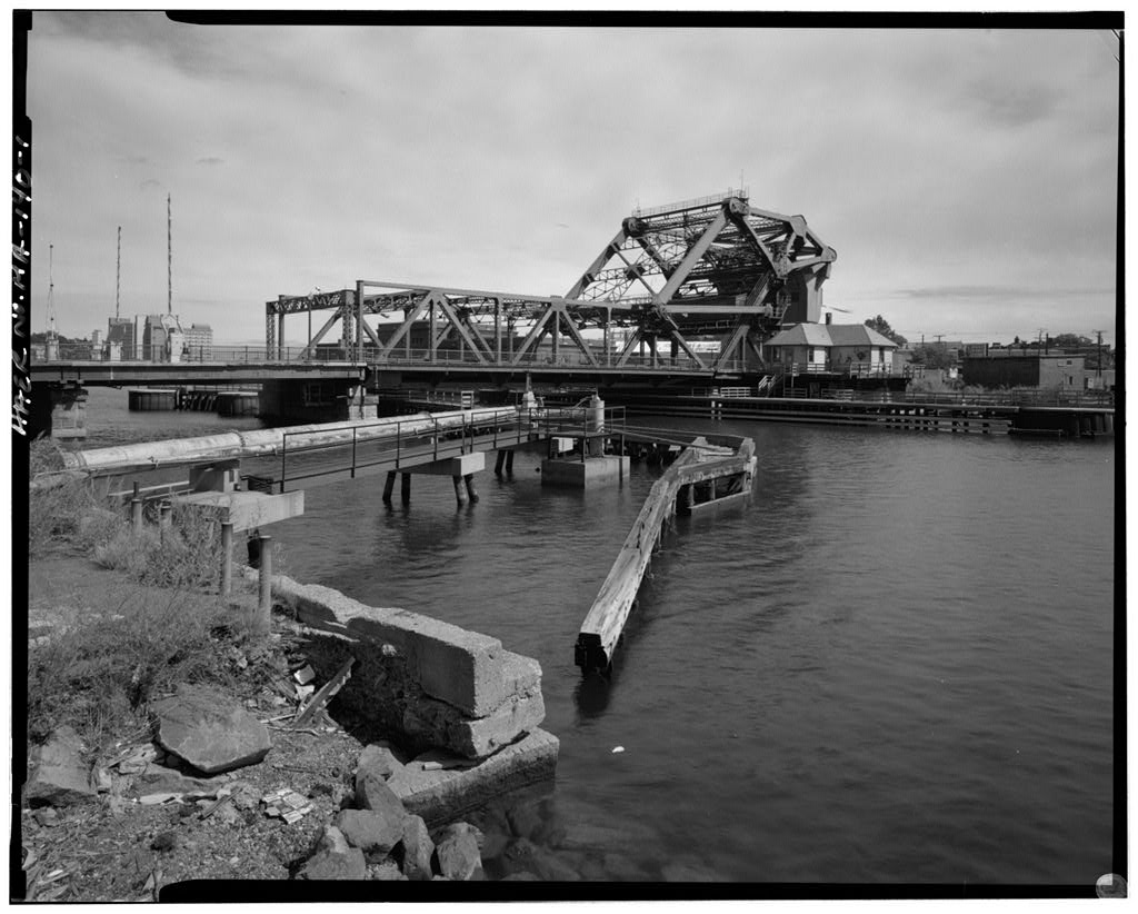
The span appears to have been replaced due to increased use of the bridge, which by the early twentieth century, carried trolley tracks and was the primary route from Boston to Sbuth Boston. Since the masonry piers were still in good condition, it was decided to reuse them rather than replace them. The reuse of the masonry substructure determined that the swing span would be a center-pivot-type, as opposed to the more common rim- bearing swing span. Although both types of turning mechanisms were adequate to the job (and the Boston Bridge Works was using both at the time) the circular pier and works left over from the span dictated the use of a center-pivot mechanism. The span, as built, is 210 feet long and 60 feet wide.
Forty feet was allowed to hold two streetcar tracks and two lanes of traffic. Two overhanging sidewalks were each 7 feet wide. The two riveted steel trusses, each 120 feet long, are of the Warren type with the top chord rising to a central 47-foot high tower. The new span raised the height of the masonry drum 4 feet 6 inches with a reinforced concrete wing wall, upon which rested the circular steel drum 40 feet in diameter and 4 feet inches deep. The six trucks which ran on a track on the drum served to keep the draw properly balanced. When the draw span was open, its weight was supported entirely by the center pier and a 26-inch diameter phosphor bronze disc, placed between two hardened steel discs.
When closed, the dead load on the center was partially relieved by the bridge seats at either end of the span, wedges being driven to raise the ends. The draw was powered by two 20-horsepower electric motors suspended from the cross girders. Through a set of steel gears, a pinion engaged a rack on the fixed foundation drum. The- bridge ends were lifted by 5-horsepower motors, similar to those used in the construction of the draw over Chelsea Creek the year before. Endlifts and turntable engine were controlled from an operating cabinet on the sidewalk near the center of the draw.
Both the motors and pinions have since been removed and the endlifts disabled.26 Later History The drawspans of Fort Point Channel saw their greatest usage in the late nineteenth century due to the heavy industry in the area. In the twentieth century, however, as industry in South Boston declined on the channel, the number of openings were more infrequent. In 1906,the drawtender at the Broadway Bridge reported opening the bridge times -an average of times a day. For the City Engineer's report, he broke down the types of vessels passing through or beneath the Broadway Bridge as follows: BROADWAY BRIDGE HAER NO.
MA-129 (Page 11) 26 steamers 955 sailing vessels tugs others27 By the annual number of openings had been reduced to and a decade later to the fewest number of openings of any of the fourteen drawbridges then operated by the City of Boston.28 By the early the Broadway Bridge draw operated only on a standby basis and mostly for garbage scows going to the Albany Street disposal station. In to the trolley tracks were removed (having been replaced by buses) and the bridge was resurfaced.
On May 13, the Federal Government declared Fort Point channel nonnavigable and the disposal station was closed in The bridge was not operated as a drawbridge after but it was kept in working order until the completion of the Central Artery in This was done in case the construction necessitated movement of materials by water but this option was never utilized. Upon completion of the roadway the draw was fixed and the draw house, fender system and machinery were demolished.29 Boston Bridge Works The Boston Bridge Works, builder of both the approach spans and the present drawspan of the Broadway Bridge, was one of the most prolific New England bridge builders.
The firm is credited with constructing half of all the railroad and highway bridges built in New England during the first half of the twentieth century.30 The company was founded by Massachusetts native, David H. Andrews, who was born in 1844.3i Andrews began his career by working in several of the many machine shops of Worcester and Fitchburg, MA, receiving invaluable "hands-on" training. In he received a Bachelor of Science degree from the Chandler School of Science and Arts, a school connected to Dartmouth College. The addition of a formal degree to his machine shop training was a decided advantage over most self-taught engineers of the period. After receiving his degree, Andrews worked for Kendall and Roberts, a Cambridge.
MA company which made boilers and hoisting engines and for the National Bridge and Iron Works company, located in Boston. In Andrews left National Bridge and became a consulting engineer in Boston and Cambridge. Two years later, utilizing his connections from his former employees, borrowed money from Kendall and Roberts to buy the tools and machinery of the National Bridge company (which had gone into receivership in with the intention of forming his own bridge manufacturing company. In Andrews named the company Boston Bridge Works and completed his first bridge (which survives today), a bowstring truss, located in Framingham MA. BROADWAY BRIDGE HAER NO. MA-129 (Page 12) In the first few years of his business Andrews was located in Cambridgeport, MA.
but in he built a factory on Binney Street in East Cambridge, MA, a location that was to remain home to the company until it closed in the (None of the buildings remain today.) While the manufacturing plant was located in Cambridge, the business offices were in downtown Boston.32 During the and the company, as stated in their advertising, built, Wrought-iron railway and highway bridges, draw bridges, long span iron roofs, iron trusses and girders of all descriptions for sustaining or movins fixed loads. 33 The company had also patented a locomotive turntable that the company claimed did not tilt as engines moved over it.
During this time period the company kept expanding their facilities and had added square feet of space by By the early the company covered square feet and employed and at busy times, 400 people. In addition to building bridges. Andrews realized the potential of the new steel frame buildings being constructed in the late nineteenth century as a source of business: the company built the framing for the Worthington Building, Boston's second steel framed structure (which is still standing today). In a fire destroyed the company's Cambridge works but the firm began rebuilding almost immediately. Andrews used the disaster as an opportunity to reconfigure and modernize the plant and he and his engineers designed many of the new structures.
The new plant was completed in In the late nineteenth century, when there were over 700 small bridge construction companies throughout the country, bridge building companies tended to focus their operations in regions, which is what Boston Bridge did, mostly building in the New England states and occasionally in other areas of the country. But at the beginning of the twentieth century many bridge companies faced the threat of trusts, i.e. one company buying and consolidating many smaller ones. The American Bridge Company, which in was bought by U.S. Steel, began to buy many of the smaller bridge companies throughout the United States; in one year they bought 24 companies.
They certainly must have been in discussion with Andrews but he resisted and the Boston Bridge Works remained an independent operation. David Andrews died in and the company, without apparent interruption, taken over by his son, John G. Andrews. In at the beginning of the Great Depression, a company profile indicated that the firm had expanded again, to 4.5 acres and still employed about 300 BROADWAY BRIDGE HAER NO. MA-129 (Page 13) people. But the impact of the Depression could not be avoided. In the company moved its business office from Boston to Cambridge, and in they stopped all advertising, although they continued to stay in business. In the firm suffered another fire and a large building was torn down but not replaced.
In the company built their last bridge; in they designed a bridge but it was built by another firm.34 The Boston Bridge Works survived for over sixty years and built many bridges throughout New England that are still extant.35 Today, of the highway bridges in the state, 76 have been identified as being constructed by the Boston Bridge Works. In addition to the fixed spans, the firm built at least four swing spans: two each of the rim-bearing and center-pivot varieties.
(In addition to the Broadway Bridge, the company also built the Bridge Street span over the Bass River in Beverly as a center-pivot swing.)36 Significance As identified by the Massachusetts Historic Bridge Inventory, conducted by the Massachusetts Highway Department: The drawspan of the Broadway Bridge [Massachusetts Highway Department No. is the largest and most impressive of the four surviving center- bearing swing bridges identified in the computer print-out. Although a total of thirteen surviving swing bridges (some of them no longer operable) have been identified in the print-out, the large majority (nine) are of the rim-bearing type.
Only the Congress Street Bridge in Salem (ca.1916), the Main Street Bridge in Amesbury (rebuilt possibly reusing an pier and bearing), and the Bass River Bridge in Beverly share the center- bearing configuration.37 The construction of the trusses themselves is typical of much steel bridge construction in the early twentieth century, when elements of bridge structure rolled channels, steel angles, lacing bars, built up channels and box girders had all been largely standardized. The significance of the structure lies in its identity as a movable lift bridge. Added significance is given by the context of the bridge. Fort Point Channel is today spanned by five moveable bridges, all examples of different types of 19th-century moveable bridge technology (HAER Documentation MA-130).
With the exception of the Congress Street bridge, all were built in the period Two different types of bascule bridges (Congress Street, a trunnion bascule; New Haven Railroad bridge, a rolling lift bascule, HAER Documentation MA-35) flank a rare retractile drawspan (Summer Street). All three are flanked by the two swing spans located at either end of the channel: Northern Avenue on the north end, and Broadway at the south end. The two are classic examples of the two principal types of swing spans, the rim bearing swing and the center pivot swing. In these two examples it is possible to clearly see the difference in truss construction. Whereas BROADWAY BRIDGE HAER NO.
MA-129 (Page 14) the load carried by the Northern Avenue bridge is transmitted to the rim by a four-posted tower (thus spreading the load to four points on the rim), the Broadway bridge transmits the entire load via a pair of diagonals and single pair of posts at the center of the trusses. More abstractly, but no less important than the physical structure of the bridge, is the substructure of the original Broadway Bridge span, built in It is the last surviving reminder of Boston's first trials in large-scale iron bridge construction and the consequent failure from faulty construction and administration. BROADWAY BRIDGE HAER NO. MA-129 (Page 15) ENDNOTES 1. Shurtleff, Fort Point itself took its name from its proximity to the first fort erected on the peninsula. 2.
Chapter Acts of "An Act Concerning the Laying Out, Altering, Widening, and Improving the Streets of Boston." 3. Annual Report of the City Engineer and Surveyor, City Document No. 22, p. 32. 4. City of Boston, Department of Public Works, Works Progress Administration, Broadway Bridge, 5. Ibid., p. 14. 6. Walter Muir Whitehill, A Topographical History of Boston. (Cambridge: Harvard University Press), pp. 7. Ricardo J. Elia, et al, Phase I Archaeological Investigations of the Central Artery/Third Harbor Tunnel Project in Boston. Massachusetts (Boston MA: Office of Public Archaeology, Boston University),pp. 8. Ibid.. pp. City of Boston, Annual Report of the Department of Public Works, p. 23. 9. "Nathaniel Henry Crafts," Boston Evening Transcript 15 June p. 12, 10.
The Ordinance is reprinted as Doc. no. 110 in the Boston City Documents of The ordinance also required annual reports, and the collection of city documents included the first Annual Report of the City Engineer (Doc. no. which provides a useful history of the department to that time. 11. Annual Report of the City Engineer and Surveyor, City Doc. No. 22, p. 15. 12. "Thomas Willis Pratt," American Society of Civil Engineers Proceedings 1 13. National Cyclopedia of American Biography (hereafter NCAB), 22 p. 14. One of the more successful users of this material was Samuel Reeves who invented the "Phoenix Column" in using flanged wrought-iron segments to construct compressive members of great strength.
Phoenix columns, produced by the Phoenix Iron Company were widely used around the country in the and in both railroad and highway spans. BROADWAY BRIDGE HAER NO. MA-129 (Page 16) 15. Patent # (3 February 16. Victor C. Darnell, A Directory of American Bridge-Building Companies. Society for Industrial Archeology Occasional Publication No. 4 (Washington, pp. Three examples of Moseley trusses are known to survive: in Wayne County, IL in Lawrence. MA now relocated; and in Claremont, NH (See Simmons, "Bridges and Boilers.") 17. Annual Report of the City Engineer, City Document No. 14, p. 17. 18. Annual Report of the City Engineer, City Document No. 15, p. 45. 19. Ibid. The company's Hyde Park property was taken over by the New England Iron Company. 20.
Davis was no exception to the water works hiring policy, but his experience had been out of state -- Brooklyn, Peru, and St. Louis until he had been called to study the prospect of building a new water supply from the Sudbury River system. During Davis' term of office, the Sudbury system was completed. (See NCAB 25 p. 51. 21. Annual Report of the City Engineer, City Doc. No. 20, p. 51. 22. Annual Report of the City Engineer, City Doc. No. 24, pp. 23. Chapter 143 of the Laws of order the railroad company to pay the city of Boston for raising the bridge, as petitioned by the company. 24. Stephen J. Roper, "Broadway Bridge, "Massachusetts Highway Department, Historic Bridge Inventory Form, 9 August 25. City of Boston, Annual Report of the Department of Public Works, specifically p. 22. 26.
Roper, Peter Stott, Sunday Morning Tour Brochure, June 17, Annual Conference (Washington, DC: Society for Industrial Archaeology").n.p. 27. Annual Report of the City Engineer, Boston City Documents. 28. Boston Municipal Research Bureau, "Boston Drawbridges" p. 1. 29. City of Boston, Annual Report of the Department of Public Works, p. 21. 30. Orra Stone, History of Massachusetts Industries (Boston. p. cited in BROADWAY BRIDGE HAER NO. MA-129 (Page 17) Gregory J. Galer, "The Boston Bridge Works in Rhode Island," typescript, courtesy of the author. 31. Darnell, p. 78. 32. Gregory J. Galer, "The Boston Bridge Works and the Evolution of Truss Building Technology," unpublished undergraduate thesis, courtesy of the author, pp. 20- 26. 33. Ibid., p. 33. 34. Ibid., p. 35.
Ibid., Appendix B - Extant Boston Bridge Works Bridges in Massachusetts. Rhode Island and Vermont, pp. 36. Stephen J. Roper, "Boston Bridge Works in the MHD Data Base," three-page list dated prepared for the Massachusetts Highway Department Historic Bridge Survey. Courtesy of the author. 37. Stephen J. Roper, "Broadway Bridge, "Massachusetts Dept. of Public Works Historic Bridge Inventory form, 9 August BROADWAY BRIDGE HAER NO. MA-129 (Page 18)
Engineering Drawings: A collection of over 172 drawings of the Broadway Bridge from through are located at the Bridge Division, Boston Department of Public Works. Drawings cover the original construction, subsequent reconstructions, removal of draw mechanisms and removal of piers for the Centra! Artery construction. "Rebuilding Great Span. General Plan of Steelwork." August 1, Blueprint. Bridge Division, Boston Department of Public Works. "Rebuilding Drawspan. General Plan - Masonry." August 1, Blueprint. Bridge Division, Boston Department of Public Works. "Rebuilding Drawspan. General Plan of Turning Mechanism." August Blueprint. Bridge Division, Boston Department of Public Works. Historic Views: Broadway Bridge, view toward Boston. Repairing Elevated trolley tracks, ca.
Photocopy from original photograph. Located at Archives, Society for the Preservation of New England Antiquities, Boston, Massachusetts. Broadway Bridge, trolley station, outbound (from Boston out) platform, March 6, Photocopy from original photograph. Located at Archives, Society for the Preservation of New England Antiquities, Boston, Massachusetts. Broadway Bridge, South Boston trolley station, between and Photocopy from original photograph. Located at Archives, Society for the Preservation of New England Antiquities, Boston, Massachusetts. Primary and Unpublished
 Block
Block