BlockBefore

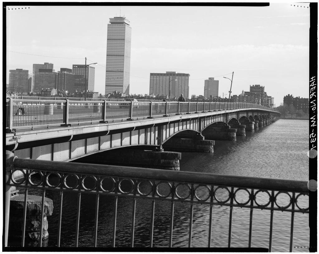
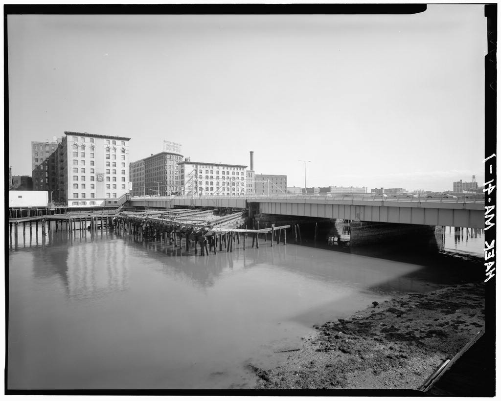
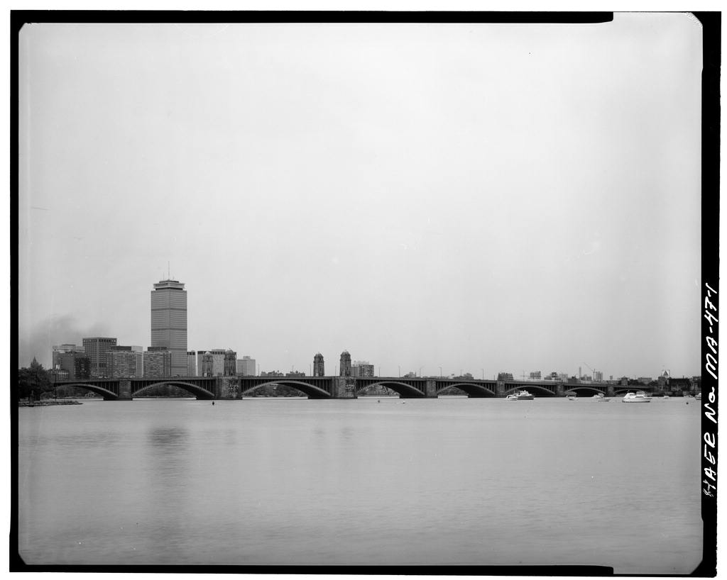
Longfellow Bridge, Spanning Charles River at Main Street, Boston

Longfellow Bridge, Spanning Charles River at Main Street, Boston, Suffolk County, MA. Surveyed as HAER MASS,13-BOST,80-, with 1 photograph and a 528-word written history.

From the record

“The chief monument of the Charles River Basin and the structure which does more than any other to formalize the planning of the river is the Longfellow Bridge, designed, the bridge commissioners wrote in "to furnish the eastern boundary of a great park system along 18 miles of river...destined to be the most beautiful park in the country.”

Written record, HAER MASS,13-BOST,80- survey. Machine-read text.

surveyed by the federal HAER program as HAER MASS,13-BOST,80- · the record runs 528 words · one of 264 surveyed structures published for this county.
Sources: the survey record at the Library of Congress

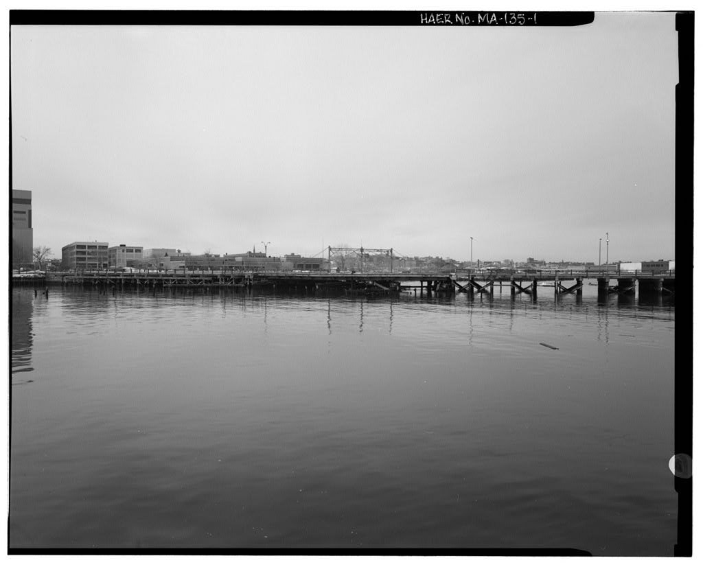
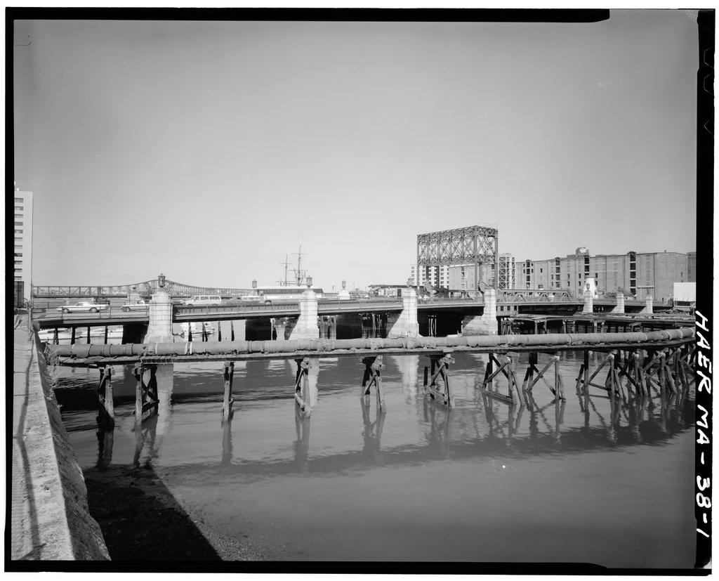
Longfellow Bridge, Spanning Charles River at Main Street, Boston, Suffolk County, MA, photograph filed with the federal survey

1 photograph from the federal survey record, Library of Congress.

Significance

447 words

Source document Quoted word for word from HAER MASS,13-BOST,80-. Not written, edited or summarised by this site.

The chief monument of the Charles River Basin and the structure which does more than any other to formalize the planning of the river is the Longfellow Bridge, designed, the bridge commissioners wrote in "to furnish the eastern boundary of a great park system along 18 miles of river...destined to be the most beautiful park in the country. It is the present purpose, to make the new Cambridge Bridge one of the finest and most beautiful # structures in the world." The Longfellow Bridge was authorized by the same legislation which authorized the Boston Transit Commission, the Tremont Subway, and the Charleston Bridge. Like the Tremont Street Subway, the Longfellow Bridge was in large part a result of heavy streetcar congestion brought about by the increased traffic of the new electric cars.

The old West Cambridge Bridge, constructed in and rebuilt in had been on the very first route to carry horsecar traffic, in Originally known as the Cambridge Bridge, the present structure was begun in July and completed in The Chief Engineer was William Jackson City Engineer since Jackson had been responsible for most of Boston's major bridges in this period, among them the Charlestown, Northern Avenue, and Harvard bridges. The Cambridge Bridge, completed three years before his death, was his most important project. The architect responsible for much of the monumental character of the bridge was Edmund M. Wheelwright Wheelwright had worked for both Peabody and Stearns, and McKim, Mead & White before starting in Boston HAER No. MA-47 page 2 on his own.

As City Architect between and he designed a large number of municipal structures including the granite kiosks for the Tremain Street Subway at Park and Boyleston Streets. Following the completion of the Longfellow Bridge, he was appointed to the corresponding post on the design and construction of the Hartford Bridge over the Connecticut River. The Longfellow Bridge is a combination street railway and highway bridge: the deck carries two lanes of street traffic on either side of the two central tracks of the Cambridge Subway (today's Red Line), though this link was not made until when the subway opened between Harvard Square and Park Street. Street traffic originally included traffic for streetcar service as well.

The deck, 105 feet wide and feet long, is supported by eleven steel-arch spans varying in length from 101 to 188 feet. The central span is flanked by the most striking features of the bridge, four granite towers, marking the formal entrance to the Harbor. The bridge is somewhat reminiscent of the Columbian Exposition of the and has been called "one of the finest steel arch bridges in the world." Transmitted by: Monica E. Hawley, Historian,

In context

Boston, Massachusetts The place record: every map, photograph and survey of this town.
Suffolk County, Massachusetts 165 topographic sheets across the county.
Library of Congress record The original filed report, and the sheets the survey produced. Those published here appear above.

Also surveyed in Boston

24 of 217 records shown

The federal surveyors worked through Boston building by building. These are the other structures they measured and filed a report on, longest report first.

SheetStructure SurveyReport
Boston Elevated Railway, photograph filed with the federal surveyBoston Elevated RailwayHAER MASS,13-BOST,127-34,555 words
Charlestown Navy YardHAER MA-90-326,428 words
Boston Government Service CenterHABS MA-135624,952 words
B. F. Keith Memorial Theatre, photograph filed with the federal surveyB. F. Keith Memorial TheatreHABS MASS,13-BOST,69-23,514 words
East Boston Steam Pump Station, photograph filed with the federal surveyEast Boston Steam Pump StationHAER MASS,13-BOST,138-19,247 words
Harvard Bridge, photograph filed with the federal surveyHarvard BridgeHAER MASS,13-BOST,79-14,362 words
Fenway Court, photograph filed with the federal surveyFenway CourtHABS MA-133413,845 words
Charles Street Jail Complex, photograph filed with the federal surveyCharles Street Jail ComplexHABS MASS,13-BOST,143A-11,650 words
Deer Island Pumping Station, photograph filed with the federal surveyDeer Island Pumping StationHAER MASS,13-BOST,137-9,553 words
Deer Island Pumping Station, photograph filed with the federal surveyDeer Island Pumping StationHABS MASS,13-BOST,132-9,107 words
Northern Avenue Swing Bridge, photograph filed with the federal surveyNorthern Avenue Swing BridgeHAER MASS,13-BOST,84-8,275 words
Summer Street Retractile Bridge, photograph filed with the federal surveySummer Street Retractile BridgeHAER MASS,13-BOST,87-8,144 words
Charlestown Navy Yard, photograph filed with the federal surveyCharlestown Navy YardHAER MA-90-307,907 words
Broadway Bridge, photograph filed with the federal surveyBroadway BridgeHAER MASS,13-BOST,135-7,746 words
New York, photograph filed with the federal surveyNew YorkHAER MASS,13-BOST,82-7,687 words
Deer Island House of Correction, photograph filed with the federal surveyDeer Island House of CorrectionHABS MASS,13-BOST,144A-7,466 words
Deer Island House of Correction, photograph filed with the federal surveyDeer Island House of CorrectionHABS MASS,13-BOST,144B-6,420 words
Franklin Park Zoo, photograph filed with the federal surveyFranklin Park ZooHABS MA-13166,293 words
South Station Tower No. 1 & Interlocking System, photograph filed with the federal surveySouth Station Tower No. 1 & Interlocking SystemHAER MASS,13-BOST,86-5,502 words
Summer Street Bridge, photograph filed with the federal surveySummer Street BridgeHAER MASS,13-BOST,139-5,482 words
Congress Street Bascule Bridge, photograph filed with the federal surveyCongress Street Bascule BridgeHAER MASS,13-BOST,77-5,232 words
Anderson Electric Company, photograph filed with the federal surveyAnderson Electric CompanyHABS MASS,13-BOST,142-4,832 words
72 Marlborough Street, photograph filed with the federal survey72 Marlborough StreetHAER MASS,13-BOST,72-4,792 words
Charlestown Navy Yard, photograph filed with the federal surveyCharlestown Navy YardHAER MA-90-694,488 words

Provenance

  • Written history. Quoted verbatim from HAER MASS,13-BOST,80-. United States federal work, no copyright under 17 U.S.C. 105.
  • Text capture. Machine-read from the scanned typescript filed with the survey, so spelling and spacing follow the original page.
  • How this page is made. Documentary passages are quoted from linked records; page labels and counts are clearly marked as presentation or calculations.