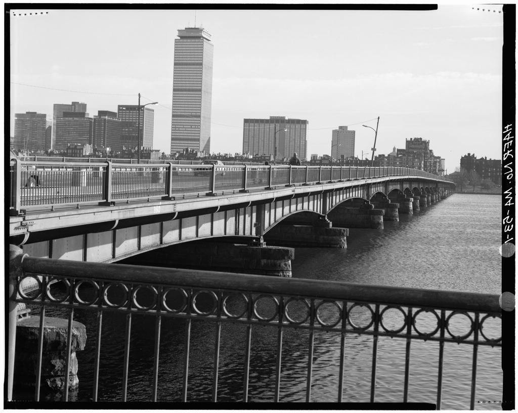
Adams Street Bridge, Spanning Neponset River, Boston
Adams Street Bridge, Spanning Neponset River, Boston, Suffolk County, MA. Surveyed as HAER MASS,13-BOST,133-, with 1 photograph and a 3,841-word written history.
From the record
“Proi ect Information: This mitigative documentation was undertaken in in accordance with a Memorandum of Agreement among the Federal Highway Administration, the Massachusetts State Historic Preservation Office, and the Advisory Council on His- toric Preservation.”
Written record, HAER MASS,13-BOST,133- survey. Machine-read text.
surveyed by the federal HAER program as HAER MASS,13-BOST,133- · the record runs 3841 words · one of 264 surveyed structures published for this county.
Source document
Quoted word for word from HAER MASS,13-BOST,133-.
Not written, edited or summarised by this site.
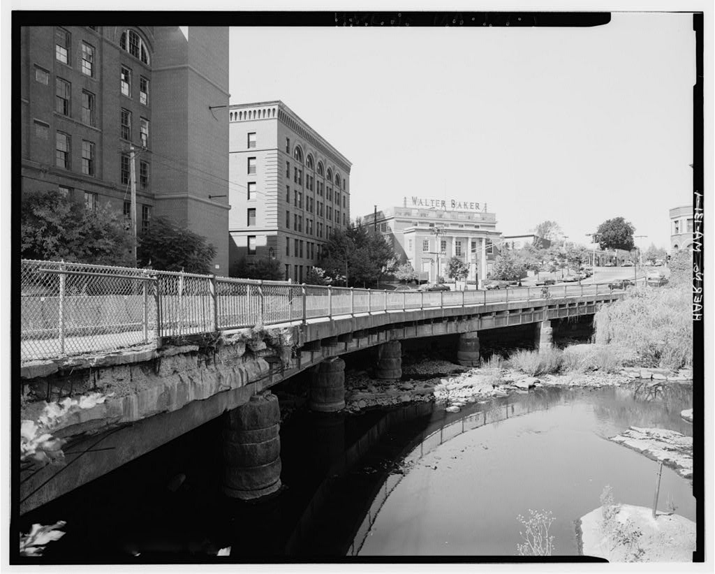
Adams Street Bridge has significance 1) as an example of stone-slab and stone- arch construction, once-common bridge- building technologies; 2) as the work of Gridley Bryant, a notable 19th-century engineer and inventor who designed and constructed the pioneering Granite Railway,- 3) as a contributing element in the Dorchester/Milton Lower Mills Industrial District (listed in the National Register of Historic Places); and 4) as a structure that recalls the important role of the granite industry in the historical development of Milton and the nearby town of Quincy.
Proi ect Information: This mitigative documentation was undertaken in in accordance with a Memorandum of Agreement among the Federal Highway Administration, the Massachusetts State Historic Preservation Office, and the Advisory Council on His- toric Preservation. The bridge is scheduled for replacement. Bruce Clouette Historic Resource Consultants Hartford, CT ADAMS STREET BRIDGE HAER No. MA-131 (Page-^2) Description The Adams Street Bridge crosses the Neponset River between the Dorchester section of Boston on the north (Dorchester was an independent town until it was consolidated with Boston in and Milton on the south.
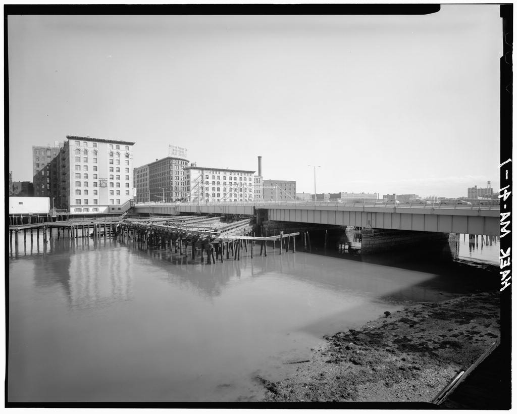
The core of the bridge is a five-span stone structure that includes two nearly semi-circular arches about 25' and 30' in span and three stone-slab or "clapper" spans each 7 to 10' long. The arches were built in but the shorter stone-slab spans appear to be earlier and may- well date from the first bridge on the site, constructed in Because the bridge has been substantially widened with concrete and steel-beam structures on both sides, the stone parts are currently not easily visible. The environment of the bridge reflects the intensive industrial development of the area in the late and early centuries by Walter Baker & Company, a chocolate manufacturer.
There is a low dam a few hundred feet upstream of the bridge and another just downstream, and large multi-story brick former factory buildings are built out to the edge of the street and hug or even extend out over the banks of the Neponset River. The buildings, including a large Neo-Classical early century office building, have found new uses by a variety of commercial, residential, and light industrial tenants. The area surrounding the bridge was listed on the National Register of Historic Places in as the Dorchester-Milton Lower Mills Industrial District. The stone portions of the bridge are constructed of roughly shaped blocks of fine-grained gray granite, a type of stone quarried at several places in Milton and nearby Quincy, Massachusetts.
Although there are remnants of sandy mortar in some joints, the stonework of both the arch and slab spans appears to have been originally laid with chinking stones added to fill in the larger gaps. Beginning at the bridge's north end, there are two stone-slab approach spans providing openings about 10' wide and 4' high; the channel for the northernmost span runs at a slight angle away from the main flow of the current. The western fascia slab for the northernmost span measures 18" thick, 40" wide, and 11' long. The next "clapper" span has an fascia slab measuring 20" thick, 40" wide, and 13' long.
There is a relatively narrow course of irregular blocks above the slab stones, with an area of large-scaled quarried granite rubble above them, providing a total overburden of about The slabs rest on side walls or piers that are about 4' high and 5' wide; the piers have rounded noses in the upstream direction. The stonework of the piers has been ADAMS STREET BRIDGE HAER No. MA-131 (Page-^3) mortared, and concrete has been poured around the bases as scour protection. The two arched spans are similar to each other but vary slightly in size, with the north arch about 6' longer.
Perhaps because of the irregularity of the stonework and the skew of the arches, the span of the north arch has been variously measured between 29' and The arches have a rise of about The arch rings are built of massive, squared-stone voussoirs, approximately 24" by 24" in section and up to about 8' in length; the row of stones at the apex has slipped downward 6 to 8" in the north arch and 3 to 6" in the south arch. The slight skew of the arches, given as 4 to 15 degrees in different sources, has been achieved by the traditional "false skew arch" technique, in which the courses of ring stones are parallel to the axis of the arch and each course is progressively offset in the direction of the skew. The spandrels of the arches are built of large-scaled quarried granite rubble masonry.
Two stones near the top of the spandrels, on the south end of the west face, are cantilevered out, possibly representing a remnant of the supports for the bridge's west sidewalk, which was built as part of the reconstruction. The south slab span is somewhat shorter than those at the north end, about 7 in span, but is otherwise identical to the others. However, immediately above it is another large slab that allows the bridge to flare out toward the south abutment. The abutments consist of granite rubble masonry similar to that of the arch spandrels. Although the slab spans and the arches appear to be built of stone from the same general source, there is considerable discontinuity in other aspects.
The stones in the slab spans are more irregular than the voussoirs of the arches, and their surfaces and edges appear considerably more weathered. Moreover, only the arches' stone exhibits the series of closely spaced, half-round drill marks that are associated with subsurface quarrying. With one exception (apparently a replacement), the slab stones are devoid of drill marks; such an appearance is consistent with earlier extraction techniques, in which surface stone was split out with hammers, chisels, and wedges. The bridge has been widened on both sides with now much- remodeled iron and steel girder-and-floorbeam structures that obscure the original stone bridge, the masonry of which is about 24' wide. The initial widening was undertaken on the east side ADAMS STREET BRIDGE HAER No.
MA-131 (Page*4) in and consisted of an iron plate-girder and floorbeam superstructure carrying a plank deck and cobblestone wearing surface. The outer face of the superstructure rested on a series of seven cylindrical stone piers, which still remain. The widened portion curved northward beyond the end of the original bridge, providing a wider and somewhat re-aligned Adams Street on the Boston side, with a long, quarried granite retaining wall defining the edge of the street in relation to the river. The stone piers supporting the widened portion are about 6' in diameter and consist of coursed quarry-faced granite stones up to 2' high, for a total height of about 8'.
Wide- flange cross-beams, 16" by rest on the girders and on beams set alongside the stone bridge; some extend out over the girders to support the curving roadway. The present floor beams, concrete deck, and concrete-encasement of the girders date from a reconstruction project undertaken in and One section of girder at the south end has been replaced with a concrete beam. Two of the concrete piers that support the inner girders of the east-side widening appear to surround large granite monoliths, 32" square. These may have been piers that supported the east- side sidewalk of the bridge as reconstructed in or they may be contemporaneous with the widening.
On the west (upstream) side the bridge has been widened about 8' with a large fascia I-beam carried on a concrete extension to the pier between the arches and an inner beam carried on cantilevers set into the stonework. The west-side widening was initially completed in and then rebuilt in Subsequently, one section of the fascia beam at the south end of the bridge was replaced with concrete. The underside of the bridge accommodates a number of utilities, including an array of 32 telephone conduits along the west side and sewer and water pipes supported by added I-beams along the east side.
The various episodes of widening have given the bridge an overall width of including a 42' roadway (currently restricted on the east side by concrete barriers) and 8' sidewalks along both sides of the bridge. The railings, known as "Boston type," are of welded construction and have closely- spaced tubular uprights between larger top and bottom pipe rails. Because the tide in Boston Harbor typically runs at 11' to it flows back over the downstream dam, resulting in substantial changes in the water level at the bridge. As a record of the ADAMS STREET BRIDGE HAER No. MA-131 (Page^5) exceptionally high tide of April which was nearly 7' above normal, iron markers were set into the stonework on the east side; if these still exist, they have been obscured by the later widening of the bridge.
Historical Background Although earlier there had been fords, footbridges, and a cart bridge a little downstream, the first bridge on the present site was constructed in According to an account published only a few years after the bridge's reconstruction in the original bridge was a two-span wooden structure with approach spans of stone-slab construction: The town of Milton built the southerly sluice and covered it with stone; the town of Dorchester built the two northerly ones, and covered them with stone; the two large ones, with the wooden bridge, were built at the joint expense of the two towns. (History of the Town of Dorchester. p. This early account substantiates the identification of the present stone-slab spans as portions of the earlier bridge.
Other evidence for such an interpretation includes the differing quarry marks and weathering of the stonework, the fact that the three stone-slab spans run at a level approximately 4 below the crown of the present arches (which is known to be the elevation of the old bridge), and the added slab needed to bring the southwest corner of the bridge into alignment with the arches. . Adams Street was part of a major route leading from Boston to Dorchester, Milton, Quincy, and other South Shore communities.
Laid out in the earliest years of the colony, the "Country Highway," as it was then known, remained the sole through road in this area until In the turnpike era, Adams Street was part of both the Blue Hill Turnpike, organized in and running southward from a point just south of the bridge, and the Dorchester Turnpike, chartered in to improve the road from the bridge north to Boston. The area that became known as Milton Lower Mills was an early trading center, since it was at the head of tidewater in the Neponset River. It also had one of the first water-powered enterprises in the vicinity, Israel Stoughton's gristmill. Throughout the and early centuries, Lower Mills continued to develop with new commercial and industrial ADAMS STREET BRIDGE HAER No.
MA-131 - "" (Page*6) enterprises, including stores, warehouses, a satinet mill, and a chocolate factory. The immediate need for rebuilding the bridge at this site was brought about by the construction of the Dorchester & Milton Branch Railroad along the south bank of the Neponset River. The existing roadway and bridge were insufficiently elevated to allow the railroad to pass below the road, but with an added 4 of height, the new bridge allowed the railroad to run in a tunnel (as it does today south of the bridge). The new bridge as completed in is shown in detail on a survey prepared for the widening of Adams Street, then known as Milton Road, made by S. Dwight Eaton and on file in the records of Norfolk County.
In addition to the two center arches, the three stone-slab spans are shown as they exist today. On both sides were sidewalks extending out beyond the bridge's masonry. Judging by the remnants that remain, the sidewalks appear to have been supported by a combination of cantilevered stones set into the spandrels and free-standing stone piers. The cost of the rebuilt bridge came to about and was shared equally between the towns of Milton and Dorchester, with Dorchester incurring a few hundred dollars in extra expenses, such as the in damages paid to Walter Baker for damages to his house and store caused by raising the street level, and for widening Adams Street on the Dorchester side. Dorchester also had to re-locate the firehouse known as Engine House No. 1.
The cost of the rebuilding, which included for a temporary bridge during construction, was partly offset by received from the sale of material from the old bridge. The contract for the reconstruction was awarded to Thomas Hollis, Jr. a prosperous local masonry contractor and supplier of stone. Hollis had inherited his father's granite business and went on to expand it considerably, owning at least one quarry in Milton, as well as interests in various stone-cutting operations in Milton and Quincy. Hollis served as president of the Granite Railway Company from to during which time he undertook the contract for the foundation for the second Minot's Ledge lighthouse east of Boston Harbor.
Although it was expensive for its day, the bridge apparently fulfilled the expectations of the local townspeople. When it was completed, the auditors of accounts for the Town of Milton made the following notation of approval: With regard to the Bridge . . . the town may congratulate itself upon an acquisition at once ADAMS STREET BRIDGE HAER No. MA-131 (Page^7) useful, ornamental, and permanent (Milton Annual Report, p. The "permanent" quality of the reconstructed bridge was called into question shortly after the Civil War, when its width and alignment proved inadequate. In Adams Street was widened and re-aligned to the east so as to meet Washington Street and Dorchester Avenue, at what became known as Pierce Square.
A long, curving granite retaining wall defined the new alignment of Adams Street on the Dorchester side, and the bridge was widened with the added beam structure carried on the cylindrical stone piers. The engineer for this work was Thomas W. Davis, Engineer of the City of Boston, which had annexed Dorchester only a year earlier. The bridge was enlarged on the west side in an extension that was rebuilt in The various episodes of widening reflected the increasingly urbanized and industrialized character of the area, which by that time was thoroughly dominated by the huge mills and warehouses connected with the Walter Baker & Company chocolate manufacturing enterprise. In the bridge was dedicated to the memory of Captain George J.
Roper, a resident of Lower Mills killed in action after parachuting behind enemy lines in Germany during World War II. Technological Significance The technology embodied in the Adams Street bridge was based upon traditional stone masonry skills common in the colonies since the first years of English settlement. The use of large monoliths to bridge short spans and arches for longer spans was simply a scaling up of the techniques stonemasons used to construct building foundations and fireplaces. However, because stone bridges were more expensive than wooden spans, towns tended to reserve them for locations that were especially heavily traveled or susceptible to flood damage. Both these conditions applied to Adams Street.
The road was a major highway linking Boston with the communities to the south, and the mill dam upstream of the bridge presented a hazard during high water. Today, examples of traditional stone-slab and stone-arch construction are becoming increasingly rare. Granite was used for stone bridges in Massachusetts whenever, as in the case of the Adams Street Bridge, it was readily available. Quarrying began around in neighboring Quincy, initially working granite ledges at or near the surface. By the early century, the industry was well-developed in both Quincy and Milton, with numerous quarries extracting granite ADAMS STREET BRIDGE HAER No. MA-131 (Page^S) that lay well below the surface.
These quarries supplied most of the building stone for the numerous granite piers, warehouses, marketplaces, and public buildings that were erected in Boston in the antebellum period. Along with related stone- cutting enterprises, the granite quarries constituted a major part of the economies of Milton and Quincy throughout the century. The greatest challenge in building the Adams Street Bridge was surely the transport and the raising of the pieces of granite, some of which probably weigh in excess of 6 tons. The erection of the stone-slab spans involved simply positioning the spanning stones on top of the walls at each end. Building the arches was more complicated.
The usual method was to erect a wooden form, called a centering, that duplicated the shape of the desired arch; the circumference of the form was finished with planks. The cut ring stones (the largest of which in the case of the Adams Street Bridge probably weigh about 2 1/2 tons) were then lifted into position on top of the planks. After the spandrels were completed, the centering was removed. While the large stones used in the construction of the Adams Street Bridge remain impressive, considering that they were cut with hand tools and positioned with derricks, block-and-tackle gear, and horse-power, Milton Lower Mills was surely the ideal locality in which to build such a structure.
Since the century, the necessary quarrying, stone-cutting, and masonry skills were found nearby in abundance, local contractors had wide experience with projects involving transporting and positioning huge pieces of granite, and, for the reconstruction, one of the most qualified individuals of the period was available to lay out the structure. The designer of the Adams Street Bridge's arches was the prominent engineer and inventor, Gridley Bryant Bryant was of the generation that acquired engineering expertise through apprenticeship, self-study, and experience. He received only a common-school education in his native town of Scituate, Massachusetts, after which he was apprenticed to a "prominent builder" in Boston for several years.
He eventually was placed in charge of all of his employer's construction projects, leaving his service around to start his own contracting business. In he worked with Harvard-educated Loammi Baldwin, on the repair and reconstruction of Boston's harbor defenses (Baldwin's father had been the engineer of the Middlesex Canal). In 182 3 he was given charge of the granite work in the construction of the United States Bank in Boston, a project during which he invented what he claimed was the first practical portable derrick. ADAMS STREET BRIDGE HAER No. MA-131 (Page**) In and Bryant conceived and built the engineering work for which he is best known, the Granite Railway in Quincy.
Bryant proposed the railway as a solution to the problem of moving the huge blocks of granite needed for the Bunker Hill Monument, for which he was the contractor, from the Quincy quarries to tidewater, where they were then carried to Charlestown in boats. Although it was a special-purpose system and relied on horse-power rather than locomotives, the Granite Railway is1 often considered a prototype for subsequent American railroads. With iron-clad wooden rails laid on granite cross- ties, at a 5-foot gauge, the railway was an immediate success, and it continued in use for more than forty years after the original project was finished. In its right-of-way was incorporated into the Old Colony and Newport Railroad.
In addition to the track itself, Bryant designed a series of ancillary features for the Granite Railway that became part of standard railroad engineering, including spur tracks, switches, and a turntable. Although he took out no patents, one of his innovations, the 8-wheel double-truck railroad car that even today remains the industry norm, was acknowledged by the courts. Bryant's prior invention provided the basis for rejecting Ross winans's claim that he had invented it, thereby saving millions in royalties that might have been due from the nation's railroads.
Bryant served as engineer and agent for the Granite Railway Company for many years, during which time he continued to design specialized machinery and conveyances for the company, such as the wheeled vehicles used to haul the 30'-tall fluted Doric columns, weighing 42 tons each, used in Boston's federal customhouse Bryant is said to have profited little from his innovations, instead supporting himself in his later years as a consulting civil engineer. At the time of the building of the Adams Street Bridge, he had an office on Court Street in Boston which he shared with his son, architect Gridley J. F. Bryant.
For his services, described in the records as a survey, plan, and estimate of cost for the bridge, the two towns paid Bryant a total of Although it may not rank among his most impressive accomplishments, the Adams Street Bridge does illustrate the bread-and-butter work of this eminent early American engineer. 1 See, for example, James E. Vance, The North American Railroad: Its Origin, Evolution, and Geography (Baltimore: Johns Hopkins University Press, ADAMS STREET BRIDGE HAER No. MA-131 (Page 0)
Bibliography
Bailey, 0. H. Milton, Lower Mills, Massachusetts. Bird's-eye view. Boston: 0. H. Bailey & Co., Boston City Directory, Dorchester, Town of. Report of the Receipts and Expenditures of the Town of Dorchester. Dorchester Antiquarian and Historical Society. History of the Town of Dorchester, Massachusetts. Boston: Ebenezer Clapp, Eaton, S. Dwight. "Plan for Widening Milton Road." Manuscript, Plan Book 2, no. Norfolk County Engineer's Office, Dedham, Massachusetts. Edwards, William C. Historic Ouincy, Massachusetts. Quincy: priv. Granite Railway Company. The First Railroad in America: A History of the Origin and Development of the Granite Railroad at Ouincy, Massachusetts. Boston: priv. Hamilton, Edward P. A History of Milton. Milton: Milton Historical Society, Massachusetts Highway Department.
Bridge Section. Bridge inspection files. Milton, Town of. Annual Report of the Receipts and Expenditures of the Town of Milton. Roper, Stephen J. Massachusetts Historic Bridge Inventory. Massachusetts Highway Department, Stott, Peter H. Inventory Form, Adams Street Bridge, Massachusetts Historical Commission, Stuart, Charles B. Lives and Works of Civil and Military Engineers of America. New York: D. Van Nostrand, Teele, Albert K. The History of Milton, Massachusetts, to Boston: Rockwell & Churchill, ADAMS STREET BRIDGE HAER No. MA-131 (Page n) 1/ r? Portion of "Plan for Widening Milton Road in Dorchester" by S. Dwight Eaton, (original in Norfolk County- Engineer's Office Dedham, Massachusetts) ADAMS STREET BRIDGE HAER No.
MA-131 (Page 2) be VllLToN HvOCOLAfxyS\_ILL5 View of bridge by George J. LaCroix, looking south (from Teele's History of Milton). ADAMS STREET BRIDGE HAER NO. MA-131 (Page 3) A.rf * ** " Detail of bridge roadway and sidewalk from 0. H. Bailey's Milton, Lower Mills. Massachusetts, looking south. ADAMS STREET BRIDGE HAER No. MA-131 (Page 14)
The original filed report, and the sheets the survey produced. Those published here appear above.
Also surveyed in Boston
24 of 217 records shown
The federal surveyors worked through Boston building by building. These are the other structures
they measured and filed a report on, longest report first.
 Block
Block