Documentation of Pier 11 was initiated in accordance with a Memorandum of Agreement between the General Services Administration, the Boston Redevelopment Authority, the Massachusetts Historical Commission (SHPO) and the Advisory Council on Historic Preservation, as a mitigation measure for various undertakings at the former Navy Yard. This documentation was prepared between April and August for ENSR Consulting and Engineering for submission to the U.S. Army Corps of Engineers, New England Division, prior to initiation of remedial investigations under the Defe!].se E-nvironmental Restoration Program. It is anticipated that the three light towers on Pier 11 will be removed.
Documentation prepared by: McGinley Hart & Associates Architects and Preservation Planners 77 North Washington Street Boston, Massachusetts CHARLESTOWN NAVY YARD, PIER 11 HAER No. MA-90-68 (page 2)
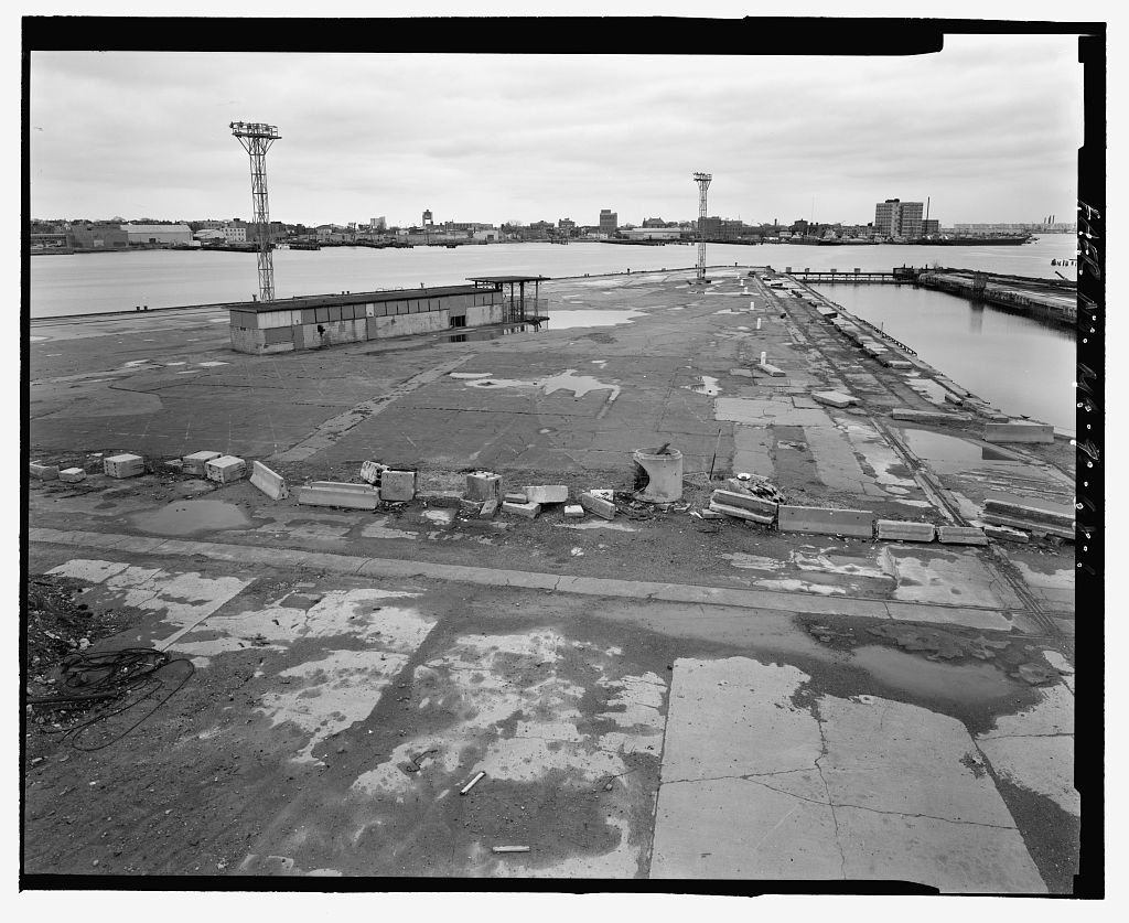
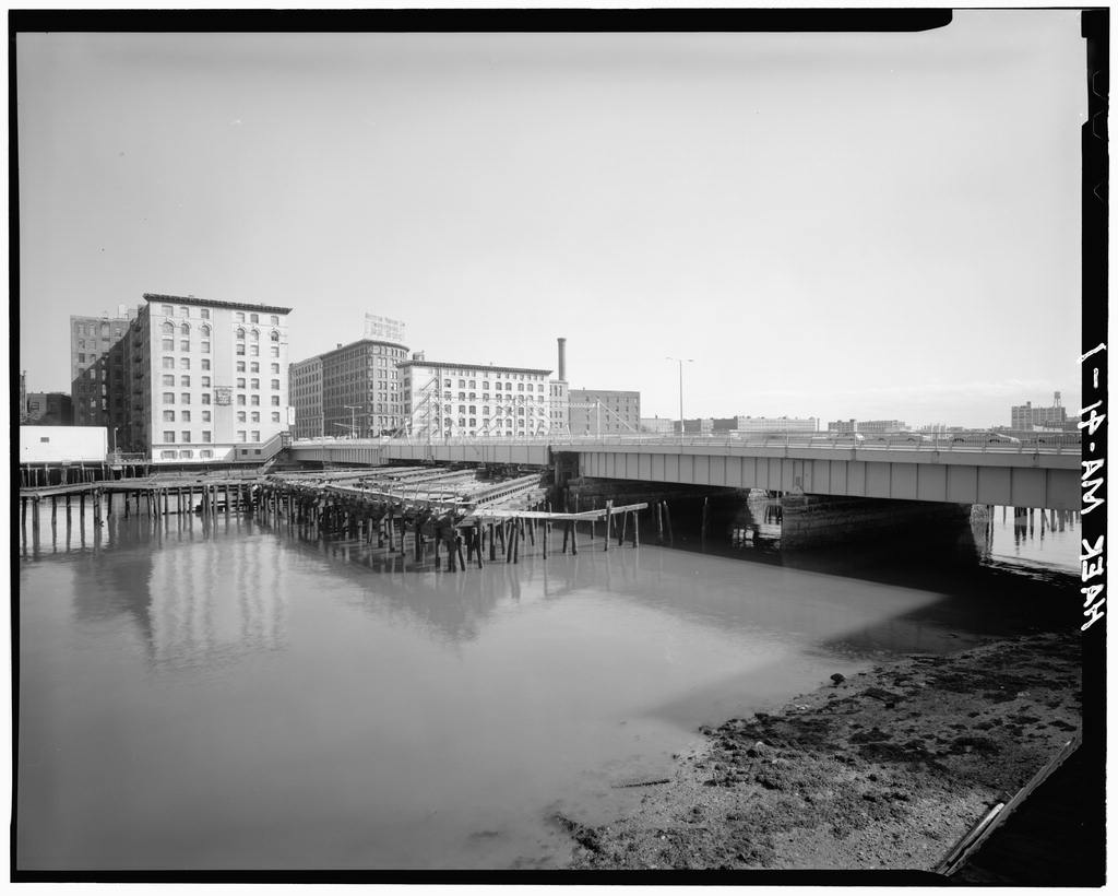
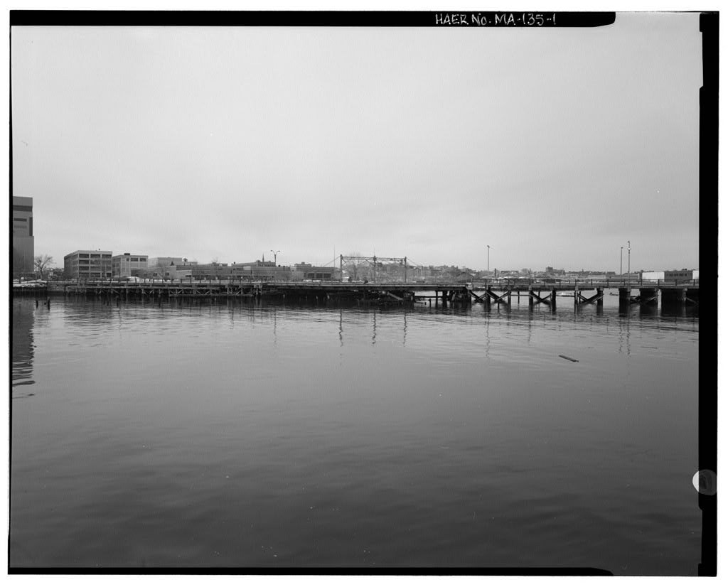
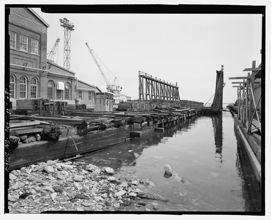
Pier 11 is located at the northeasternmost edge of Charlestown Navy Yard, at the confluence of Little Mystic Channel and Mystic River in Boston's inner harbor. (See location plan.) The pier, whose shape is generally triangular, forms half of the northeast perimeter of the shipyard, and shares a common wall with Dry Dock 5. This remote end of the Navy Yard has been fenced off, and is overgrown with vegetation and sparsely populated with abandoned buildings. The pier remains virtually intact, including three light towers and an abandoned utility building. PIER 11
Pier 11 is a steel-reinforced concrete pier, on concrete-filled steel pipe piles. It measures approximately long on the north side, long on the south side, wide at the inboard end, and 50' wide at the outboard end. Its size and shape were dictated by the Navy Yard boundaries, and existing structures, such as Dry Dock'5, which shares a common wall with Pier 11. The pier was equipped with mechanical systems for electric lighting, compressed air, oxygen, steam, fresh and salt water, and an automatic sprinkler. Remnants of pipes, valves, and other parts of the mechanical systems still exist, as well as three steel light towers. These light towers are approximately 60' high, and are located along the northeastern side of the pier.
The light towers support banks of incandescent light fixtures, which allowed to around-the-clock work shifts. Crane tracks are still visible on the pier's north side. There are a number of forged steel bollards bolted to concrete pads on the north edge of the pier. A concrete block industrial service building, Building is centrally located on the pier, and measures long x 20 ' wide. There is a 20'-square, open-sided shelter surrounded by a chain-link fence on the east end of the service building. The service building housed switches and controls for the pier's utilities, as well as offices and restroom facilities.
WHARFS AND PIERS AT CHARLESTOWN NA VY YARD Wharfs and piers were critical to Charlestown Navy Yard's mission of shipbuilding and maintenance, and shipyard's location was chosen with potential pier and wharf facilities in mind. The peninsula known as "Moulton's Point," located between two rivers in Boston's inner harbor, was considered an ideal site for docking ships. As early as requests were made for building a wharf or dock at Charlestown, but without any immediate threat of war, the government's attention and finances were focused on other problems of the young nation. During the first decade after the yard's establishment, naval vessels were built, stored and repaired at private wharfs, but the drawbacks to this arrangement were obvious.
Not only did renting wharf space cost the government a considerable sum of money, it was also a great inconvenience in the construction and repair of ships. CHARLESTOWN NA VY YARD, PIER 11 HAER No. MA-90-68 (page 3) In a cobb wharf was constructed to enclose the marsh at the center of the yard for "keeping the masts, yards, timbers, etc., in a state of preservation."1 Boats could dock at the wharf at half-tide, out the wharfs principal use was to form a dam for the timber basin where wood was stored. This remained the only docking facility until when Navy Yard Commandant William Bainbridge proposed the construction of wharfs and other improvements at the yard. If a wharf could not be built, Bainbridge recommended breaking up the yard and selling the ground.
2 At his urging, on the eve of the War of the Secretary of the Navy approved construction of a wharf "where the longest of your public vessels may lay with safety afloat at all times."3 The War spurred the Navy to begin development of their shipbuilding and repair facilities. By the yard had two wharfs on the waterfront, one at either end of the yard. As the Navy grew and the fleet expanded, additional docking facilities were required at the shipyard.
In the Secretary of the Navy's annual report for he stated: "Much inconvenience is experienced from the want of additional wharf room, the present wharves being insufficient to accommodate the public and private vessels visiting the yard; and the item for the wharf is therefore considered as highly necessary."4 By the shipyard boasted six "shear wharfs," three at either end of the yard. During the the wharfs were numbered 1 through 6. These numbers were changed at the turn of the century to accommodate the anticipated construction of several new piers. PIER 11
Pier 11 was originally constructed as a timber marginal wharf during World War IL It was primarily used for degaussing ships. Degaussing was a process by which ships were demagnetized for protection against magnetic mines. The northeast comer of the waterfront was the selected location for this pier, as it was the only piece of waterfront property which was unoccupied by docking piers. (See site plan, 1Edwin C. Bearss, Charlestown Navy Yard, Historic Resources Study, Volume I (United States Department of the Interior, National Park Service, Boston National Historical Park, Boston, Massachusetts, p. 34. 2Ibid., p. 3Bettina A. Norton, The Boston Naval Shipyard, (Boston: The Bostonian Society, p. 12. 4U. S. Department of the Navy,Report of the Secretary of the Navy, p.
CHARLESTOWN NA VY YARD, PIER 11 HAER No. MA-90-68 (page 4) Beginning in the yard sought funding for a number of its public works projects, and a master plan for the shipyard was drawn up. One of these projects was the demolition of narrow wooden Pier 11 and replacement with a steel and concrete fitting-out pier. This was done, in part, because the wooden piers could not sustain the weight of the cranes which were needed for work on radar masts and other special equipment on modem naval vessels. In addition, the shipyard hoped to install a system of integrated crane tracks, which would allow a number of cranes to be concentrated on one pier for specialized work.
Proposed projects at the eastern end of the yard involved replacing Piers 8, 9, 10 and 11 with reinforced concrete piers which could accommodate an integrated system of crane tracks, and revitalizing Dry Dock 5, which had not been properly constructed and needed new pumps and a new closure gate. Only a few parts of the master plan were realized, however. Several new piers constituted the most significant improvement in the waterfront area. By legislation enacted in June the Commonwealth of Massachusetts replaced the former Harbor Commissioner's line with a new pier and bulkhead line, extending the limits of the shipyard farther seaward. This made it possible to lengthen the piers.
Work had already begun on replacing Pier 4A with a concrete and steel structure, twice the width of the original wharf. Pierimprovement resumed in the mid-1950s when Congress authorized funds for replacing Piers 4, 6, 7 and 11. Work began in late and continued for the next several years. Each of the new concrete and steel piers cost between and Other work on the waterfront included repairing and improving the quay walls in the vicinity of Piers 5, 6, and 7. Pier 11 was demolished and rebuilt between and (See site plan, The new pier was constructed of reinforced concrete with crane tracks to accommodate work on large ships such as aircraft carriers. This work was accomplished by the firm of Merritt, Chapman & Scott.
During the next two decades, Pier 11 primarily served as a berthing pier for aircraft carriers. The pier was abandoned in when Charlestown Navy Yard was decommissioned. The U.S. Army Corps of Engineers, New England Division, is presently developing plans to remove the three steel light towers under the Defense Environmental Restoration Program.
Charlestown Navy Yard is nationally significant as one of the earliest naval shipyards- in the United States, founded in shortly after the establishment of the U.S. Navy. Together with the navy yards at Norfolk, Virginia, and Brooklyn, New York, it was the most important facility of its kind in the United States until the end of the Civil War. Decommissioned in the yard has retained many of its historic components, and is a significant site which illustrates aspects of the naval, industrial and technological history of the United States. It is CHARLESTOWN NA VY YARD, PIER 11 HAER No. MA-90-68 (page 5) listed on the National Register of Historic Places and is a designated National Historic Landmark. Pier 11 is significant as the last pier built at Charlestown Navy Yard.
It is also the largest. It was originally a narrow timber pier constructed during World War II to serve in degaussing ships. It was demolished and rebuilt in to accommodate maintenance on aircraft carriers. CHARLESTOWN NA VY YARD, PIER 11 HAER No. MA-90-68 (page 6)
Bearss, Edwin C. Charlestown Navy Yard, Historic Resources Study, Volumes I and II. United States Department of the Interior, National Park Service, Boston National Historical Park, Boston, Massachusetts, Black, Frederick R. Charlestown Navy Yard, Historic Resources Study, Volumes I and II. United States Department of the Interior, National Park Service, Boston National Historical Park, Boston, Massachusetts, Boston Redevelopment Authority. Charlestown Navy Yard: Master Planfor the Yard's End, March Pier 11 Design Project Files, uncatalogued archival materials. Boston National Historical Park Archives, Charlestown Navy Yard, Boston, Massachusetts. Pier 11 Historic Photograph Collection. Boston National Historical Park Archives, Charlestown Navy Yard, Boston, Massachusetts.
Raber, Michael S. and Matthew W. Roth. Boston Naval Shipyard: A Plan for Cultural Resource Management in the Buy Parcel Area, study prepared for the Boston Redevelopment Authority, New Haven, Connecticut: Raber Associates. United States Department of the Interior, National Park Service. National Register of Historic Places Nomination Form: Charlestown Navy Yard, United States Department of the Interior, National Park Service. National Register of Historic Places: Charlestown Navy Yard National Historic Landmark Survey, February Yard Plans, Charlestown Navy Yard. Boston National Historical Park Archives, Charlestown Navy Yard, Boston, Massachusetts. CHARLESTOWN NA VY YARD, PIER 11 HAER No. MA-90-68 (page 7) ,- r - - ~ ~ ~ ~r::~:"N::::p,a:=Al(J~=~=~ -'.~O: 00 -~ ~~ l - - - - - ' 0:" 'o .
,L" ... ,., . ,us oar l~B ,rehou~e 1 I 187 ,i .I :3tora9~ ~ :Q () tr1 ~~ ::0 - ::0 i '\ 0 tr1 :\.:i...... >-j . ~ > I j. \0 0I ~ h 0\ El'ev;;_tlona,) ; ~ 00 Extreme Hi~h Water .. (tile I att;'r _only tw1<;e, :" , . in over fifty year:,) ,, , . McanHigh\vater(approx,) , i6 Mean Lew '.-later. ' too. itj' p:, ~ L Extreme Low Water References:- oq ~ 1-) _.c _ (1) R i -r . . . ~ - - - - - - - - - - 00 '-" J~ Site Plan, Site Plan,
 Block
Block