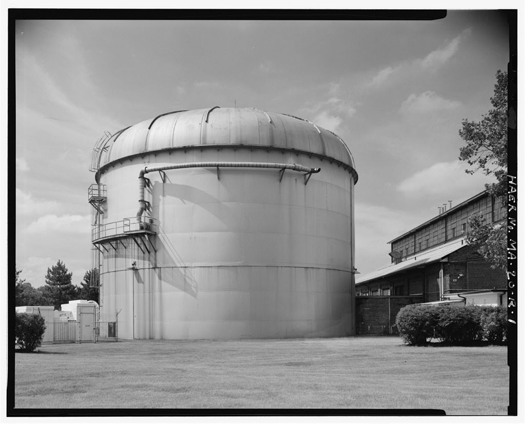
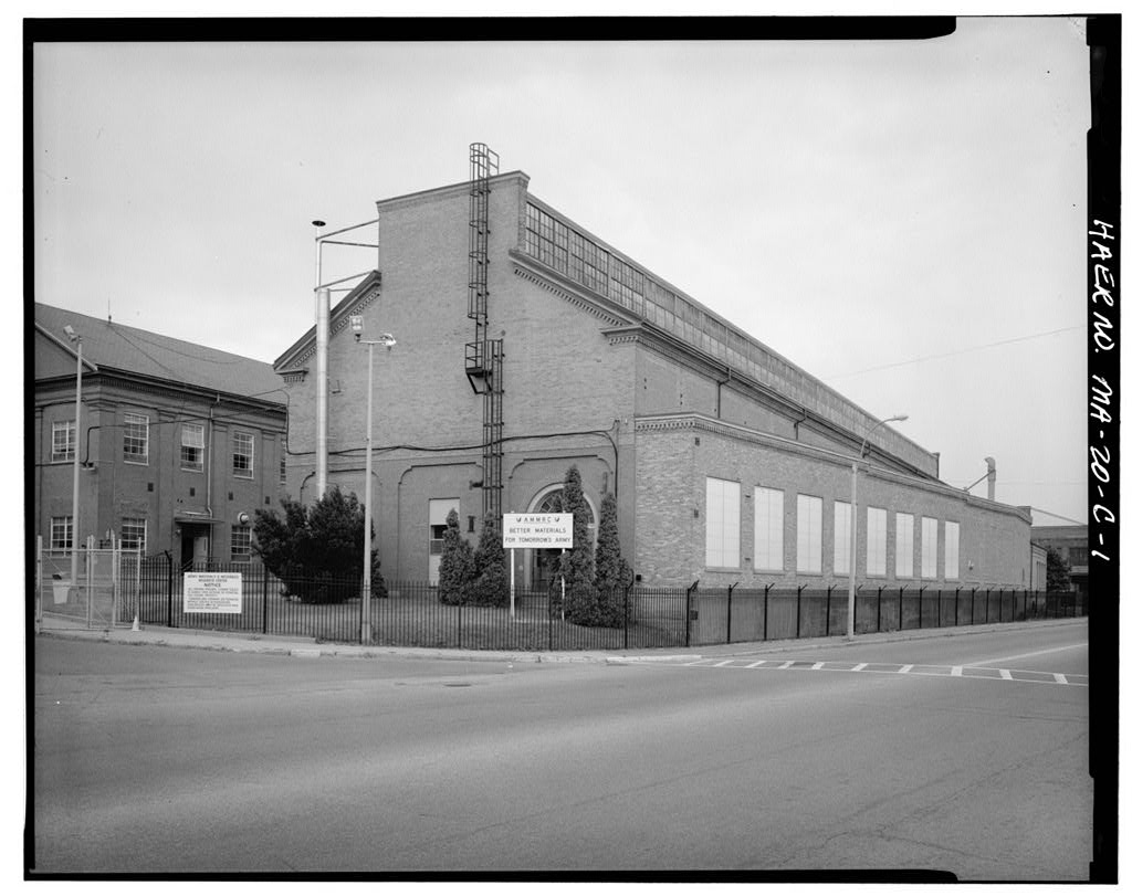
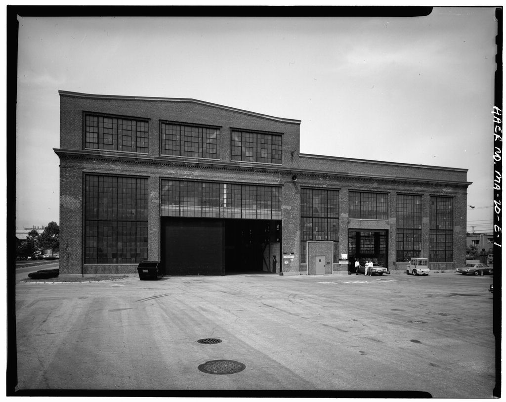
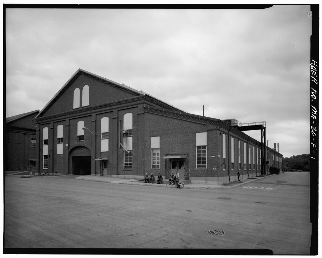
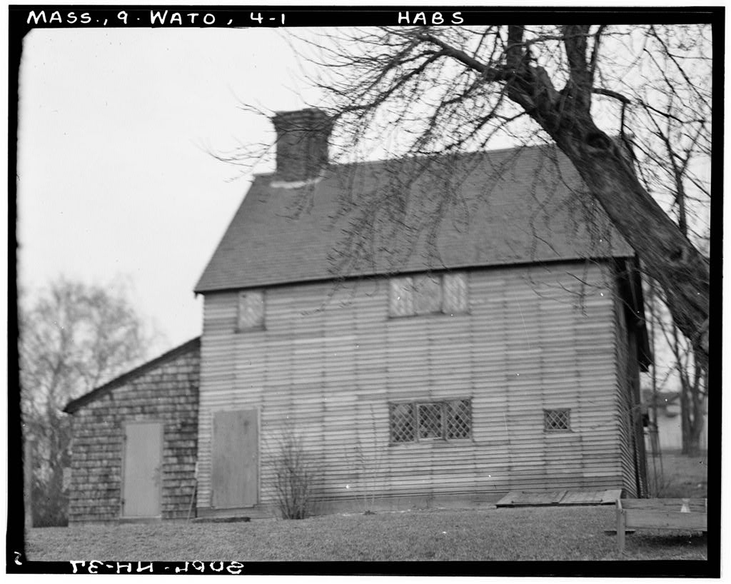
Watertown Arsenal, Olmsted Landscape, Arsenal Street, Watertown
Watertown Arsenal, Olmsted Landscape, Arsenal Street, Watertown, Middlesex County, MA. Surveyed as HABS MASS,9-WATO,6G-, with 1 photograph and a 7,610-word written history.
From the record
“The Olmsted landscape designed in and executed beginning in at the Watertown Arsenal is significant as an excellent and reasonably well preserved example of the work of the noted firm, Olmsted Brothers of Brookline, Massachusetts.”
Written record, HABS MASS,9-WATO,6G- survey. Machine-read text.
surveyed by the federal HABS program as HABS MASS,9-WATO,6G- · the record runs 7610 words · one of 333 surveyed structures published for this county.
Source document
Quoted word for word from HABS MASS,9-WATO,6G-.
Not written, edited or summarised by this site.
The Olmsted landscape designed in and executed beginning in at the Watertown Arsenal is significant as an excellent and reasonably well preserved example of the work of the noted firm, Olmsted Brothers of Brookline, Massachusetts. It is a contributing element in the Watertown Arsenal Historic District, a district eligible for listing in the National Register of Historic Places. WATERTOWN ARSENAL, OLMSTED LANDSCAPE HABS No. MA-l (Page 2) PART
Descriptive Information
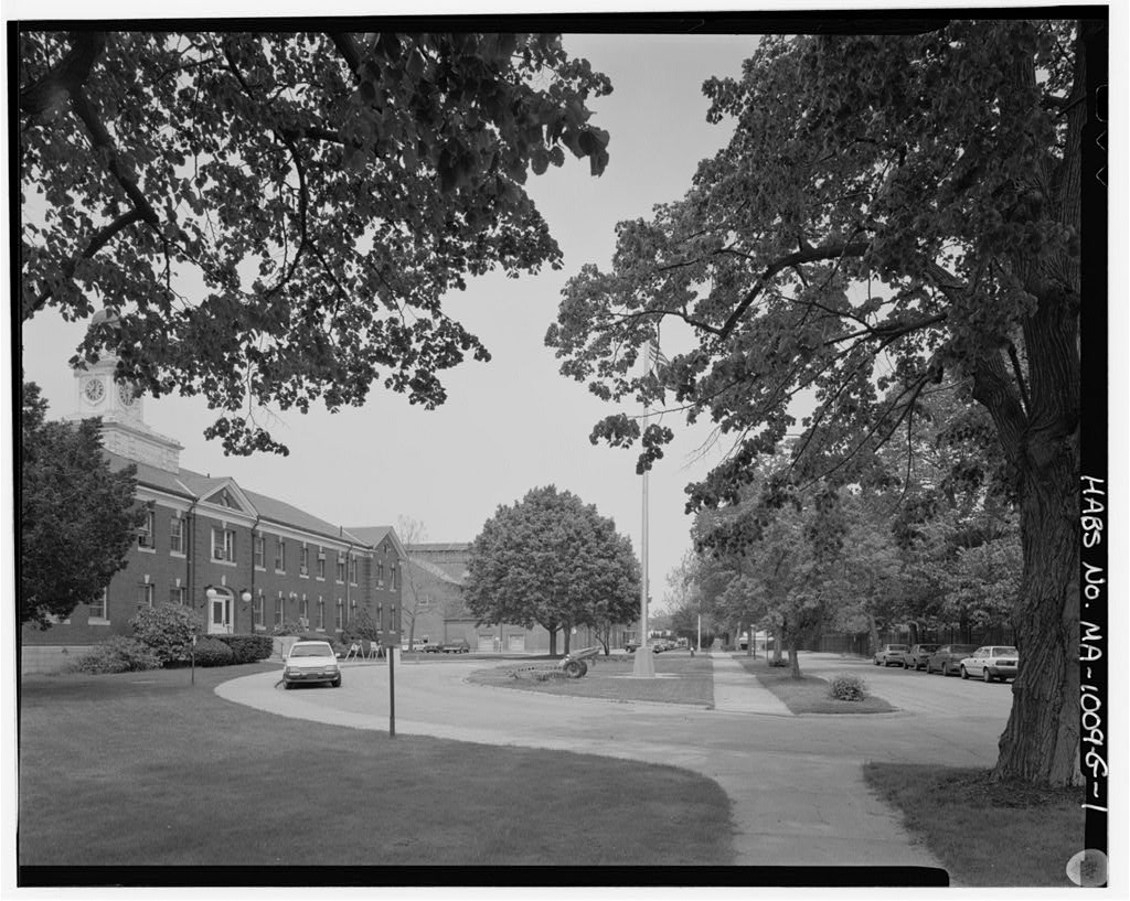
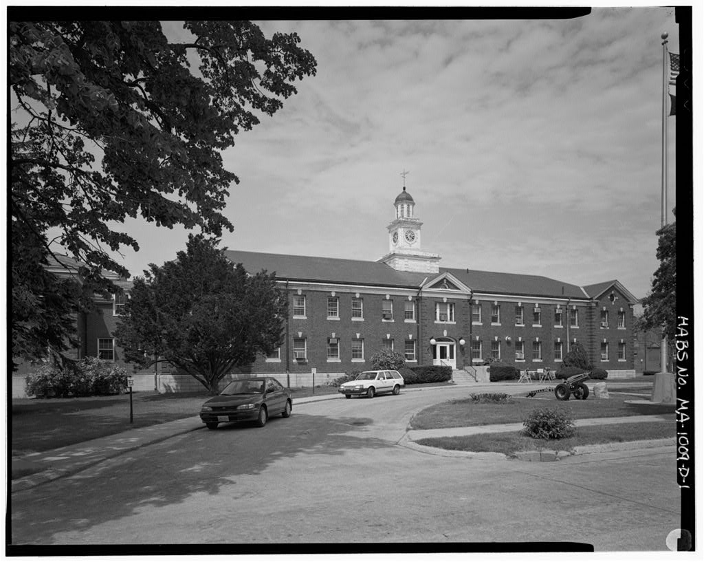
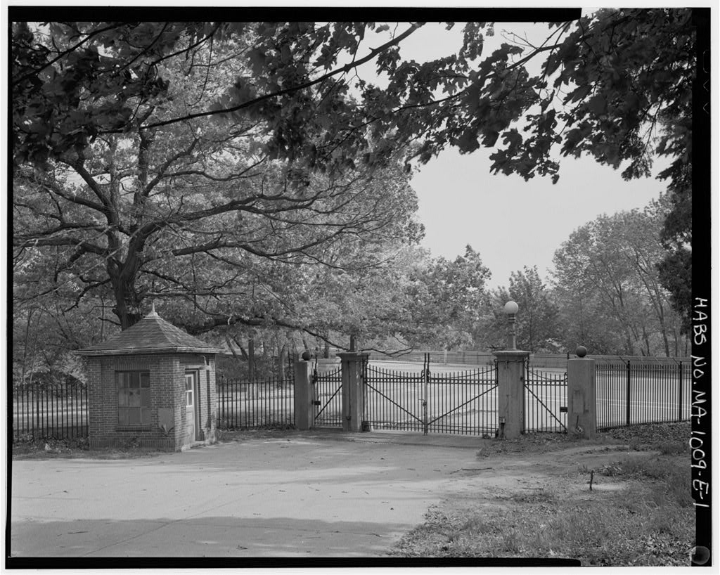
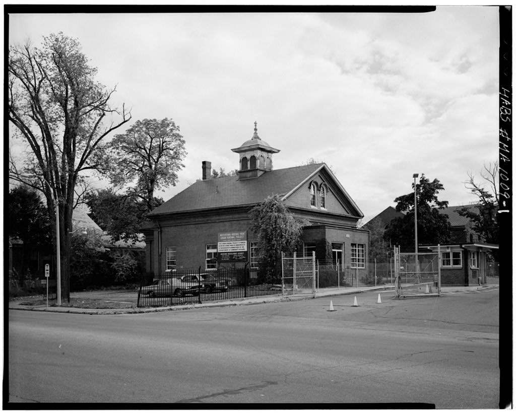
The portion of the Army Materials Technology Laboratory site (AMTL), historically known as the Watertown Arsenal, which reflects design work of the Olmsted Brothers landscape architecture firm (Olmsted Project comprises approximately 10 acres in the southeast section and along the east edge of the 48-acre U.S. Army property. The designed landscape encompasses the areas around Building Administration Building (HABS No. MA-'009-D), Building Commander Officer's Quarters (HABS No. MA-1009-F), the main entrance drive connecting the North Gate at Arsenal Street and the South Gate and Guard House, Building 142 (HABS No. MA-1009-E) at North Beacon Street, as well as the south embankment overlooking North Beacon Street and the Charles River.
The site topography is generally level, sloping gently downward from north to south, with a steeper elevation drop at the southern end. The scope of the original design included 55 acres of land to the east that is no longer Army property. Project correspondence (Manuscript Division, Library of Congress, Washington DC) and plans (National Park Service, Frederick Law Olmsted National Historic Site, Brookline, MAL however, indicate that the principal areas of concern were the entrance drive and the setting of Buildings 111 and Today's landscape is the result of multiple phases of development since the founding of the Arsenal in 181 6. It contains a basic structure reflecting the Arsenal's nineteenth-century layout, many elements of the Olmsted plan, and changes that have occurred between ca.
and the present. Comparison of archival materials with modern conditions indicates that the Olmsted plans for site design and plantings were not entirely implemented. The framework of roadways and walkways in the plans as built remains largely intact, although post-1920 plant material types and location do not conform in many instances to Olmsted's design. Three structures, a tennis court, a grape arbor, and a large "victory garden" arbor were added in the and two propellant storage bunkers, Buildings 244 and were constructed into the south embankment near the South Gate. In general, the landscape is well preserved and adequately maintained, retaining strong echoes of its nineteenth-century and Olmsted-era development phases.
It combines a formal entrance drive and formal facade setting for Building a more relaxed yet elegant approach for Building 111 , a park-like landscape and wooded embankment south of Building and an informal open lawn, formerly an orchard, west of Building Original Design Intent, Implementation, and Current Appearance In the broadest sense, the purpose of the Watertown Arsenal design project as conceived by Brigadier General Tracy C.
Dickson, Commanding Officer, and as interpreted by Frederick Law Olmsted in early project correspondence and meeting notes, was "a simplification of the road arrangement and systematic tree and shrub planting" (Olmsted Site Visit Notes, 25 March in order to "make the grounds more attractive" (Dickson Letter to Olmsted, 25 February Refinement of the basic concept and formation of specific design recommendations took place between February 191 9 and the submittal of final drawings and specifications on 1 December , 91 9. Within the current AMTL property, the principal components of the Olmsted plan pertained to the relocation of the main road from the South Gate to Building simplification of the service roads in cOf'lnection with Bui/ding and treatment of grounds and vegetation.
The latter consisted of five classes of areas with different distinctive treatments: 1) southern frontage overlooking the river, 2} adjacent to main buildings, 3) lawn areas, 4) adjacent to industrial buildings, and 51 utilitarian spaces (Olmsted Letters to Dickson, 2 June and 1 December Although never stated, the advent of the automobile no doubt influenced some of Olmsted's recommendations, particularly those for WATERTOWN ARSENAL, OLMSTED LANDSCAPE HABS No. MA-I009-G (Page 3) improving the main road and the service roads around Building most all of which were implemented.
The overall plan combined park-like treatments characterized by sweeping curves, walkways, and interesting trees and shrubs in the tradition of Andrew Jackson Downing with tight evergreen and loose, flowing perennial and annual beds adjacent to Buildings 111 and An imponant effect was to be created by generous use of flowering trees (dogwood, magnolia, etc.) and shrubs (viburnum, spiraea, honeysuckle, forsythia, etc.) along the grounds, dotting the lawn and framing the buildings, and the use of broadleaf evergreens (rhododendron, mountain laurel, etc.) on the south embankment. The plan proposed a woodland setting on the embankment, calling for large masses of understory shrubs, creating a naturalistic setting.
Essentially none of the evergreens survive, and it is not clear that this aspect of me planting plan was ever carried through. Perhaps these elements of the planting scheme were too costly or considered too elaborate for the Arsenal. Main Road The road patterns considered by Dickson and Olmsted had evolved over 100 years of Arsenal history prior to 191 9, but did not coherently address early-twentieth-century needs in the south entrance area. The South Gate was an early element from which a road led nonhwest up the slope then directly nonh on level ground to a cross road at the south end of the store house, barracks, and office quadrangle that formed the core of the early Arsenal. The quadrangle and nonh-south road section are no longer Army propeny and are heavily altered.
The road from the Nonh Gate marked the west edge of the quadrangle and ran straight south to the southwest corner of the quadrangle. In when Building Commanding Officer's Quaners was built, the Nonh Gate road was extended south past Building The road bulged east to accommodate a small oval island in front of the Commanding Officer's Quaners and terminated at a narrow path that ran along the top of the south bank. Rectangular islands with curved corners were used as pan of the south quadrangle entrance and along the west side of the Nonh Gate road, funher separating the industrial buildings on the west from the residential buildings on the east.
Between about and 191 9, a new nonhwest-southeast road was created connecting the South Gate road with the oval in front of Building thus providing a more direct nonh-south route across the Arsenal and from the South Gate to Building the new Administration Building erected ca. The major site plan feature recommended by the Olmsted plans, and implemented by the Arsenal, was the relocation and reconstruction of the new road connecting the South Gate and Commanding Officer's Quaners. At the same time, the road leading nonh to the quadrangle was abandoned. The new alignment, staked by Arsenal engineers and checked by Olmsted staff, was a more direct line, a wider roadbed, and had improved grades. A distinction was also made between the road and the Building 111 entrance drive.
South and nonh of Building Olmsted proposed sidewalk paths on the west side of the road. These apparently were never built, and the area south of Building 111 is lawn today. The design of the south area used broad sweeping road and walkway curves and a variety of plant material to enhance the park-like qualities of the area. Few trees were planned along the road edge in order to link the lawns on both sides of the road. Contrary to Olmsted's plan of nonh of Building an existing, nineteenth-century path of brick laid in herringbone pattern was retained and remains today. It runs from the Building 111 front entrance straight nonh to the north end of the Building 111 driveway. WATERTOWN ARSENAL, OLMSTED LANDSCAPE HABS No.
MA-lO09-G (Page 4) In the area of the main drive between Building 131 and the North Gate, most of Olmsted's suggestions appear to have been carried out. Here, the plan called for widening on the east side to 24 or 25 feet. This would have eliminated the sidewalk on the east side, but a new sidewalk was to be built on the west side in back of an existing row of trees. Today, the road bed measures approximately 25 feet. A narrow asphalt sidewalk runs along the east side of the road and terminates near the south end of Building indicating that this path was kept, although narrowed . Today a seven-foot wrought iron fence delineating the east boundary of AMTl runs along the center of the sidewalk.
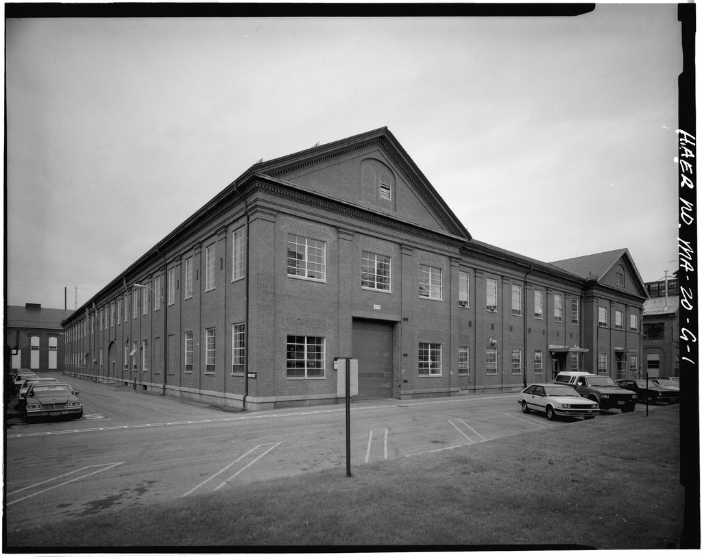
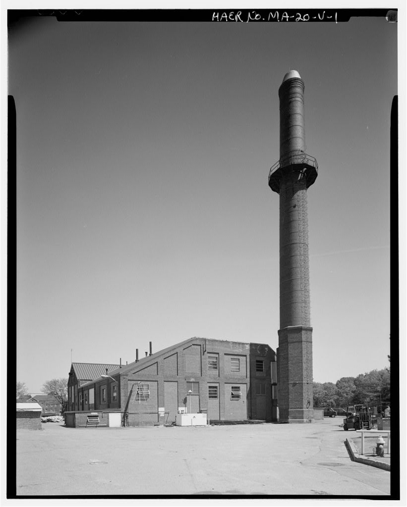
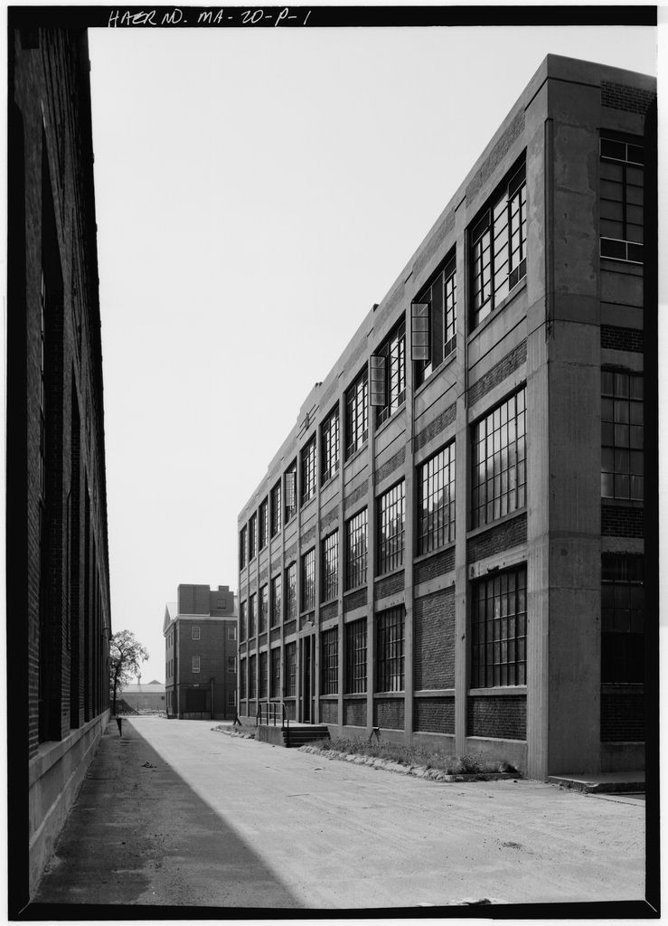
On the west side of the road, a grass strip (part of the nineteenth-century landscape) contains a concrete sidewalk behind the street-edge trees as specified by Olmsted. Olmsted called for European lindens; today both sides of the road are lined with mature lindens in approximately the spacing indicated on the Olmsted plans. Existing trees along the drive at the time were a mixture of species, including maples and elms. A hedge of 90% Japanese barberry and 10% Japanese Quince was proposed along the west edge of the green strip to screen the walk from the shops on the west. This was either never planted or has been removed. Japanese yew and lenne's magnolia were to be spaced in the grass between the walk and the hedge. Two highly mature yew stand opposite Building 37, HAER No.
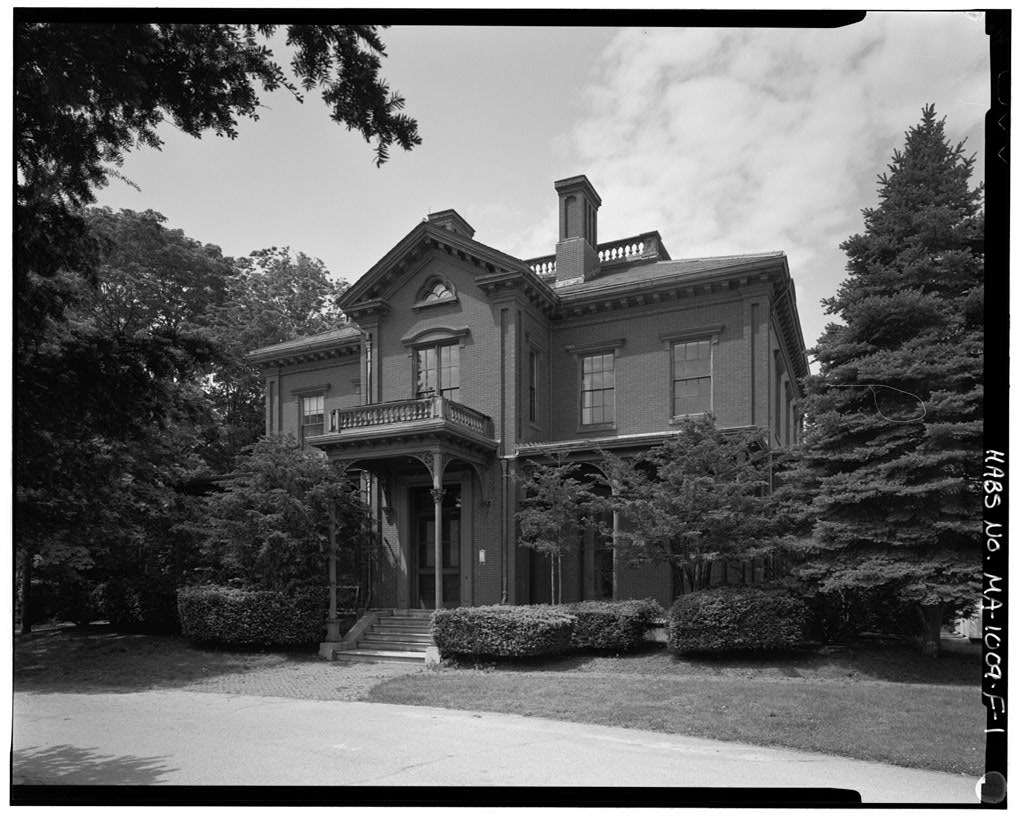
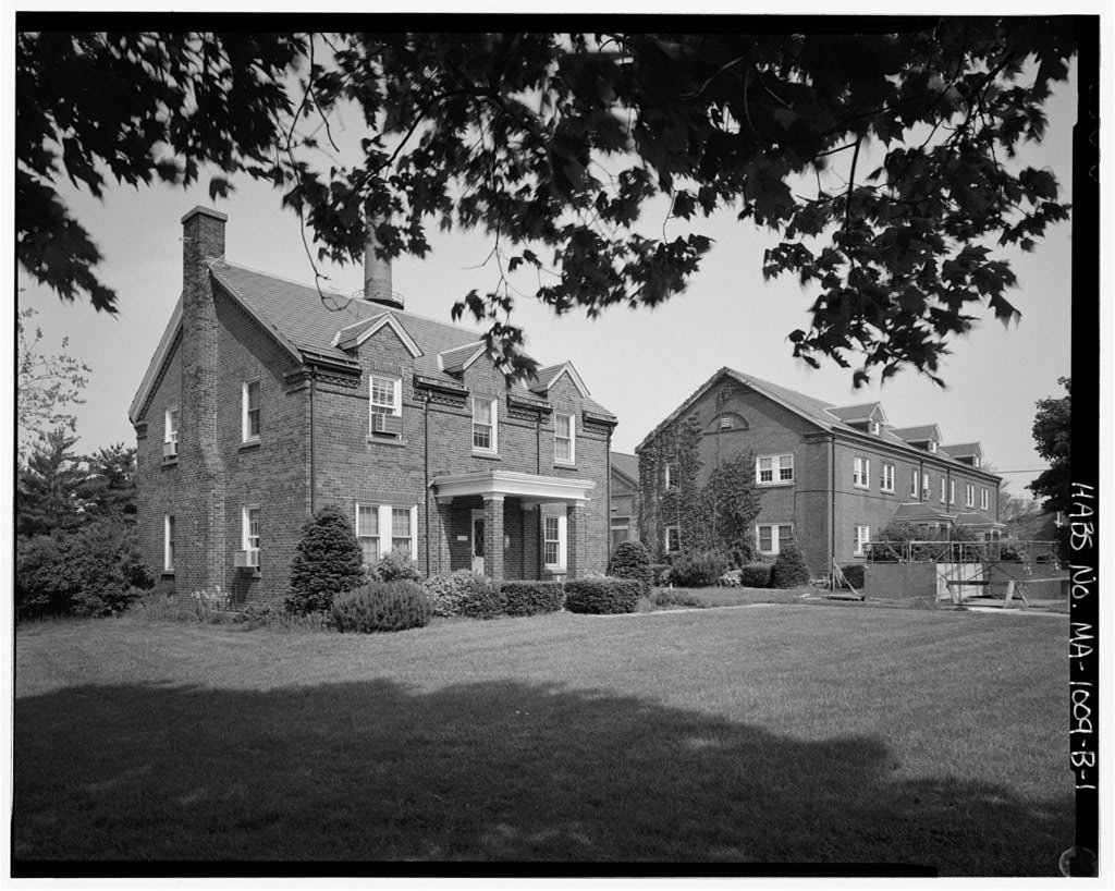
MA-20-0 as indicated on the plans, but as elsewhere in the Arsenal, none of the magnolias appear to have been planted. Building 11" Commanding Officer's House (HABS No. MA-1009-F), Entrance, Service Roads, and Environs Building 111 is an elaborate, brick-and-brownstone Italianate dwelling with a T-plan. It was constructed in to house the Arsenal's Commanding Officer. The entrance treatment proposed by Olmsted for Building slightly Victorian in flavor, comprised reworking the entrance oval drive and the addition of walkways and new plantings. The minor changes to the oval configuration were carried out, but not all the walkways were removed or installed as was recommended (see discussion of service roads and lawn area south of house).
Olmsted's planting plan for the oval and the front of the house called for Japanese yews and dwarf English yews anchoring beds of geranium and cannas in the oval with a mix of foxglove, phlox, and other flowers near the house. Olmsted's recommendations for realigning the service road connecting the main road to the north rear of Building 111 were not implemented, nor were most planting suggestions. The service road, as it appears on the plans and exists today, runs in a straight line south-north, turning east for a short distance to join the main road. A row of seven mature cedars, which Olmsted called for removing with the road, line the east side of the road.
Heading south as it approaches the north side of the house, the drive curves southwest and enters a southwest-northeast oriented teardrop turn-around, then proceeds into a rectangular rear yard abutting the west end wall of the house. In and probably up to when a garage was installed in the basement of the house, a curved edged stopping area was located on the east side of the service road north of the turn-around with a curved path leading to the front entrance. These features no longer exist. Olmsted's plans called for eliminating the turn-around in favor of a larger rear stopping area and relocating the road to a gently curving east-west alignment just north of the house.
Lilac hedges were to be moved and privet hedges installed to better define laundry area and utilitarian spaces at the rear of the house. Although the service road reconstruction did not occur, an important space-defining plant material recommendation was carried out. Olmsted recommended moving an existing lilac hedge between Buildings 111 and 131 that divided the public approach on the east from utilitarian garden WATERTOWN ARSENAL, OLMSTED LANDSCAPE HABS No. MA-I (Page 5) areas on the west. The hedge was relocated eastward, and at the southern end near Building 111 a curved hedgeline was created to follow the line of the service road turn-around.
Lawn Area South of 8U11ding 111 The park-like lawn area south of Building between the building and the south embankment, was laid out in the Olmsted plan with a revised system of paths in order to achieve two purposes: '" first, to get the maximum use and enjoyment out of this area as a recreation ground for Arsenal employees, and second, to secure a reasonable amount of privacy for the Commanding Officer and his family. (Olmsted letter to Dickson, 1 December For the enjoyment of the employees, the plan included relocating an existing path closer to the top of the embankment. Along it would be erected a summer house and a terminal seat with views to the river for the use of Arsenal employees. Olmsted's plan shows view lines from the seat, summer house, and porch.
No trace of the path exists, and the area remains lawn. The site shown for the terminal seat on the plans is definitely marked by some old plantings including two dwarf chamaecyparis, but lacks the flowering shrubs and trees such as leucothoes, Highbush cranberry, Flowering Dogwood, and Arrowwood noted on the Olmsted plan. A low stone wall that was to incorporate the viewing seat was apparently not executed. The presence of the chamaecyparis on the bank edge and the existence of an early-twentieth-century concrete bench, unique at AMTl, located in a grove of trees nearby, suggests that the concept of the terminal seat was carried out, but in a different way than Olmsted had intended. No information exists on whether the summer house was ever built.
In the two propellant storage bunkers, Buildings 244 and were constructed into the hillside at this location, destroying the earlier landscape. This section is now recontoured and contains a grove of pine trees. An existing path connecting the main entrance road and the embankment path was to be removed and replaced by two paths, one closer to the South Gate leading to the summer house and one closer to Building 111 leading to the viewing seat. The public path west of the terminal seat was to be discontinued, and the section of the plateau directly south and southwest of Building 111 was to be separated from the rest of the grounds by interesting planting (Olmsted letter to Dickson, 1 December Several elms in this area were to be removed.
The design called for deciduous material at the top and bottom of the embankment, an evergreen understory along the embankment, and a path and steps connecting the upper and lower lawn areas. The proposed plant material for screening included Wing-Branched Burning Bush, Weeping Golden Bell Forsythia, White Fringe Tree, Ninebark Spiraea, Witch Hazel, and Wayfaring Tree. The lawn today contains no evidence that the proposed paths were installed, and none of the screening flowering trees and shrubs, if they were planted, survive. The lawn today is planted with scattered trees, some of which appear as existing trees (with calipers of 10 to 13 inches in to be retained on the Olmsted plan. Most notable is a cluster of four large sugar maples immediately south of the main block of the house.
Existing narrow steps on the east side of the Building 111 piazza were to be replaced with broad steps on the south side of the piazza leading directly to the south lawn. The piazza steps were relocated from the east to the south, although it appears that the east granite steps were reused, rather than replaced with broader treads. Plantings around the piazza included perennials which no longer remain and B6&ton ivy which today has spread over a large bed west of the piazza. At the west end of the south lawn, the park-like setting was separated from a large apple orchard west and southwest of Building 111 by a service road connecting the rear parking area with the path at the top of the south embankment. Olmsted redefined this section to enlarge and enclose the park.
He recommended removal of all paths, planting a Common Lilac hedge on a straight line drawn west from WATERTOWN ARSENAL, OLMSTED LANDSCAPE HABS No. MA-I009-G (Page 6) the southwest corner of the house to the bank, then northwest along the bank, then north along the west edge of the orchard. All apple trees south of the hedge were to be removed and a cluster of Highbush Cranberry and Wing-branched Burning Bush were to soften the sharp V at the intersection of the hedge and the embankment. One Hybrid Weigelia was to go midway along the hedge on the south side. The appearance of this area today indicates that the recommendations were partially fulfilled. The hedge was planted as proposed, but with Privet rather than Lilacs.
It still remains even in sections now overgrown along the top of the bank. No apple trees remain south of the hedge and there is no evidence of the ornamental shrubs today. South Embankment The approach to the south embankment was .. An open wooded effect utilizing most of the good existing trees, supplemented by the gradual addition of other varieties harmonious with them and by the gradual introduction in liberal quantity of groups, masses, and specimens of handsome shrubs, including many evergreen and flowering shrubs of a long lived sort and smaller flowering plants with plenty of room for walking about among them and getting views out upon the river.
The purpose would be twofold: to make the frontage of the Arsenal on the parkway strikingly beautiful with the kinds of plants notable not for quick effects but for permanently increasing richness and dignity when maintained with stability over long periods of years, such as rhododendrons, azaleas and other ericaceous shrubs, box bushes, yews, flowering dogwoods and certain wild flowers of smaller growth; and to provide a place where the Arsenal employees can walk or sit in considerable numbers, especially at lunch time, in the pleasantest of surroundings overlooking the river.
(Olmsted Letter to Dickson, 2 June In the submittal of final plans, Olmsted noted that all the plantings and improvements will not realize the full impact of one distinct asset, the potential for "permanent and delightful" views of the Charles River Basin. He recommended highly selective trimming and cutting, to be done when leaves are off the trees, to open up views from the windows and piazza of the Commanding Officer's House, and the proposed summer house and seat. The cutting needed to be done with the "greatest care and restraint", in order to open only good views and to preserve the foliage massed bank seen from North Beacon Street. (Olmsted Letter to Dickson, 1 December The plans also called for regrading the embankment to install a meandering path at the midpoint of the slope.
At the toe of the slope, the massed plantings would give way to a strip of open lawn, fronted at the North Beacon Street fence by a screen of trees and shrubs (crabapple, dogwood, spiraea, sumac, etc.) with emphasis on pines at the South Gate. The extent of implementation of this portion of the plans seems quite limited. Today the embankment remains wooded with pines, maples, and oaks, infilled by an understory and naturalized plants. There is no evidence that the extensive shrub planting scheme or the walkway were ever achieved; any regrading of the slope for a pathway is discernible. The area between the bottom of the slope and the fence is a lawn with oak, pine, and maple trees planted all across it. 8uiiding 131 (HA8S No.
MA-1009-DJ Environs Historic views indicate that the elliptical drive at the front (east) entrance of Building 131 was established sometime after construction (ca. and the Olmsted involvement Olmsted's contribution to the site was to rationalize the sidewalk system. The planting was simple. A narrow WATERTOWN ARSENAL, OLMSTED LANDSCAPE HABS No. MA-lO09-G (Page 7) shrub and perennial bed was proposed along the front of the building, except the end pavilions added in with upright Japanese yew flanking the entrance. Starry Magnolia were to be planted in front of the end pavilions and at either side of the sidewalk in the elliptical island across from the main entrance.
Larger trees were envisioned northeast and southeast of Building Today, this area retains the sidewalks as laid out by Olmsted, but none of the plantings remain. This area also retains an earty-twentieth-century cast-iron sign post. Located on the east edge of the main drive opposite the Building 131 entrance, the post has a fluted shaft, ball finial, sign brackets, and the patent date, 22 July An early-twentieth-century photograph reveals that a similar post appeared on the building side of the ellipse. Former Orchard Based on examination of the Olmsted plans, the Watertown Arsenal fruit orchard contained approximately 100 regularly spaced trees.
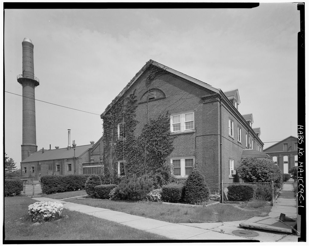
It was located west of Buildings 111 and 131 and extended south to the embankment, west to a rocky knoll, and north to a line midway between Buildings 111 and Apple trees predominated, although peaches and other varieties were represented. A path led from the rear of Building 111 in a northwest direction through the orchard. At the northwest corner of this open orchard area, historic maps show a small farming complex including several pOUltry houses, a cow barn, now Building 117 (HABS No. MA-l009-B), and a stable, now Building 118 (HABS No. MA-l009-C).
Olmsted's proposal entailed removing portions of the orchard at the south edge where a hedge would separate the orchard from the lawn (see above), and on the east edge, where a relocated Common Lilac hedge and new hedges would define an enclosed laundry yard (see above). The path was to be removed, perhaps, again, to promote privacy for the Commanding Officer and his family by discouraging public access. Today this area is a large grassy lawn covering nearly the entire space between Buildings and a parking lot on the north. Six or seven scattered apple and pear trees remain of the original orchard. A large beech tree, which was apparently not part of the Olmsted scheme, stands near the northwest corner of this open area.
Some of the hedge work was done, and removal of trees at the south edge seems to have occurred. The path was not removed and remains in place. It is paved in brick laid in running bond and is visible at the east end for a short distance; most of its length is covered with grass, but contrasting grass materials distinguish its location from its surroundings. Its presence has also been verified by archaeological examinations (Cherau and Miller, in prep.). The major change to this area, aside from the loss of the fruit trees, is the addition of two garden features and a tennis court at the east end of this open area in the 1 The tennis court is northwest of Building 111 with a lilac hedge screen on the east side.
A grape arbor just south of Building 131 is a wood structure with grape vines growing on it. The "victory garden" is a wood double arbor, with north and south entrance breaks, enclosing a rectangular area. The enclosure may have been a vegetable garden at one time, but is now lawn. Two fruit trees from the original orchard remain within the grapevine covered arbor. Industrial Buildings The landscape treatment of the industrial buildings was confined to trees and turf, "except that here also climbers could be advantageously used on the buildings much more extensively than in the past" WATERTOWN ARSENAL, OLMSTED LANDSCAPE HABS No.
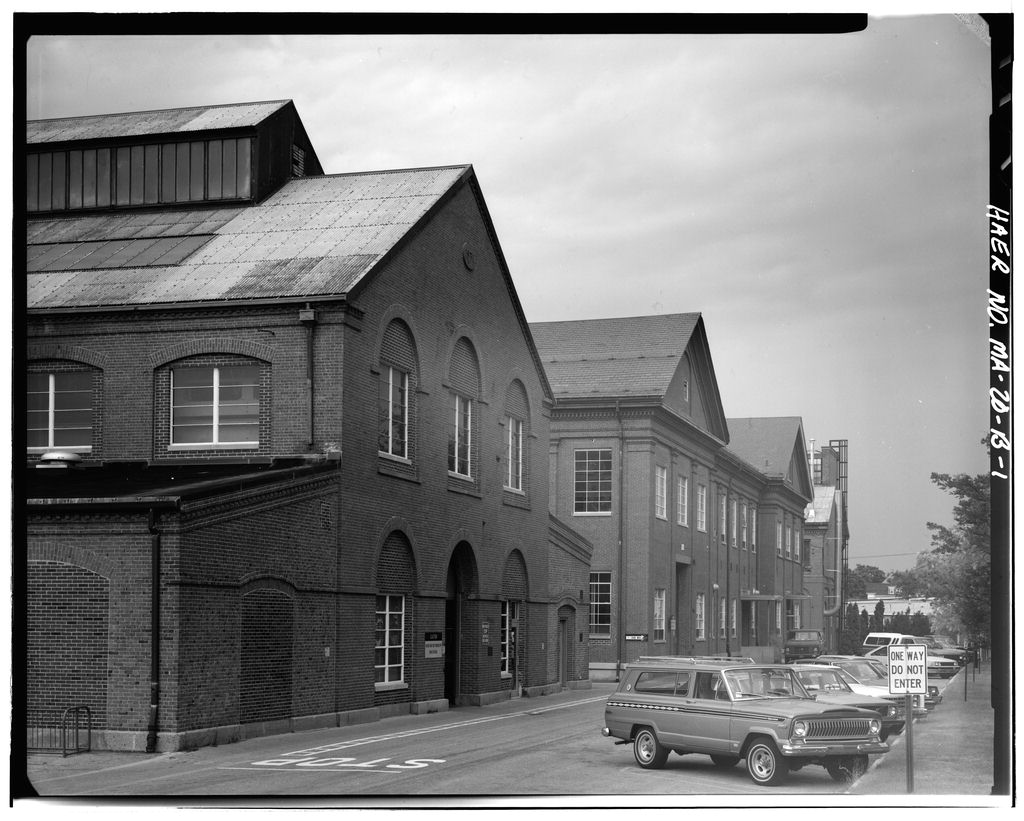
MA-l (Page 8) (Olmsted letter to Dickson, 2 June Olmsted's plans included drawings for trellises and sidewalk vine planting pockets along the south side of the Machine Shop Shed. This building stood south of Building 37 (HAER No. MA-20-DI and has been demolished. The general types of plantings around the industrial buildings at AMTl today consist of turf and trees, as specified by Olmsted, although the plant material is more recent. None of the trellised treatments survive. PART
Historical Information
During the first 100 years of its history, the Watertown Arsenal site was characterized by a combination of industrial, residential, administrative, and agricultural buildings, and by a landscape that encompassed the utilitarian (both industrial and agricultural) and park-like areas. According to local tradition, a gardener at the Arsenal in the mid- and late nineteenth century planted over 100 different species of trees along one of the main roads that led to Building 111 (Dobbs Greenhouses were located in the east part of the property, within the 55 acres sold to the Town of Watertown after the Arsenal closed in The Arsenal was a prominent landscape for the community and the Charles River Basin.
It served both as a mini-arboretum or park, and retained a pastoral quality with fruit and vegetable gardens and farm animals into the twentieth century. The scenic and recreational qualities of the area were being recognized in the early decades of the twentieth century, when the Metropolitan Park Commission began development of North Beacon Street as a park along the Charles River. In early the Arsenal's commanding officer, Brigadier General Tracy C. Dickson (served as It. Col. Tracy C. Dickson, 3 Mar - 8 Jan and as Brig. Gen. Tracy C. Dickson, 14 Oct - 17 May contacted the Olmsted Brothers landscape Architects of nearby Brookline concerning improvements to the Arsenal grounds.
The Olmsted Brothers firm was comprised of the son and adopted nephew of the famous and influential Frederick law Olmsted, designer of Boston's "Emerald Necklace" park system, Central Park, New York, and numerous other public and private landscapes. The principal in charge for the Arsenal project was Olmsted's son, Frederick law Olmsted, Jr. Commanding Officer Dickson exhibited a strong interest in the Arsenal's history and in improving and preserving it for the future, as reflected in his detailed history (Dickson Dickson defined the program for the Olmsted Brothers' proposed landscape improvements. The project was designated Job by the Olmsted firm.
In his introductory letter to Olmsted, Dickson noted that he had heard of the "artistic work" of the firm and hoped that a way could be found to engage the firm despite the government being .. exceeding economical" (Dickson letter to Olmsted, 25 February, Olmsted's reply reported that his time was largely occupied by his position as an officer in the United States Housing Corporation, Washington, but indicated his interest to work on the project (Olmsted letter to Dickson, 8 March On 25 March, Olmsted conducted a four-and-one-half hour site visit, probably including lunch with Dickson in Building At that time, Dickson laid out his interest in the south-central portion of the grounds. It was agreed that Arsenal engineers would make a 40' = 1" tracing of the area and add tree locations.
A print of the plan would be used by Olmsted staff in the field to conduct a pr&liminary study and prepare a lump sum proposal for preparation of plans and specifications. Dickson outlined his interest in simplification of road arrangement and systematic tree and shrub planting. He indicated that he expected to have $1 500 a year for the project, usually in Mayor June, out of unpaid balances. This money could be applied to contracts before the end of the fiscal year on June 30 for deliveries of plants and materials in the subsequent growing season. In addition, a steam roller and 15 to 30 men would be available for site work and planting. WATERTOWN ARSENAL, OLMSTED LANDSCAPE HABS No.
MA-I (Page 9) Dickson also summarized some of his future plans which included acquisition of more land west of School Street for two more industrial buildings and construction of at least three storage buildings on government-owned Charles River marshlands, southwest of North Beacon Street (Olmsted Site Visit Memo, 25 March In subsequent correspondence among Olmsted, Dickson, and de las Casas, Chairman of the Metropolitan Park Commission Olmsted assisted in arranging an exchange of land whereby the MPC gave up land northeast of Arsenal Street in return for land of the United States southwest of North Beacon Street. Olmsted coordinated information on the proposed new buildings with necessary road relocations and new roads.
The Olmsted firm was also the landscape architect for the MPC at this time (Olmsted Letter to Dickson, 21 June Olmsted also advised on Dickson's proposed expansion plan, in which he hoped to acquire land west of School Street for new construction. Olmsted recommended against closing School Street, but suggested that School Street be depressed and bridges built to carry Arsenal Street and the railroad over School Street (Olmsted Letter to de las Casas, 26 March In the end, Dickson built the two store buildings close to the east side of School Street on land already owned by the Arsenal, the Locomotive Repair House, (HAER No. MA-20-S1 and the Bar Stock House, (HAER No. MA- School Street and land to the west were acquired and developed two decades later in .
Invitation to bid on the Watertown Arsenal landscape design project appeared in the 21 May 191 9 "Circular Advertisement and Proposal". On 2 June the Olmsted firm sent a letter proposal which offered to prepare a series of plans and consultations for a fee of Of this total, firm principal services accounted for and assistants and other costs Olmsted noted that the plan supplied by the Arsenal engineers was not sufficiently detailed and accurate in certain places for regrading and new roads. Arsenal engineers and Olmsted staff would need to work together to make calculations and adjustments for the final general plan. General consulting services and general supervision by the Olmsted Brothers would apply to the execution of any of the work covered in the specifications within one year.
The proposal went on to roughly outline topics to be included in the general plan. In addition to the issues discussed in Part I Descriptive Information above, the list included several roadway and walkway improvements and site selection for new buildings in the eastern half of the Arsenal. These areas are in the oldest part of the Arsenal, the 55-acre east half that was sold by the U.S.
Army in and are not part of present-day AMTL The recommendations included widening the main road from the West Quarters to the Guard House, abandoning the central road on the axis of the South Store, construction of a new road from the main road 150 feet north of the South Gate eastward to the site of a proposed new forge and then north to the hospital, addition of a new walk approximately following the same route, and sites for additional officers' Quarters on the slope above the North Beacon Street parkway and for officers' apartments east of the East Quarters at the old Quadrangle (Olmsted Letter to Dickson 2 June The contract for the project was executed 26 June (Dickson Letter to Olmsted, 2 July Little work seems to have been done over the summer months, but in early September Olmsted requested that the United States Housing Corporation send a set of Quarter-scale drawings for Bridgeport apartment houses, Types G-2 and to Dickson at the Watertown Arsenal (Olmsted Letter to iJSHC 9 September Shortly thereafter, Olmsted was informed that they had been sent (Chase Letter to Olmsted 11 September These plans were likely to be have been considered for the new officer's Quarters under discussion, none of which appear to have been constructed.
Staking and laying out the new road alignment from the South Gate to the Commanding Officer's Quarters took place in October and November. E.C. Whiting of the Olmsted office reviewed staking WATERTOWN ARSENAL, OLMSTED LANDSCAPE HABS No. MA-I009-G (Page 10) done by Arsenal engineer and principal draftsman, Fred Brauer, and his assistant Mr. Wilson on 28 October Minor revisions were required in the field, but the results were apparently satisfactory (Whiting Site Visit Memo, 28 October Brauer's name verified in Dickson On 1 December Olmsted submitted to Dickson the final drawings, plans, and specifications for improvements at the Watertown Arsenal.
The submittal included a general plan at 40' =1" showing the locations of future buildings, widenings and changes of existing roads and walks, and locations for new roads, walks, tennis courts, garden areas, etc.; grading and profile drawings for the two new roads from the South Gate; details for trellises and vine pockets under granolithic walks on the shed south of the Maintenance Shop {Building 37, HAER No. MA-20-DI; a bound volume of planting plans at 20' = 1 together with the corresponding planting lists and with general specifications for planting, soil If preparation, and maintenance (Olmsted Letter to Dickson, 1 December A full set of these materials is on file at the Frederick Law Olmsted National Historic Site, Brookline, Massachusetts.
No information has been located concerning the implementation of the Olmsted plan at the Arsenal. Even Dickson's history makes no mention of the improvement program, although it does include some information on the Arsenal staff in charge of the project. Fred Brauer, who oversaw the new road layout and other aspects of the landscape design project, was born in Horton, Norway, April 25, He came to the Arsenal as a draftsman in was promoted to principal draftsman in and then to chief draftsman in He was one of the principal directors of gun carriages in the as well as designing manufacturing equipment, buildings, and various implements and accessories for the service (Dickson 12, In he was the employee with the longest tenure at the Arsenal, having been there 39 years and 4 months (lbid:21I.
In his history of the Arsenal, L. S. Foster described the status of the physical plant since World War I. On the grounds urgent and adaptable projects have been carried out. Much remains to be done and it is hoped to expedite these jobs. The grounds are in good shape -- the landscape is neat, orderly, and pleasant. Originally designed by Olmsted Brothers who are nationally known, the roads and paths are conveniently laid out -- there are many fine examples of our native American trees and many specimen plants and shrubs. The atmosphere is comparable to that of the best col/ege campus.... Missing trees along Arsenal Street and the Charles River Road and within the'Arsenal have been filled in. An evergreen hedge was planted round the whole Arsenal.
The Arsenal grounds have been cleaned up, shrub beds generously planted and the approaches made more fitting to a government plant. (Foster Much of this work was carried out with labor and materials supplied by the CWA, ERA, and WPA federal works projects. The grape arbor, "victory garden" and tennis courts northwest of Building 111 may have been added at this time. In a preservation plan for the Olmsted landscape was prepared as part of an Arsenal-wide master plan (Arrowstreet The plan reported the presence of excess dead material in older vegetation, widespread evidence of insect infestation, and recommended a regular program of pruning, feeding, and spraying to ensure the survival of this exceptional landscape (lbid:85). - PART III SOURCES OF INFORMATION A.
Plans and Drawings Army Materials Technology Laboratory, Facilities Engineering, Watertown, Massachusetts. WATERTOWN ARSENAL, OLMSTED LANDSCAPE HABS No. MA-I009-G (Page 11) National Park Service, Frederick Law Olmsted National Historic Site, Brookline, Massachusetts. Original Olmsted Brothers plans B. Historic Views Army Corps of Engineers, New England Division, Waltham, Massachusetts. Photographs (5 volumes: to Army Materials Technology Laboratory, Library, Watertown, Massachusetts. Foster Notebooks, files, and historic photographs (nineteenth century to Army Materials Technology Laboratory, Photo Lab, Watertown, Massachusetts. C. Bibliography Adams, Virginia H. Historic American Engineering Record Addendum to Watertown Arsenal: HAER Nos, MA-20-C. D. E. F. G.
and Documentation for Watertown Arsenal: HAER Nos. MA-20-R. S. T. U INPS # Prepared for the U.S. Army Corps of Engineers, New England Division. Waltham, MA and the Historic American Buildings Survey/Historic American Engineering Record, National Park Service, U.S. Department of the Interior, Washington, DC. Arrowstreet Inc. U.S. Army Materials Technology Laboratory. Watertown. Massachusetts. Installation Master Plan - Phase II. Historic Preservation. Conservation and Maintenance Program. Prepared for U.S. Army Materials Technology laboratory, Watertown, MA. Baylies, libby 1 982 Watertown Arsenal (Gun Carriage Manufacturing Complex) Draft National Register of Historic Places Nomination. Unpublished typescript. Watertown: Army Materials Technology Laboratory, library.
Burns, Libby Baylies and Betsey Bahr Historic American Buildings Survey of the United States Army Materials and Mechanics Research Center. Watertown. Massachusetts HAER No. MA-20. Washington, Historic American Buildings Survey/Historic American Engineering Record, National Park Service, U.S. Department of the Interior. Cherau, Suzanne G. and Beth P. Miller Intensive Archaeological Survey, Army Materials Technology Laboratory. Watertown, Massachusetts. To be submitted to the U.S. Army Corps of Engineers, New England Division, Waltham, Massachusetts (in prep.), Dickson, Tracy C. History of Watertown Arsenal, Watertown, Massachusetts. Unpublished typescript. Watertown: Army Materials Technology Laboratory, Library.
Dobbs,Judy A History of the Watertown Arsenal Watertown: Army Materials and Mechanics Research Center. WATERTOWN ARSENAL, OLMSTED LANDSCAPE HABS No. MA-IO09-G (Page 12) E.G. & G. Idaho, Inc. USATHAMA (U.S. Army Toxic and Hazardous Materials Agency) Preliminary Assessment/Site Inspection for the Army Materials Technology Laboratory. Idaho Falls: Idaho National Engineering Laboratory. Foster, Laurence S. The Development of the Arsenal. Unpublished manuscript. Watertown: Army Materials and Mechanics Research Center. Mather, John History of the Watertown Arsenal. Unpublished typescript. Foster Notebook. Watertown: Army Materials Technology Laboratory, Library. Olmsted Brothers Correspondence relating to Watertown Arsenal. Washington Library of Congress, Manuscript Division.
Watertown Arsenal Arsenal News. Arsenal News. For additional sources, consult Burns and Bahr 1 previously submitted to the Library of Congress as HABS/HAER documentation for Watertown Arsenal, HAER No. MA-20. PART IV PROJECT INFORMATION The Public Archaeology Laboratory, Inc. (PAL Inc.) was retained by the U.S. Army Corps of Engineers, New England Division to prepare HABS and HAER documentation for the Watertown Arsenal. The documentation was conducted in April, May, and June by the PAL Inc. project team including Virginia H. Adams, Senior Architectural Historian, Martha S. Moore, Landscape Architect, Catherine Vieth, Assistant Architectural Historian, and Maureen A. Cavanaugh, Preservation Planner.
The large format photography was completed in May and June by Robert Brewster of Warren Jagger Photography, Inc., Providence, Rhode Island. WATERTOWN ARSENAL, OLMSTED LANDSCAPE HABS No. MA-lO09-G (Page 13) APPENDIX
Planting Plan Watertown Arsenal Olmsted Brothers
Landscape Architects File No. 6672-A (Courtesy National Park Service. Frederick Law Olmsted National Historic Site) NO. SCIENTIFIC AND POPULAR NAME SPACING SIZE ESTIMATES AND NOTES AND AND ABBR. CONDITION 1 Pinus strobus 8 8 ft White Pine 2 Pinus resinos. 8 8ft Red Pine 13 Pinus ustrl.ca 8 8ft Austrian Pine 4 Rhodod.ndrum m.ximum 4ft 3 4 Laurel 6 Lsucothoe catssbeel 2% 1% C.tssbee' "ocothoe 6 K.lmi. I.dfoli. 4ft 2 2% Laurel 7 D..rvIlI. trifid. 2 2 3 Bush H_vsuck.. 8 Viburnum opulus 6 6 ft 6 Highbush Cr.nberry 9 Cornus florida 6 8 6 tt flowering Dogwood 10 lonlcar. t.rtaric. 3 4 6 T.rt.rlan H_vsuck.. 11 Euonymus .I.tus 3 4 6 Wing br.nched Burning Bush 12 Rhododendron 2 3 Hybrid 13 C,.teegus c.rriersi 6 C.rriere's Thorn 14 Forsythi. suspene. 3 4 6ft Weeping Goldan Bush 1Ji Cornus florid.
rubr. 6 6 ft 6 ft Pink flowering Dogwood 16 Az.... viscos. H_vsuckia WATERTOWN ARSENAL, OLMSTED LANDSCAPE HABS No. MA-IO09-G (Page 14) NO. SCIENTIFIC AND POPULAR NAME SPACING SIZE ESTIMATES AND NOTES AND AND ABBR. CONDITION 17 Ginkgo biloba 8 ft Maidenh.ir Tr.a 18 Viburnum tomentcaum 5 Single J.p.naaa Snowb.1I 19 Spirae. sorbifolia 3 4 5 A.h-le.ved Spir.a 20 Azal.a nudlflora Pink Tar F1ow.r!?1 21 Vibumum prunlfollum 5 Black Haw 22 !Viburnum' cauinoid.s 5 Withe Rod 23 Azalea lut Flame Azal 24 IAz.lea' arbor eans Tr Azalea 25 (Azalea' v_yi Carolina Az.lea 26 Syringa vulgaria 6ft Common Ulac 27 Sophora japonlea 8ft Japanesa Pagoda Tr 28 Andromed. floribund. 15' apr.ad Ulv-of-Tha VaileV Bu.h 29 Xanthorlrlhiza .piifoli.
SCIENTIFIC AND POPULAR NAME SPACING SIZE ESTIMATES AND NOTES AND AND ABBR. CONDITION 73 Taxu. capltata 3ft Upright Jap_M Yaw 74 Ampelopala Valtchilll I_ton Ivy 76 Wlatarie multijuga J e p _ Wlateria 76 Clemat. Jackmannl Jackman's Clamat. n Clemat. (Jackmannll alba White Jackman's Clematia 78 Ro.e Gardenia Pa" Yahow Wlchutlana IRose' ~ 79 (Ro.e, Alberic Barf7' , White Wlchureian Ro.e 80 Uguatrum amuren.. Amoor River Privet PMonia fMtlva maxima J 8' 82 Pure White Peony urlUm spedo.um I Pink Jap_sa Uly 83 Anemone japonlca alba White WInd Flowe, 84 Canna CIty of Port/and 86 Anemone Jeponlca pink 86 Canna Flag of Truca 87 Hemerocallia mlddendorflflii Golden Yellow Day Lily 88 Varben.. 89 Vinca minor Periwinkle SO Syringa vulgaria 2 3 ft Common Ulac 91 Althea roeaa -- Hollyhock. 92 Crat..
gua pyracantha Evargr.en Thom 93 Ro.a Thousand Beauties WATERTOWN ARSENAL, OLMSTED LANDSCAPE HABS No. MA-l (Page 18) NO. SCIENTIFIC AND POPULAR NAME SPACING SIZE ESTIMATES AND NOTES AND AND ABBR. CONDITION 94 p ..onla En_Ju&" 95 Delphinium Tall hybridtJ 96 Bed plan.. Funkla .ubeordata White Plantain Uly Ulium .p.closum Pink Japan lily HamarocaUis middendorllfJii Golden Y.llow Day Uly 91 BedtJ plan.. Coraop.is gr.ndlflor. Ticb d Chrysanthemum Sha.ta Dai.y 98 Iria pallida dalmatlca 99 Bede planta Digitalis gloxiniclflora Gladioli Amarlca Gladioli P.ace 100 Veronica longifolia .ub ilis 101 Phlox drummondilll 102 A.t.r am.Uus 103 Ageratum 104 Geranium Beaut. Portona 105 Digitalis gloxiniclflora 106 Pa.onla Pa.onla Gladioli '.
Gladioli Ulium .p.ciosum Ullum V.llow WATERTOWN ARSENAL, OLMSTED LANDSCAPE HABS No. MA-I009-G (Page 19) NO. SCIENTIFIC AND POPULAR NAME SPACING SIZE ESTIMATES AND NOTES AND AND ABBR. CONDITION 107 Cercidiphyllum japonieum K.ct.ura Tree 108 Acer ccharlnum Silver Maple 109 Schizophragma hydr.ngaoict.. Climbing Hydr.ngaa mz ' l1 t """ '53 j . 'i'rr r WATERTOWN ARSENAL, OLMSTED LANDSCAPE ( HABS No. MA-I009-G (Page 20) LOCATION MAP (USGS BOSTON SOUTH, MAl SCALE: 1 ( 1& T 77 nn n 7 WA TERTOWN ARSENAL, OLMSTED LANDSCAPE HABS No. MA-1009-G (Page 21) LOCATION MAP WITHIN WATERTOWN ARSENAL (Source: E.G. & G. USATHAMA report. - ( N I -@- ., , " m rye -- - . t _lin Ilk WATERTOWN ARSENAL, OLMSTED LANDSCAPE HABS No.
MA-I009-G (Page 22) MAP SHOWING ARSENAL IN THE LATE NINETEENTH CE~TURY (Source: Dobbs , '? m 15 WATERTOWN ARSENAL, OLMSTED LANDSCAPE HABS No. MA-I009-G (Page 23) OLMSTED SITE PLAN [COMPOSITE) (Source : Arrowstreet 1- _ _ _ _ _ . _.. ,C : ( rr !tiE ii WVC Ii . 9& 57 WATERTOWN ARSENAL, OLMSTED LANDSCAPE HABS No. MA-I009-G (page 24) DETAIL OF SITE PLAN DRAWING #A 10, SHEET 2, SOUTH GATE AREA (Source: National Park Service, Frederick law Olmsted National Historic Site, Brookline, MA) ( - - -l. . ,. \. '. ~. r. I ,. ,'. . ' I I ,. , ', I I W ' mm' 1m r 7 mm WATERTOWN ARSENAL, OLMSTED LANDSCAPE HABS No.
MA-I009-G (Page 25) DETAil OF SITE PLAN DRAWING #A-10, SHEET 5, COMMANDING OFFICER'S QUARTERS AREA (Source; National Park Service, Frederick Law Olmsted National Historic Site, Brookline, MAl , Ii ... ;; ' . i /; .# " ( '.' . ... : ; "' I . . "-; : . ,: .
The original filed report, and the sheets the survey produced. Those published here appear above.
Also surveyed in Watertown
24 of 36 records shown
The federal surveyors worked through Watertown building by building. These are the other structures
they measured and filed a report on, longest report first.
 Block
Block