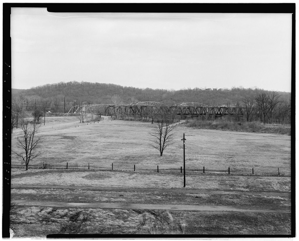
This documentation was undertaken in January, in accordance with the Mem- orandum of Agreement by the Ohio Department of Transportation as a mitigation measure prior to the removal of the bridge. Fred Mitchell Historic Preservation Associates P. O. Box Cincinnati, Ohio # CLEVES BRIDGE HAE'R NO. OH-70 (Page 2) The area served by the Cleves Bridge has been primarily ag- ricuitural in land use from its early settlement up to the pres- ent. With the exception of the Village of Cleves, platted in and North Bend platted in the area is rural in char- acter avoiding the impacts of urban development. As the frontier road system developed and settlement began to occur, several additional small villages were established that grew to serve the varied needs of the surrounding agricultural area.
Elizabethtown and Miami town in Ohio and Lawrenceburg , Indiana also became important settlements. Cincinnati, founded in outgrew all other surrounding villages and became an important market for the variety of crops, fruits and livestock that were being raised in the surrounding areas, especially in western Hamilton County. As early as crude roads linked this side of the county with eastern Indiana and Cincinnati. Although several attempts were made to construct a road adjacent to the Ohio river, the crossing over the Great Miami River proved to be a major impediment. A small ferry at the con- fluence of these two rivers operated for a short period of time. It was found, however, that a better crossing existed on the west side of Cleves.
This was situated on a more reliable road that linked Cincinnati and Lawrenceburg, Indiana. By a road system had evolved with the ferry at Cleves being the first crossing over the Great Miami River north of the Ohio River. Although bisected by several rivers and smaller tributaries, the transportation system of this part of the county was becom- ing well connected with use of various bridges and ferry opera- tions. The crossing at Cleves emerged as the most desirable and has remained so with the ferry being replaced by several bridges throughout the years. Another important means of transportation within the area was the use of the Whitewater Canal. This was started in the early and finished in as an alternative for passengers and produce. This canal linked Cincinnati to Brookville, Ind.
crossing the Great Miami River approximately 1/4 of a mile north of the established road crossing at Cleves. Although a minor canal within Ohio's canal system, it proved to be an important transportation alternative for southwestern Ohio and southeastern Indiana. This was especially true with respect to movement of goods and agricultural products to and from Cincinnati. Prior to the arrival of the railroad, public transportation relied on stage coaches, the canal and an emerging rural system of omnibus lines. Additionally, travelers could board a steam CLEVES BRIDGE HAER No. OH-70 (Page 3) boat, on the Ohio River, at North Bend and make the trip to Cin- cinnati or Lawrenceburg, Indiana. The first railroad into Cincinnati was the Little Miami Railroad in and linked the city to points north.
It was evident that the railroad was to be an important means of trans- portation . An early casualty of the competition between the railroad and the canal was the Whitewater Canal. By part of the canal's right-of-way was being used by the Ohio and Indiana Railroad linking Cincinnati and Indianapolis. By 18 69, the Indianapolis, Cincinnati and Louisville was using the former canal right-of-way. (1) In following the destruction of the bridge by flood, the location of the Cleves Bridge was moved from just west of the village to just north of the railroad trestle that used the the right-of-way of the Whitewater Canal. It was felt that the new location was more stable and less likely to be eroded by movement of the river and it also afforded a higher approach to the crossing.
As transportation diversified, the rural landscape remained very much as it did earlier being primarily agricultural in char- acter with several smaller villages providing needed services. The bridge at Cleves was destroyed by the flood of and re- placed with the current bridge. Since the flood, that de- stroyed almost all bridges in the area, road transport has gain- in volume at a modest rate and the transportation system has re- mained stable. In a similar bridge was constructed adjacent to the existing Cleves Bridge to carry the increased traffic that used U. S. 50. At that time the traffic flow was redirected so that the older bridge carried the east bound flow with the west bound traffic being carried on the newer bridge.
During the mid was constructed with part of it running west of the Cleves Bridge adjacent to the Ohio-Indiana border. The Lawrenceburg exit has diverted some traffic that would otherwise have used U. S. 50 and crossed the Cleves bridge. However, the levels of traffic that cross the bridge attest to the fact that this road is still an important route in western Hamilton county. The historic economic development pattern of western Hamil- ton County is closely linked to its transportation patterns. The river bed of the Great Miami and Whitewater Rivers cut through the land and proved to be a major physical barrier that required attention in order to facilitate travel and commerce. CLEVES BRIDGE HAER No.
OH-70 (Page 4) Prior to a ferry crossing existed that linked both sides of the river at Cleves. This method proved to be a slow means of crossing and with increasing demand for travel was re- placed by a wooden truss bridge. This was funded by a private undertaking, the Cleves Bridge Company, which was organized to sell shares at $50 each to finance construction and maintenance. This was entirely a local undertaking with primary support coming from residents of the surrounding townships. The newly constructed bridge functioned as a toll bridge with a graduated fee charged based on the mode of transportation used. Stockhold' ers of the company were not charged. (2) In the Cleves Bridge Company sold the bridge to the Hamilton County Commissioners.
This was undertaken for reasons that included the fact that the bridge was becoming old and re- quired costly maintenance, other bridges were being constructed in the vicinity, revenues were declining and the county was taking over the more established road system and the bridges that served it. A flood in destroyed this and several other bridges with resulting hardships for residents of several villages and farmers within the area. Severe erosion and a shift in the course of the river necessitated a change in the location of a bridge that was to be constructed. A site immediately adjacent to the railroad bridge, north of the old site was chosen as the new location because it offered a stable river bed and had a higher approach.
This reduced the possibility of rising r iver water threatening to inundate the bridge and the approaching roadway. The new metal truss bridge provided an effective river crossing for a number of years. in a disasterous flood caused by an unusual amount of rainfall swelled the banks of all rivers and tributaries in Ham- ilton county. This resulted in the loss of numerous farms, vil- lages and life. Almost all bridges, metal and wood truss, were also destroyed. The Cleves Bridge was included in the destruc- tion. (3 and 4) One account, written by Judge Stanley Struber, illustrates the fury of the flood at Cleves. "The Ohio and Great Miami Rivers had gone on a rampage of unprecedented fury. The lower parts of Cleves, south of Miami Avenue, were already inundated from backwaters of the Ohio.
Then into the region swelled the Great Miami with such force as to destroy both the Big Four Railroad and CLEVES BRIDGE HAER No. OH-70 (Page 5} county bridges. The surging waters suddenly broke through onto Cooper Avenue flooding homes and threatening their destruction. Soon the shore became lined with people be- wailing the fate of their neighbors, trapped in those homes that might, at any moment, be worked off their foundations by the lashing waters. (5) Immediately following the flood of March, the Hamilton County Commissioners sought to replace the Cleves Bridge. After discussions concerning the design of the new bridge and incorpor- ating a location that would withstand future floods, bids were received on August 30, from six bridge companies that sought the contract.
(6) The firms and bids included: Penn Bridge Company Capital Construction Co. King Bridge Company Massilion Bridge Co. Bracket Construction Co. Central States Bridge Co. The Penn Bridge Company was selected since it had the lowest bid and was a reputable firm even though its bid was almost below the estimate of the highest bidder and below the County's estimate. The abutments, piers and site preparation were separate bids and the total cost for the new construction was The Penn Bridge Company of Beaver Falls, Pennsylvania pro- duced wrought iron, steel conbination bridges, iron sub-struc- tures, buildings, roof trusses and general architectural iron work. The firm was incorporated in and was an outgrowth of the Timothy B- White & Sons Company that was established in Mr.
White initially started out as a carpenter/contractor and also owned a planing mill and sash and door factory in In he started to construct wooden bridges throughout Pennsyl- vania, eastern Ohio, West Virginia and Maryland. The construc- tion of iron bridges began in resulting in the formation of the earlier company with a factory at New Brighton, Pennsylvania. Ten years later the company moved to a new factory in Beaver Falls following a fire. Mr. White held several patents incor- porating innovations in steel truss bridge construction. The company became a major firm designing and constructing metal truss bridges in the Middle Atlantic and Midwestern states. They went out of business in the early (7) The Parker through truss bridge was constructed in in- CLEVES BRIDGE HAER No.
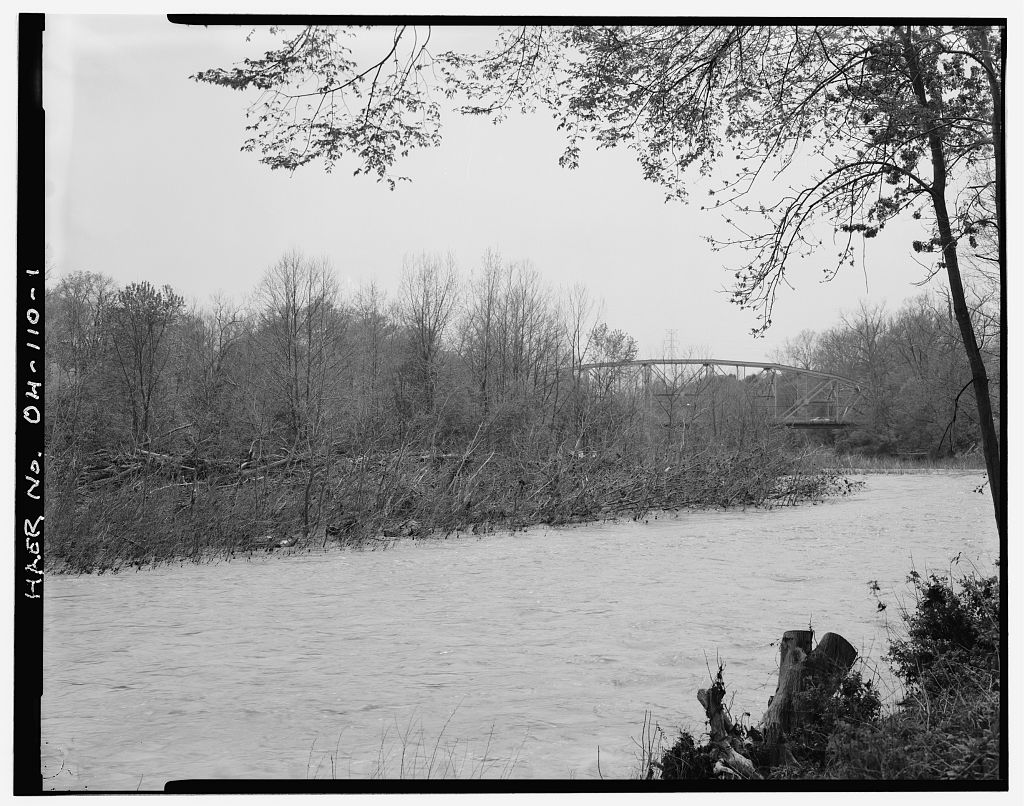
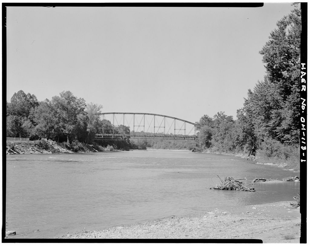
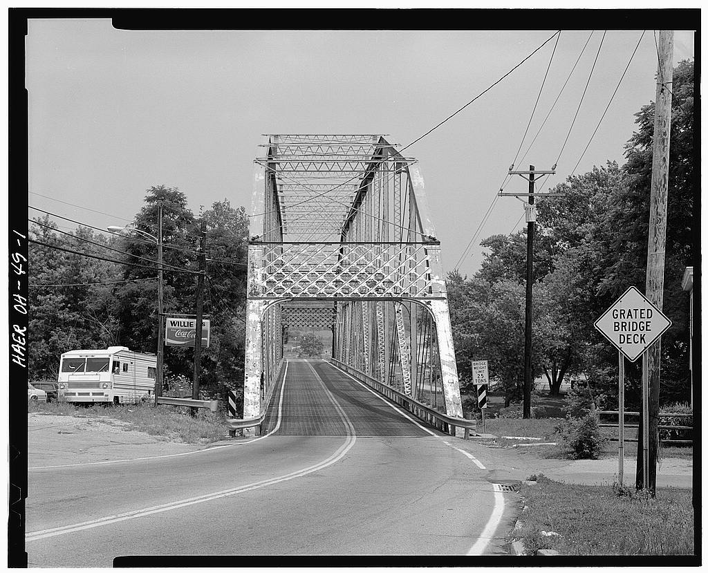
OH-70 (Page 6) corporating the design drawn by the Penn Bridge Company. It con- sists of a total of four spans for an overall length of 882 feet. The first and fourth (end) spans are each in length with 10 panels each measuring Minimum clearance under each portal strut is 25' and the maximum height of 35' is reached at the central three struts. The second and third spans are the larger and each measures in length with twelve panels each measuring Minimum clearance under each portal strut is 28* and the maximum height of 46' is reached at the central three struts. Clear distance between trusses is with 10" clear distance between guard rail faces. There is a side- walk cantilevered off the south side.
(8) Material of construction is riveted steel beams for the in- clined end portals, top and lower chords, lattice steel for the vertical bracing and eyebar steel at the diagonal tension mem- bers with pinned connections. The portal bracing, at the end of each span exhibits plain iron spandrels. The existing asphalt concrete decks are resting atop nine steel stringers supported by numerous floor beams. The entire structure sits on two new masonry piers with concrete facing and one existing pier from the older bridge. One existing and one new abutment are incorporated into the design. The deck is in width between curb faces. The bridge width is below the 30' bridge width establish- ed as a minimum safe width.
Incorporated into the original de- sign was a rail track used by the Cincinnati, Lawrenceburg and Aurora Traction Line. This company had a similar track incor- ported into the previous steel truss bridge. When the company ceased operation, the track was removed in The date plates, originally located on the portal strut at either end of the bridge have been removed by the Ohio Depart- ment of Transportation for safe keeping and incorporation into the new bridge as stipulated within the Memorandum of Agreement. The text of the inscription reads as follows: BUILT BY PENN BRIDGE CO. BEAVER FALLS, PENNA. F. E. WESSELMAN, PRES . H. C. INNIS COMM'RS SAMUEL WEIL, JR. CLINTON COWEN, CO.SURVEYOR Since its construction, the bridge has received both mainten- ance and major structural attention.
(9) A chronology includes: CLEVES BRIDGE HAER No. OH-70 (Page 7) New Concrete Deck New Railing Expansion Joints All Bearing Devices Replaced Original Concrete Sidewalk Replaced With Steel Plate New Concrete Deck with Asphaltic Surface Minor Rehabilitation Diagonals Replaced Vertical Hangers Strengthened Lateral Rods Cleaned and Tightened New Steel Painted Bridge Painted with Epoxy Paint Existing Asphaltic Surface Removed Resurfaced With Asphaltic Concrete Bridge Deck Patched Abutments and Piers Patched Bridge Waterproofed As the result of an annual inspection by the Ohio Department of Transportation in February, it was found that one of the four eyebars of the lower chord member had fractured.
The bridge was immediately closed and all traffic was switched to the ad- jacent bridge requiring that this bridge now carry two way traf- fic. A structural consultant, Balke Engineers, was hired to undertake an in-depth examination of the bridge to determine the extent of structural deterioration and decay. As part of this investigation, H. C. Nutting Co., was subcontracted to perform ultrasonic testing of all pins. A majority of the pins were test- ed with the results showing that over seventy percent exhibited internal flaws. Additionally, an evaluation of other truss mem- bers showed that there is severe corrosion which has significant- ly reduced the load carrying capacity of the bridge.
It has been determined that a corrosion of metal structural members is the single most important factor resulting in the deterioration of the bridge to its present condition. CLEVES BRIDGE HAER No. OH-70 (Page 8) FOOTNOTES (1) Titus, C. 0., Atlas of Cincinnati and Hamilton County, (2) Burress, M., It Happened 'Round North Bend: A History of Miami Township and Its Borders, 19 7 0. (3) Cincinnati Enquirer, March 26, (4) Cincinnati Enquirer, March 27, (5) Quoted in Burress, M., It Happened 'Round North Bend: A History of Miami Township and Its Borders, (6) Cincinnati Enquirer, August 30, (7) Bausman, J.
H., History of Beaver County, Pennsylvania, New York, New York, (8) Dimensions from copies of original construction drawings prepared by Penn Bridge Company and in the possession of Ohio Department of Transportation. (9) Taken from: Documentation for Consultation- HAM U. S. 50- (R) , Ohio Department of Transportation, January, Balke Engineers, Bridge Condition Report: Bridge No. Ham- E. B. U. S. Route 50 Over The Great Miami Riverf Hamilton County, Ohio, June,
Emerson, W. D., Map of Hamilton County, Cincinnati, 0, Moessinger, G. and Fred Bertsch, Map of Hamilton Co. Ohio, Cincinnati, 0., Ohio Department of Transportation, The Ohio Historic Bridge Inventory Evaluation, and Preservation Plan, Ohio Department of Transportation, Cleves Bridge Structural File No. Lebanon, Ohio, Ohio Historic Preservation Office, Ohio Historic Bridge Inven- tory Form No. Ham-4759-53: Cleves Bridge, CLEVES BRIDGE HAER No. OH-70 (Page 9) > I SicH CXJ c o rH w -P u (13 u O M o 1-1 ffl # 1-i w a> O c -Hil w .o > e w D l-l 2 u C (0 a CO ro >< _,. c^dIi!l!lUli= iiaiim urn IIIWIH in CLEVES BRIDGE HAER NO. OH-70 (Page 10)
General Location Map ADDENDUM TO: HAER OH-70 CLEVES BRIDGE HAER OHIO,31-CLEVS.V,1- Spanning Great Miami River on U.S. Highway 50 Cleves vicinity Hamilton County Ohio FIELD RECORDS HISTORIC AMERICAN ENGINEERING RECORD National Park Service U.S. Department of the Interior C Street NW Washington, DC
 Block
Block